🇩🇪 USA-Loop
oder wir folgen den Spuren von Lewis, Clark, Custer und Crazy Horse
Wer die Einreisebestimmungen nicht liest, den bestrafen die Grenzer. So wandern 5 Eier und 2 Zitronen in die Tonne, aber wir bekommen im Gegenzug freundliche Tipps und eine Karte mit eigenhändig eingezeichneten Punkten, die es lohnenswert zu besuchen gilt in North Dakota. Überhaupt sind wir sehr angetan von der unkomplizierten Abfertigung an der Grenze, sogar die schon heruntergefahrenen Computer wurden neu gestartet dem Dienstschluss in 2 Minuten zum Trotz (uns war nicht klar, dass auf der amerikanischen Seite keine Sommerzeitumstellung erfolgt). Die USA empfangen uns mit offenen Armen und ganz entspannt 😎.
Der Homey bzw. unsere Reisekasse freuen sich über Dieselpreise um € 0,80/l. Umgekehrt ist das Preisniveau und die Qualität in den Supermärkten nicht mit Kanada vergleichbar, so müssen wir neue Märkte und Produkte erkunden und trauern unserem liebgewonnenen Sobeys nach, den kanadischen Preisen (!) leider auch (obwohl sie aus deutscher Sicht auch ganz schön teuer waren/sind).
Der Plan ist, die Badlands zu besuchen, das Crazy Horse Monument und die Präsidentenköpfe des Mt. Rushmore anzuschauen und dann den Yellowstone Park über den Beartooth-Pass (3337m) zu erreichen, um dann von dort wieder nordwärts zurück nach Alberta zu gelangen, bevor unser Kanadavisum Ende Oktober ausläuft. Aber es kommt alles anders, doch der Reihe nach….
Auf Empfehlung der netten Grenzer besuchen wir beide Roosevelt-Parks und verstehen sofort, warum diese tollen Parks zu den meist unterschätzten Parks der USA gehören. Wir hatten sie eigentlich auch nicht vorgemerkt, sind aber im Nu begeistert und verzaubert von der tollen Landschaft.
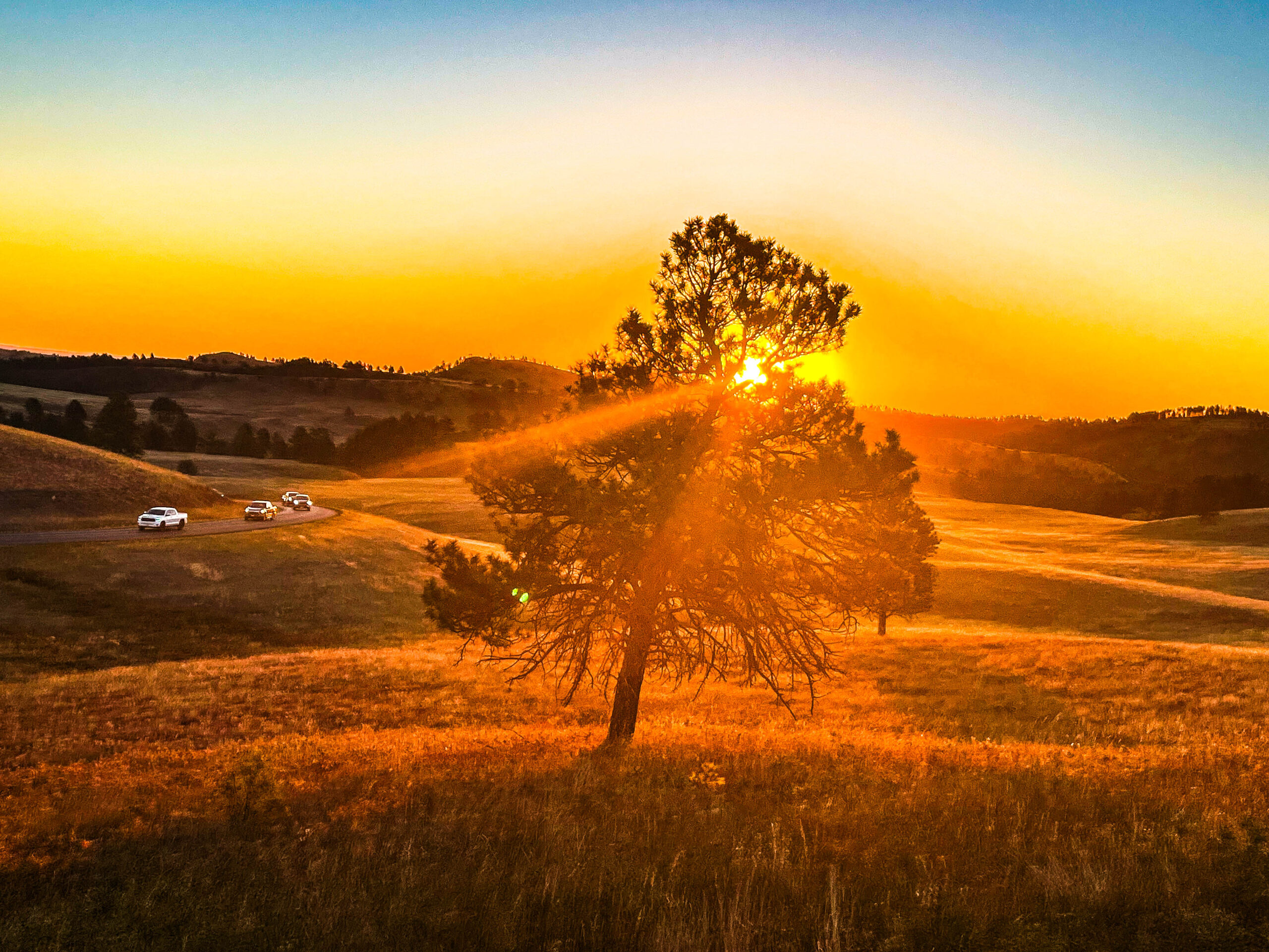
Der Weg dahin ist sehr diesig durch den Rauch der unzähligen Waldbrände im westlichen Kanada und USA, tw. sehr starker und böiger Wind. Die Fahrt führt durch welliges Grasland mit Wasserstellen und Ölförderpumpen, quasi eine Hochebene in 700m Höhe.
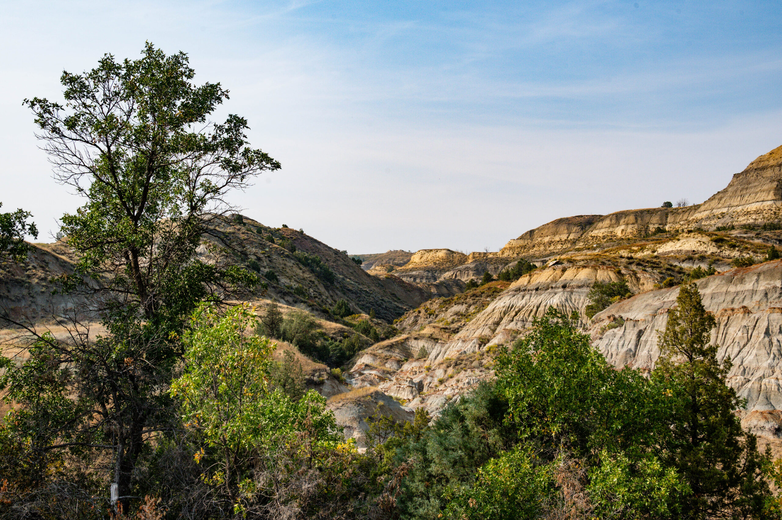
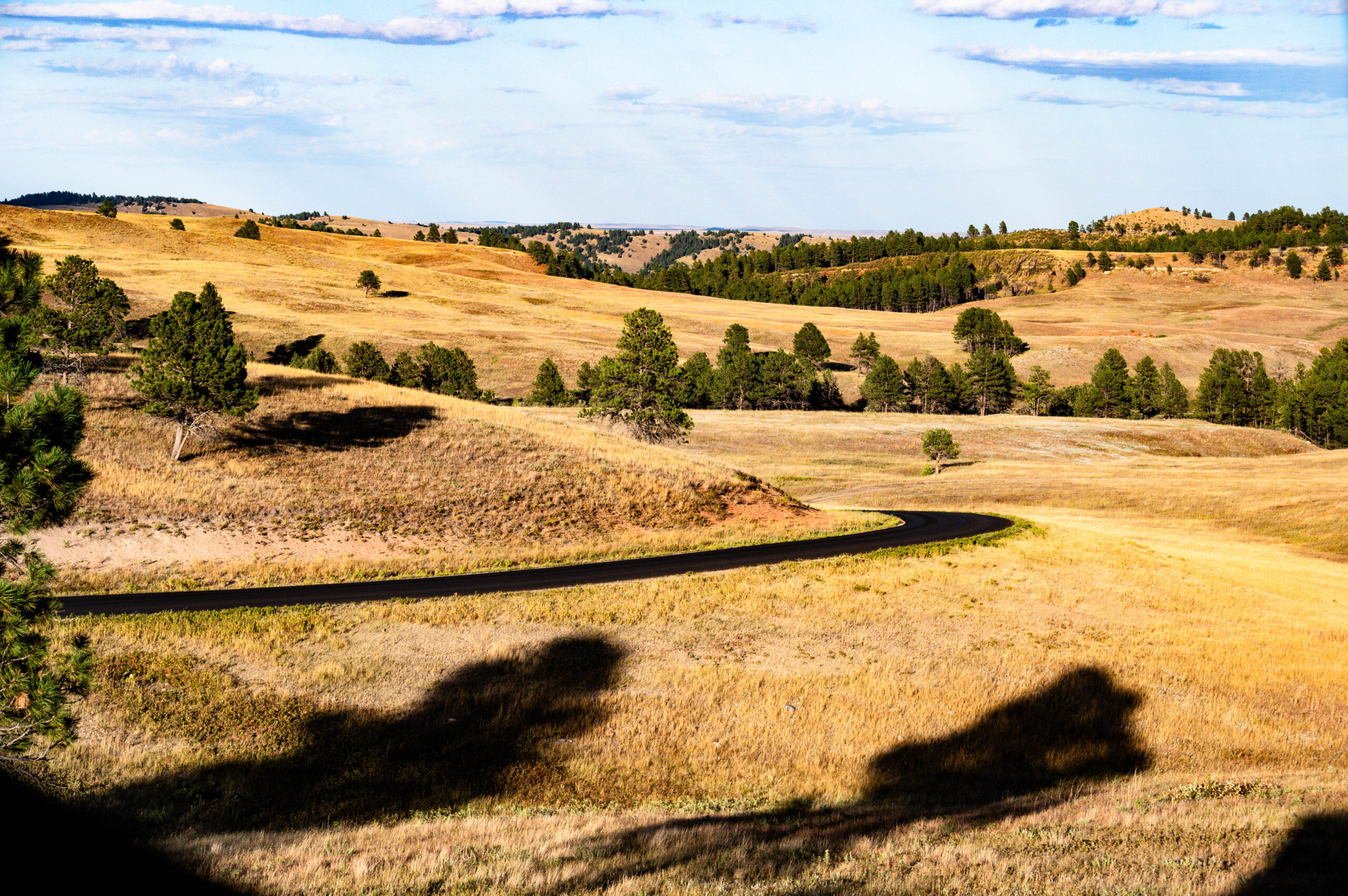
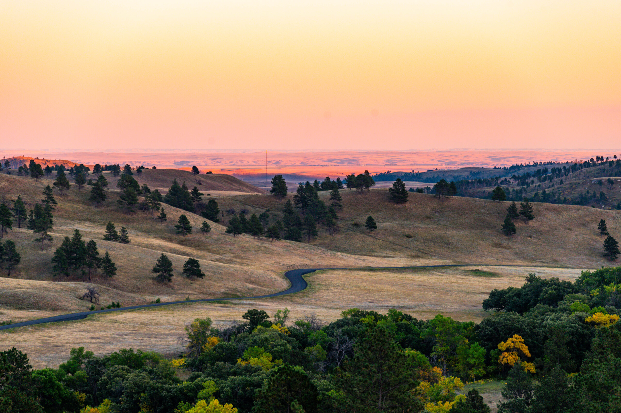
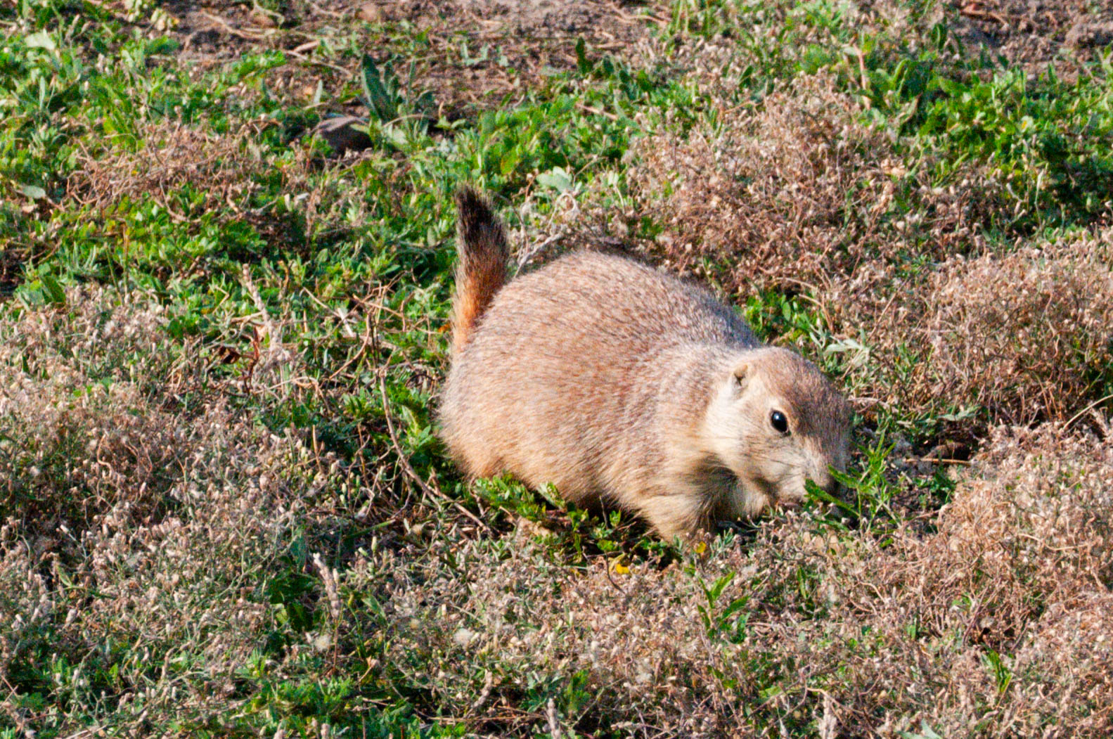
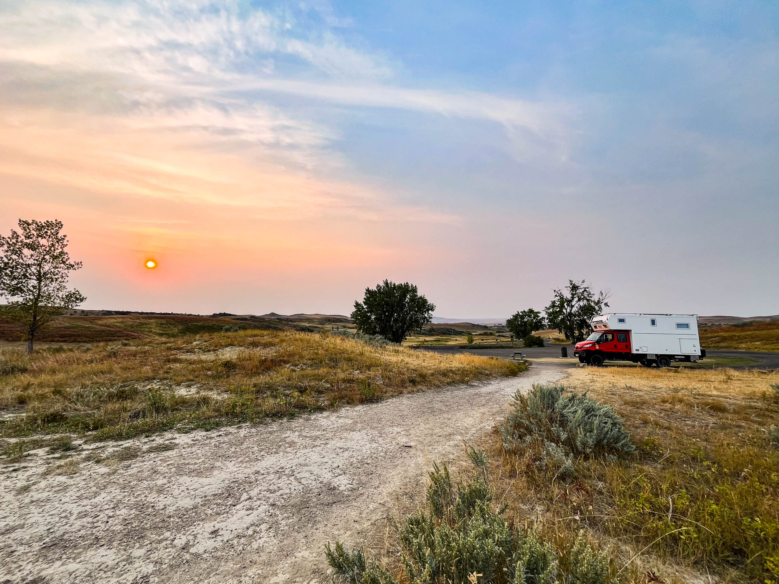
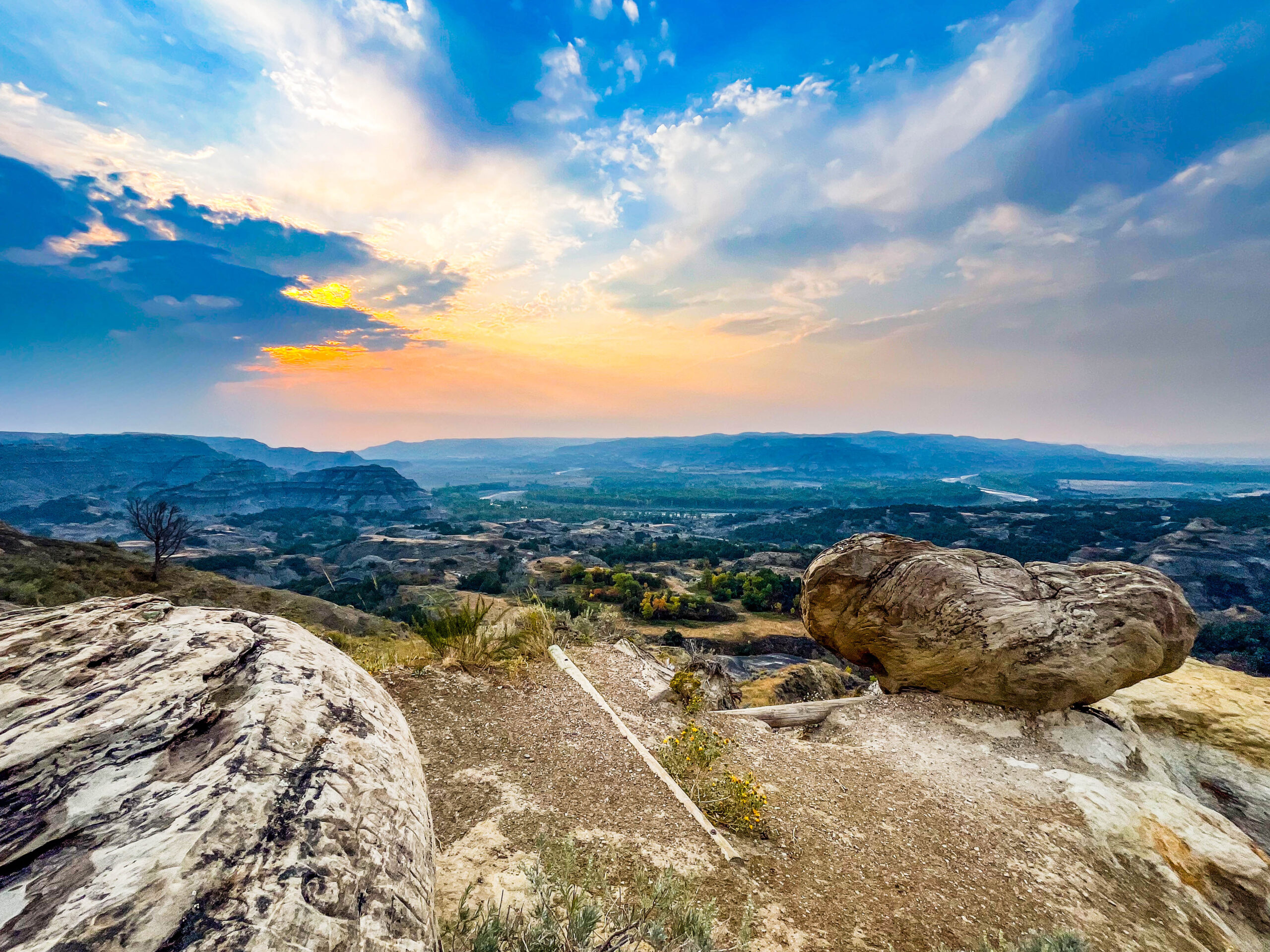
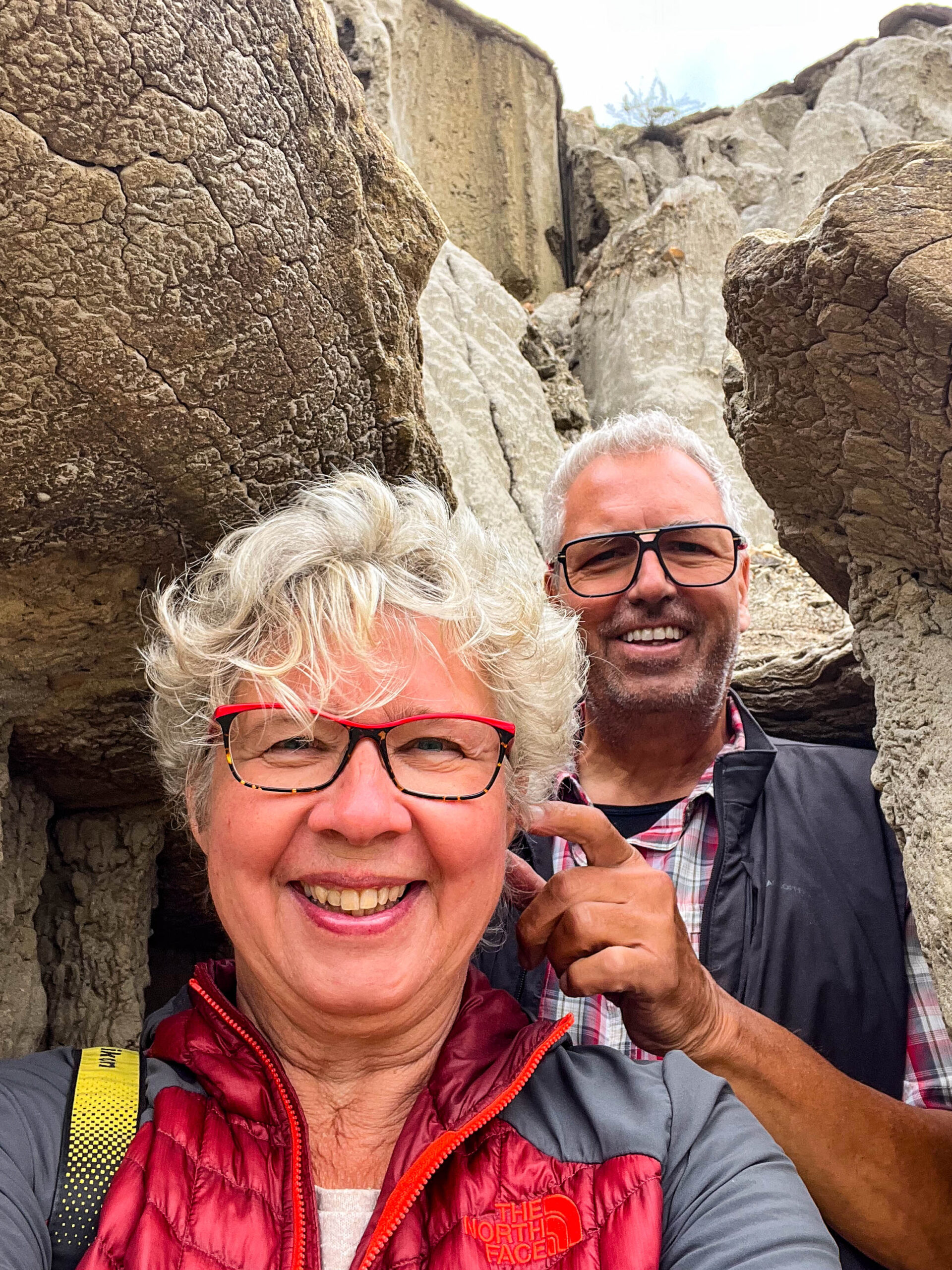
Im Theodore Roosevelt NP (North) folgen wir dem Scenic Loop, ein Traum voller schöner Szenerien und Ausblicken auf Badlands Landschaften und das Tal des Little Missouri River. Am letzten Aussichtspunkt kommt uns überraschend eine ganze Herde Bisons entgegen und wir sind sofort von den mächtigen Tieren umringt ganz so wie im Allgäu, wenn der Schorschi seine Kühe zum Stall die Straße hinauftreibt. Das Mufflon am Straßenrand ist die Zugabe, zuvor hatten wir nur welche mit dem Fernglas weit entfernt entdecken können.
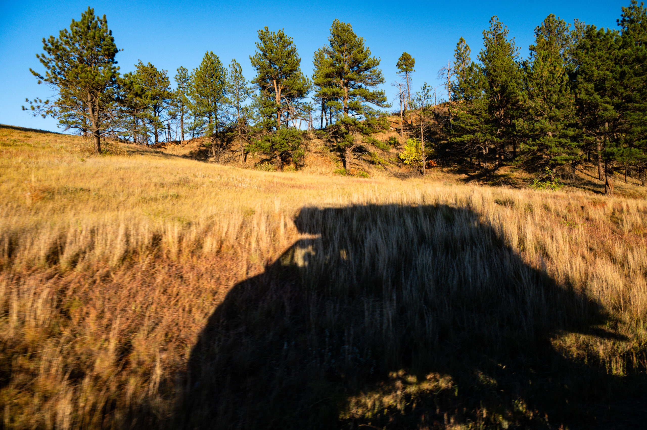
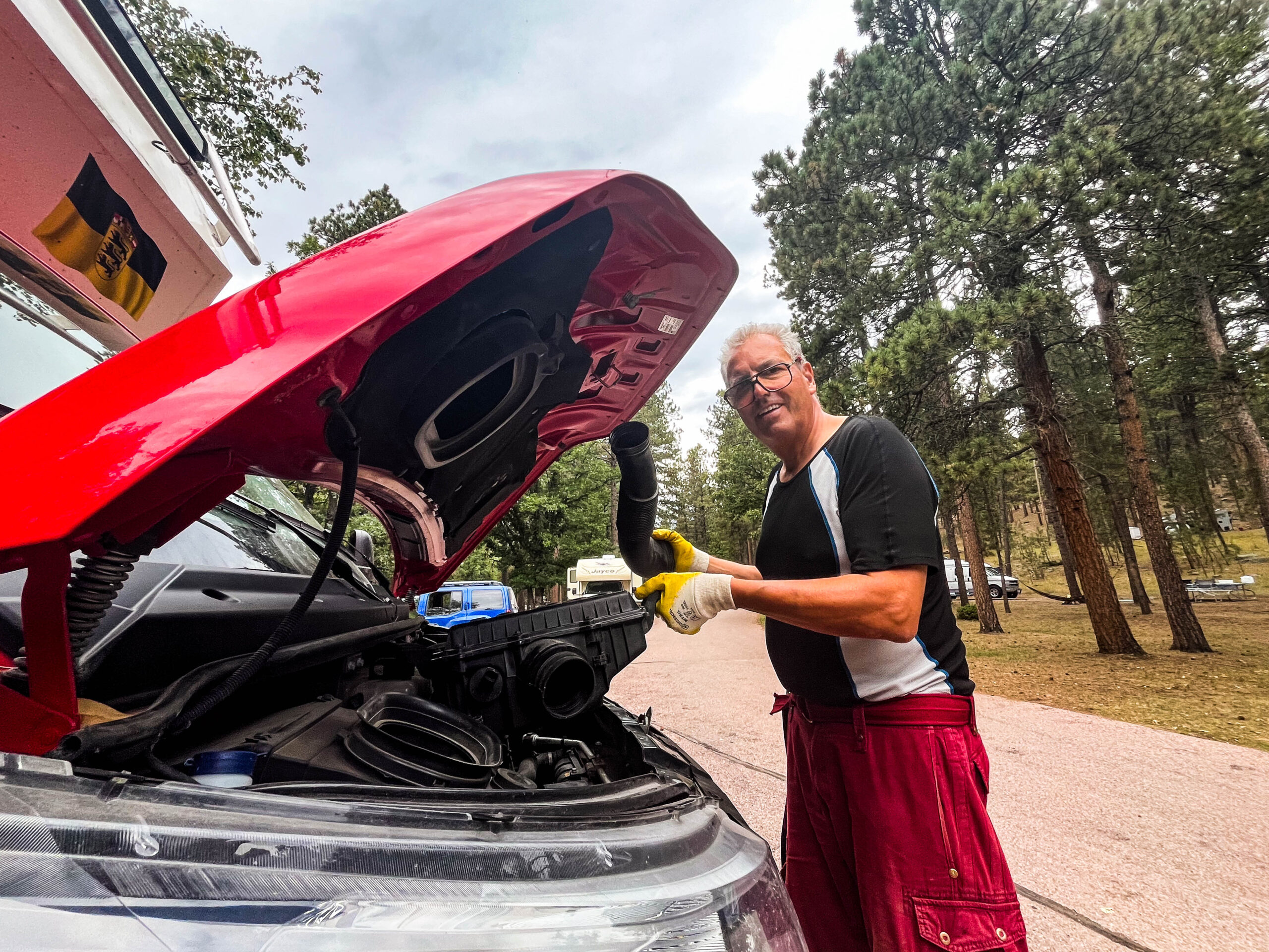
Dummerweise macht unser Motor Fisimatenten und läuft heiß, d.h. irgendwie schaltet sich der Zusatzventilator nicht mehr ein, wenn er gebraucht wird, das Wechseln der Sicherung bringt nur kurzzeitig Erfolg, bevor bevor sie sich wieder verabschiedet. Von nun an fahren wir bergauf mit maximaler Heizung und Gebläse statt mit Klimaanlage und Kühlung. Die Augen suchen immerfort nach einem passenden Parkplatz oder Haltebucht, um nicht von der Zwangsabschaltung des Motors mitten auf der Straße überrascht zu werden. Der Blick auf die Öltemperatur und die Einschätzung der Steigung, besser noch das Herbeisehnen einer Gefällstrecke, wird für die nächsten Wochen unser fahrerischer Alltag.
Gemäß der Absprache mit den Rangern, die am Vortag schon Kassenschluß hatten, besorgen wir uns für $ 80 eine Jahreskarte („America the beautiful“ gilt für jeweils ein Auto mit Insassen für alle Nationalparks der USA).
Weiter durch Sandsturm und Rauch zum 2. Park-Teil, dem Theodore Roosevelt NP (South). Wieder Scenicdrive, die Landschaft weicher, weiter, runder, leider fehlt sturmbedingt das Fotografie-Licht. Dafür jede Menge Tiere: Präriehunde, wilde Truthähne, Wildpferde, Hirsche und immer wieder Bisons. Wir legen einen Pausentag ein, fast zwangsweise, da eine „Red Flag Wind- und Blizzardwarnung“ angekündigt ist mit punctum maximum auf unserer geplanten Route. So lernen wir ein Mitglied der dt. Backgammon Nationalmannschaft kennen – Sabine Brinkmann, nebenbei auch Berliner Stadtmeisterin – aktuell auf USA-Sabbatical im Hymer Sprinter unterwegs.
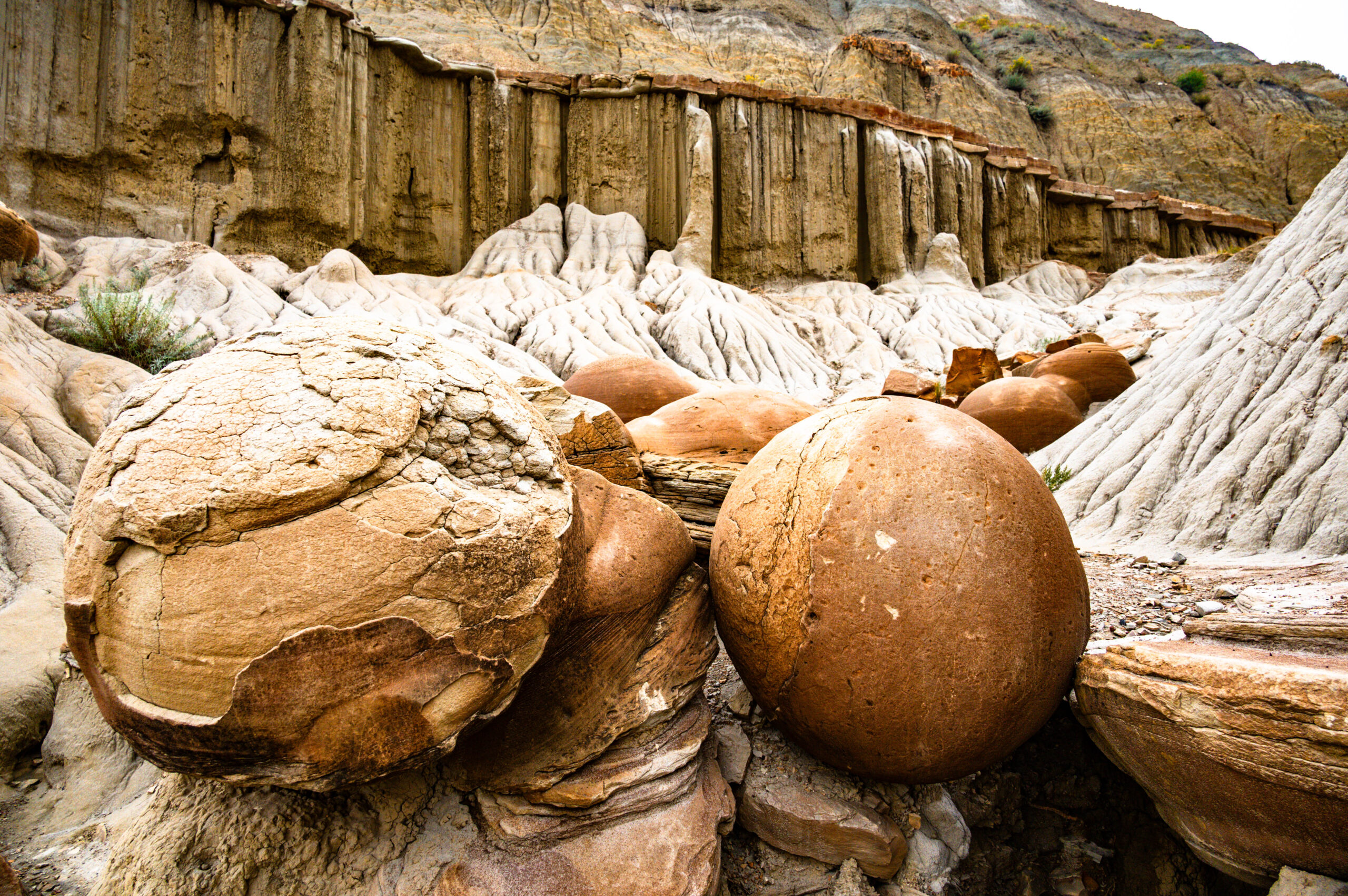
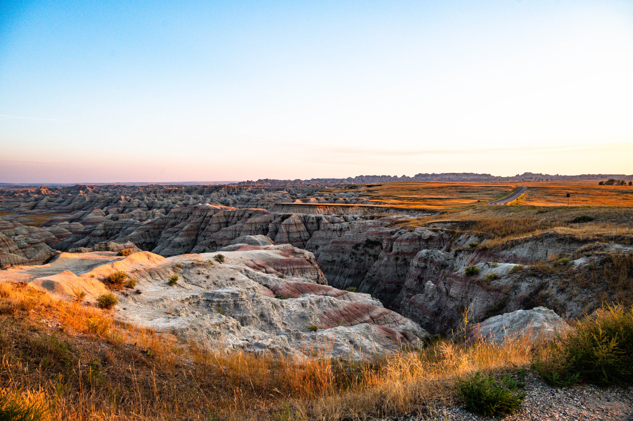
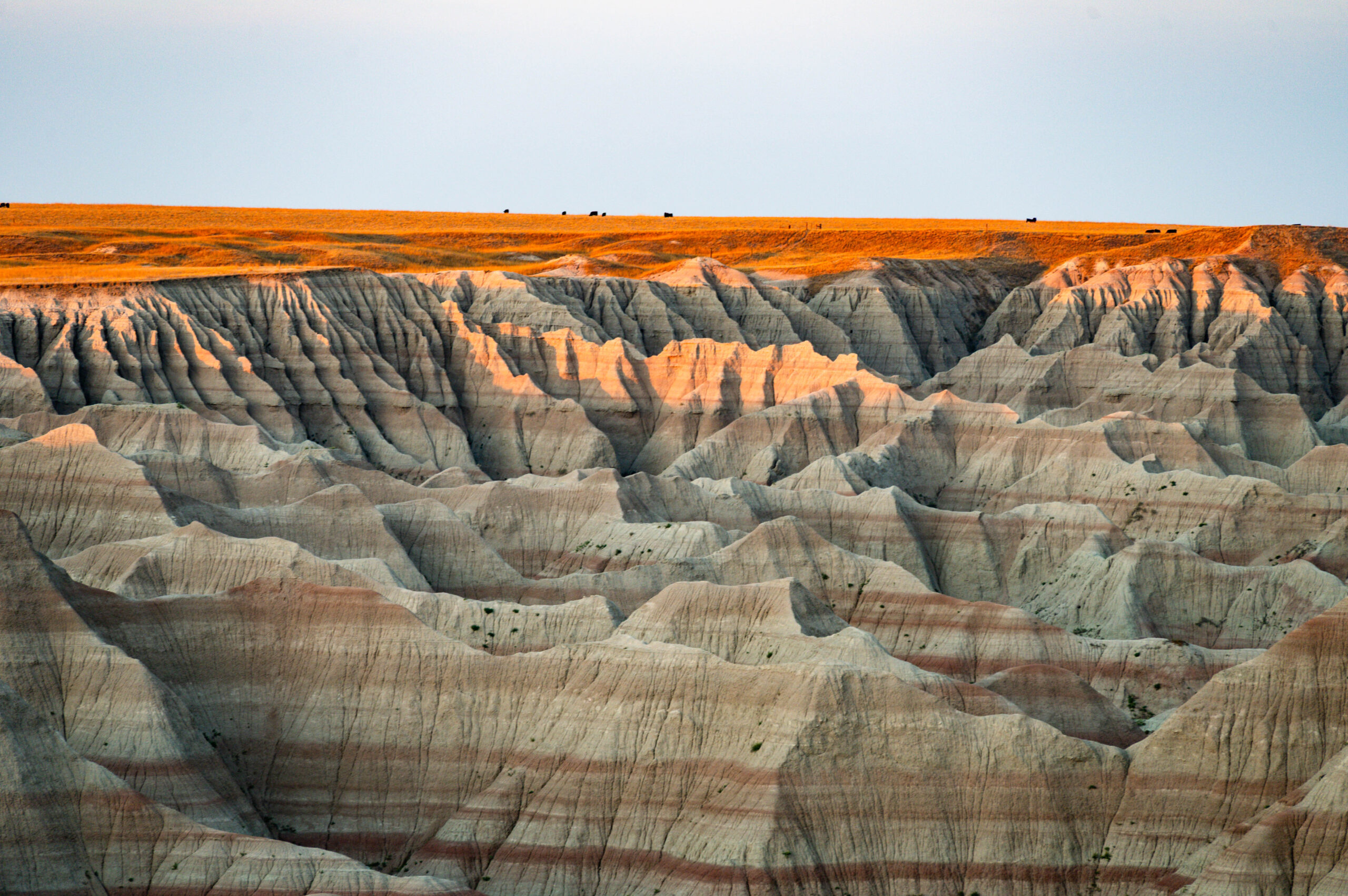
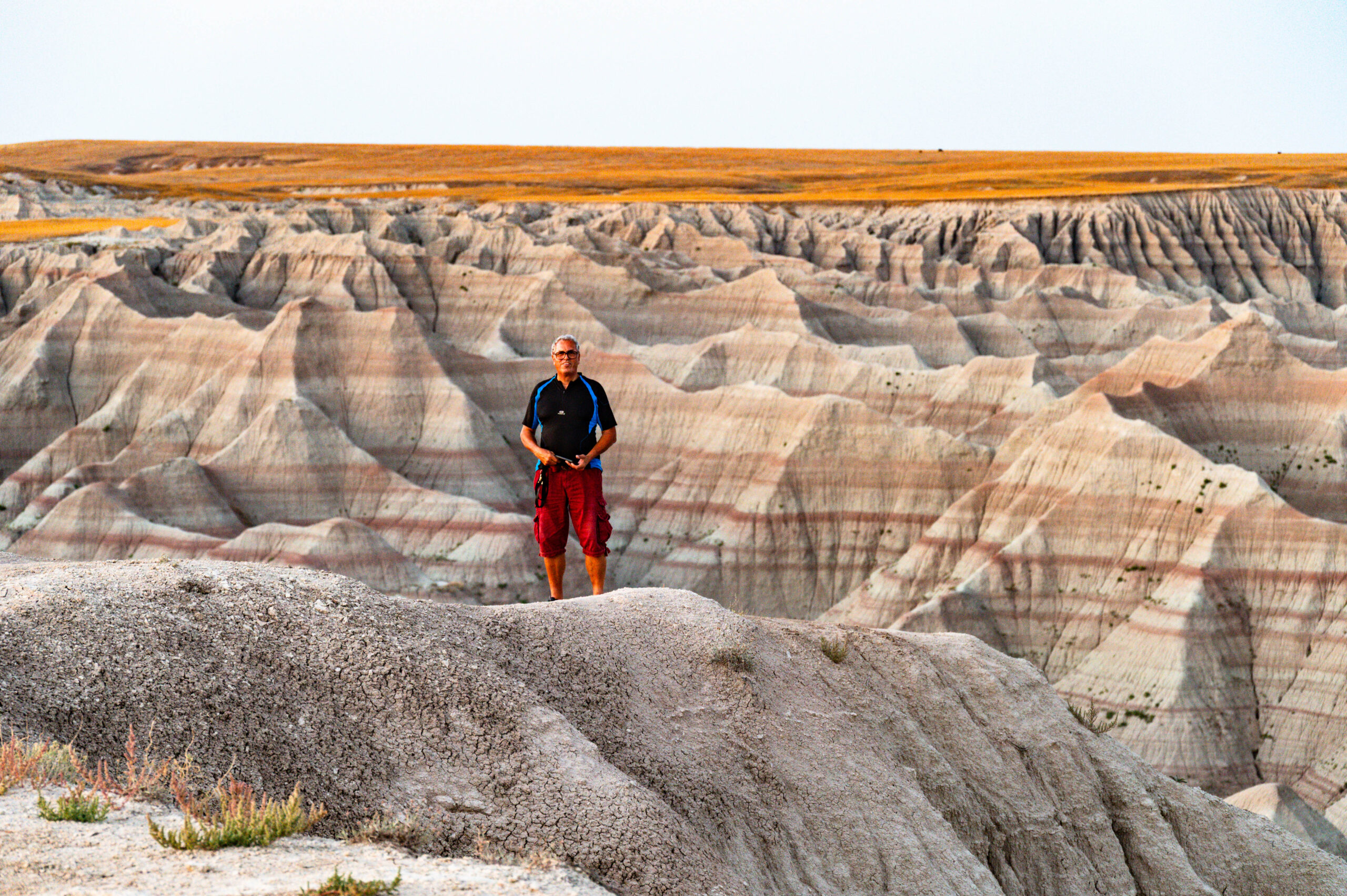
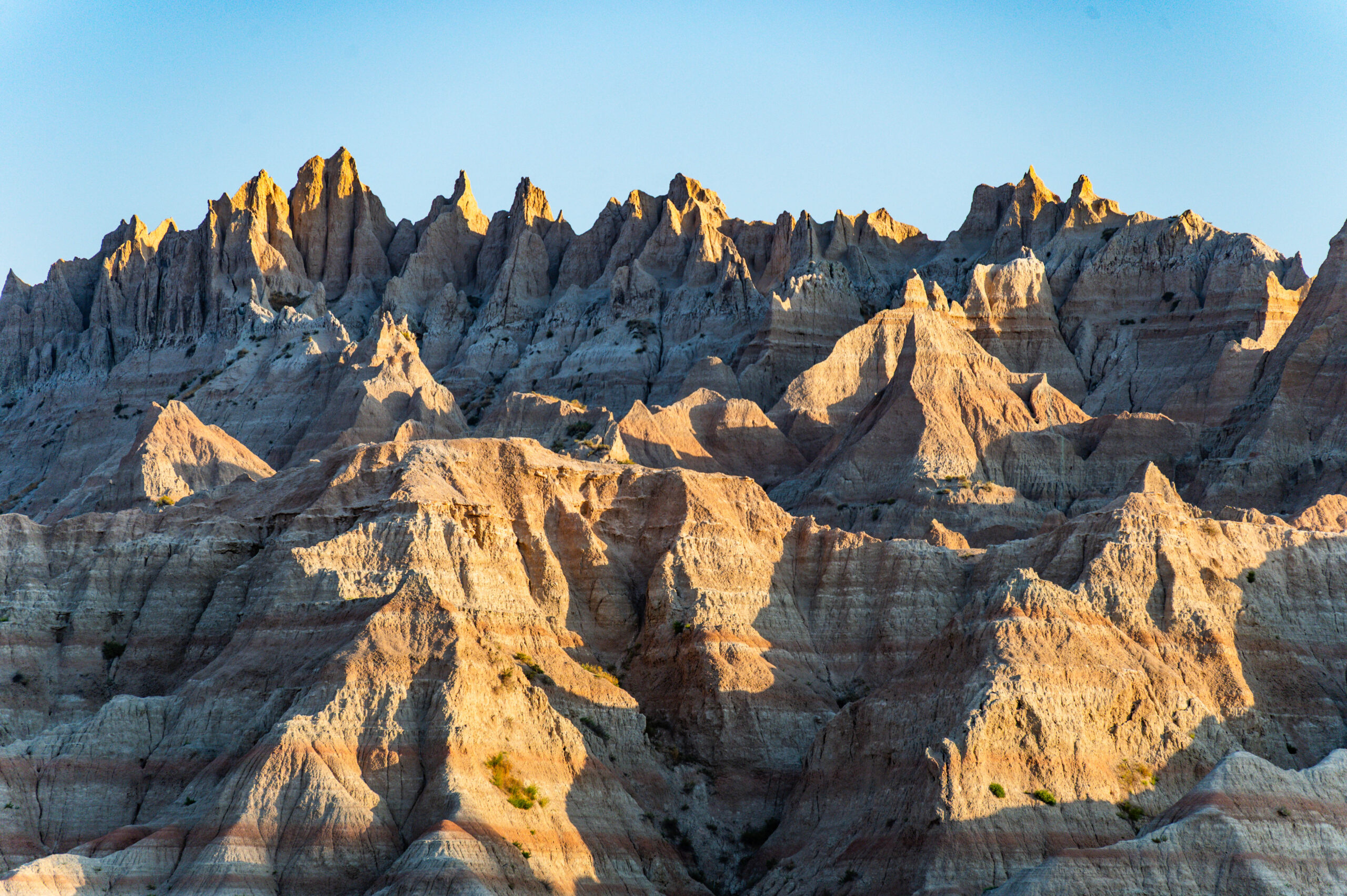
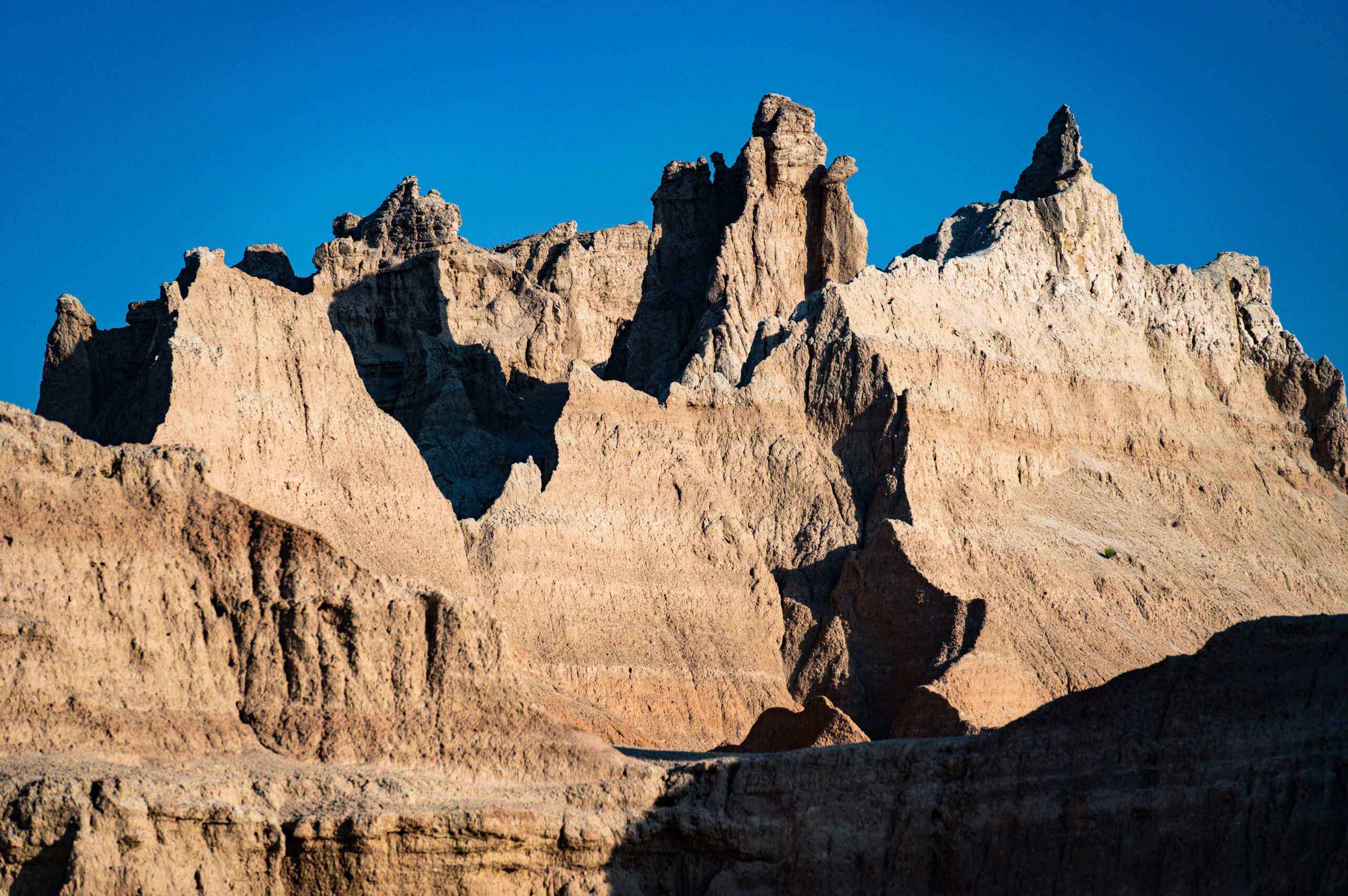
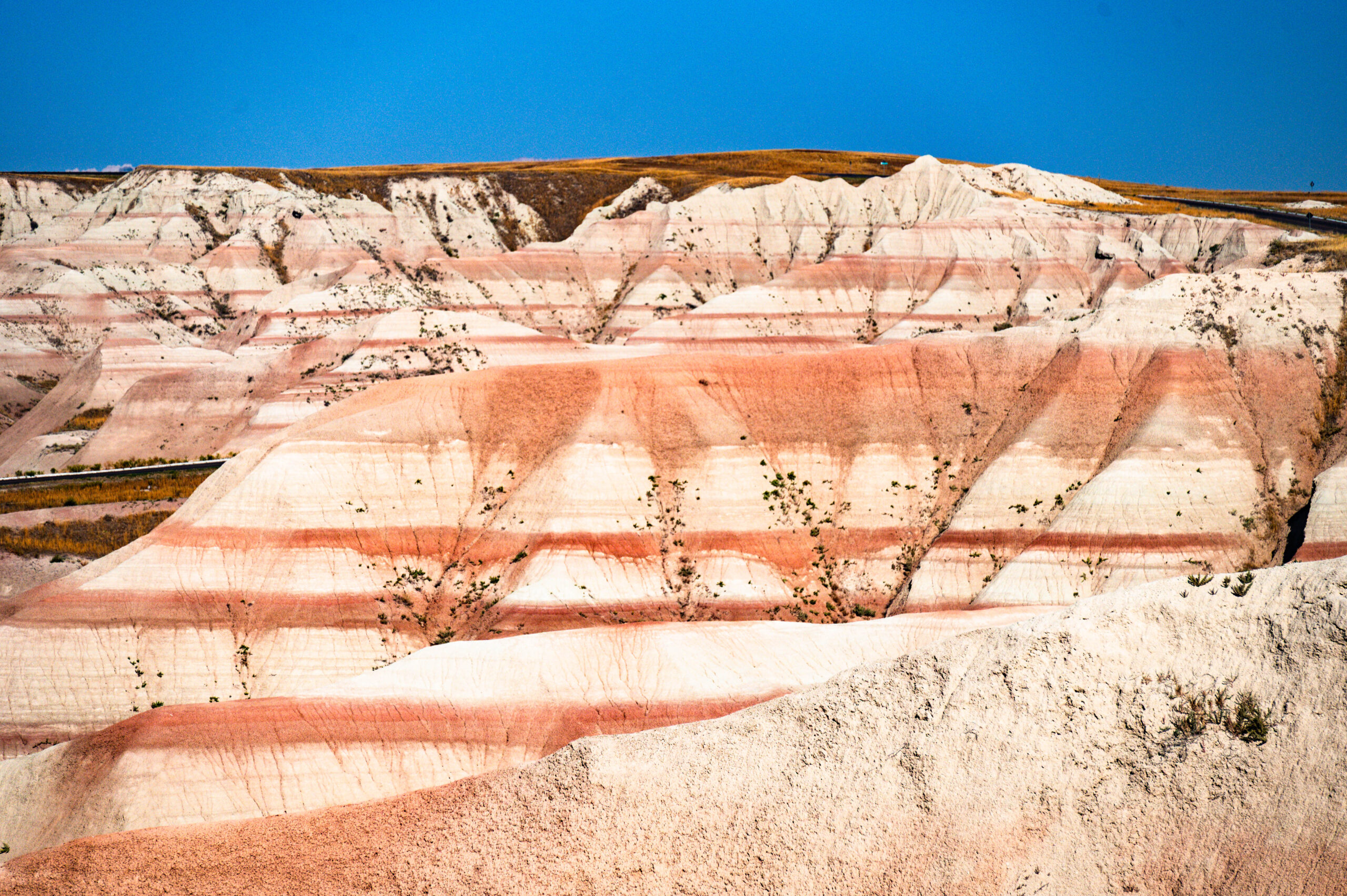
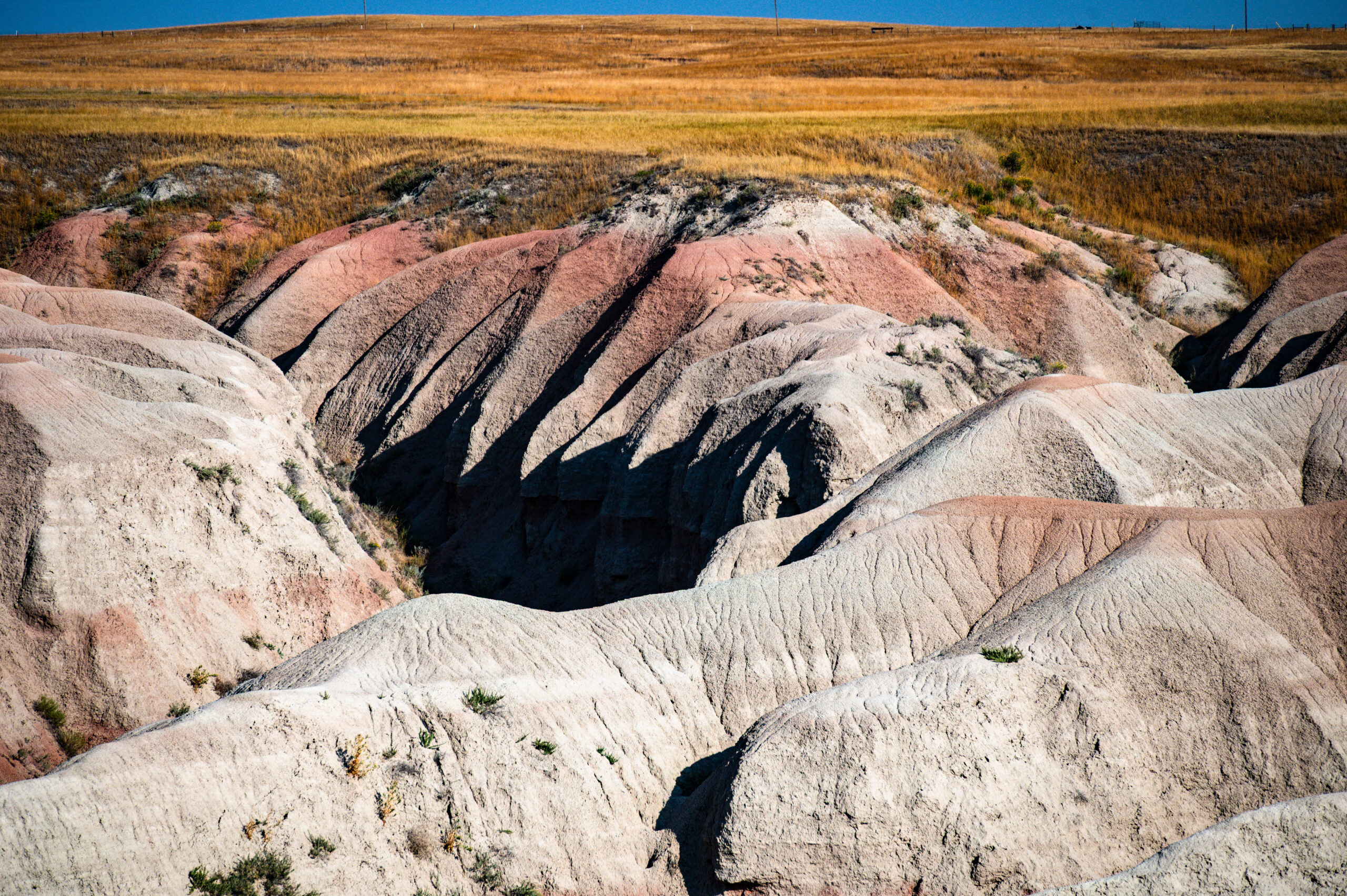
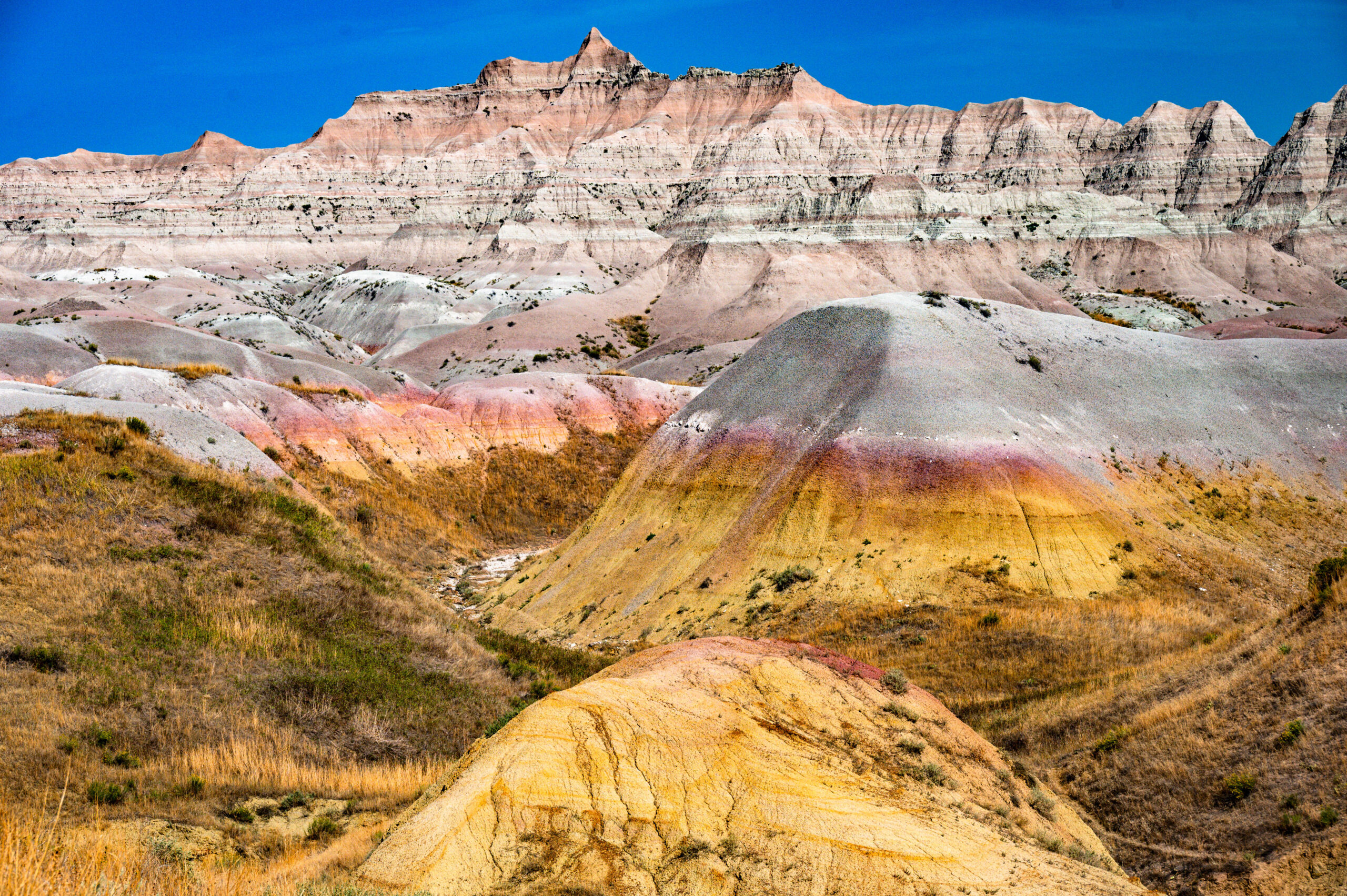
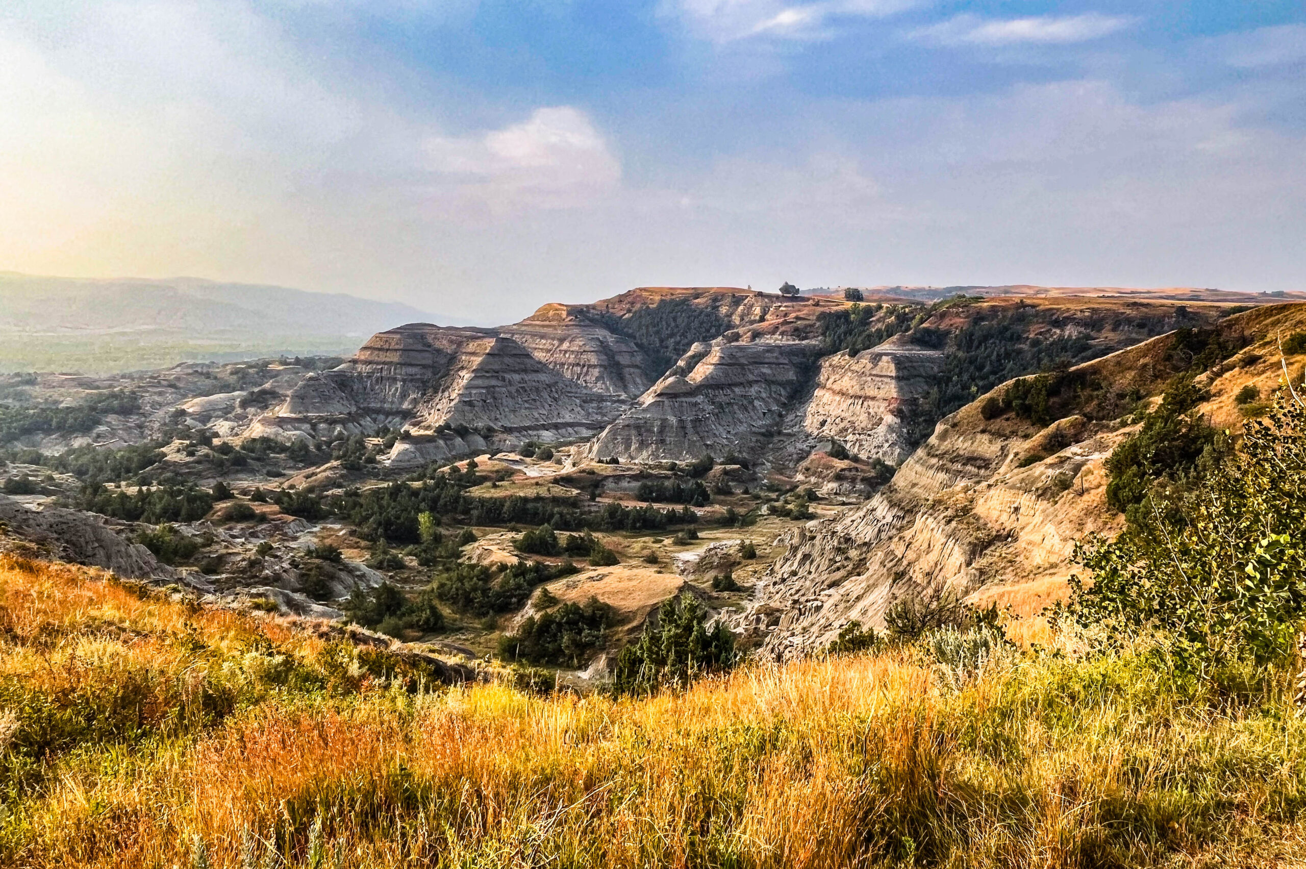
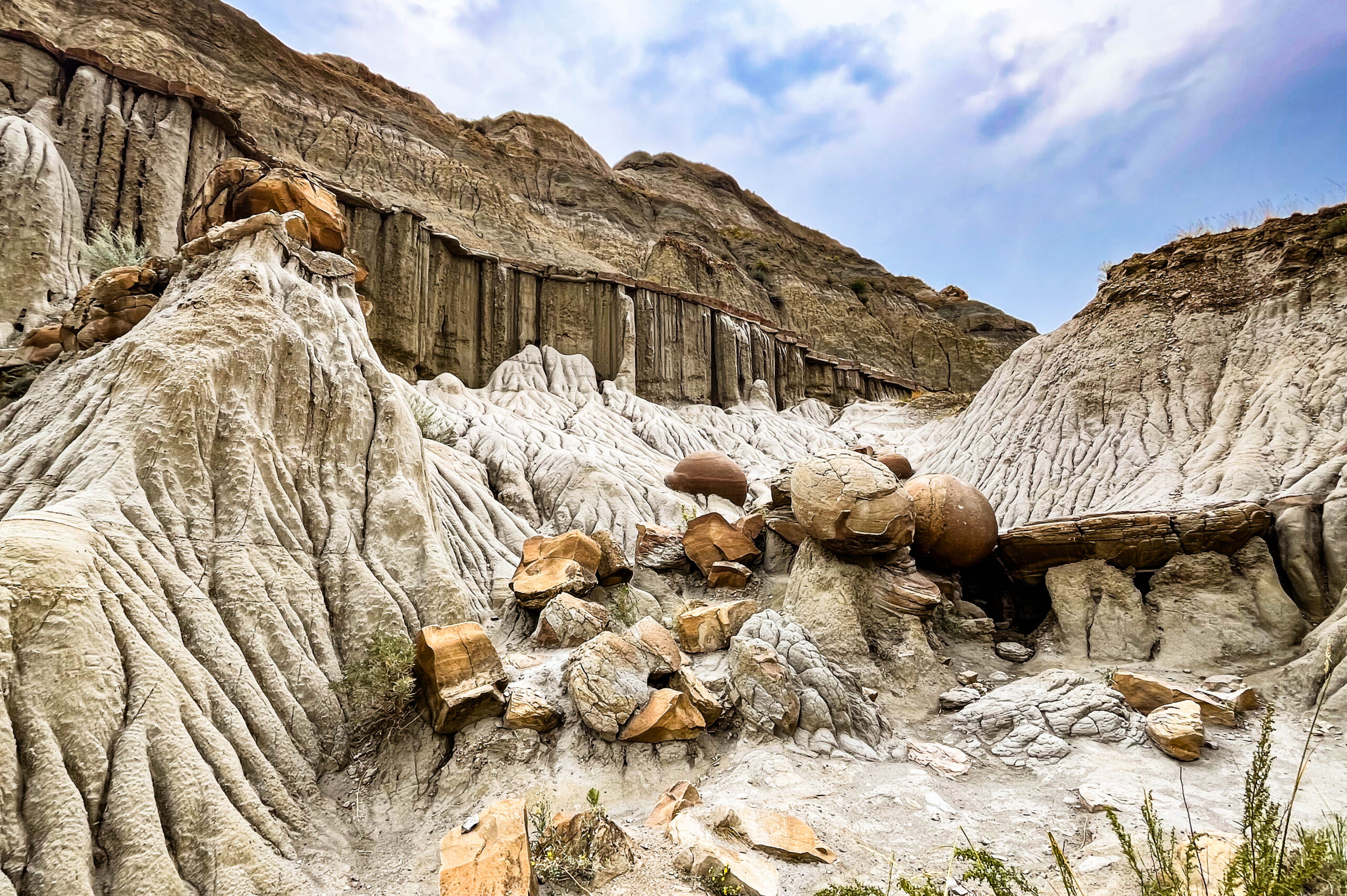
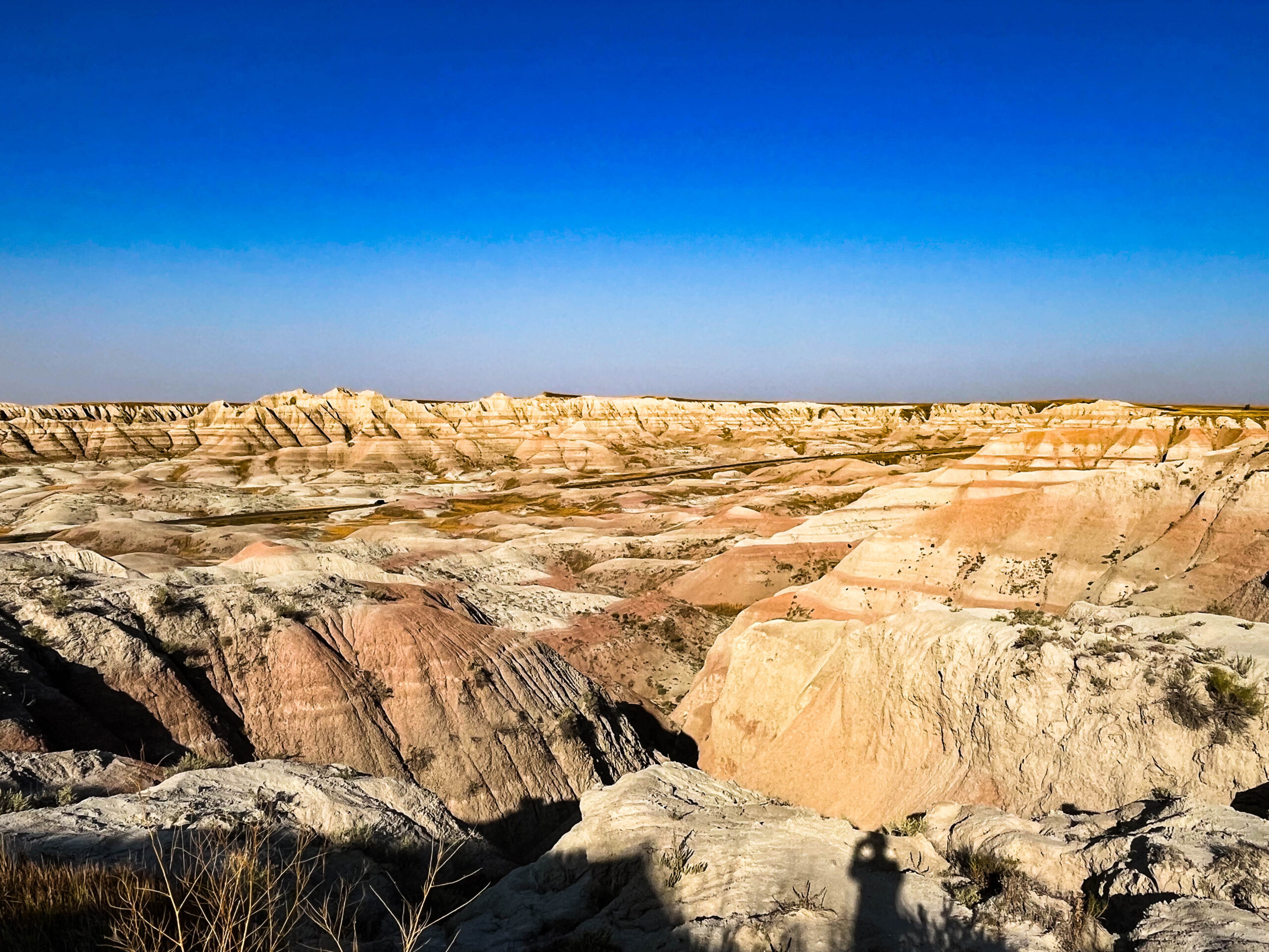
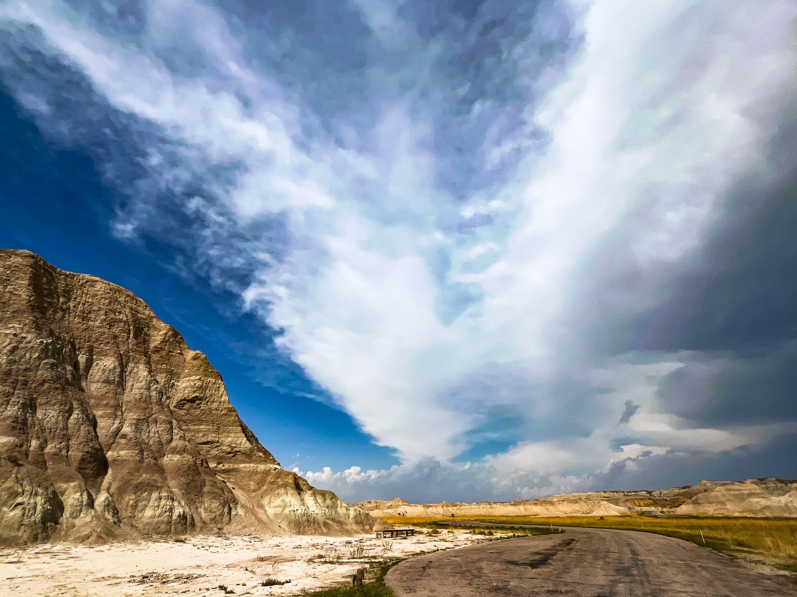
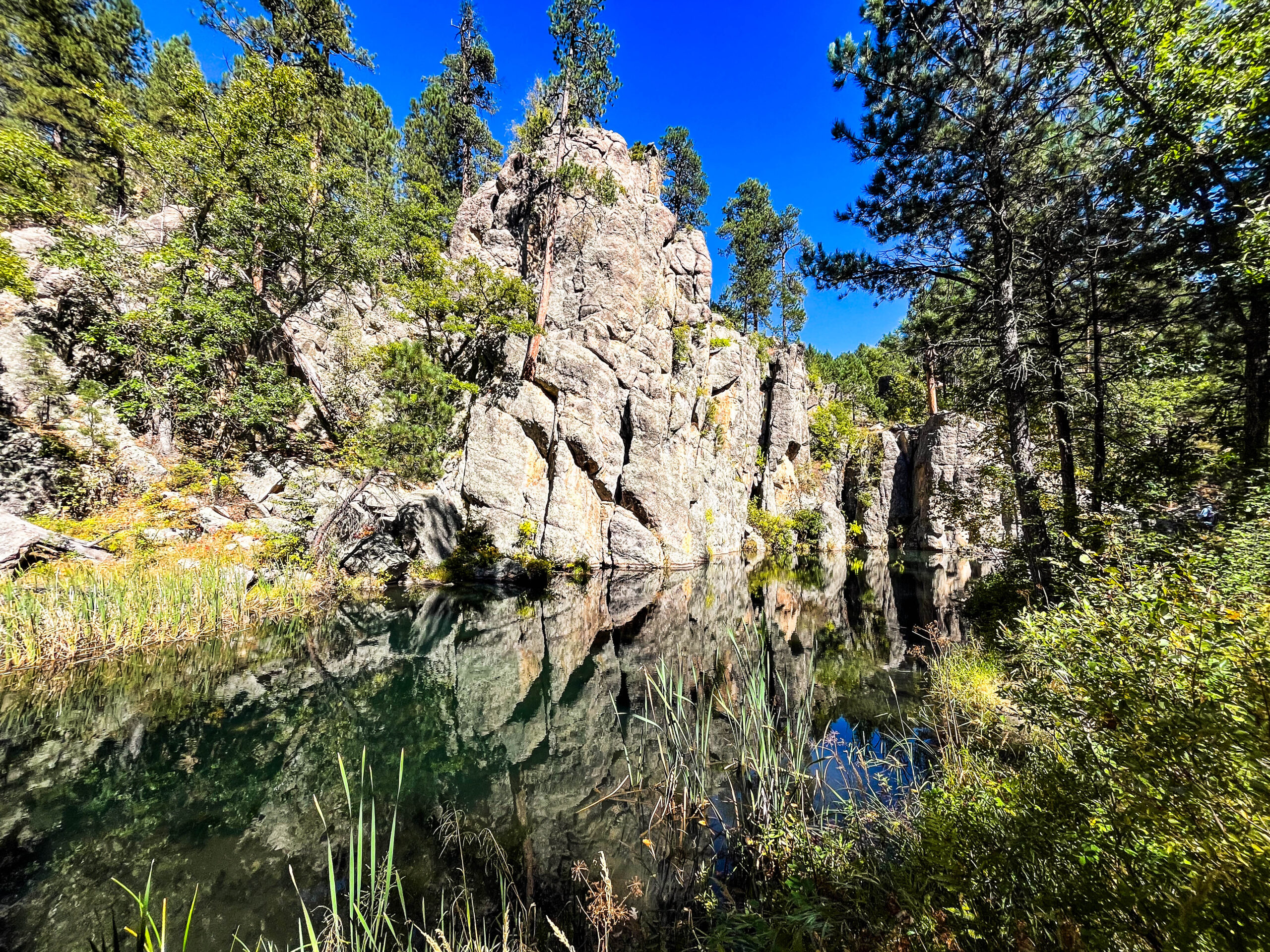
Der Begriff Badlands wurde erstmals für einen Teil im Südwesten von South Dakota verwendet. Französisch-kanadische Trapper nannten die Region „mauvaises terres a traverser“ („schlechtes Land zum Durchqueren“). Der Name bezieht sich auf die Schwierigkeiten, denen Reisende in dieser zerklüfteten Landschaft ausgesetzt sind. Die Erdoberfläche ist in Badlands durch leicht verwitternde Gesteine und offene Böden geprägt. Durch Wasser- oder Windeinwirkung werden vor allem Schiefertone, Tonsteine und Lehme rasch erodiert, was zur Entstehung der typischen Oberflächenformen führt. Wichtige geomorphologische Formen in Badlands sind Canyons, Schluchten und Hoodoos. Ein Badlands-Gebiet besteht überwiegend aus sich ständig erweiternden Schluchten und Tälern, zwischen denen scharfe Kämme stehen bleiben. Manche Badlands besitzen außerdem eine spektakuläre Farbgebung, die z.B. zwischen schwarzen/blauen Kohleschlieren und gelben/rötlichen Lehmablagerungen wechselt. Badlands gibt es auf allen Kontinenten, wo das Land karg und rau ist und es kaum Vegetation gibt. [Wikipedia]
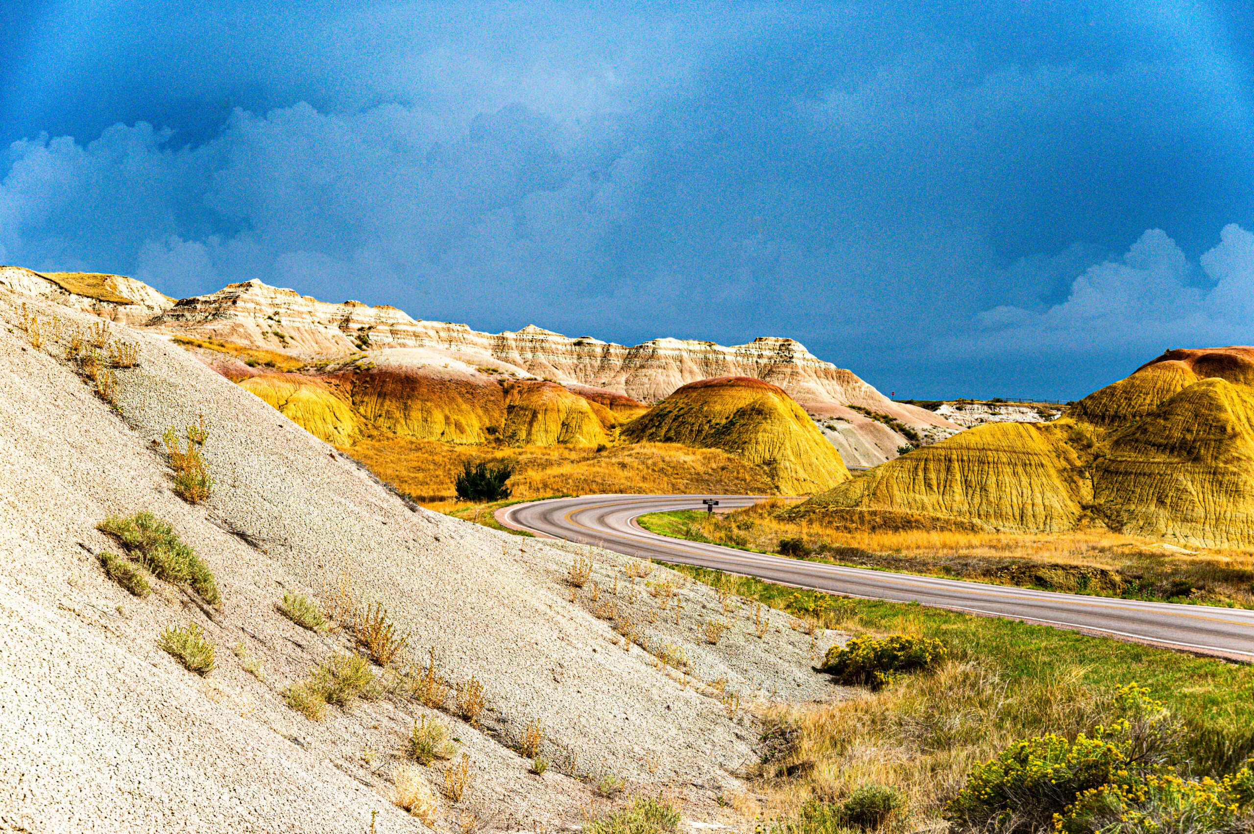
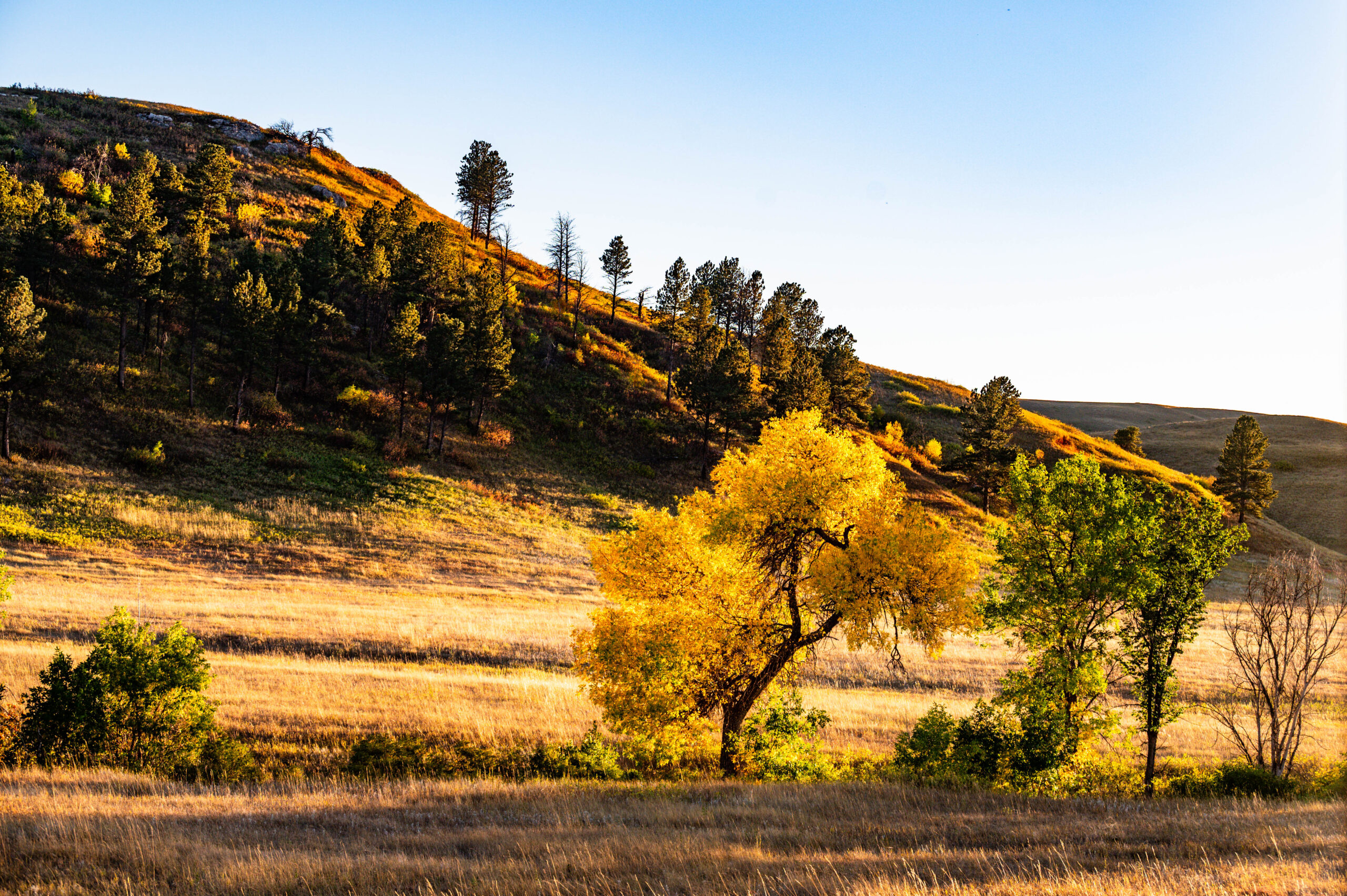
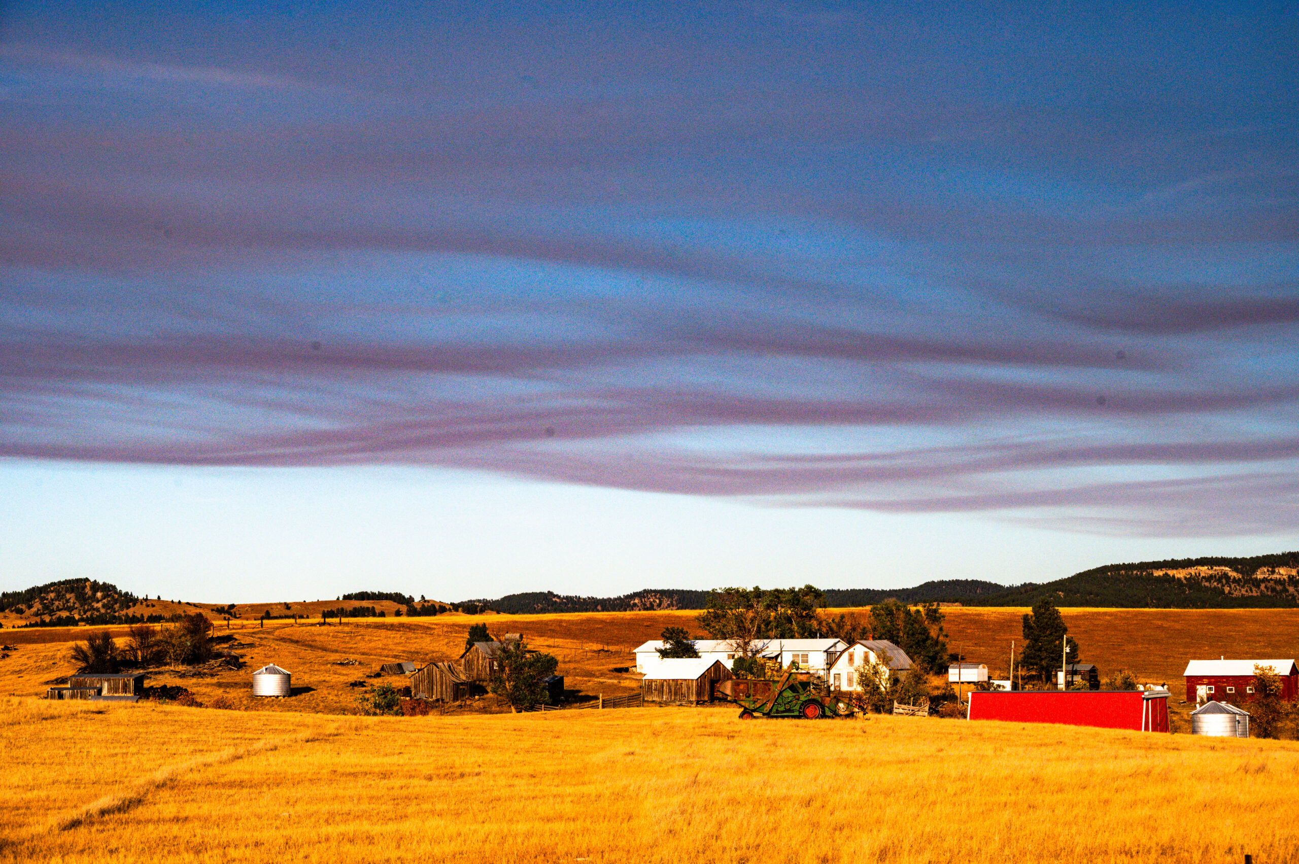
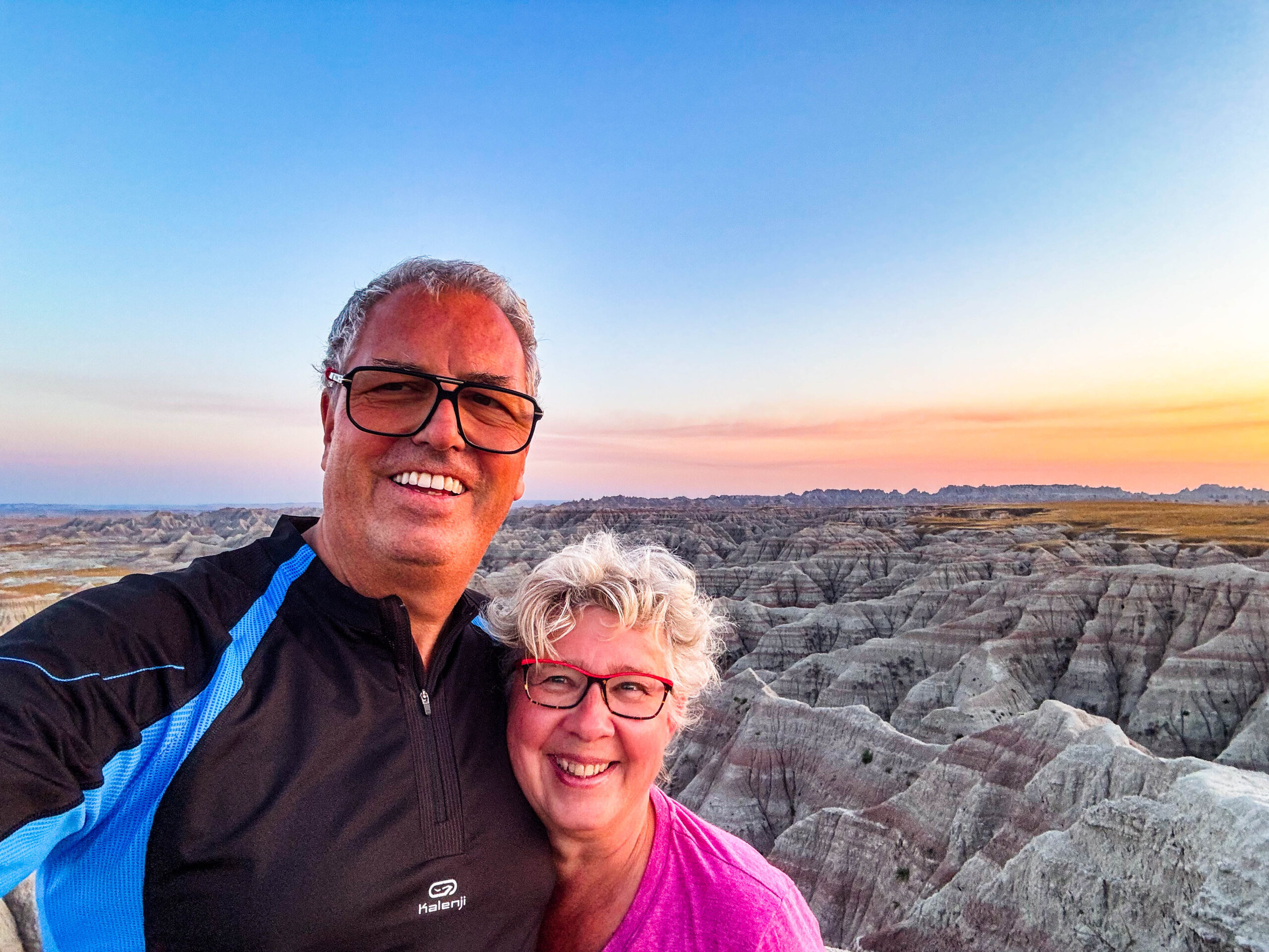
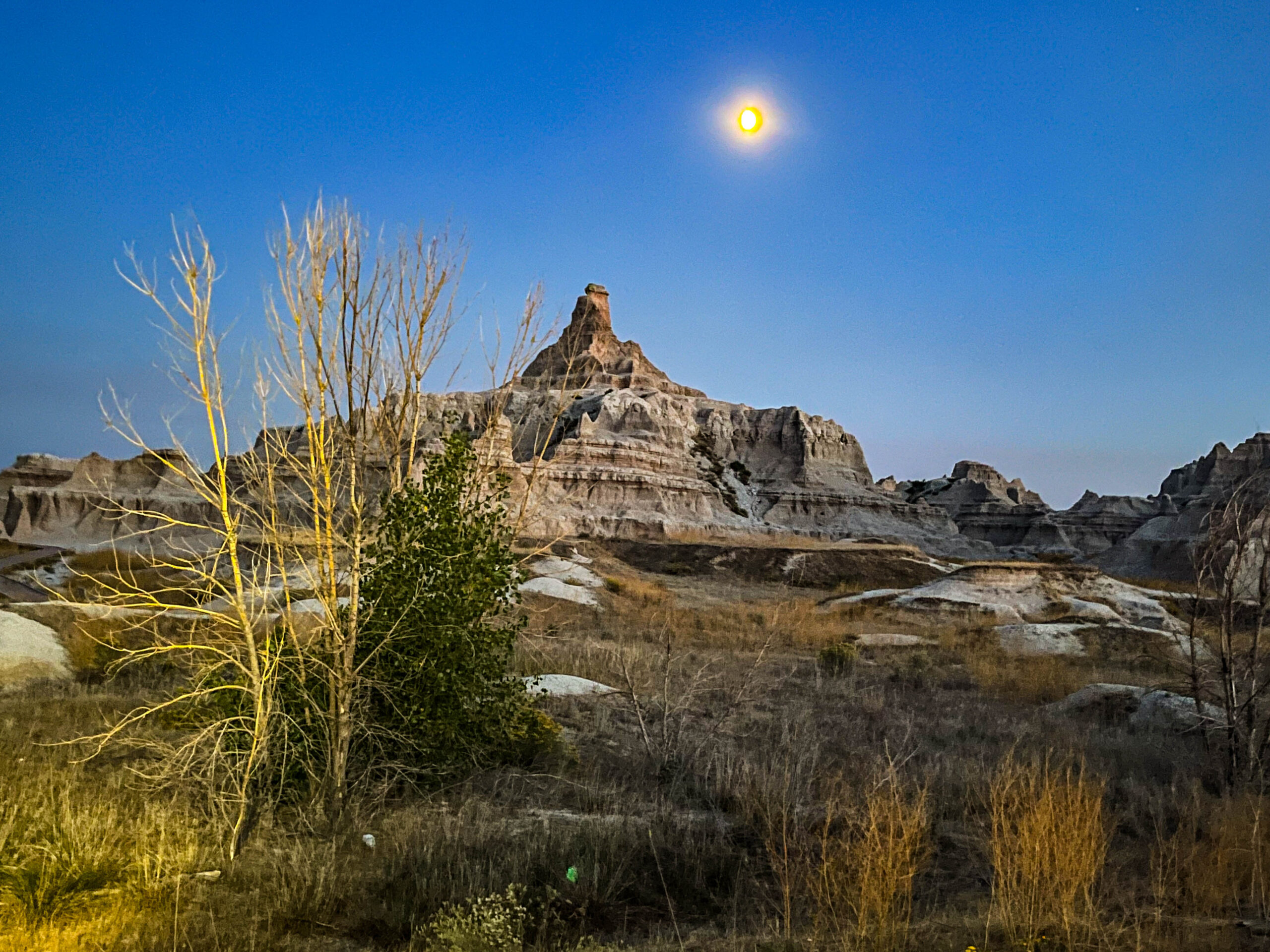
Es wird sichtbar Herbst, die Blätter leuchten in den verschiedensten Farben mit Überwiegen der gelben und roten Blätter. Über die Städtchen Hettinger (Sitzbesichtigung) und Lemmon geht es durch die wellige Prärie, schier endlose Sonnenblumenfelder – tw. schon abgemäht – wechseln mit schwarzen Rinderherden, dazwischen immer wieder Ölförderpumpen mit ihrem gemächlichen Nicken. Perfekt zum Sonnenuntergang und Mondaufgang sind wir am Eastgate des Badlands NP und verweilen am View-Point, bis es richtig dunkel ist.
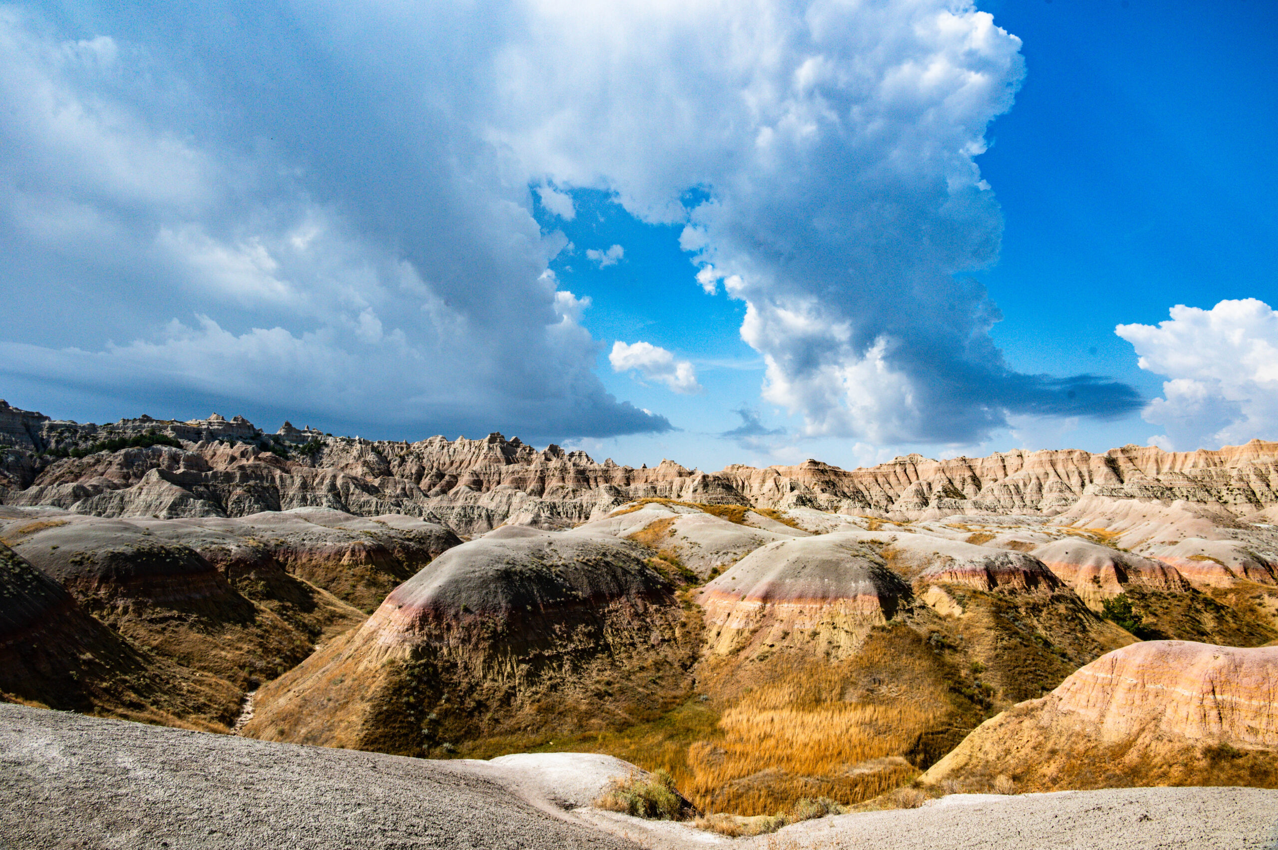
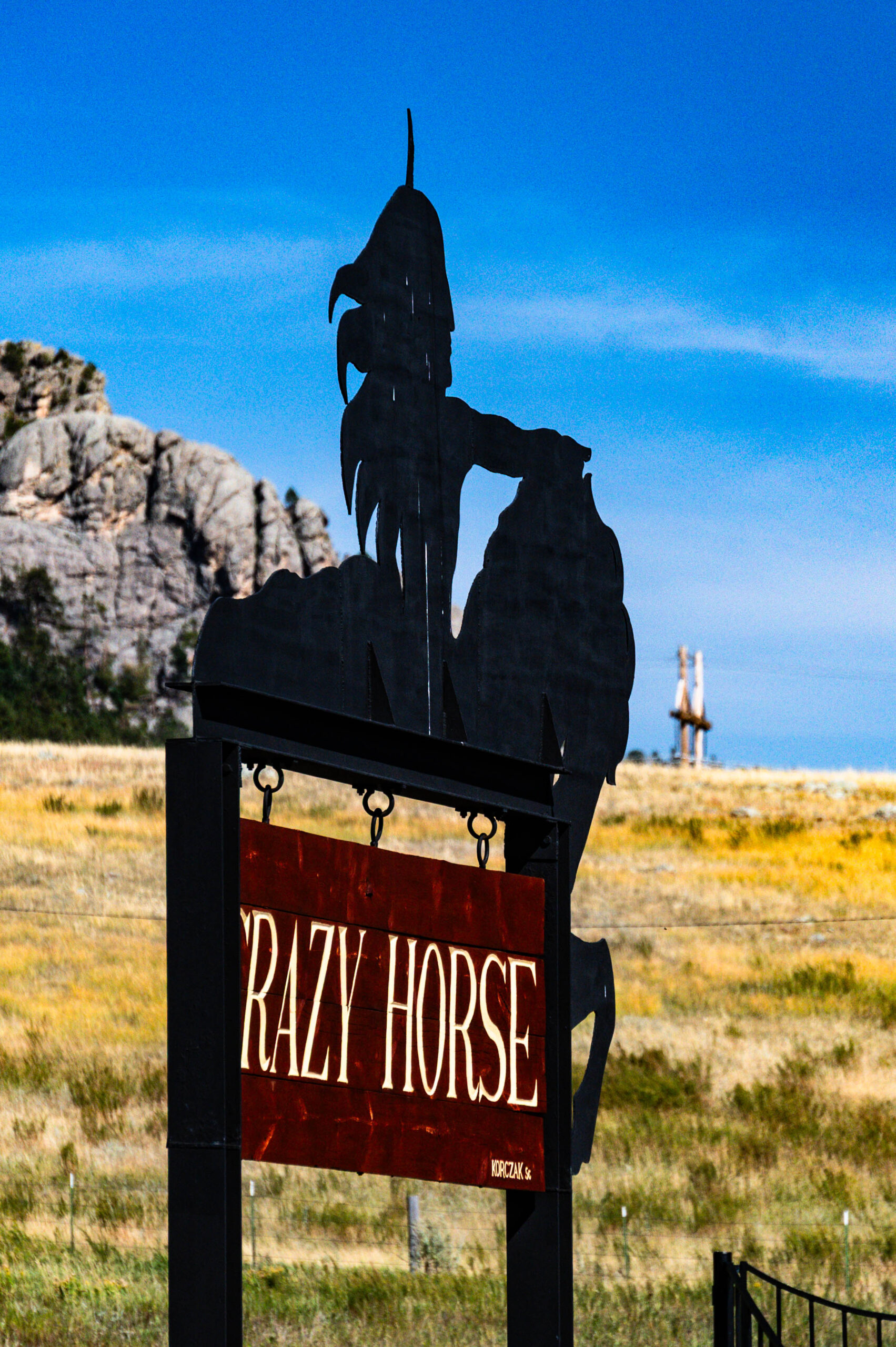
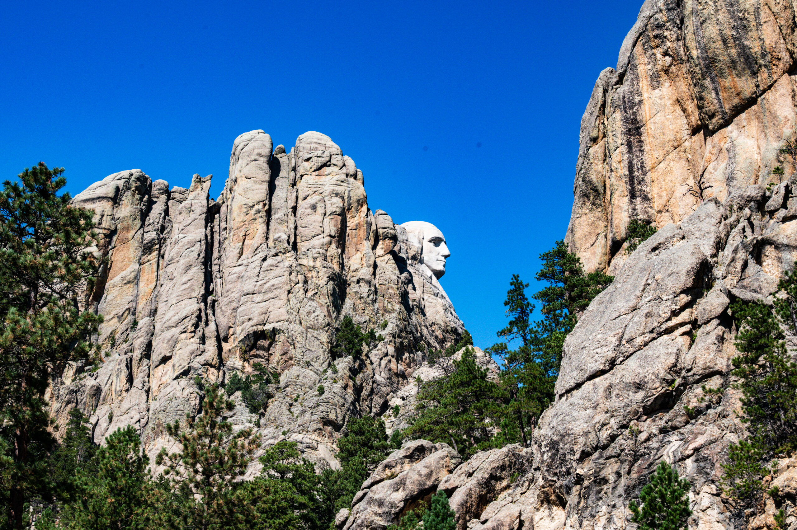
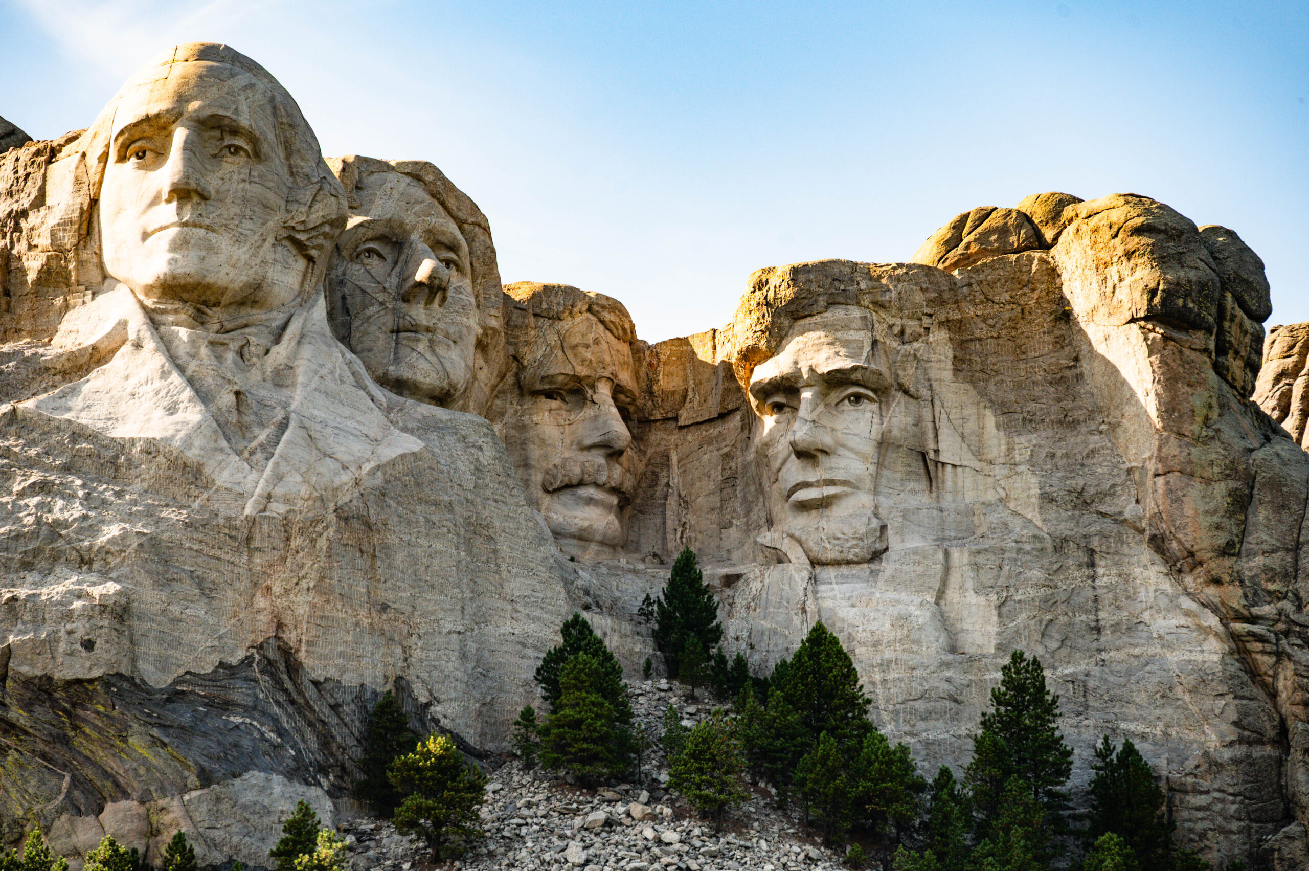
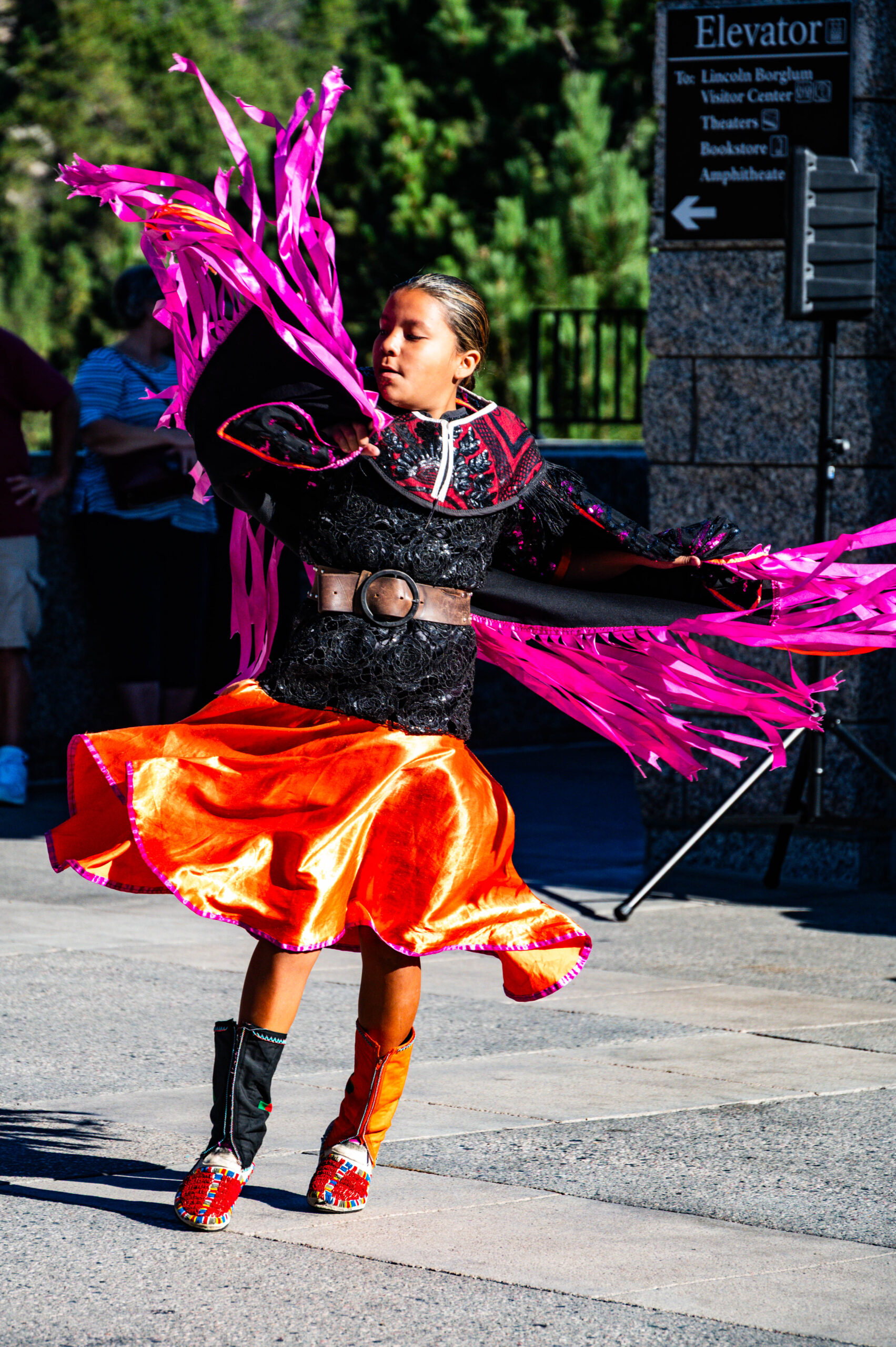
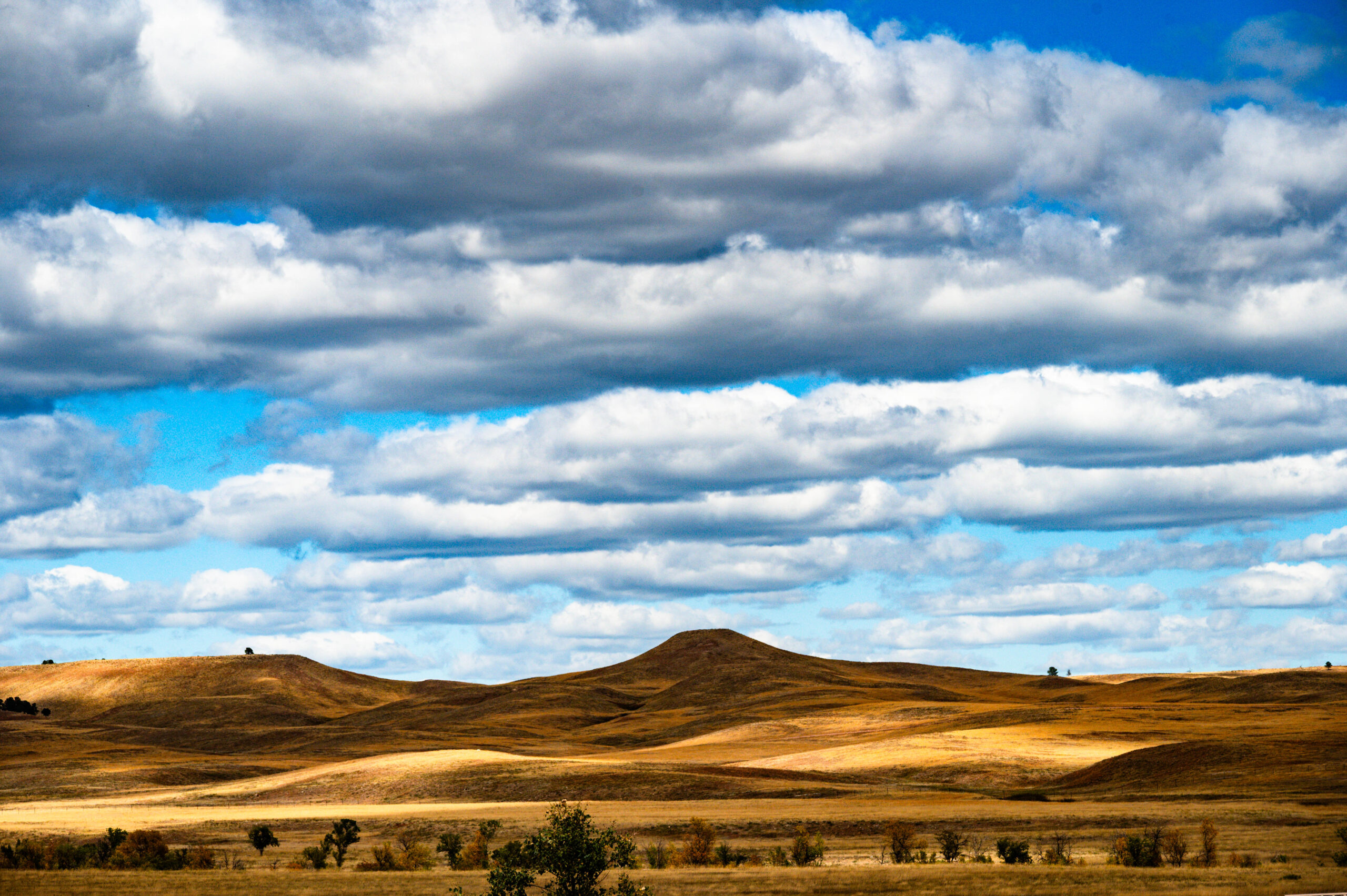
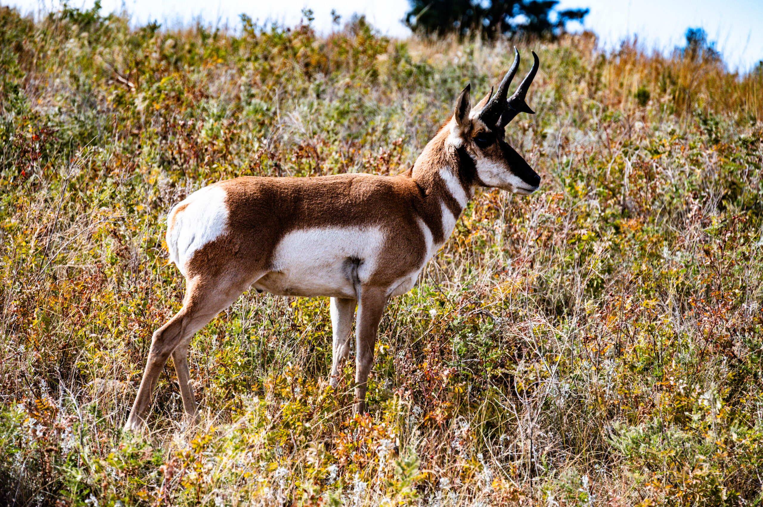
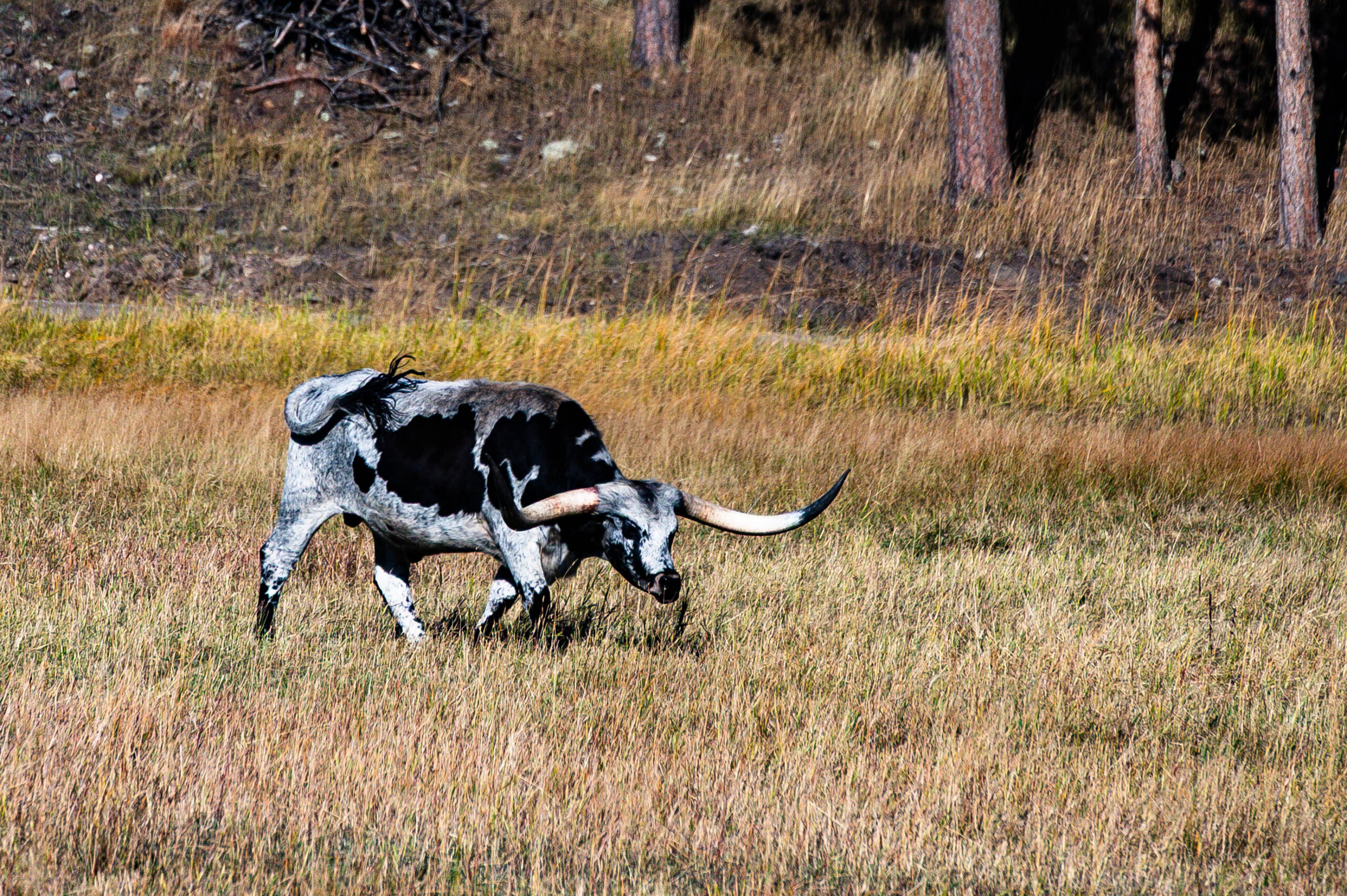
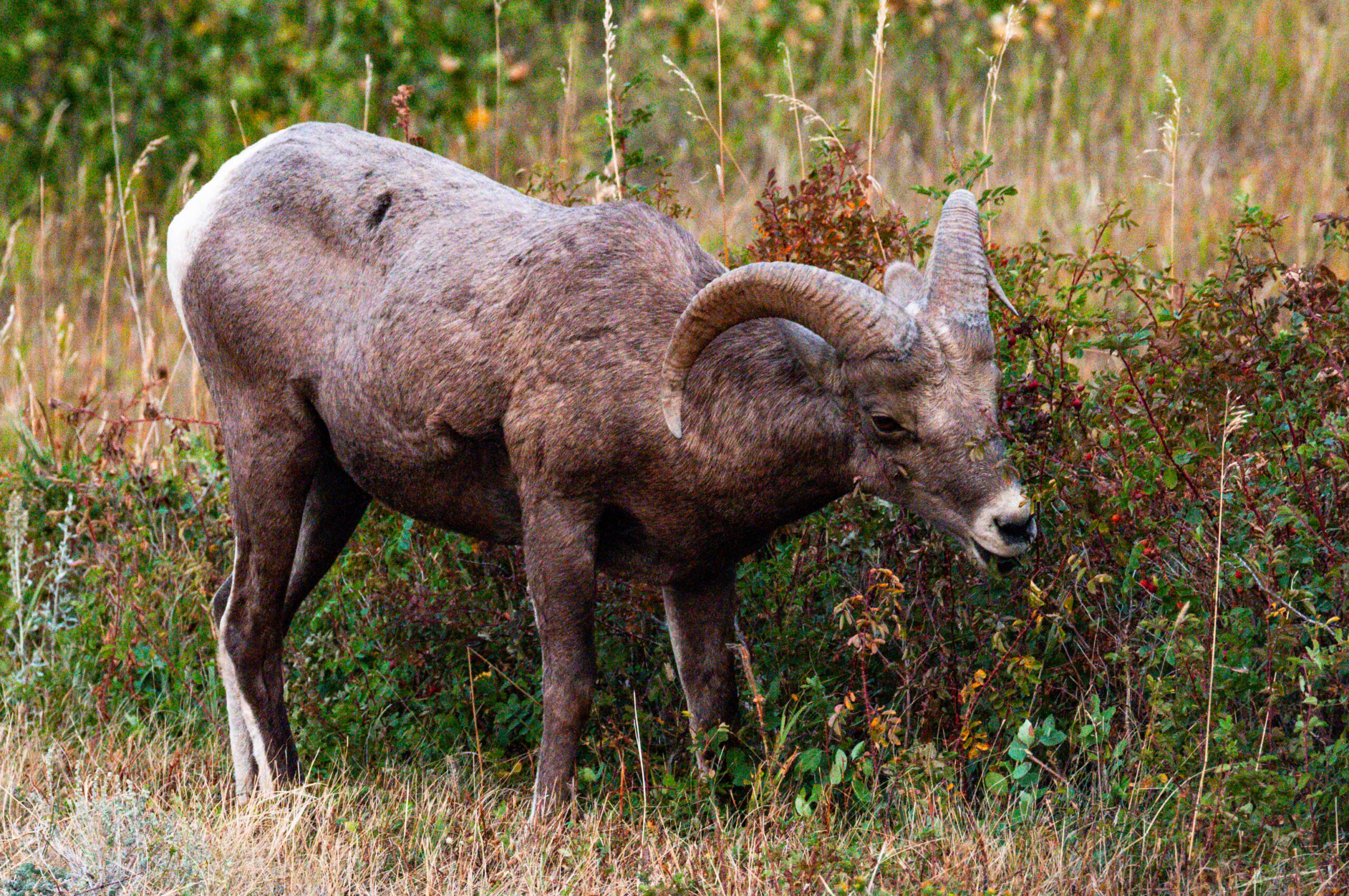
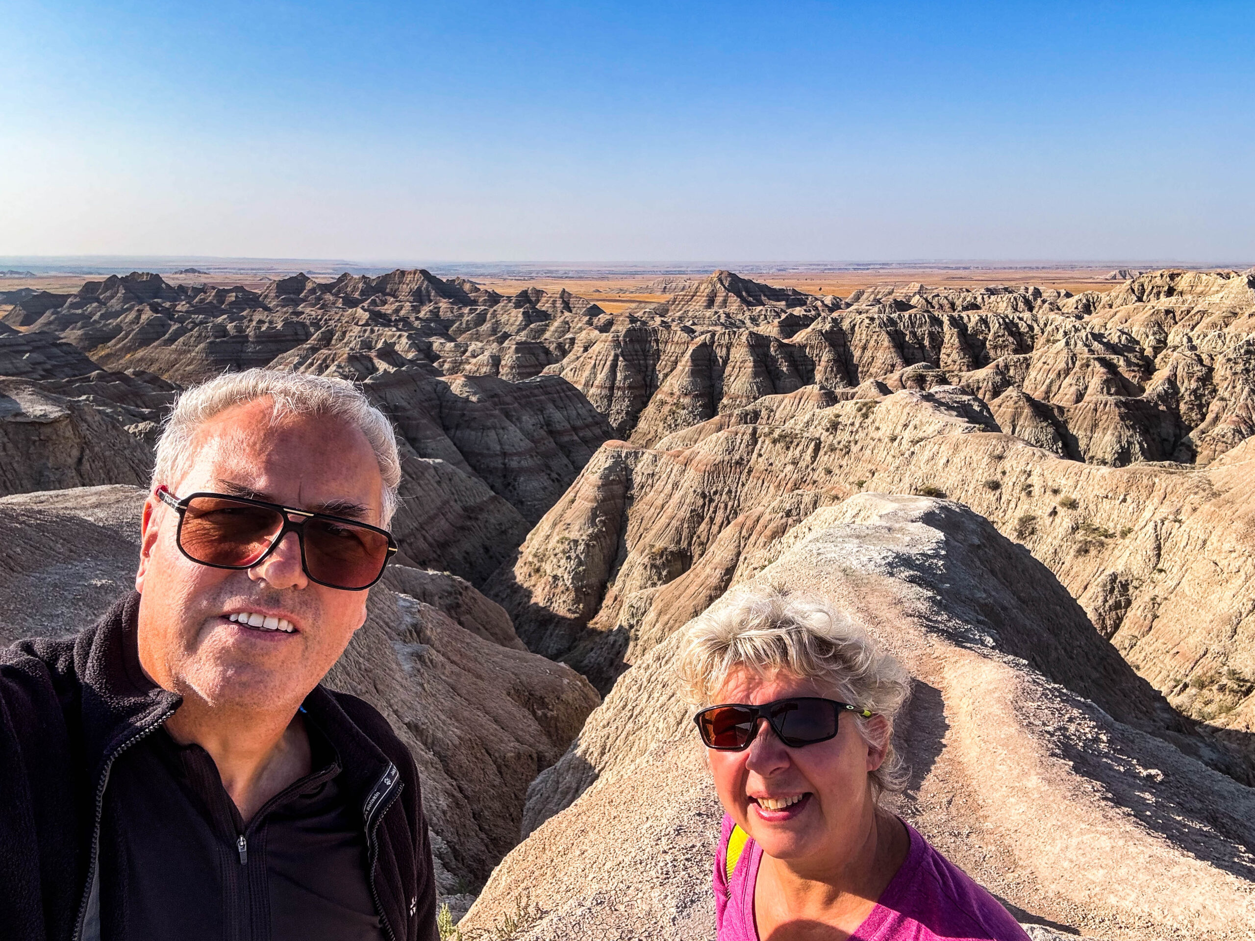
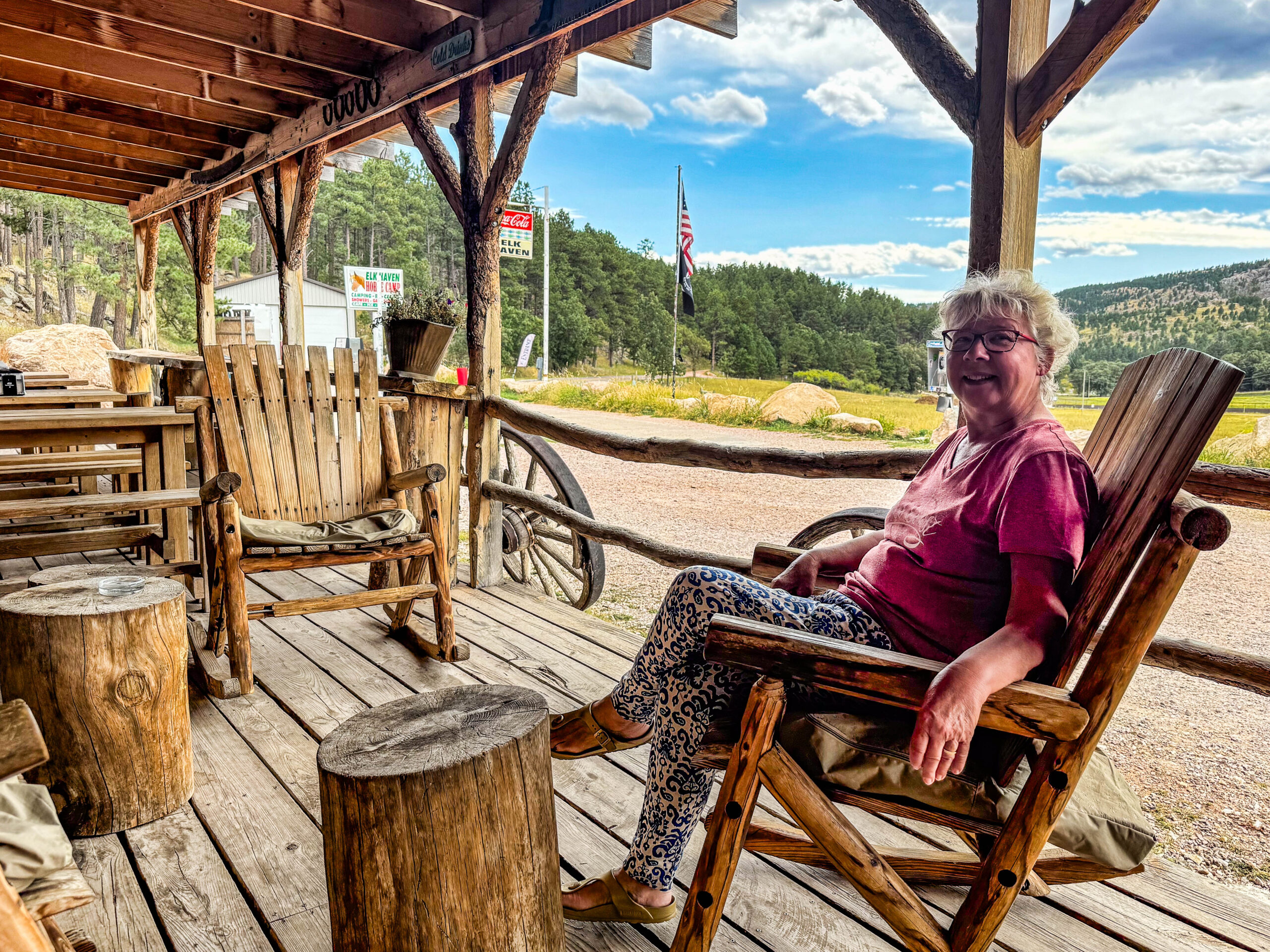
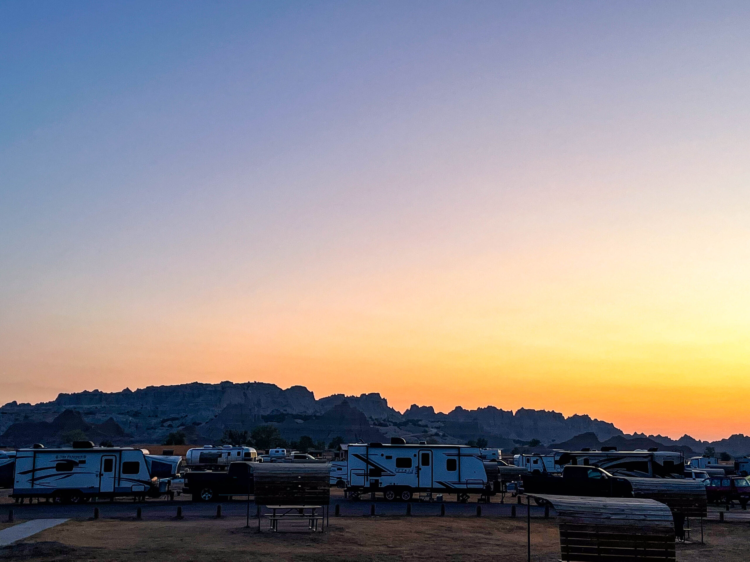
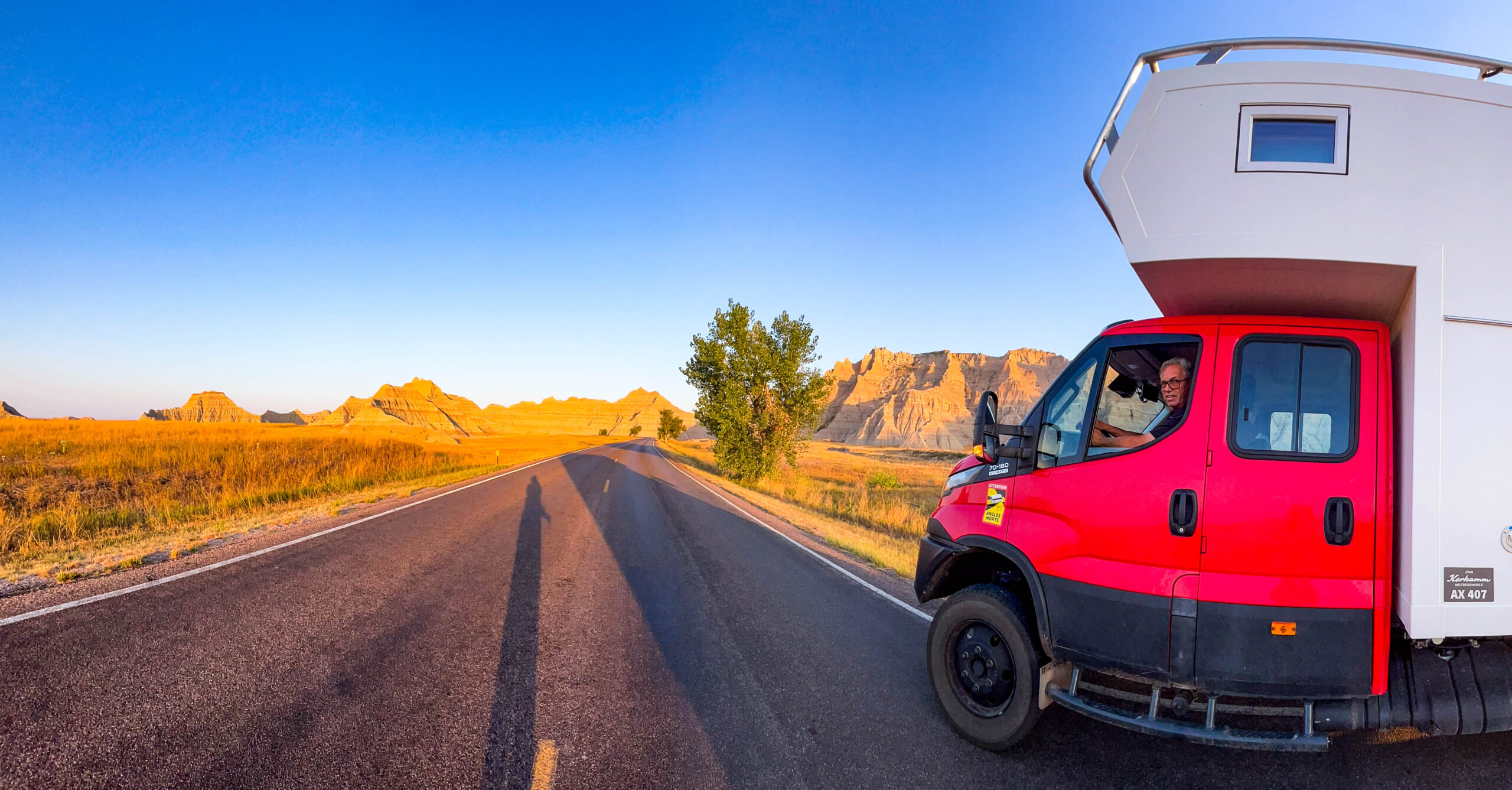
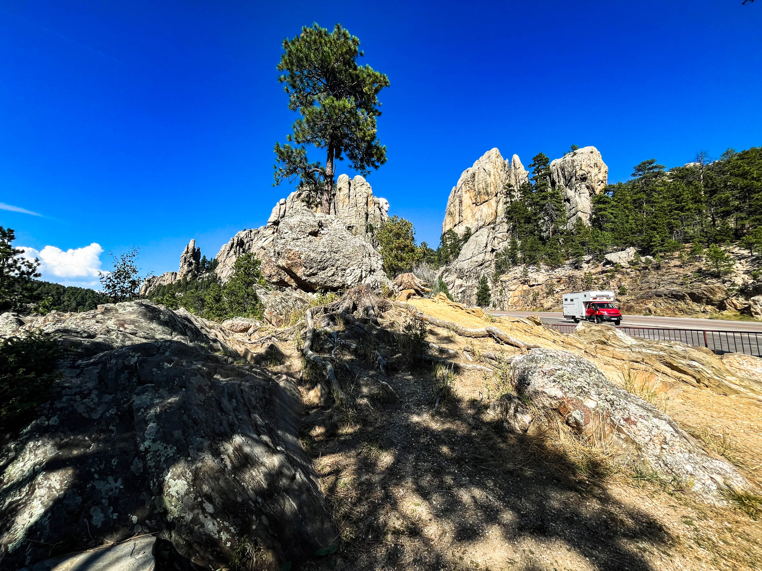
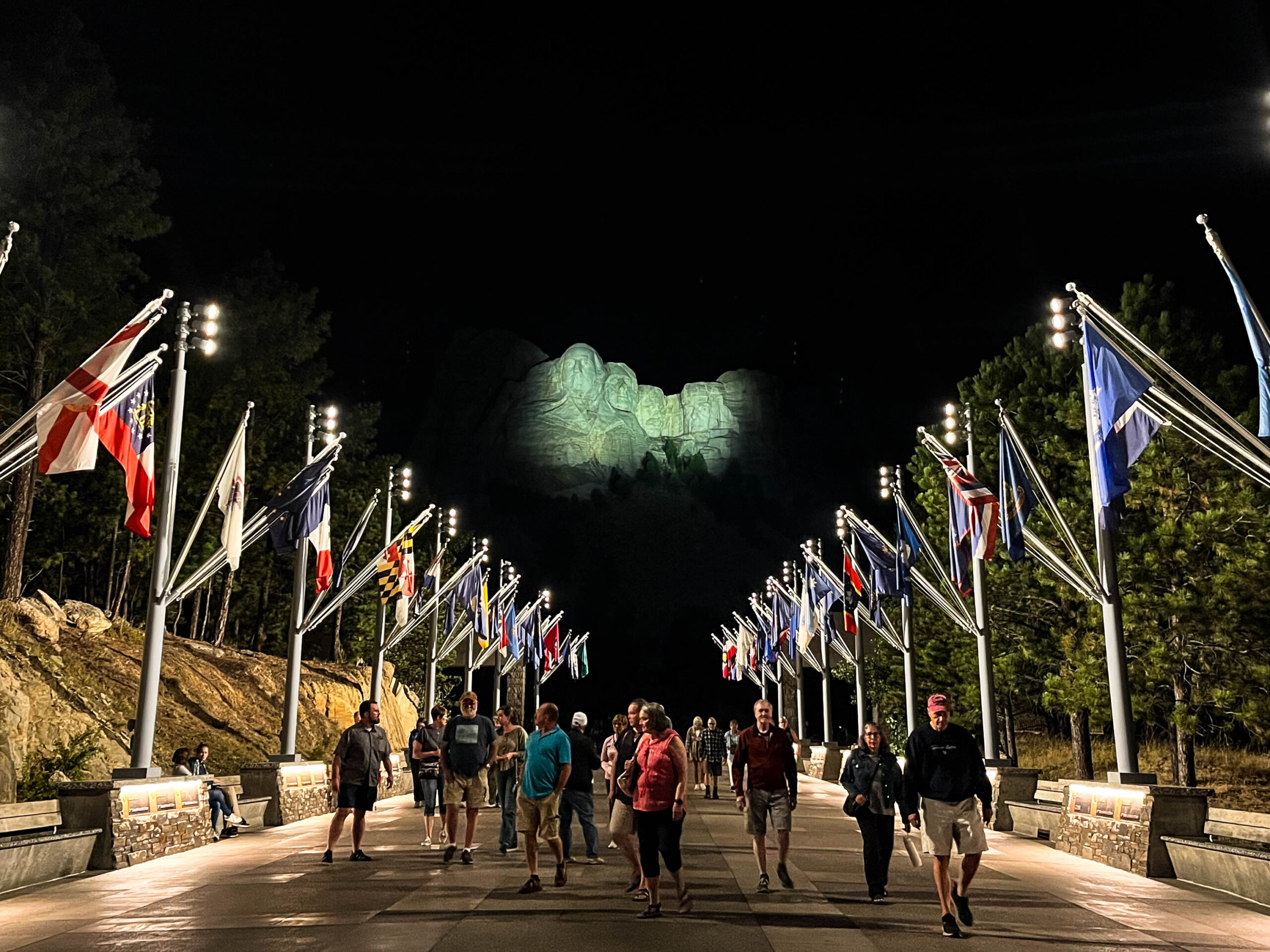
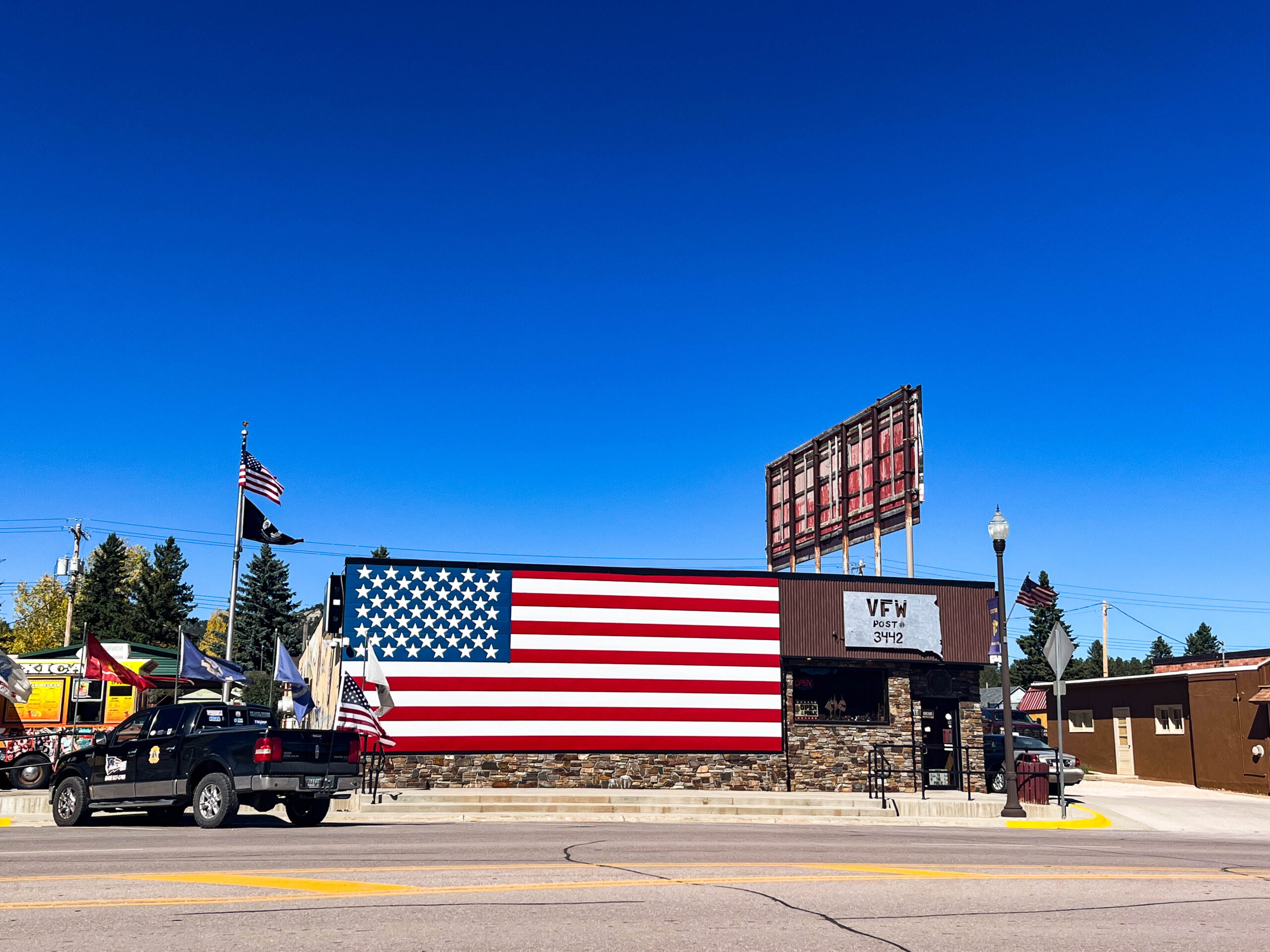
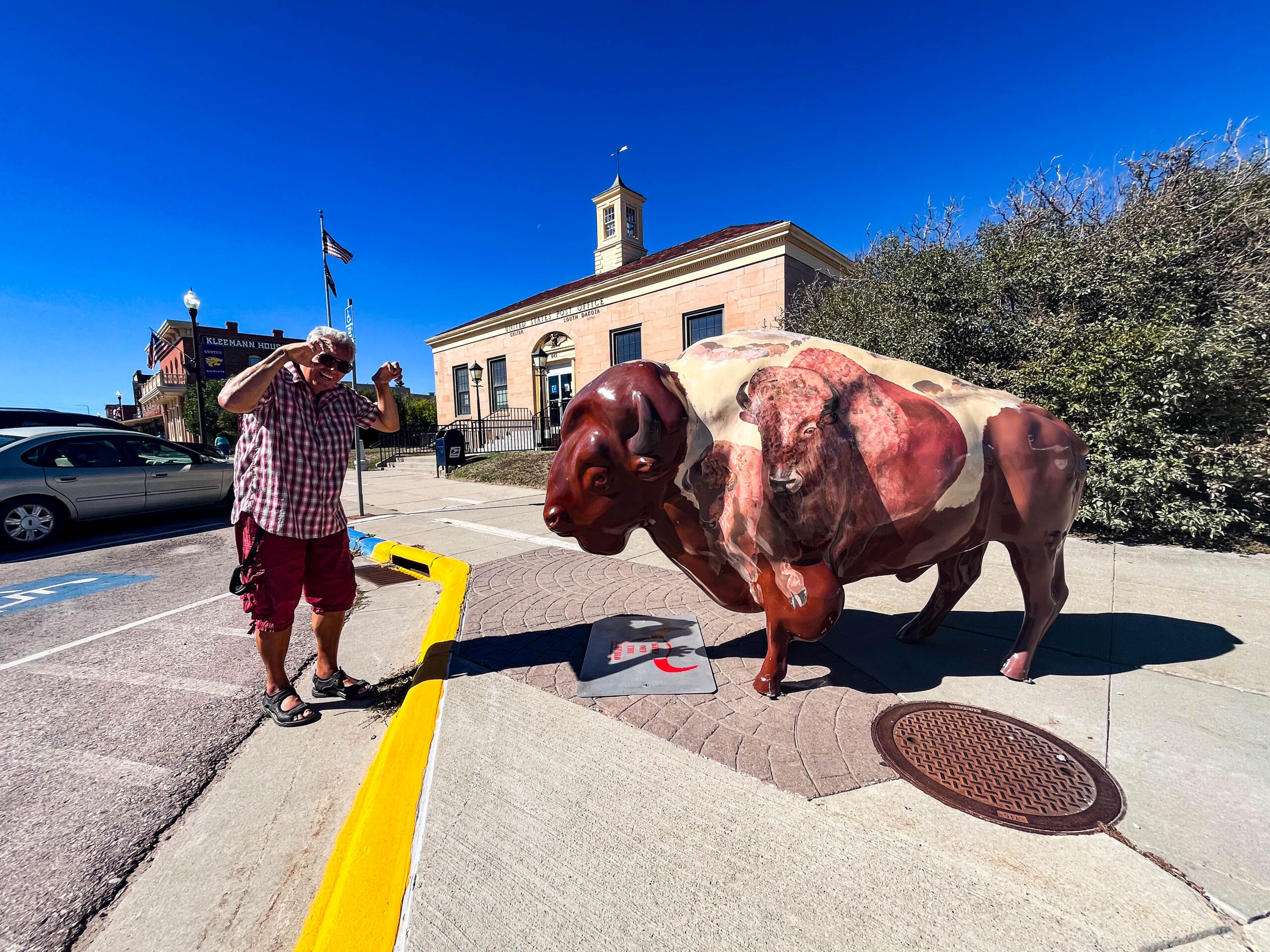
Der nächste Tag zeigt uns die spektakuläre Landschaft erst so richtig, hinzu kommen tolle Wolkenformationen, ein kurzes, aber heftiges Gewitter. Immer wieder wird vor Klapperschlangen gewarnt. Wir sehen Bighorn Sheep, vereinzelte Bisons und verlassen schließlich den Park via Rim-Route Richtung Rapid-City und übernachten nach wunderschöner Fahrt mit jeder Menge an Hirschen im Wind Cave NP (riesiger Höhlenkomplex). Am nächsten Morgen müssen wir aber leider feststellen, dass die Höhle wegen Renovierung geschlossen ist. Der Film der Höhlenführung zeigt, was wir verpassen. Das berühmte große „boxwork“ Vorkommen ist wenigstens im kleinen Museum anschaulich dargestellt. Wir fahren tiefer in die Black Hill Mountains, leider auch höher. Die Schwierigkeiten mit der Motorkühlung werden mehr, zunehmend ungeplante Stopps zur Abkühlung sind nötig. Das Crazy Horse Monument und vor allem die Mt. Rushmore Gedenkstätte faszinieren uns. Wir lösen als Senioren ein Parkticket für $ 5 – es ist ein ganzes Jahr lang gültig. Angesichts dieses Sparpotentials gönnen wir uns dann 2 Bisonburger mit Blick auf die Präsidentenköpfe. Abends beeindrucken die Lightshow und Flaggen-Zeremonie mit Dank und Ehrung der Veteranen, sehr ergreifend, sehr amerikanisch. Den kulturellen und spirituellen Kontrapunkt setzen die Tänze der Lakota-Frauen am nächsten Morgen.
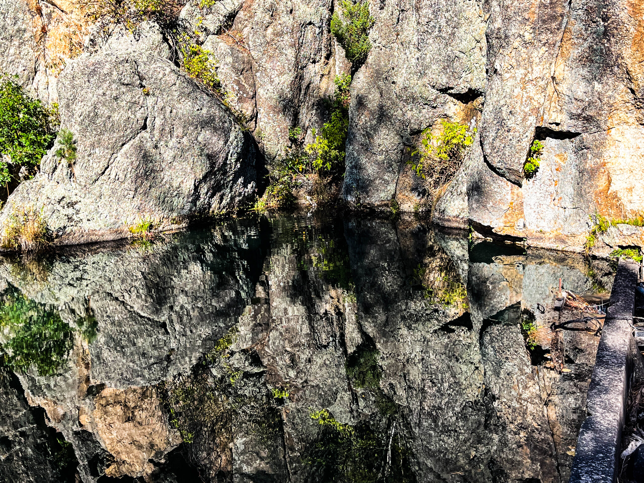
Die Black Hills (auf Lakota Paha Sapa‚ Schwarze Berge oder He Sapa) sind ein Gebirgszug im Westen des US-amerikanischen Bundesstaats South Dakota, der bis ins nordöstliche Wyoming hineinreicht. Er liegt isoliert im östlichen Vorland der Rocky Mountains am Westrand der Great Plains und weist eine von der Umgebung abweichende Fauna und Flora auf. Eine Unterart des Junko kommt beispielsweise nur hier vor und in den Wäldern sind Küsten-Kiefern, Weiß-Fichten und Biegsame Kiefern zu finden. Auf Grund der dichten Nadelwald-bestände sind hier Vogelarten wie Kiefernhäher, Fichtenkreuzschnabel und Indianergoldhähnchen beheimatet. Die Black Hills gelten den Lakota-Sioux als heilige Berge. Zudem stellen sie den Gegenstand zahlreicher Mythen der Lakota dar. Noch heute besuchen einige Stammesangehörige die spirituellen Orte in den Bergen, um ihre Religion auszuüben. Im Vertrag von Fort Laramie 1868, den die US-Regierung mit den Lakota-, Cheyenne- und Arapaho-Indianern abschloss, wurden den drei Völkern das Sioux-Reservat zugesprochen und die Black Hills den Lakota als exklusives Jagdgebiet zugesichert. Eine nach dem Vertrag illegale Expedition unter George Armstrong Custer erkundete 1874 die Black Hills und fand in den Bergen Gold. Nach den Goldfunden versuchte die Regierung die Lakota zu einer Abtretung der Bergkette zu bewegen, allerdings ohne Erfolg. Goldsucher drangen rechtswidrig in das Gebiet ein, es entwickelte sich ein Goldrausch. Konflikte im Winter 1875/76 führten zum erneuten Einsatz Custers und des 7. Kavallerie-Regiments und der Schlacht am Little Bighorn im Juni 1876. Nach der endgültigen Niederlage der Indianer im Herbst desselben Jahres wurden 1877 das große Sioux-Reservat zerschlagen und den Lakota die Black Hills entzogen. Ein Prozess der Lakota aus dem Jahr 1921 dauerte bis 1980, als der Supreme Court in der Entscheidung United States v. Sioux Nation of Indians, 448 U.S. 371 (1980) die Maßnahme als Enteignung einstufte und den Lakota 105 Millionen Dollar als Entschädigung zusprach. Obwohl das Lakota-Reservat zu den ärmsten Regionen der Vereinigten Staaten gehört, nahm die Vertretung des Volkes die Zahlung nicht an, sondern verlangt bis heute die Rückgabe der Berge. Die Gelder waren bis 2007 durch Zinsen auf über $ 750 Millionen angewachsen. Die Black Hills erstrecken sich zwischen 43°30′ und 45° nördlicher Breite sowie 103° und 105° westlicher Länge. Der im Kartenbild annähernd elliptische Gebirgszug ist etwa 160 km lang und bis zu 96 km breit. Seine Längsachse verläuft in nord-südlicher Richtung. Die Basis der Black Hills liegt in 760 bis 900 m Höhe. Der höchste Punkt ist der Black Elk Peak mit 2.208 m im Süden. [Wikipedia]
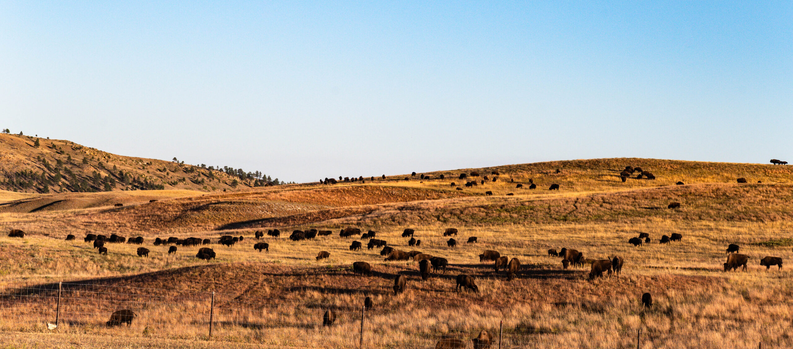
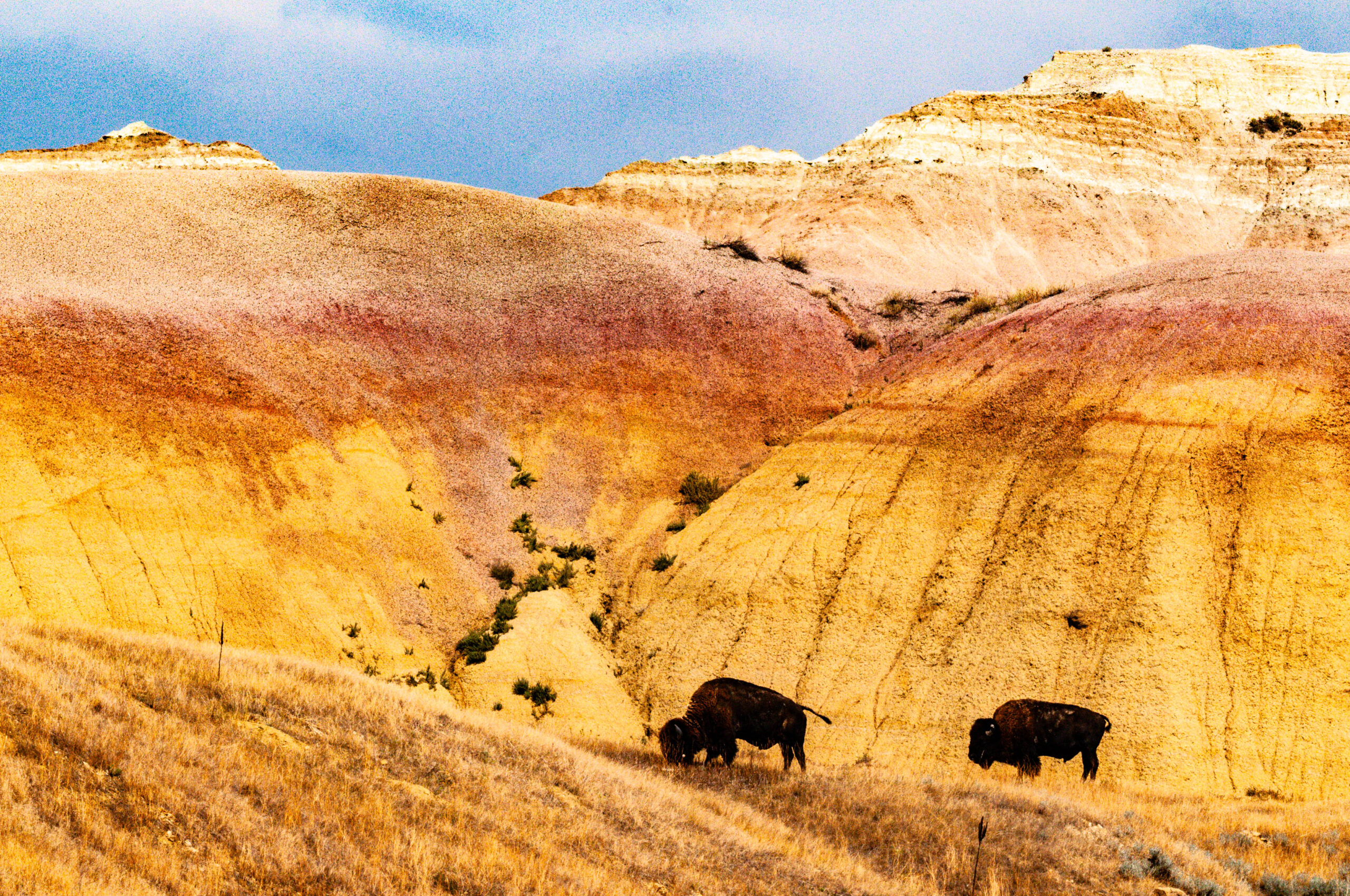
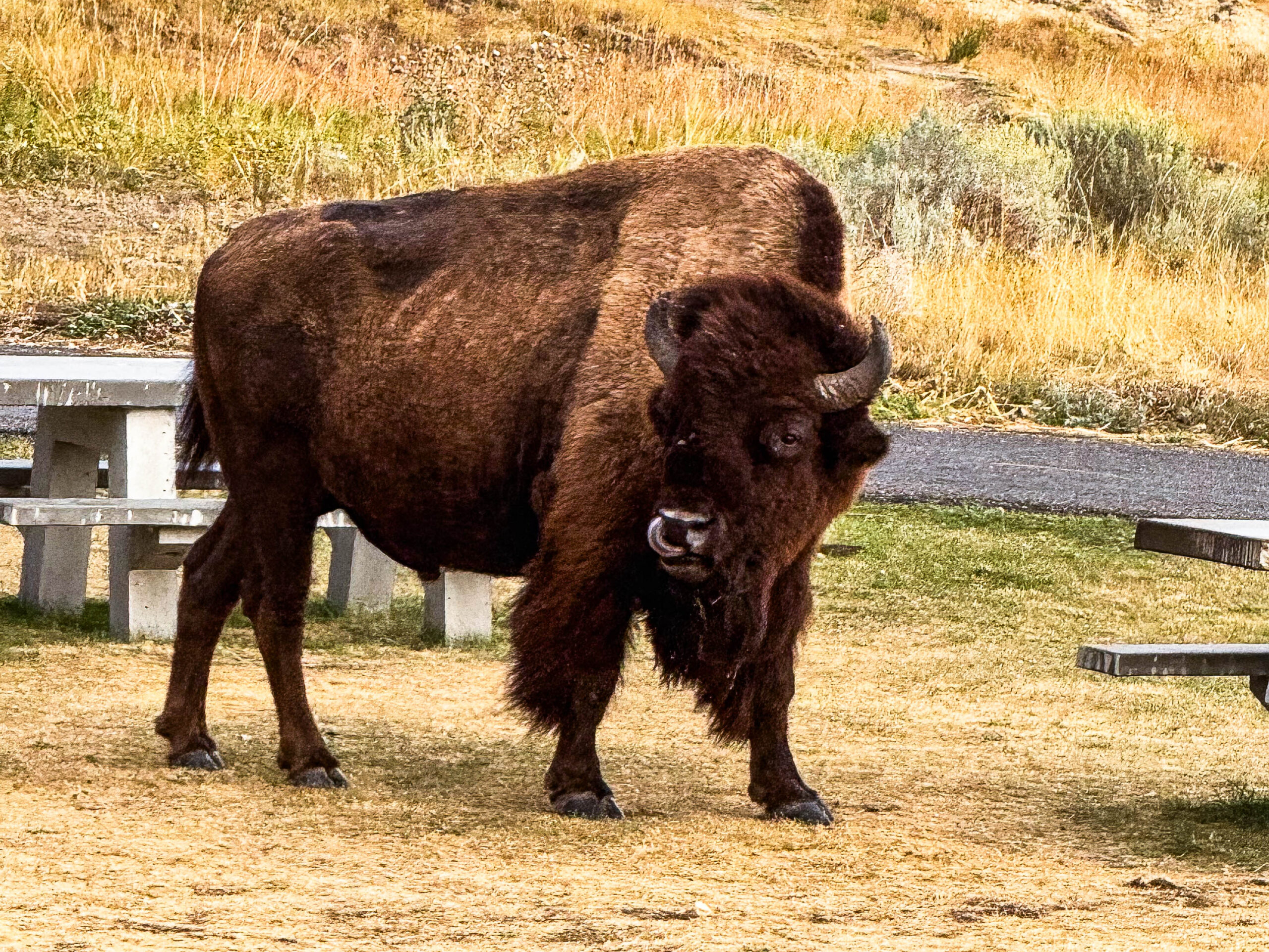
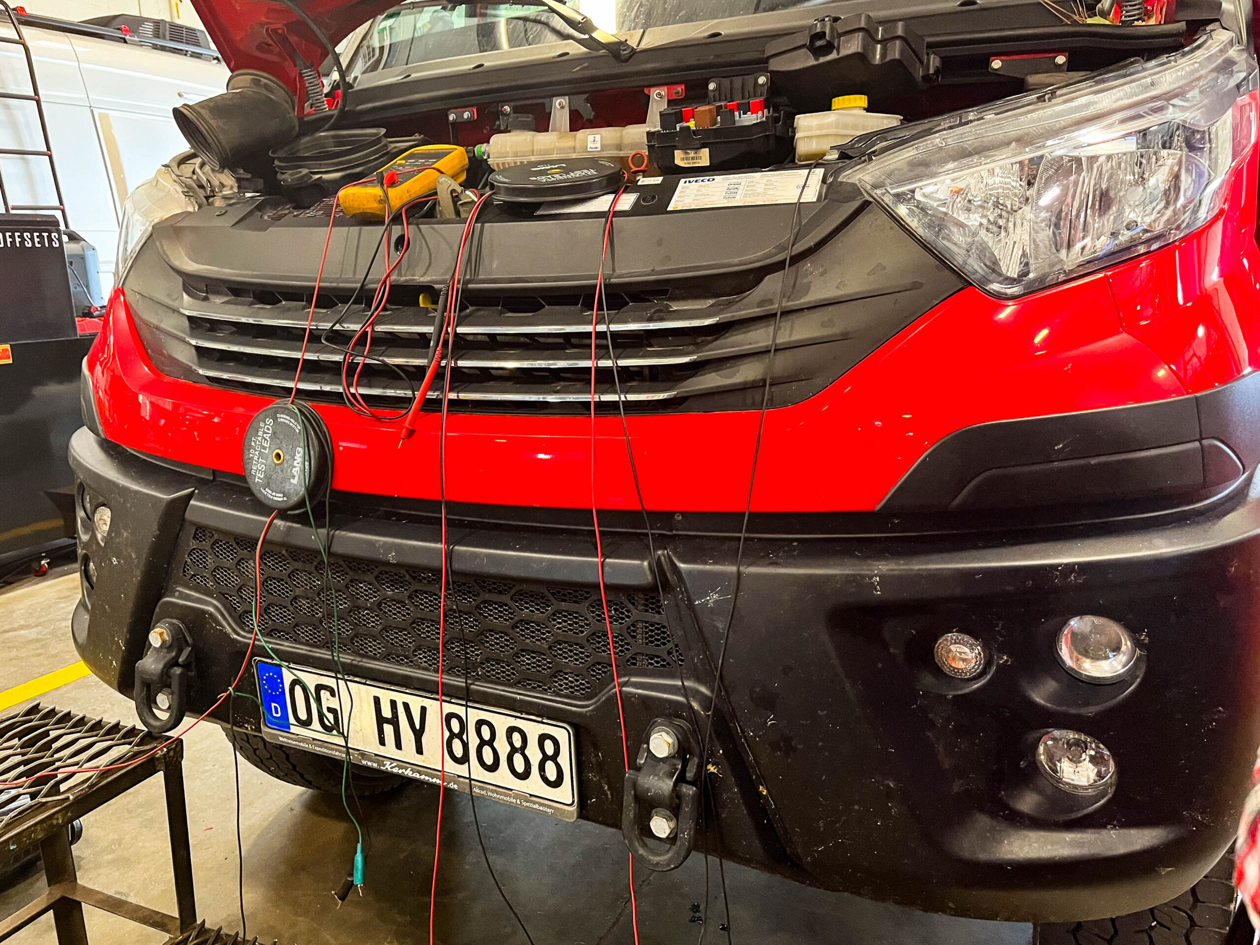
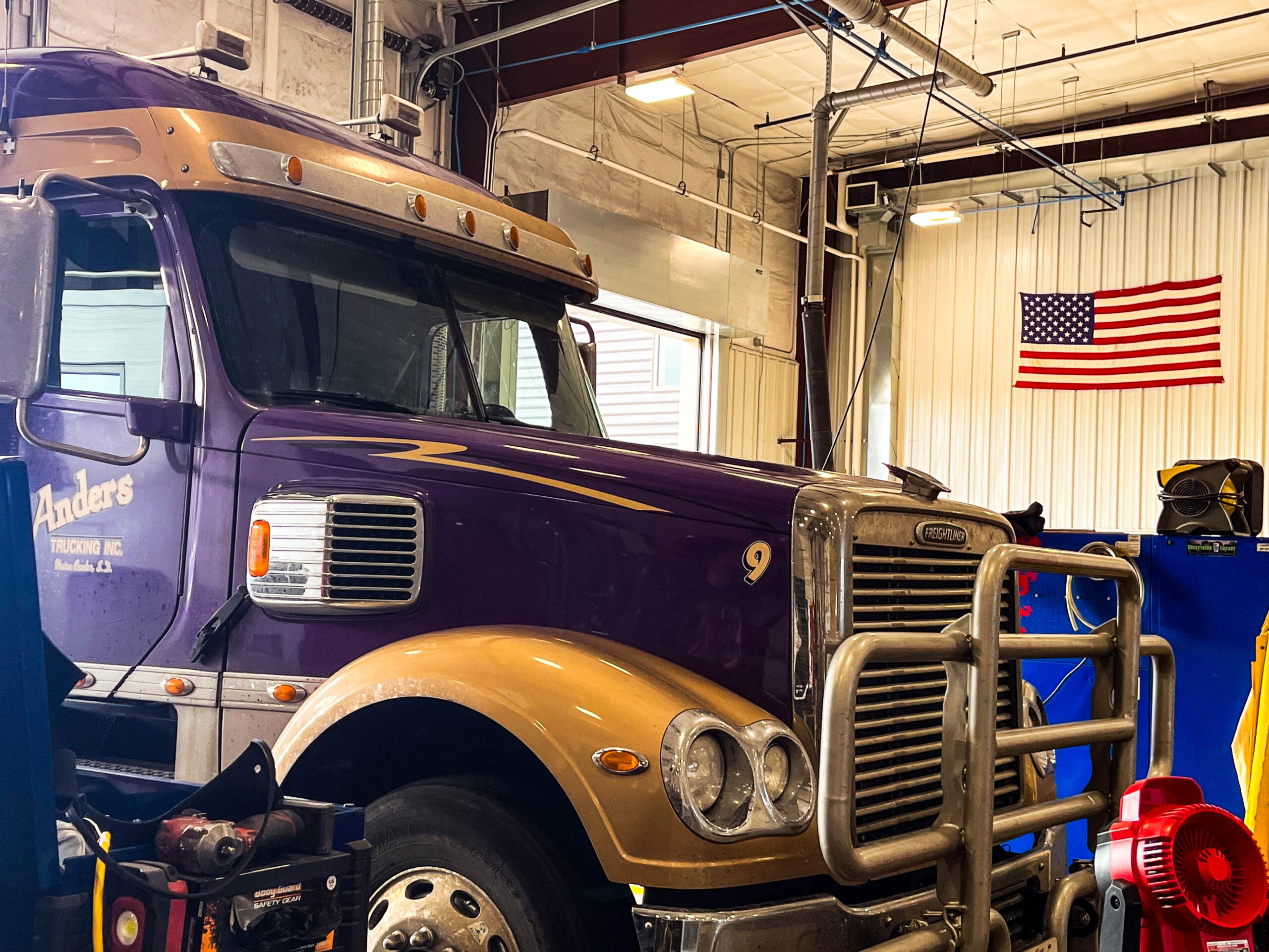
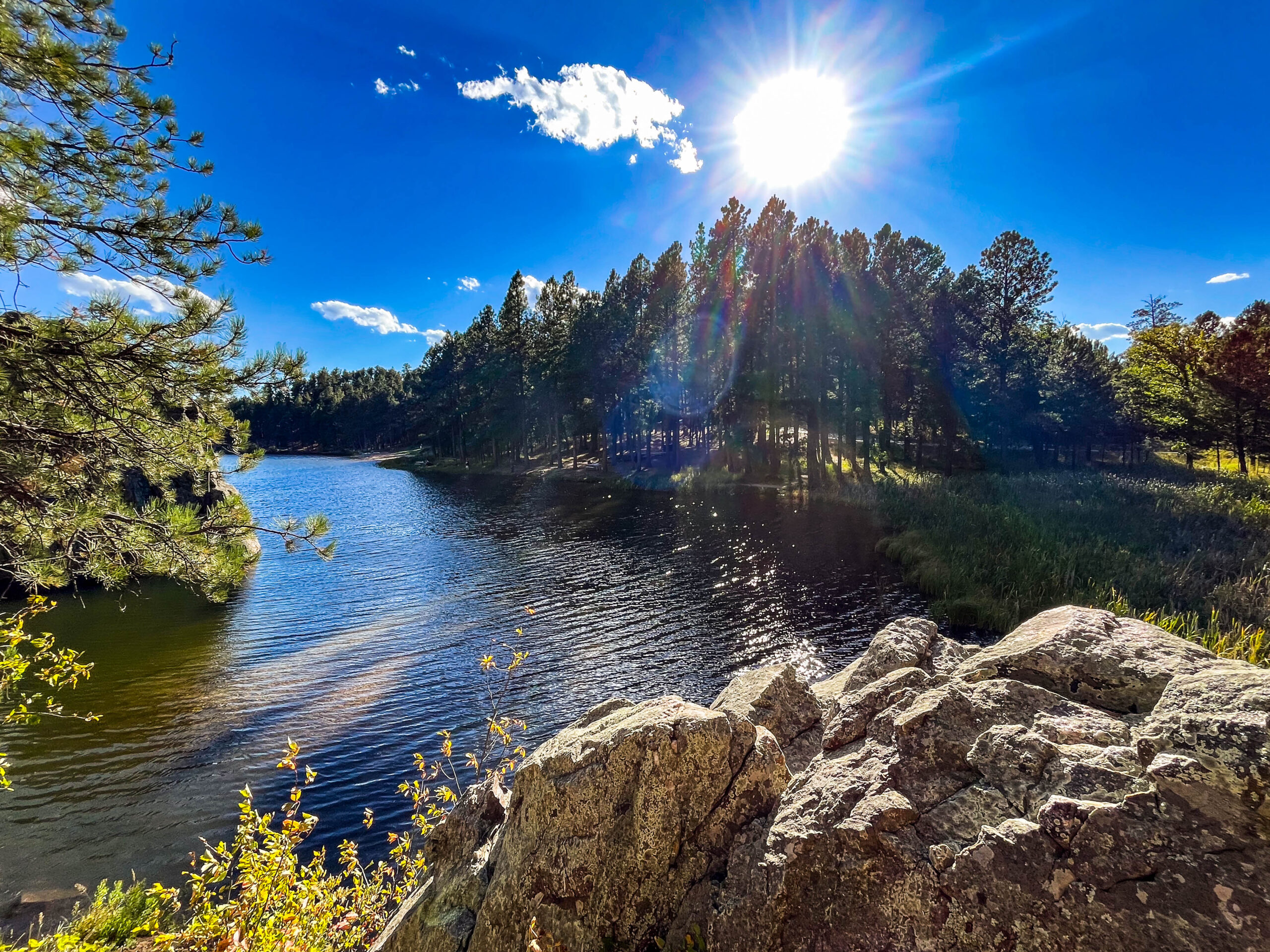
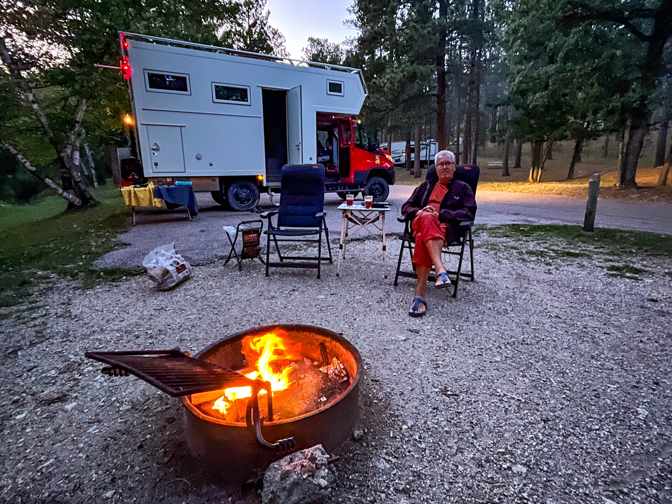
Wir müssen uns dringend um das Temperaturproblem unseres Motors kümmern und beschließen, Hilfe in Rapid City zu suchen. Mit Mühe finden wir nach etlichen Absagen (Angst vor Haftungsansprüchen) bei Floyds Truck Services jemanden, der bereit ist, nach unserem Motor zu schauen. Nach etwas Wartezeit ist klar, die Kupplung des Zusatzventilators ist defekt. Ein Ersatzteil muss von Deutschland eingeflogen werden und sollte binnen Wochenfrist eintreffen. Ein Freund zuhause investiert viel Zeit und Mühe und organisiert die Zusendung. Wir vereinbaren einen Termin zum Tausch in der Werkstatt und beschließen die Wartezeit im nahegelegenen Custer-State-Park zu verbringen. Das jährliche „Buffalo-Roundup“ & Arts-Festival findet laut Schild am Eingang 10 Tage später statt. Schade für uns dachten wir, da werden wir dann mit repariertem Homey im Yellowstone NP sein. Aber erstens kommt es anders und zweitens als man denkt: Nach 2 Tagen haben wir eine Tracking-Nr. und eine umfassende Bilddokumentation, wie wir unseren Iveco auseinandernehmen können/müssen, um die Kupplung zu tauschen. Wir genießen den Park in Herbstfarben bei Temperaturen zwischen 30/35 ° , wandern, baden und machen ausgiebige „game-drives“. Tatsächlich toppen hier die Bisons alles, große Herden ziehen mal nah neben oder auf der Straße, mal fern über die Hügel fast wie bei der großen Migration in Afrika. Daneben finden sich Dickhornschafe, Springböcke, Präriehunde, Weißwedelhirsche, Esel, Kojoten und Bergziegen entlang der Strecke.
Doch warum bewegt sich unsere Ersatzkupplung nicht aus dem UPS-Center am Frankfurter Flughafen? Tagelang versuchen Michael und wir in der Servicewüste UPS Auskunft zu bekommen, es fehlte eine Zollerklärung, obwohl alles mit einem UPS-Mitarbeiter besprochen und so mit seiner Hilfe ausgefüllt wurde. Ein Tag nachdem wir endlich wussten warum es stockte, haben wir die Zollerklärung via Zollagent UPS zukommen lassen. Nun waren sie aber nicht in der Lage, dem Paket bzw. der Tracking-Nr. die Zollerklärung zuzuordnen und haben schließlich das Paket zurück zum Absender geschickt (wo es bis heute auf uns wartet).
Unsere Stimmung ist am Tiefpunkt. Wir beschließen unter Auslassen der Berge zurück nach Kanada zu fahren. Das Buffalo-Roundup nehmen wir noch mit, den Yellowstone NP verschieben zähneknirschend.
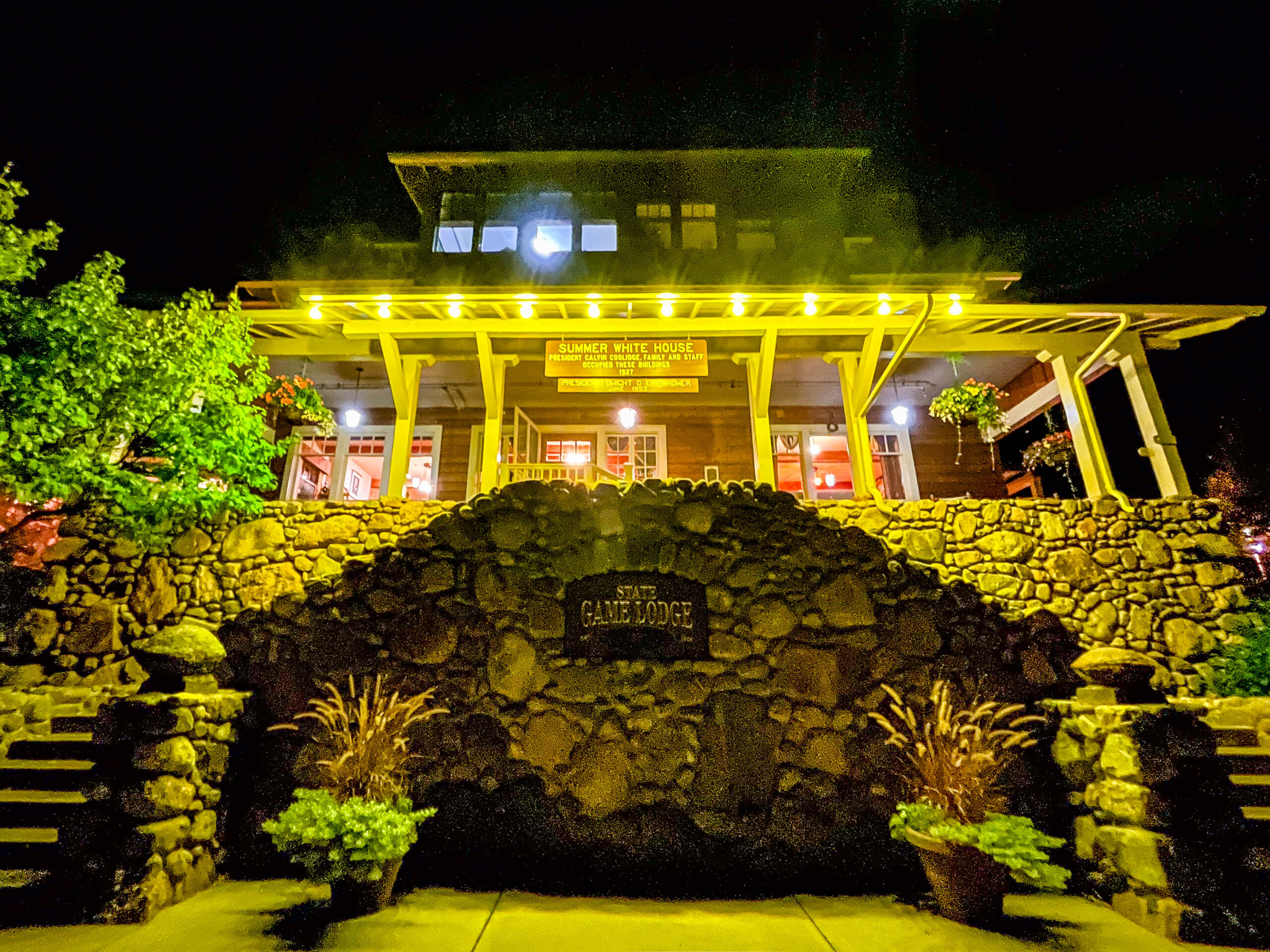
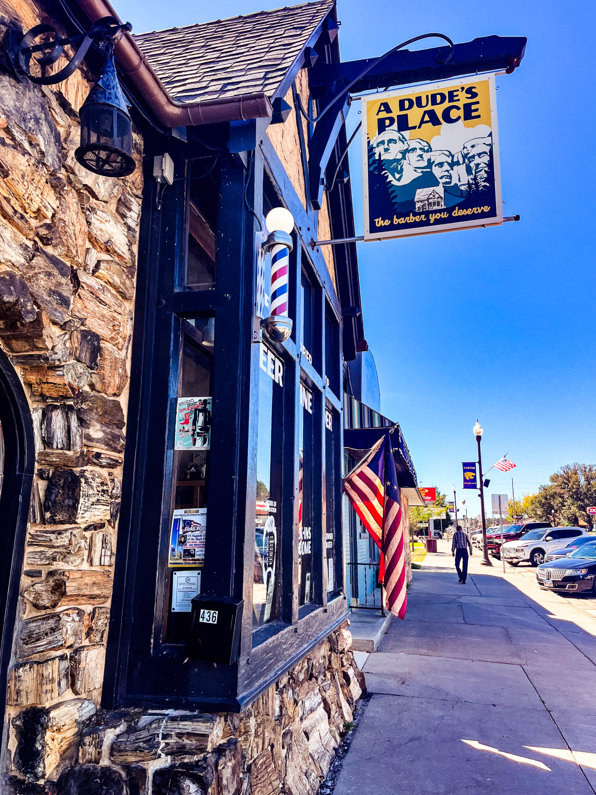
Aus Frust fahren wir nach Custer – ein Frisörbesuch hilft immer – und gönnen uns abends im Park ein Bisonsteak in der Coolidge Game Lodge, quasi dem sommerlichen „White House“ des 30. Präsidenten der USA.
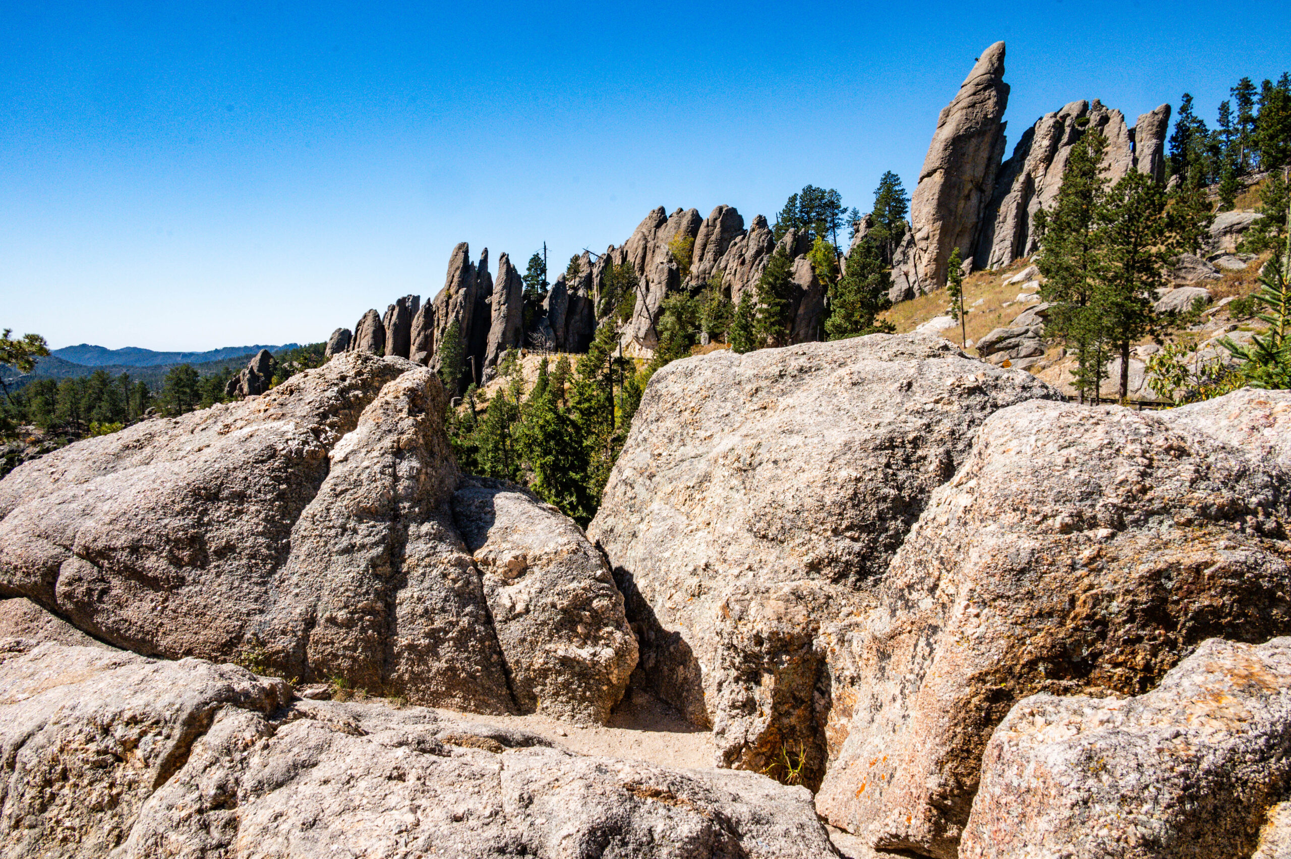
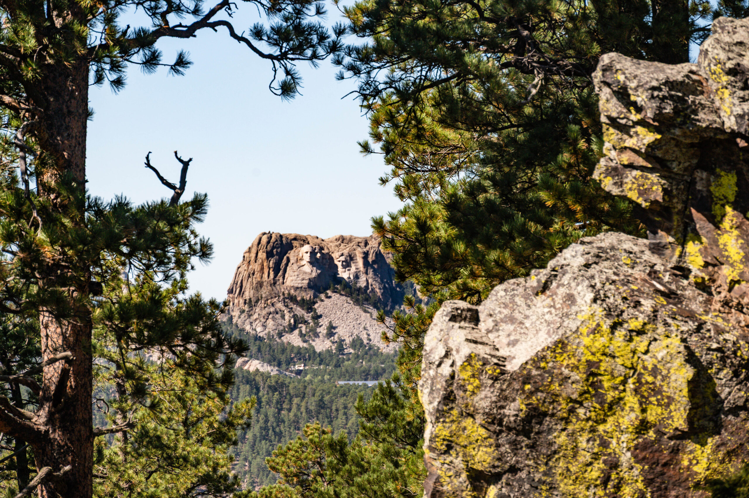
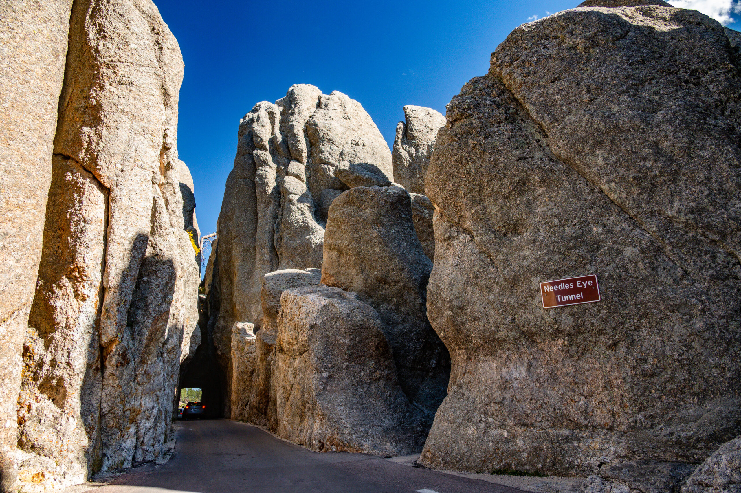
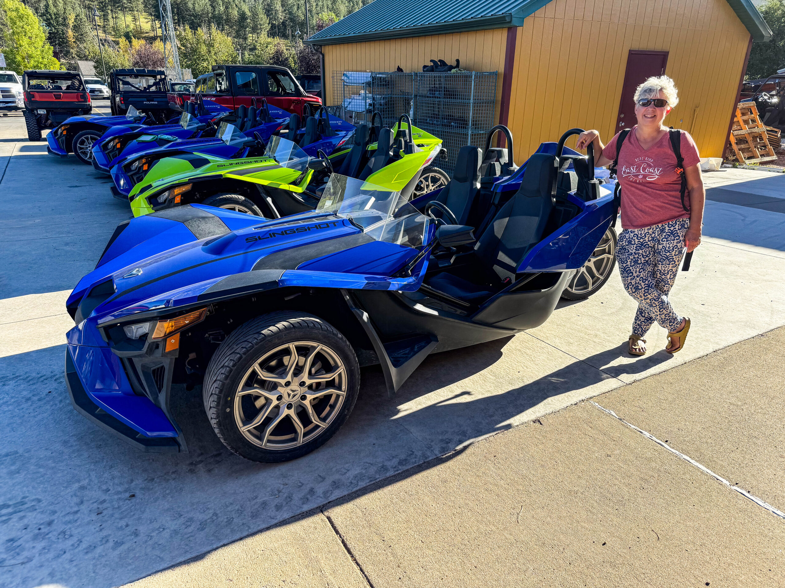
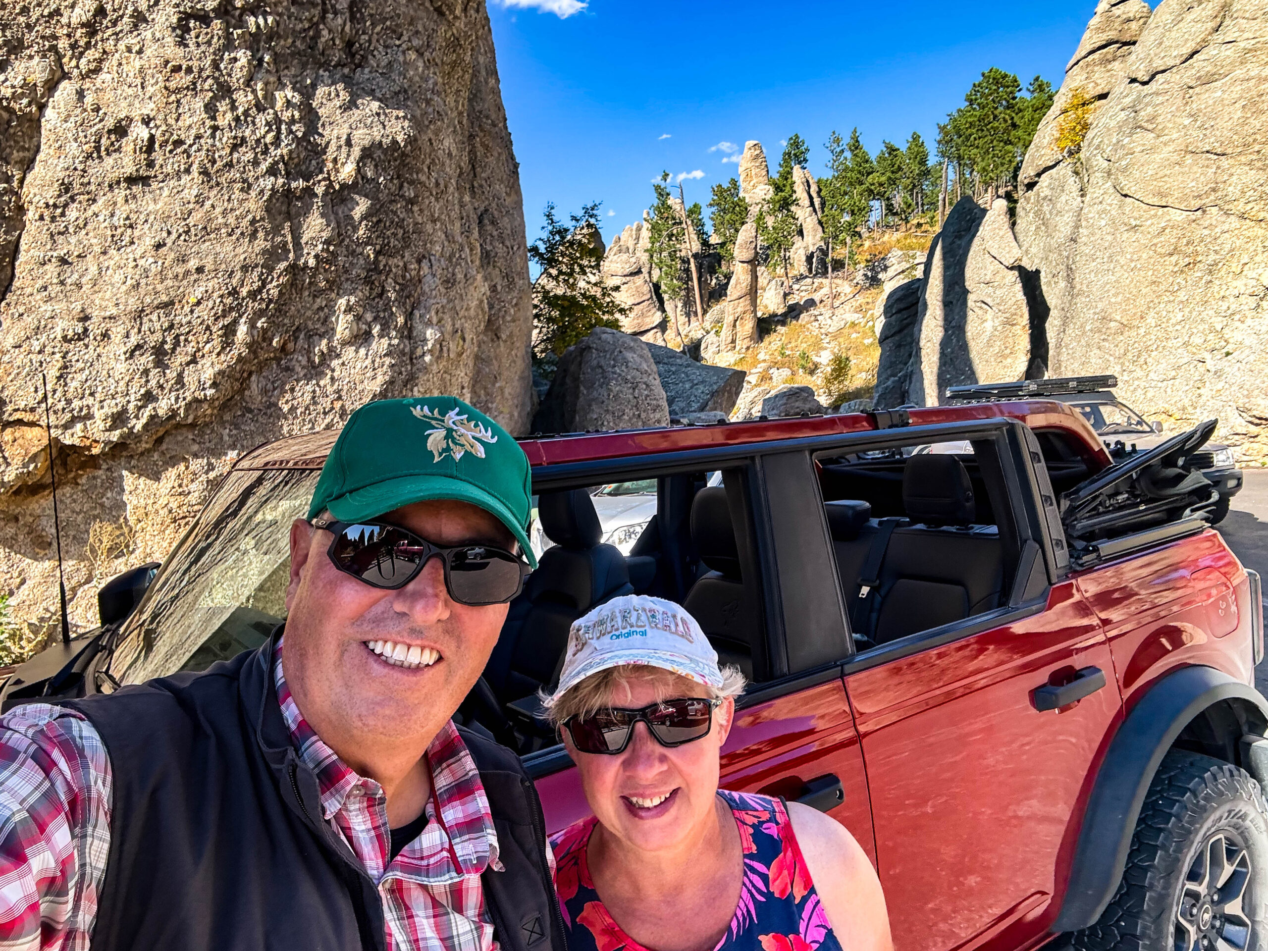
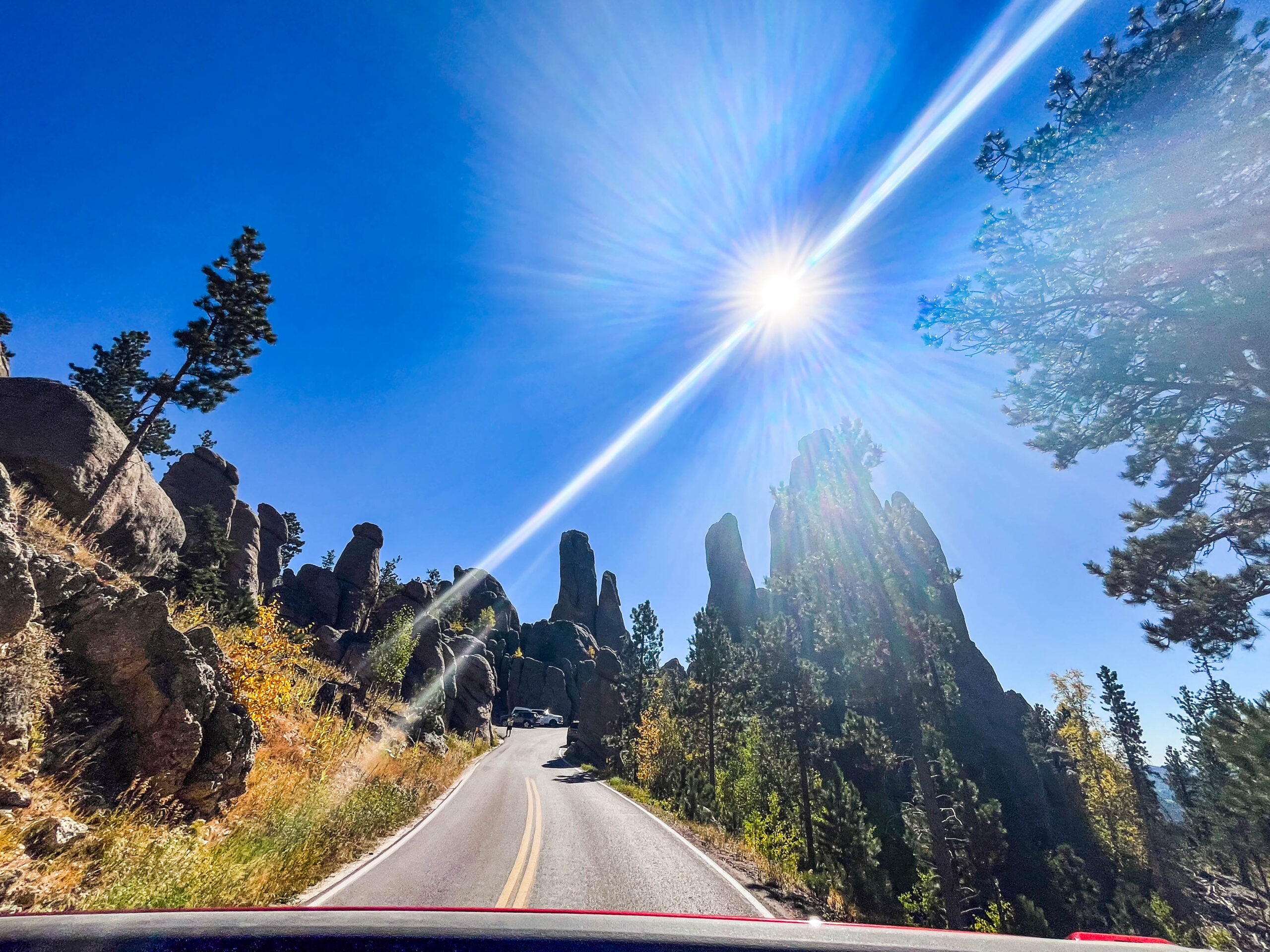
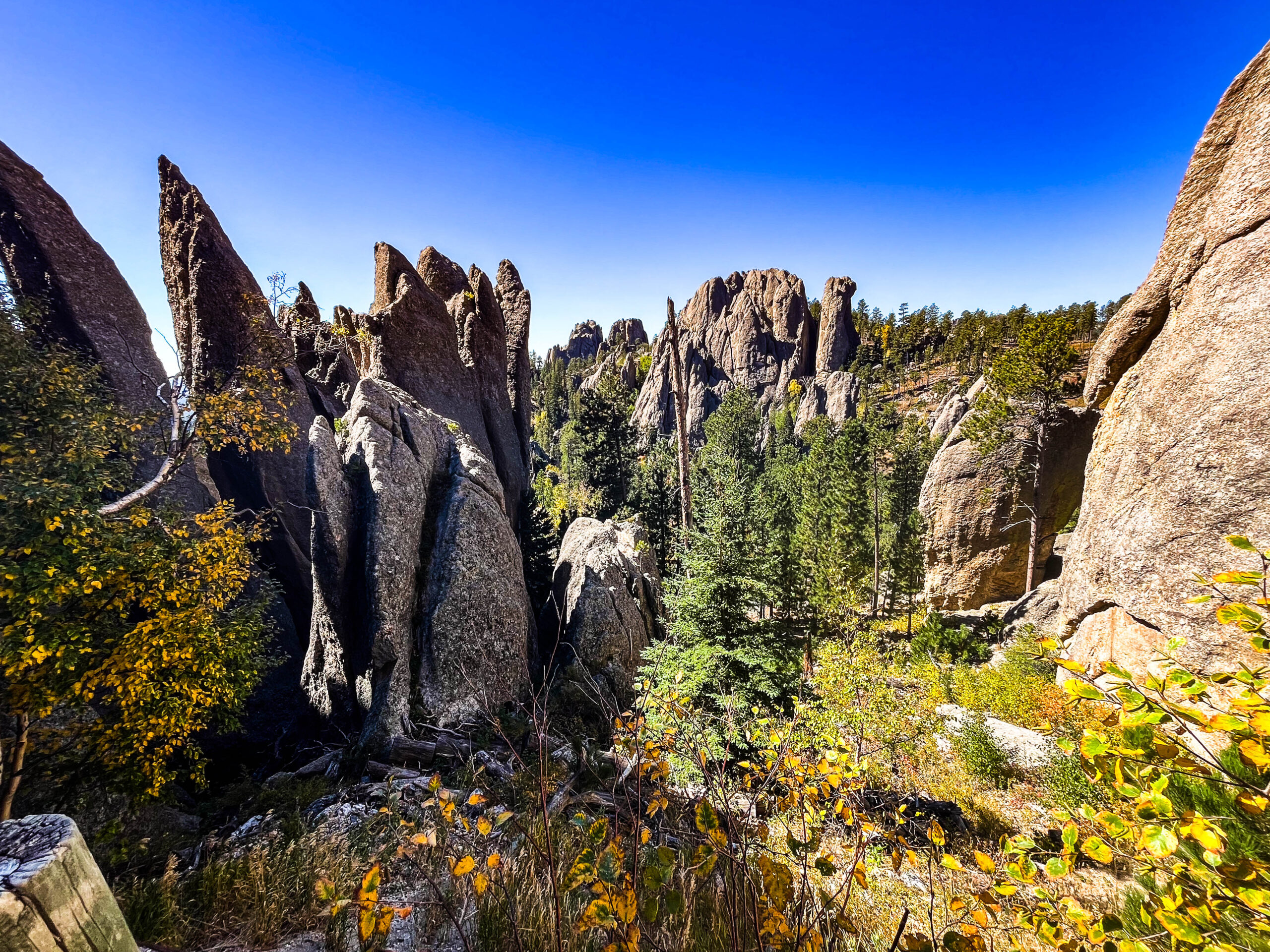
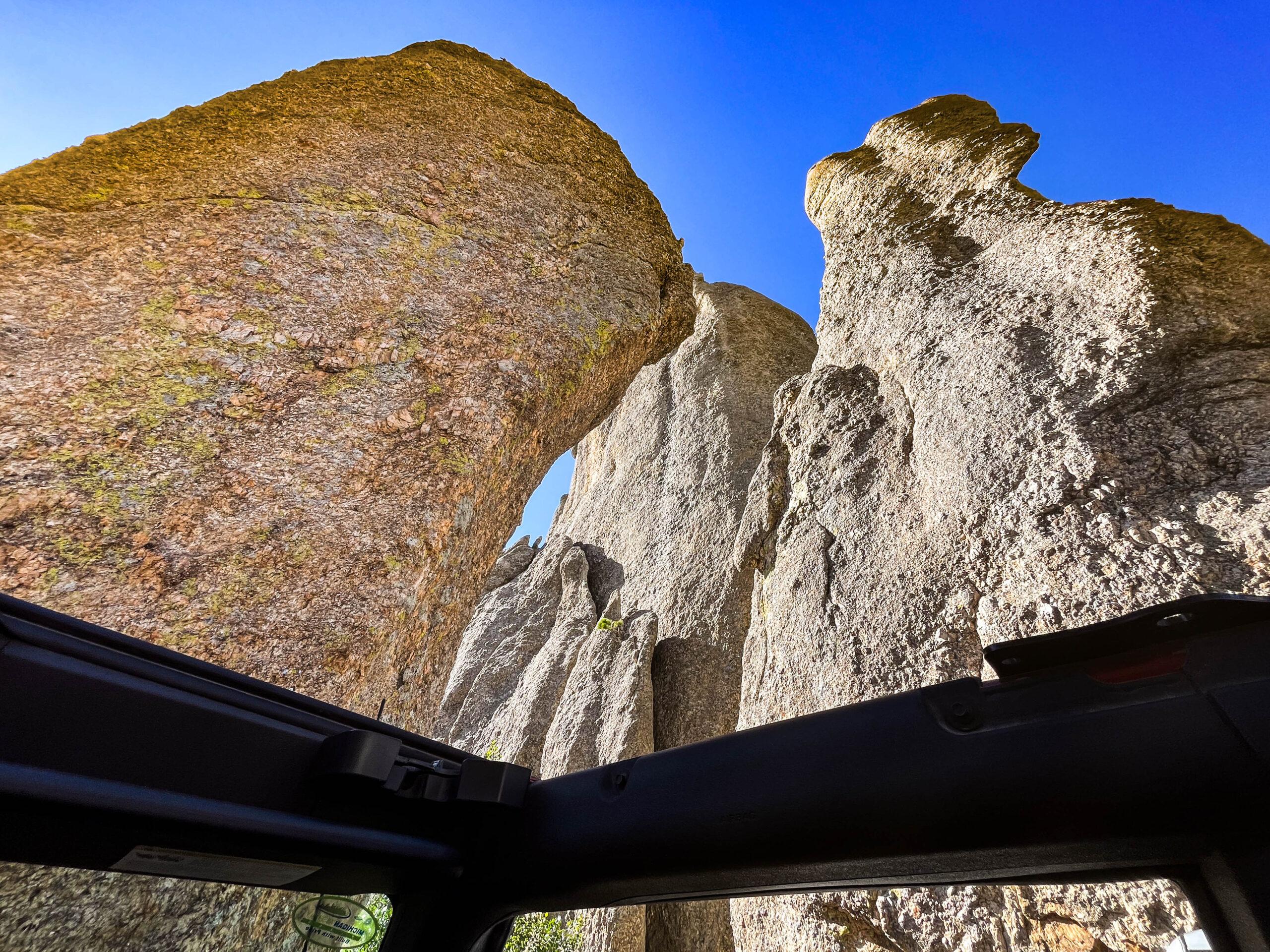
Um die Scenic Drives „Needles Highway“ und „Iron Mountain Road“ fahren zu können, mieten wir uns ein Auto. Der in der Abstimmung von Euch mehrheitlich gewünschte „Slingshot“ war nicht mehr verfügbar – fast schon Gottseidank, im Laufe des Tages waren wir über die funktionierende Klimaanlage und Dach überm Kopf (Sonnenschutz) doch sehr froh. Der nagelneue Ford Bronco war jedenfalls fast so ein Eyecatcher wie unser Homey und fuhr genial leise und präzise. Ein spektakulärer Tag mit schönen Ausblicken, engen Straßen, schmalen, niedrigen Tunnels, die gerade mal knapp ein nicht zu großes Auto passieren lassen und dies alles ohne Ampelregelung. Der Doane Robinson Tunnel bietet auf der Fahrt nach Norden einen tollen Blick auf die Präsidentenköpfe des Mount Rushmore. Eine Besonderheit gleich dahinter, ein 360° Straßen-Viadukt, erinnert an das berühmte Eisenbahn-Kreisviadukt von Brusio der Rhätischen Bahn im Puschlav.
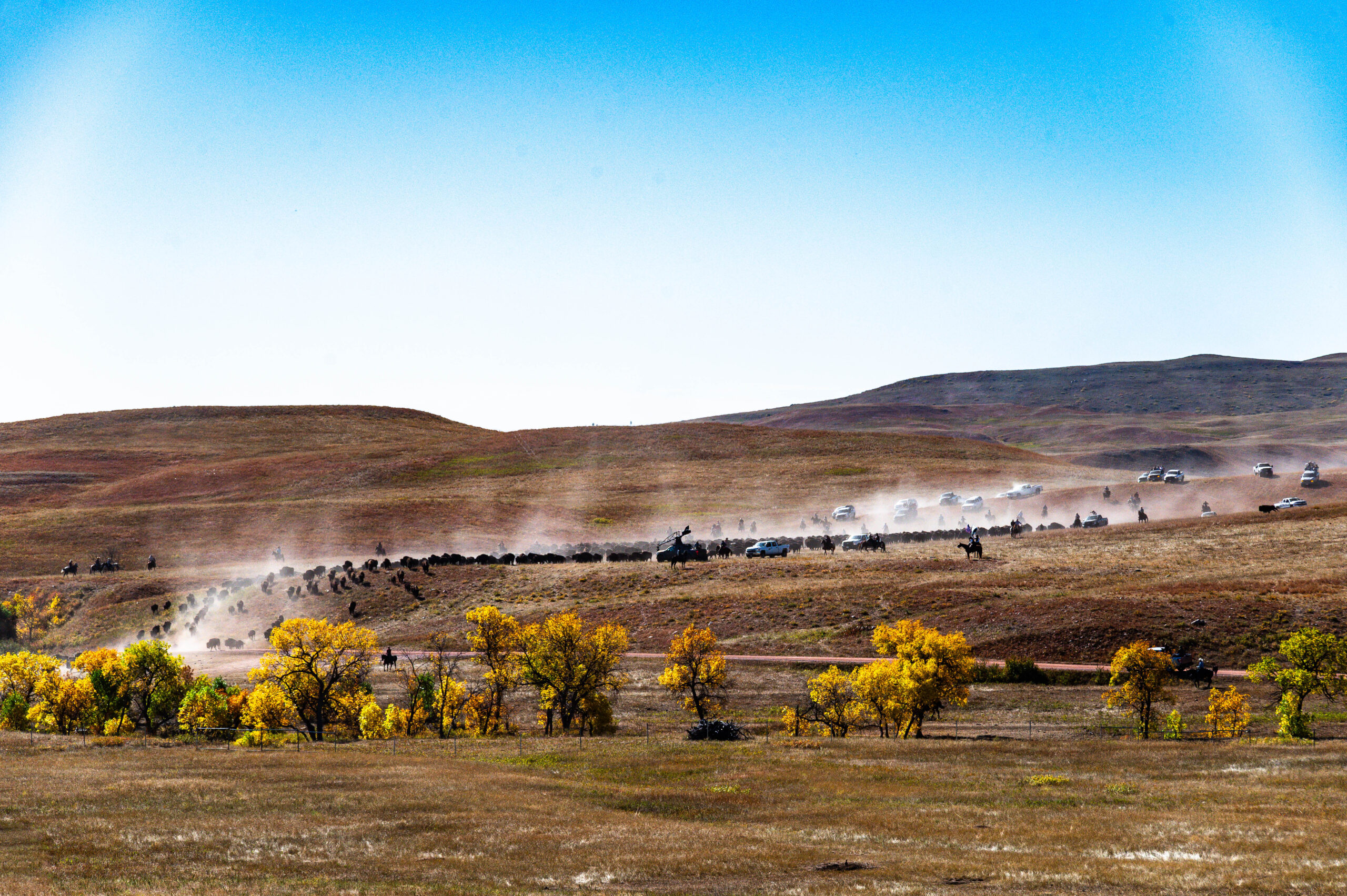
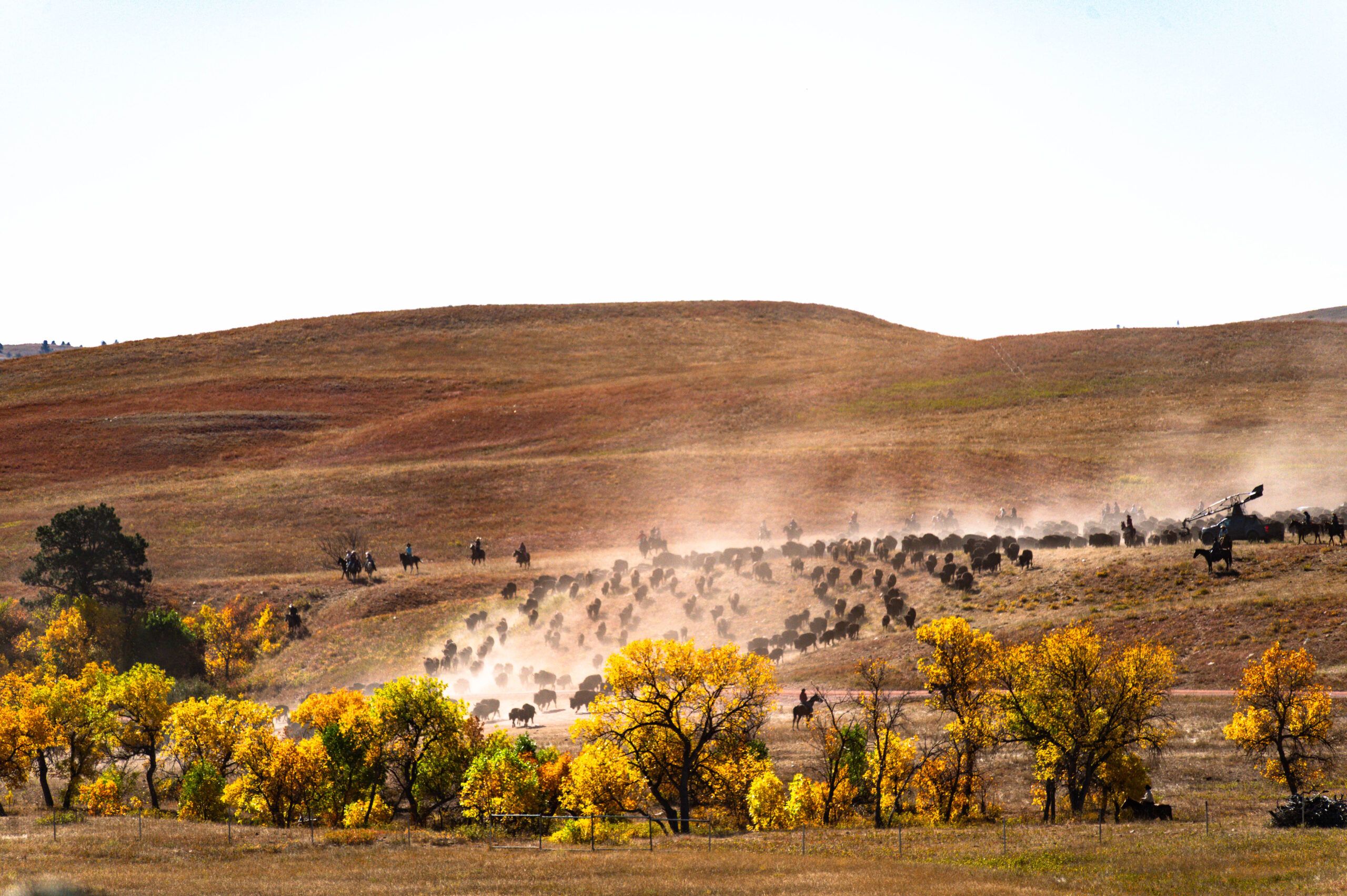
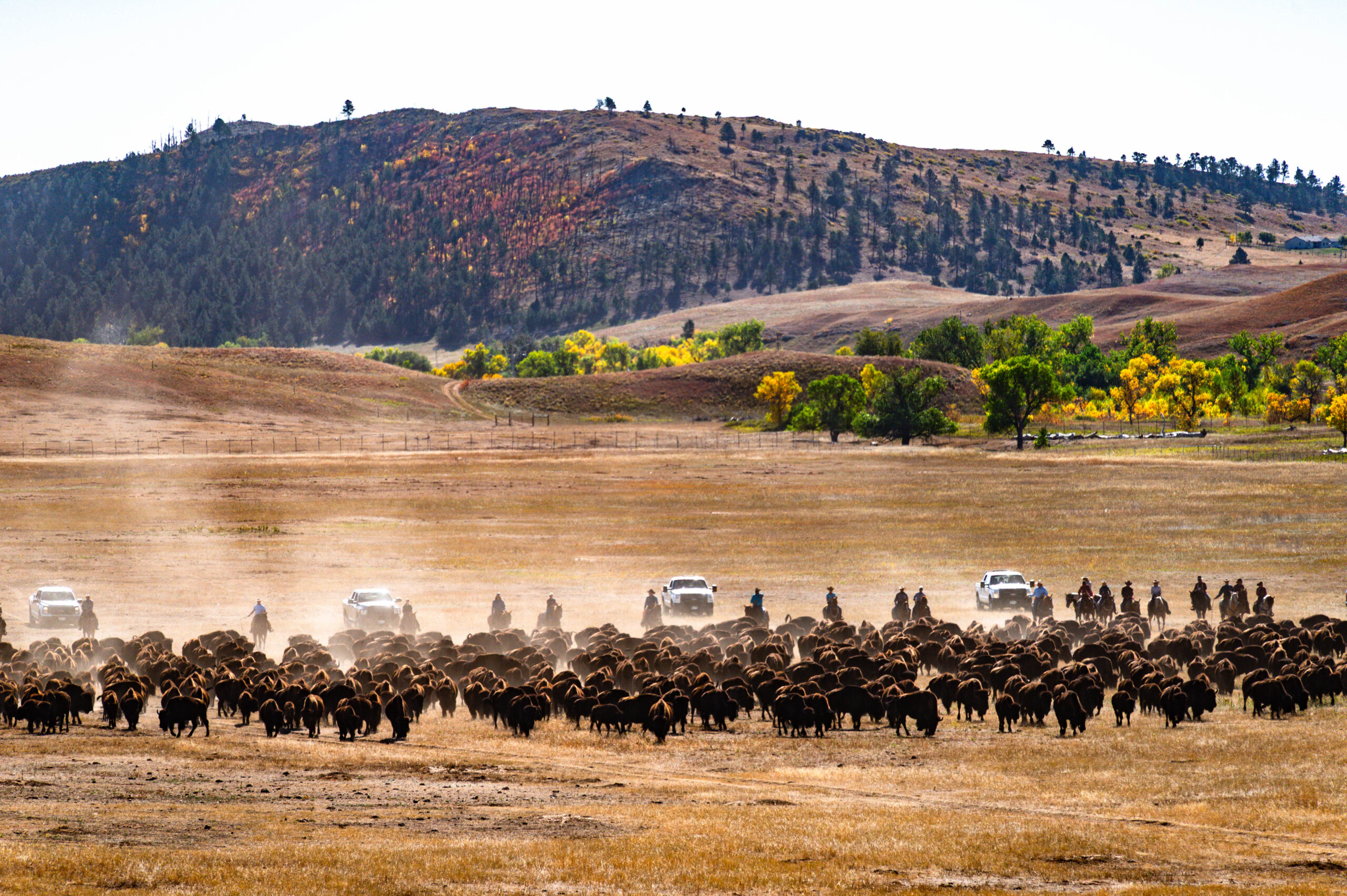
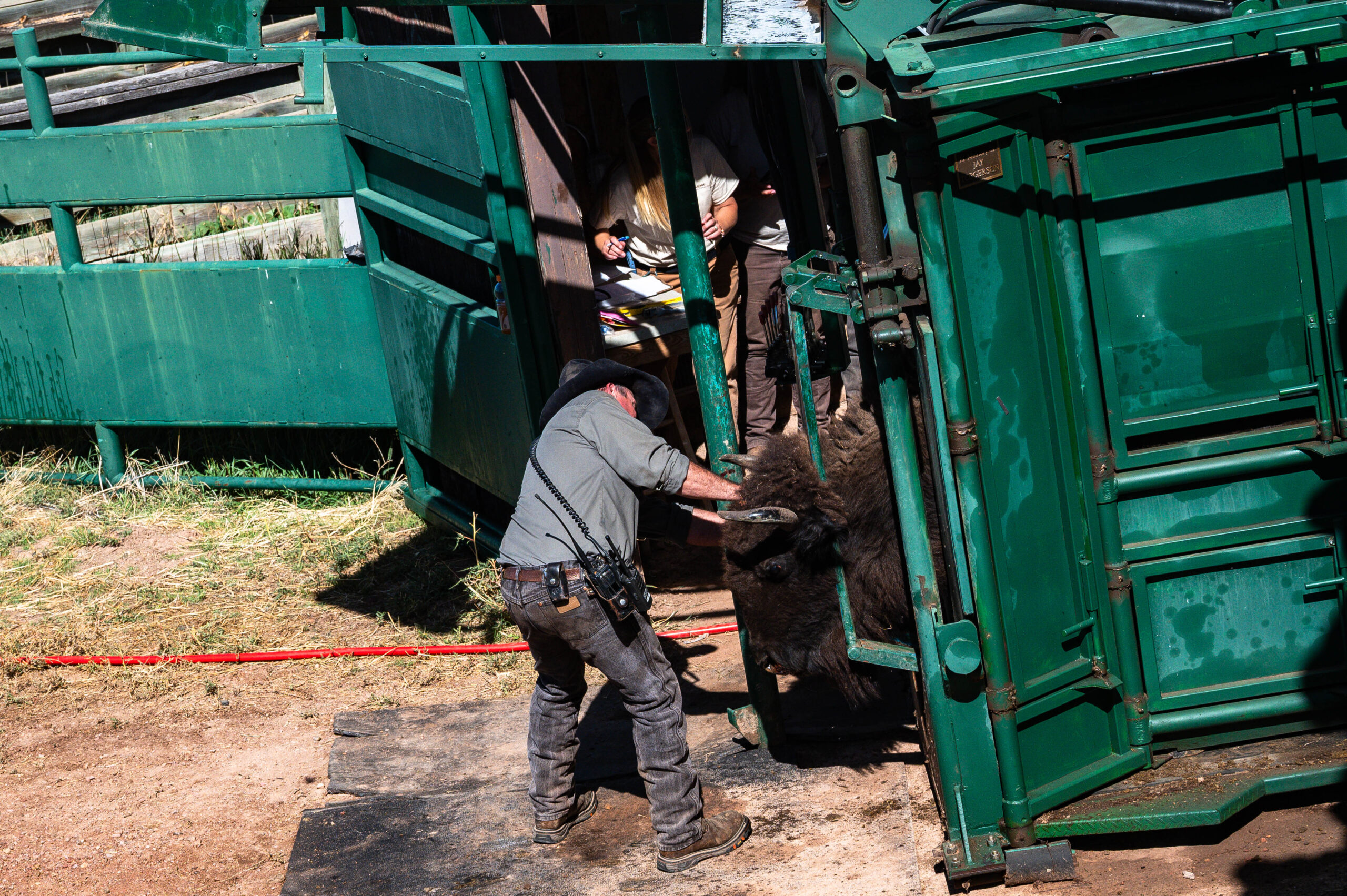
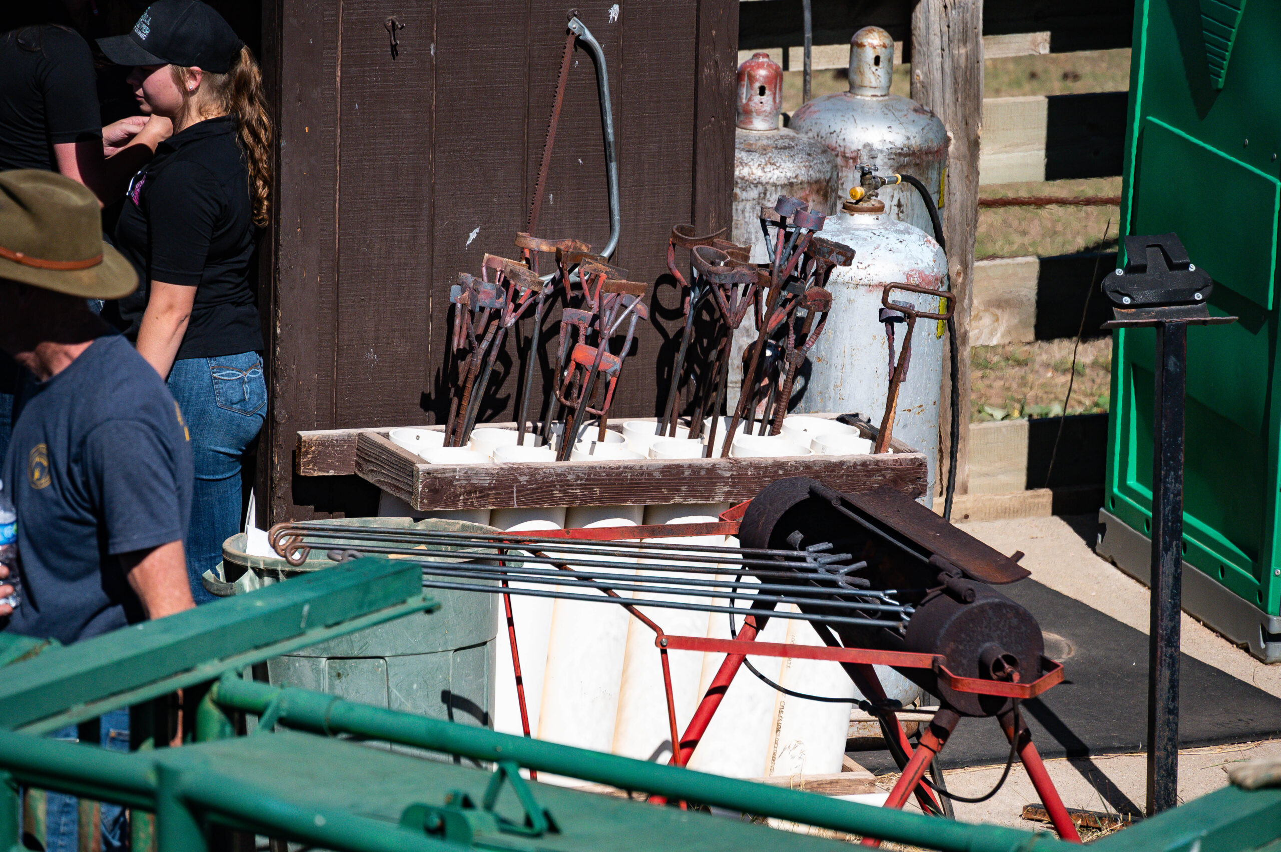
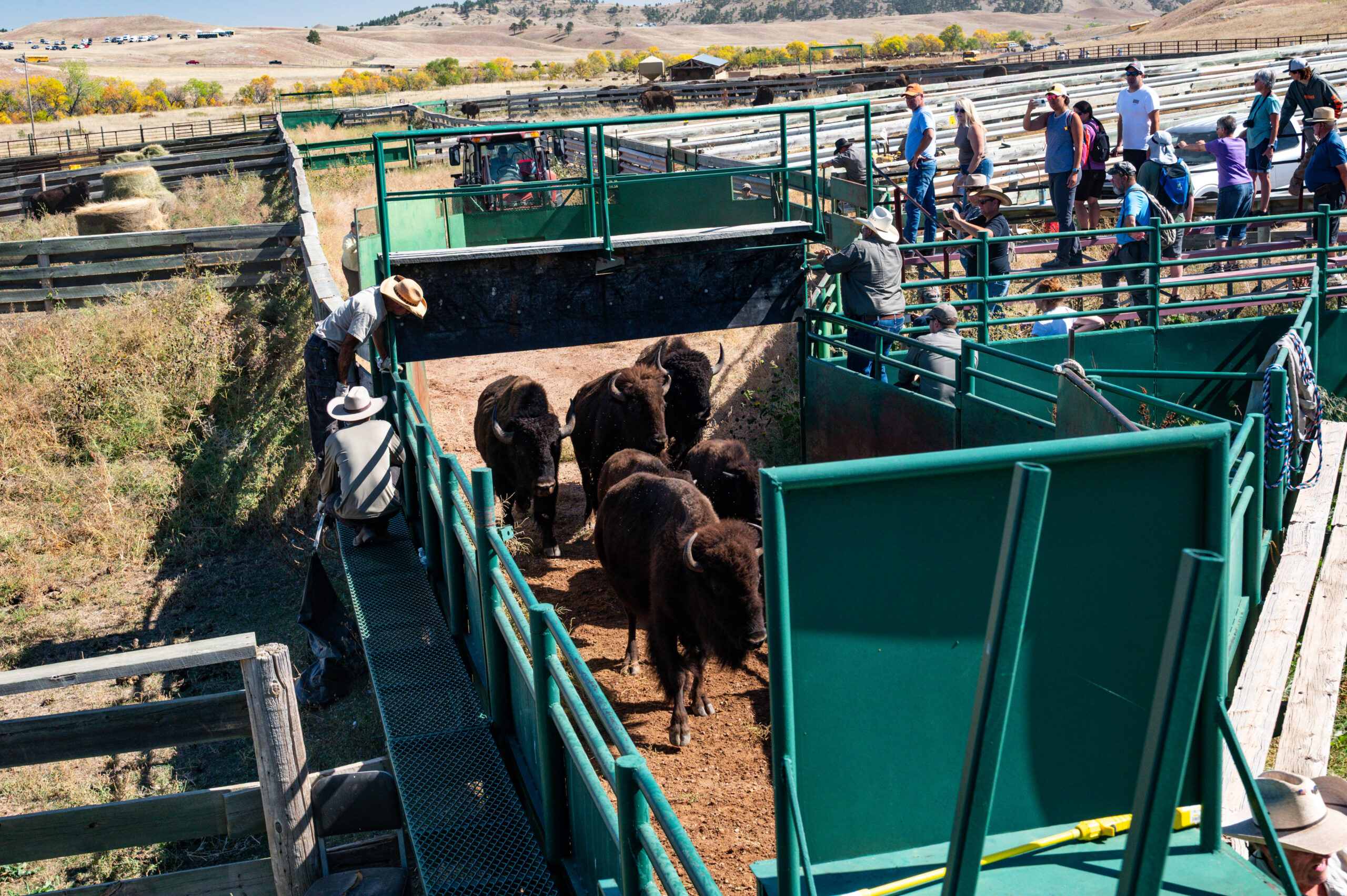
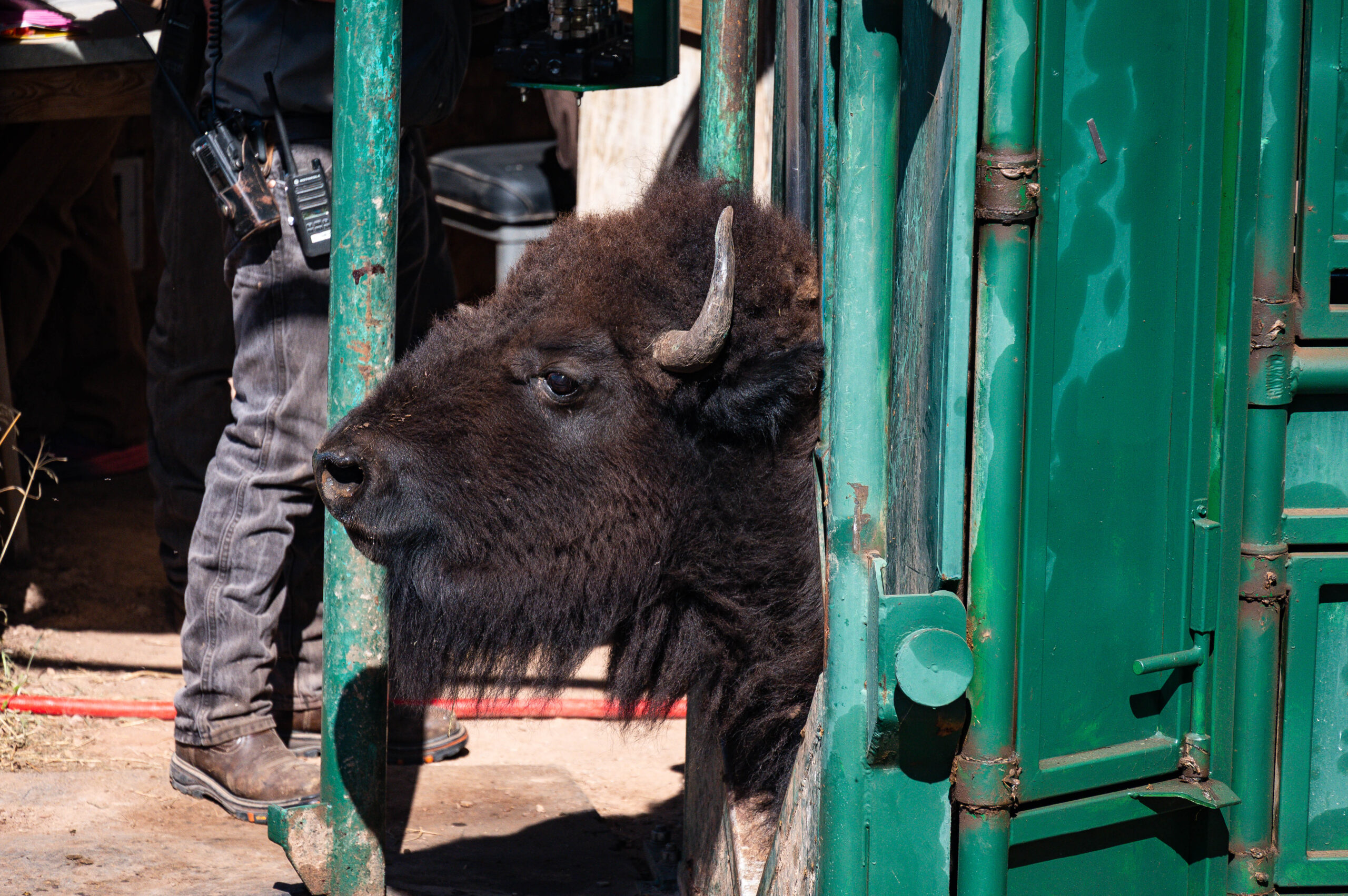
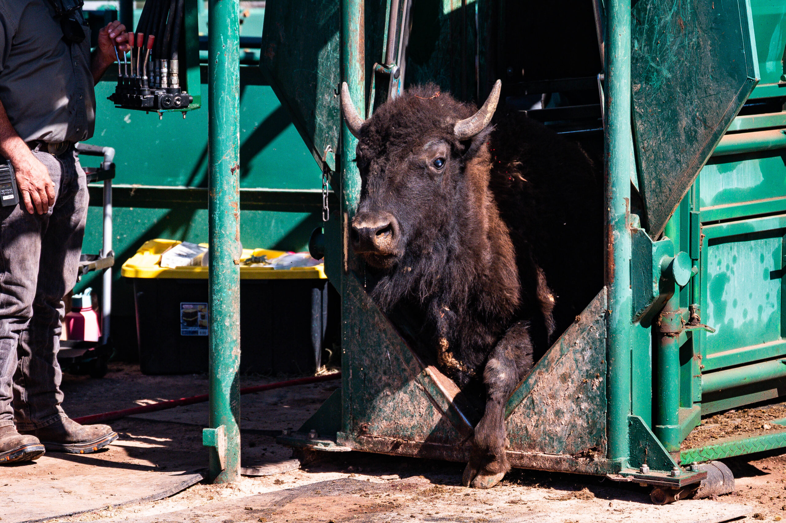
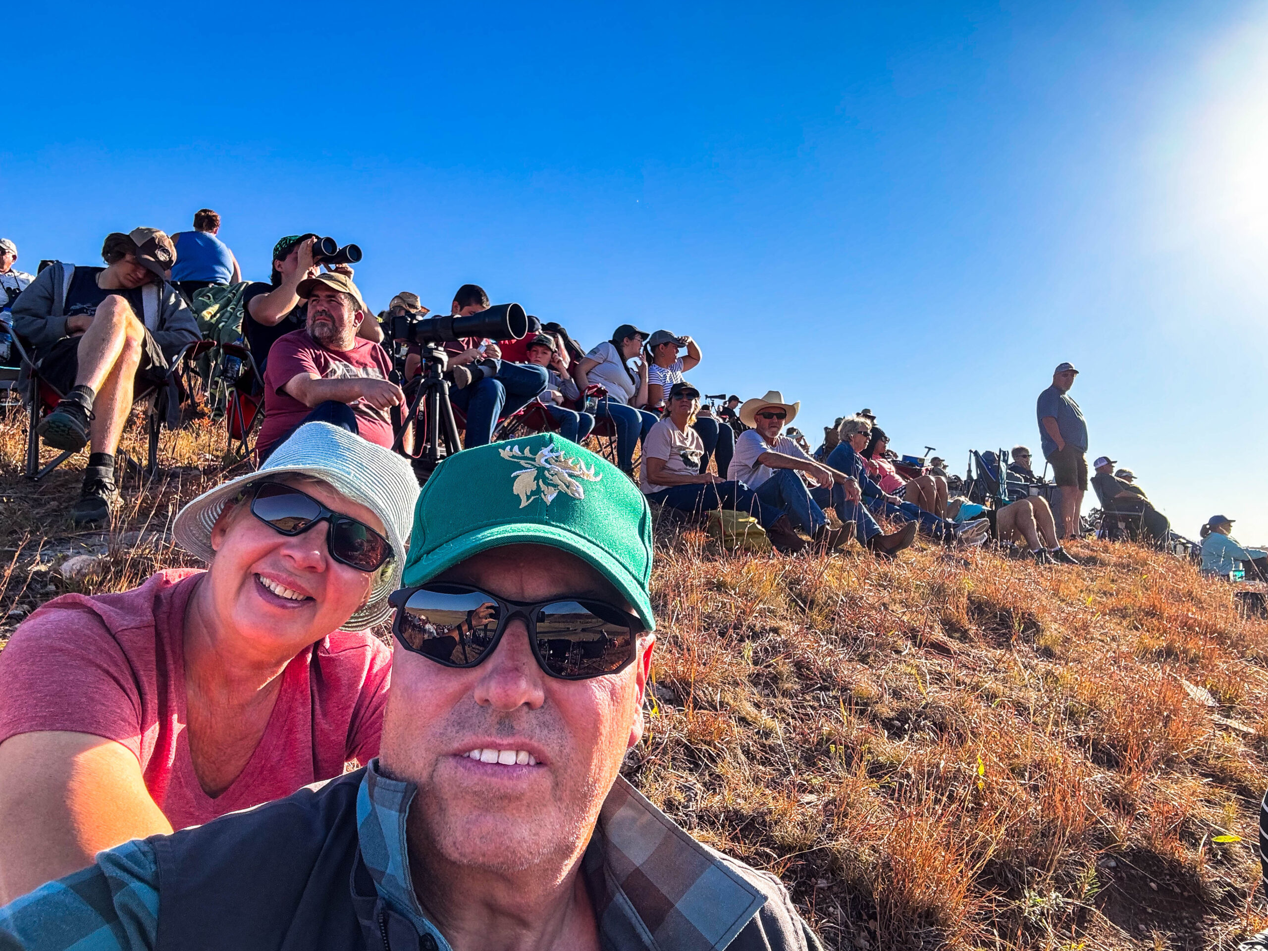
Der Tag des Großereignisses beginnt früh und kurz nach 5h00 reihen wir uns in die Warteschlange (ca 9 km) vor dem North Parking & Viewing des Buffalo-Roundup‘s ein. Pünktlich mit Sonnenaufgang setzt sich alles sehr diszipliniert in Bewegung. Auf dem Parkareal angekommen folgen wir dem gutgemeinten Rat eines Rangers und frühstücken erstmal in aller Ruhe, anstatt gleich auf den Hügel zu stürmen und sich der gleißenden Sonne auszusetzen. Wie richtig und gut diese Entscheidung war, zeigt sich, als wir dann problemlos super Plätze mit fantastischer Aussicht auf das zu erwartende Spektakel finden und dort auch noch länger auf die Bisons warten müssen. Das Absingen der Nationalhymne läßt alle wartenden Zuschauer mit der Hand auf dem Herz aufstehen. Dem heißen Wetter geschuldet lassen sich die Tiere viel Zeit, statt 9h30 wird es fast eine Stunde später und es ist eher ein müder Zug, denn eine den Boden erzittern lassende Stampede an Tieren. Peitschenknallen der Cowgirls und Cowboys bewegen die mächtigen Tiere heute kaum, selbst die Gouverneurin Kristin Noem auf ihrem Schimmel mit der großen amerikanischen Flagge in der Hand wirkt ob der Warterei genervt. Aber Hunderte von Bisons zu sehen ist die Mühe wert! So scheuen wir die Hitze nicht und laufen anschließend noch zu den Korralen und schauen dem geschäftigen Treiben zu: Bestandsaufnahme, Aussortieren der Tiere, die verkauft werden sollen, Jährlinge mit Brandzeichen versehen (S für South Dakota und Ziffer fürs Geburtsjahr), Impfen. Immer wieder erzittern die Metallkäfige unter den Tritten der Tiere, bevor die hydraulischen Fixierkäfige keine Bewegungen mehr zulassen. Übrigens sind die männlichen Tiere bereits separiert („they are making too much trouble“). Trotzdem ist es sehr gefährlich, eine Mitarbeiterin wäre um ein Haar von einem Horn erwischt worden. Es ist der Streß greifbar, leider müssen auch wiederholt Elektroschocker eingesetzt werden. Mit dem letzten Shuttlebus geht es zurück zum Parkareal.
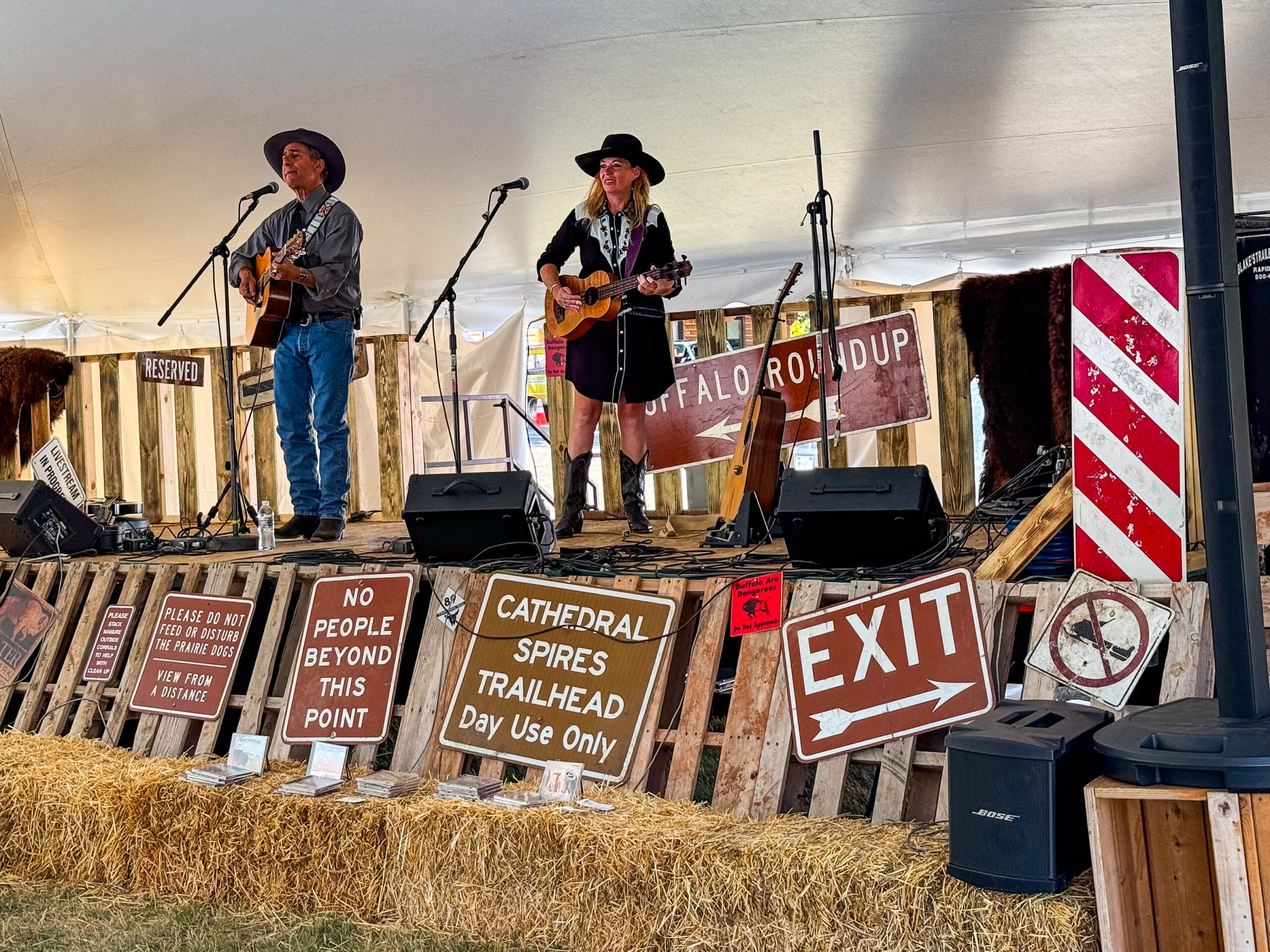
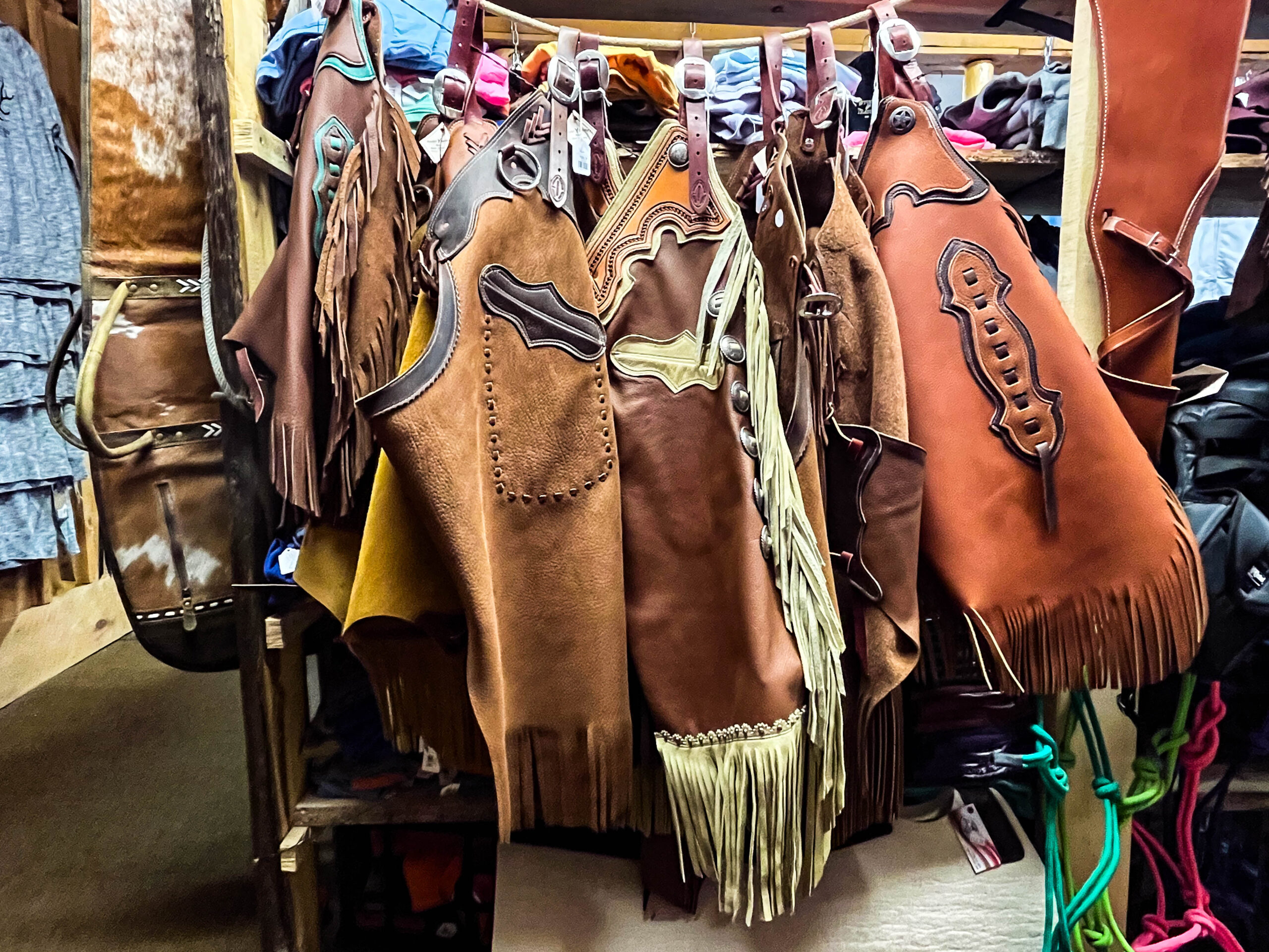
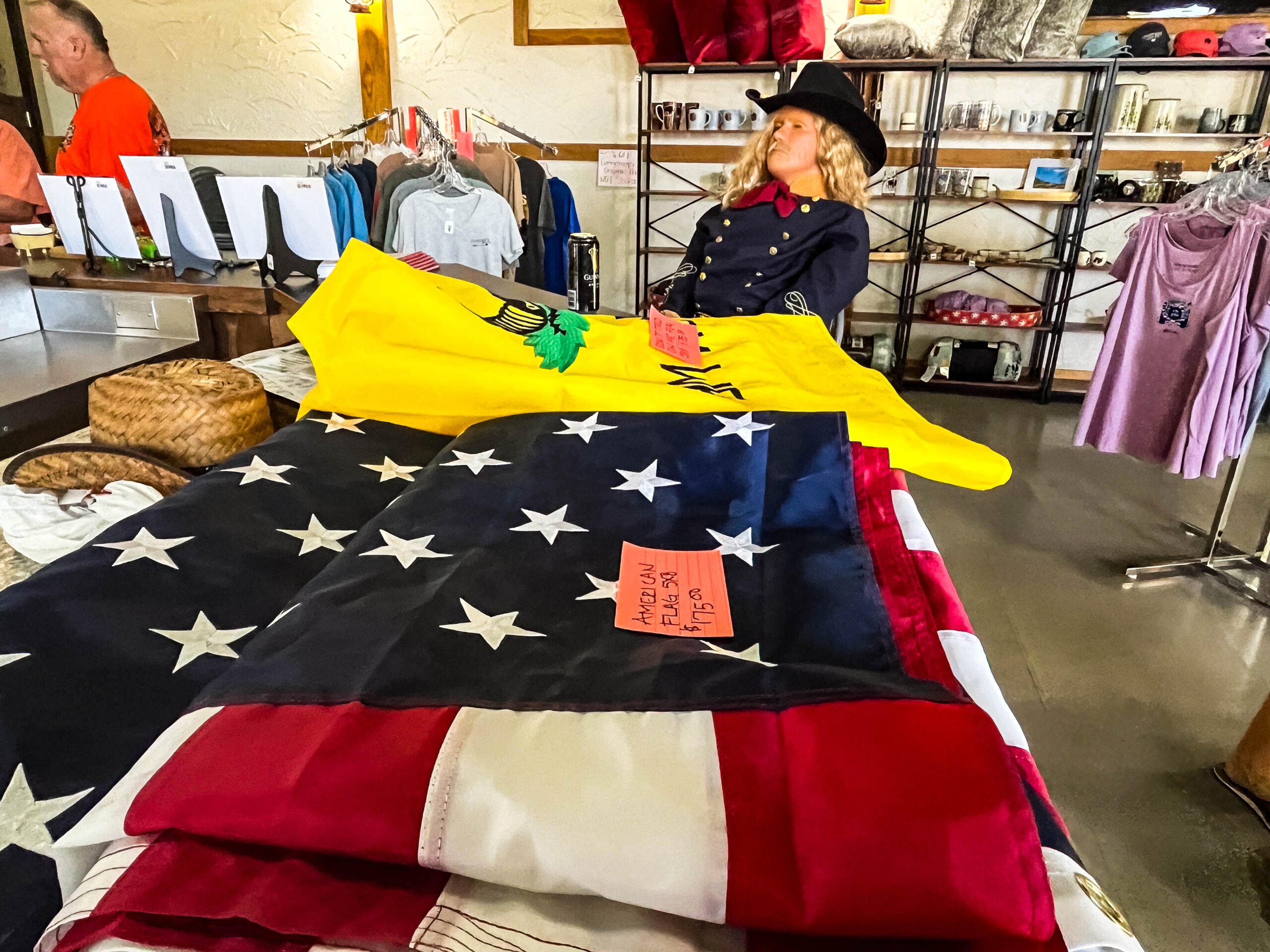
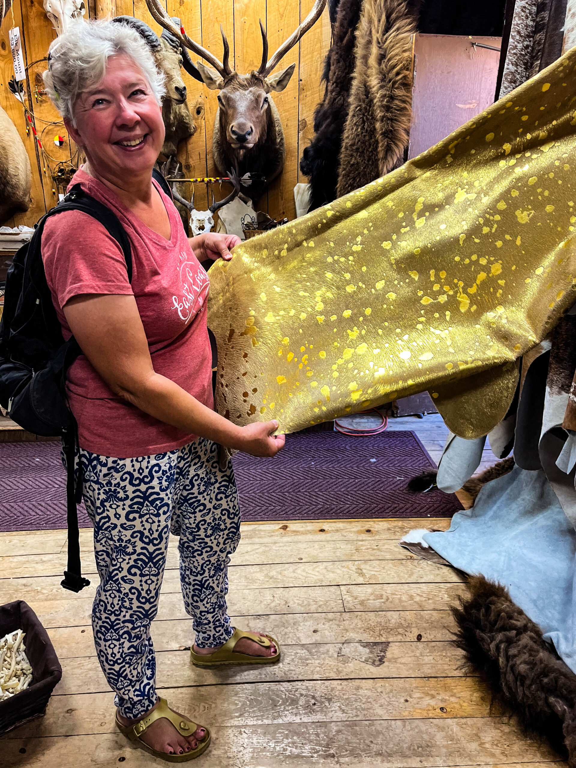
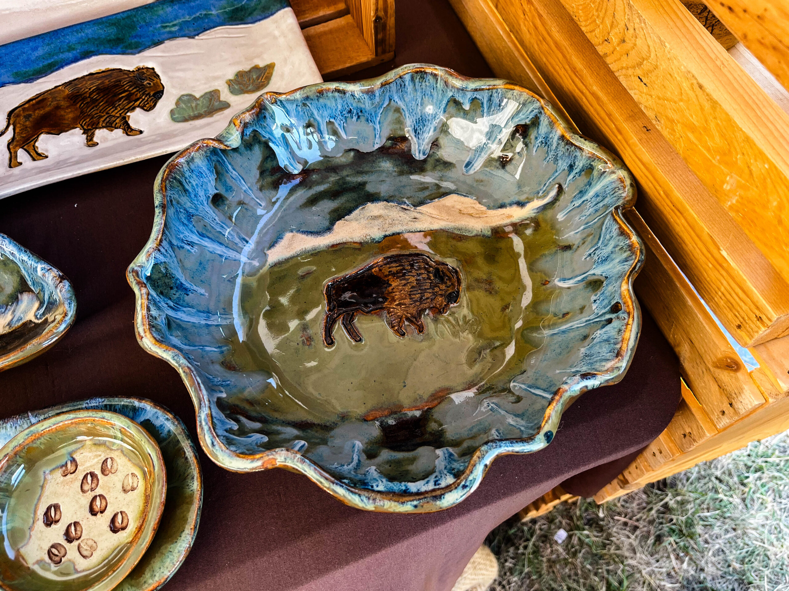
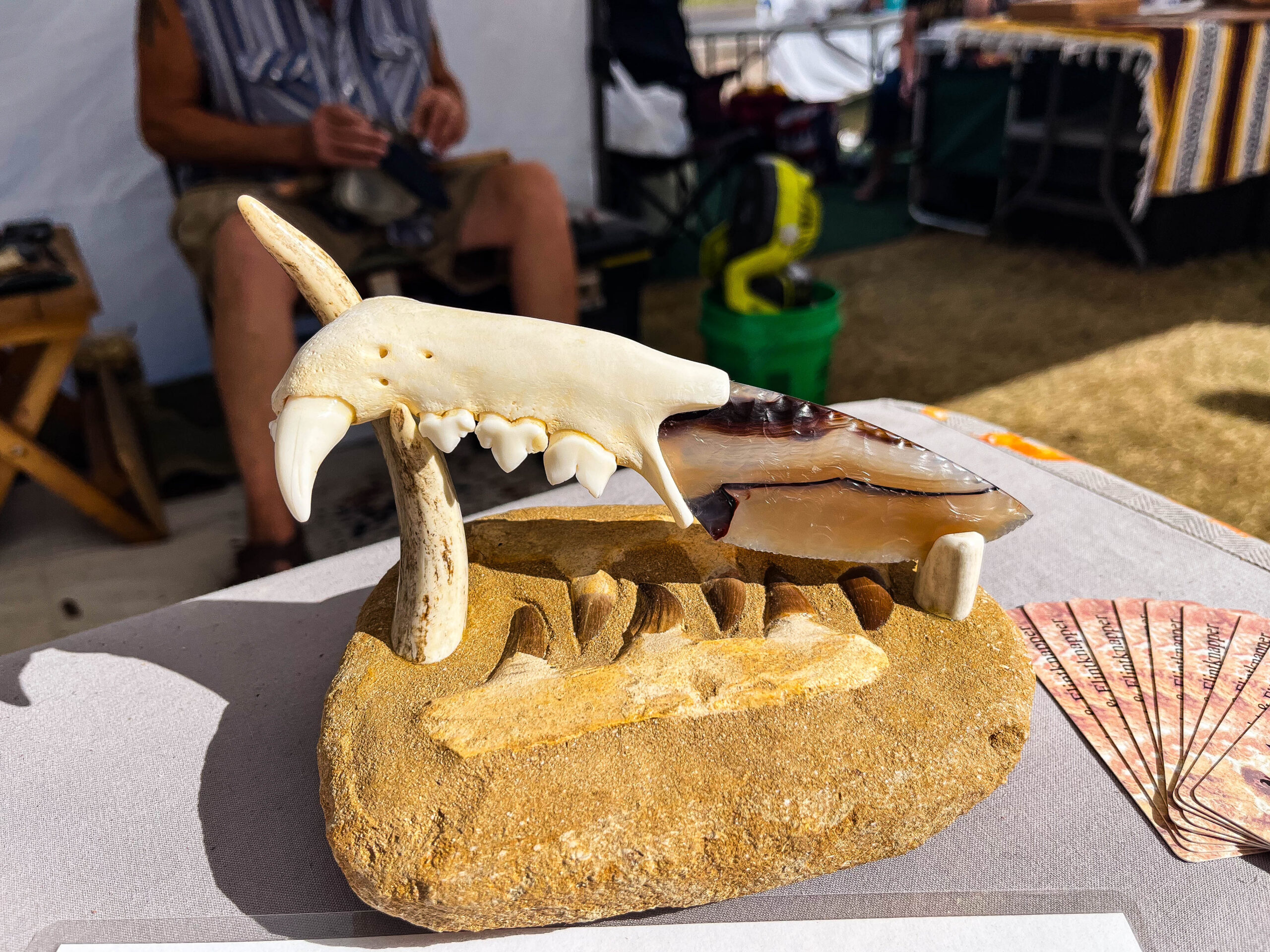
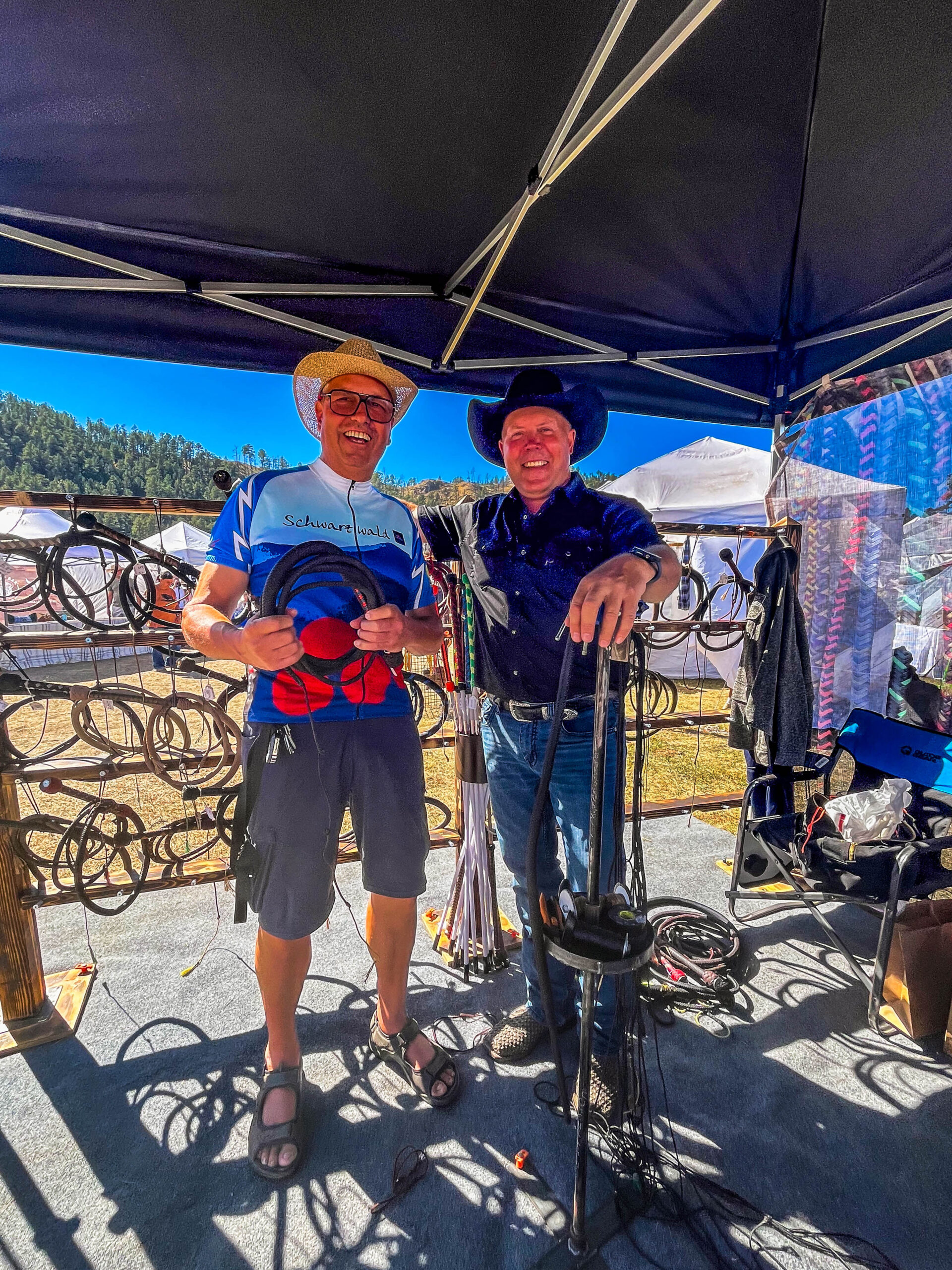
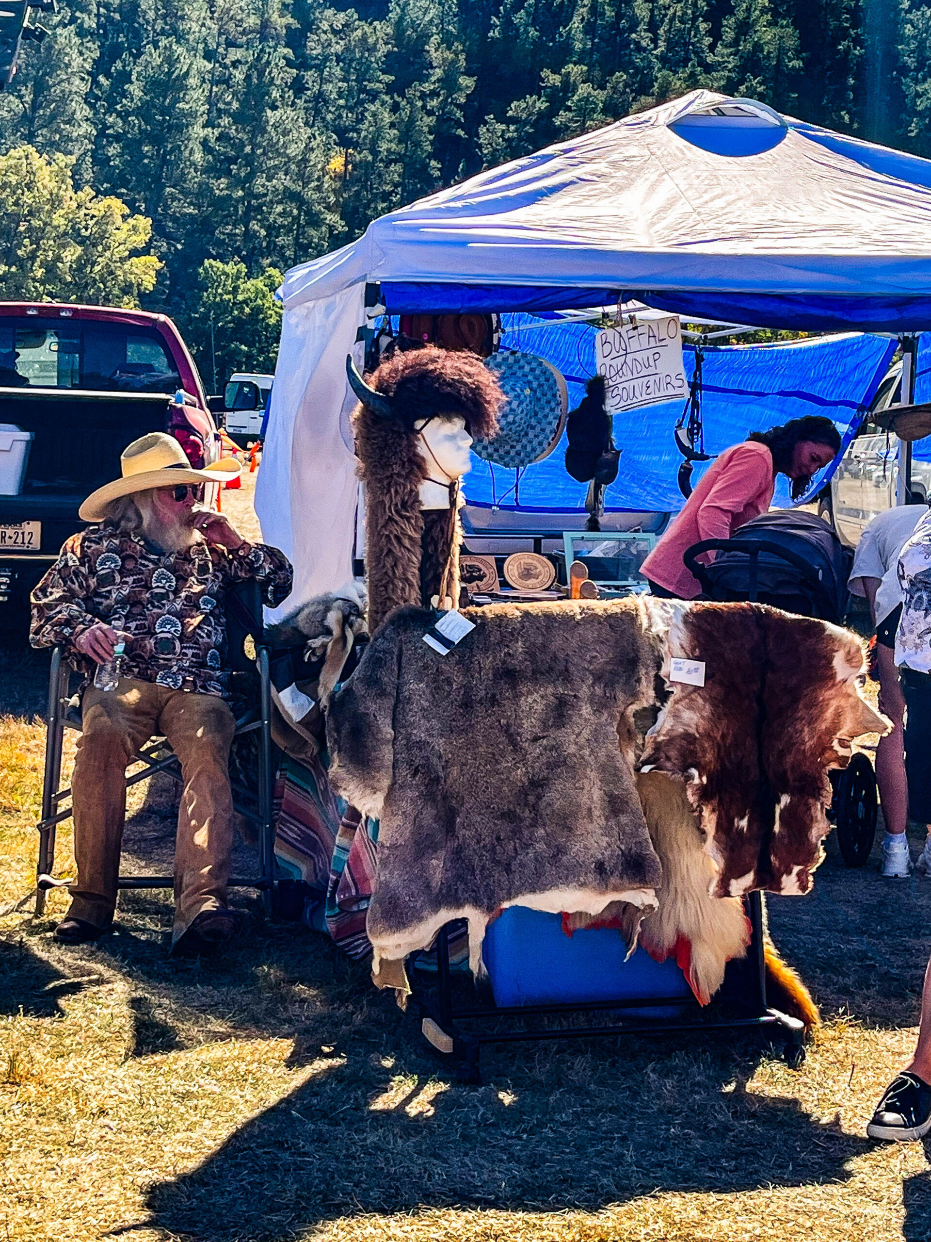
Das Pancake-Frühstück lässt uns am nächsten Morgen schon um 8h00 auf dem Buffalo Arts Festival auftauchen. Im großen Festzelt treten stündlich wechselnd Country-Musiker auf. Die Stände zeigen viel Schönes und Interessantes, ein wirklich komplett anderes Spektrum wie bei uns: Geweihe, Felle, viele Bisonleder-Sachen, Messer (tw. Deko-Objekte mit Steinklingen und wertvollen Griffen), Peitschen sowie Garderoben-Elemente mit Gewehrhalterungen (Fotografieren nicht erlaubt!), daneben die Stände von jeweils Republikanern und Demokraten – die allerdings im „Trump“-Land nur wenig Zulauf hatten. Daneben allerdings auch Vertrautes wie Holzbretter, Steine, T-Shirts, Filzwaren und viel Schmuck. Wir kommen mit fast allen Händlern ins Gespräch, sie zeigen sich interessiert, woher wir kommen, es sind schöne Stunden und die Mitbringsel-Kiste füllt sich.
Über den Devil‘s Tower und die Prärie soll es zurück nach Kanada gehen.
28.09.24 / Tacho 39.464 km, davon 15.781 km in Kanada und 1.889 km in USA
🇬🇧 USA-Loop
or we follow in the footsteps of Lewis, Clark, Custer and Crazy Horse
If you don’t read the entry regulations, the border guards will punish you. So 5 eggs and 2 lemons go in the garbage can, but in return we get friendly tips and a map with points worth visiting in North Dakota marked by hand. We are very impressed by the uncomplicated customs clearance at the border, even the computers that had already been shut down were restarted in 2 minutes despite the closing time (we didn’t realize that there was no daylight saving time changeover on the American side). The USA welcomed us with open arms and in a very relaxed manner 😎.
The Homey and our travel budget are happy about diesel prices around € 0.80/l. Conversely, the price level and quality in the supermarkets is not comparable to Canada, so we have to explore new markets and products and mourn our beloved Sobeys, unfortunately also the Canadian prices (!) (although they were/are also quite expensive from a German perspective).
The plan is to visit the Badlands, see the Crazy Horse Monument and the presidential heads of Mt. Rushmore and then reach Yellowstone Park via the Beartooth Pass (3337m) and from there head north back to Alberta before our Canadian visa expires at the end of October. But everything turns out differently, but first things first….
On the recommendation of the friendly border officials, we visit the two Roosevelt Parks and immediately understand why these magnificent parks are among the most underrated parks in the USA. We hadn’t actually planned to visit them, but we are immediately impressed and enchanted by the fantastic landscape.
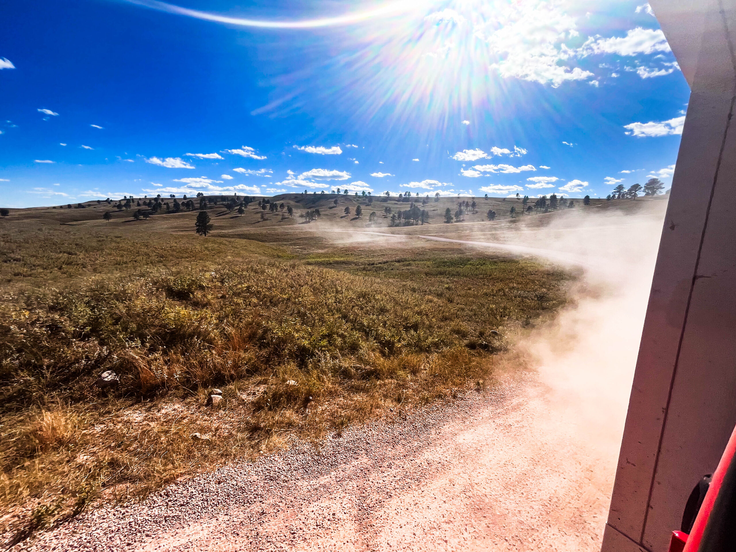
The road there is very hazy due to the smoke from the countless forest fires in western Canada and the USA, sometimes with very strong and gusty winds. The drive leads through hilly grassland with waterholes and oil pumps, a kind of plateau at an altitude of 700 meters.
In Theodore Roosevelt NP (North) we follow the Scenic Loop, a dream full of beautiful landscapes and views of badlands and the valley of the Little Missouri River. At the last viewpoint, we are surprised by a whole herd of bison and are immediately surrounded by the mighty animals, just like in the Allgäu when Schorschi drives his cows up the road to the barn. The mouflon at the side of the road is the encore; until now we had only been able to spot a few in the distance with binoculars.
Unfortunately, our engine is spinning and running hot, i.e. somehow the auxiliary fan no longer switches on when it is needed, and changing the fuse only works briefly before it fails again. From now on, we drive uphill with maximum heating and fan instead of air conditioning and cooling. Our eyes are constantly searching for a suitable parking space or rest area so that we are not surprised by the forced engine shutdown in the middle of the road. Checking the oil temperature and estimating the gradient or, even better, longing for a downhill stretch will be our daily driving program over the next few weeks.
As agreed with the rangers, who had already closed the day before, we buy an annual pass for $80 („America the beautiful“ is valid for one car with passengers for all national parks in the USA).
Onwards through sandstorms and smoke to the 2nd part of the park, Theodore Roosevelt NP (South). Scenic drive again, the landscape is softer, wider, rounder, unfortunately there is no light for photography due to the storm. But there is plenty of wildlife: prairie dogs, wild turkeys, wild horses, deer and, again and again, bison. We take a day off, almost inevitably, as a „red flag wind and blizzard warning“ is announced with punctum maximum on our planned route. We get to know a member of the German national backgammon team – Sabine Brinkmann, also Berlin city champion – currently on a sabbatical in the USA in a Hymer Sprinter.
The term Badlands was first used for a part of southwest South Dakota. French-Canadian trappers called the region „mauvaises terres a traverser“ („bad land to cross“). The name refers to the difficulties that travelers face in this rugged landscape. The earth’s surface in badlands is characterized by easily weathered rocks and open soils. The effects of water or wind quickly erode shales, claystones and loams in particular, resulting in the typical surface shapes. Important geomorphologic forms in badlands are canyons, ravines and hoodoos. A badlands area consists mainly of constantly widening canyons and valleys, between which sharp ridges remain. Some badlands also have a spectacular color scheme, alternating between black/blue charcoal streaks and yellow/reddish clay deposits, for example. Badlands can be found on all continents where the land is barren and rough and there is hardly any vegetation. [Wikipedia]
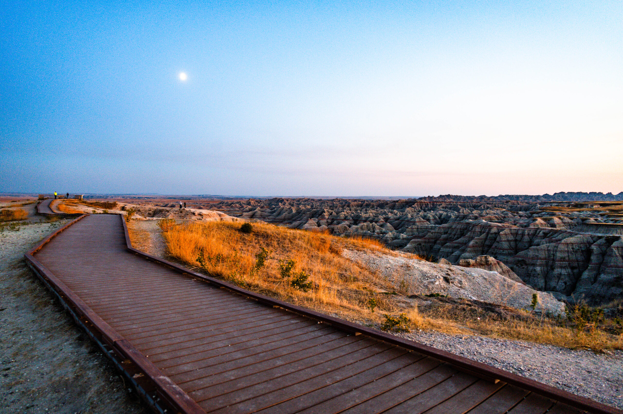
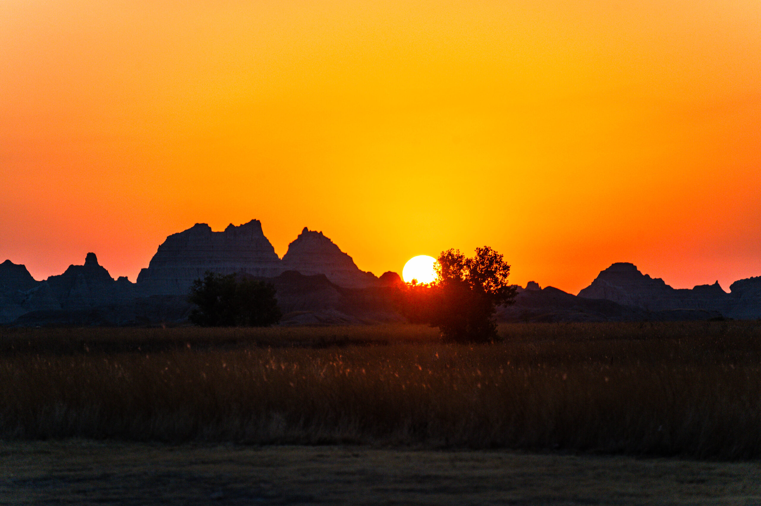
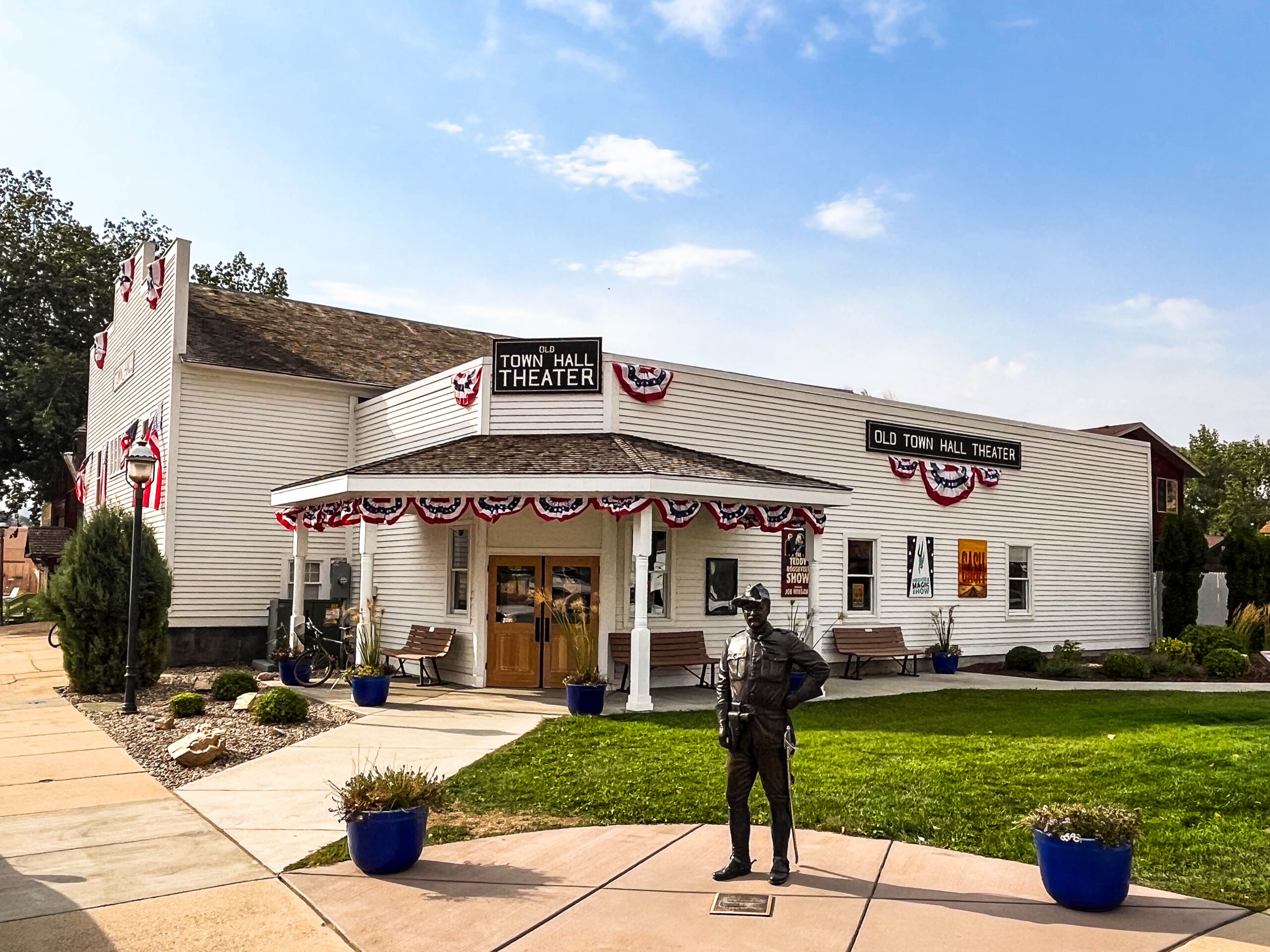
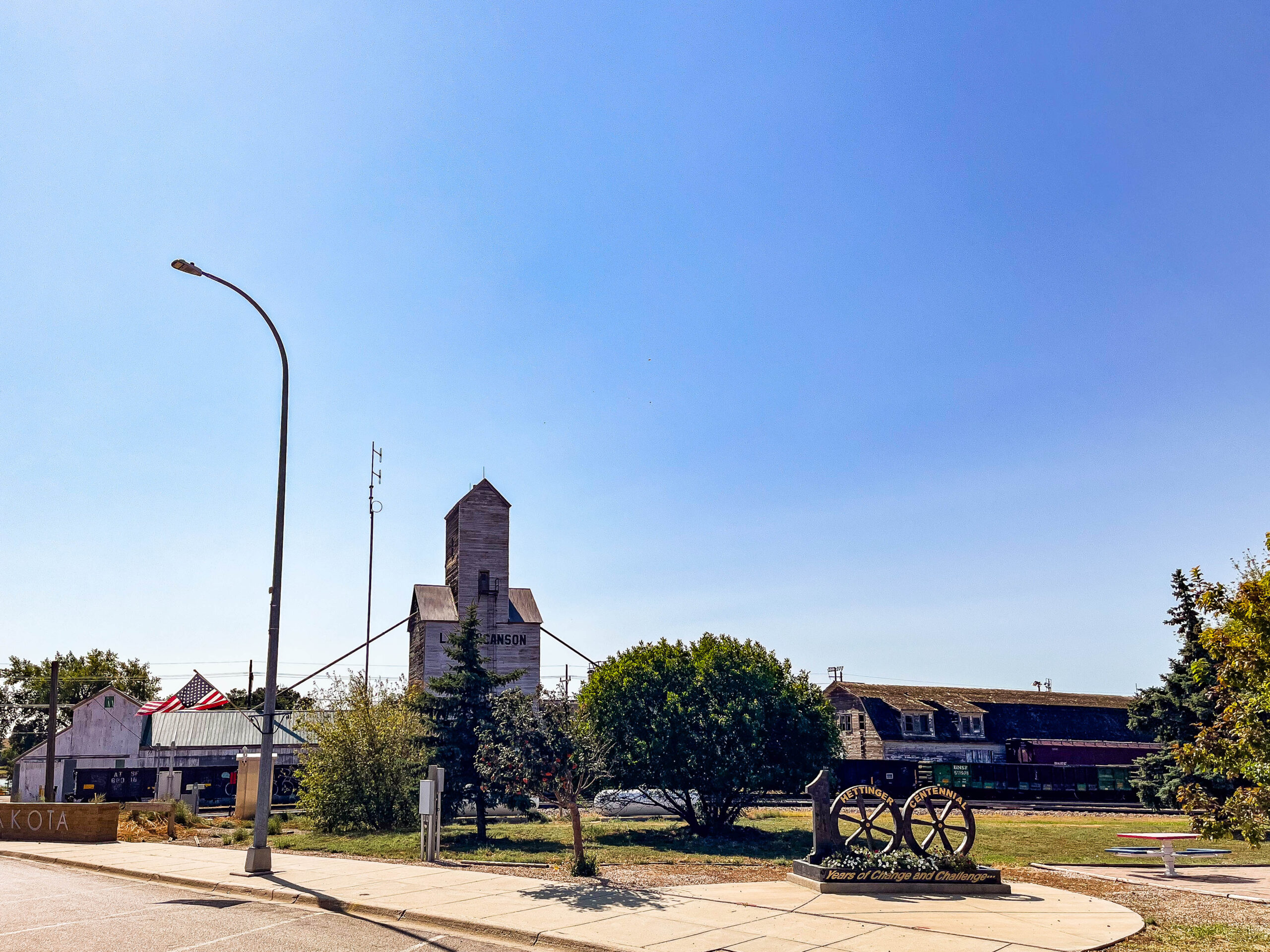
Autumn is visibly approaching, the leaves are glowing in a variety of colors with a predominance of yellow and red leaves. We pass the small towns of Hettinger (visit) and Lemmon on our way through the rolling prairie, seemingly endless fields of sunflowers – some of which have already been mown – alternating with herds of black cattle, with oil pumps nodding leisurely in between. We arrive at the Eastgate of Badlands NP just in time for sunset and moonrise and linger at the viewpoint until it gets really dark.
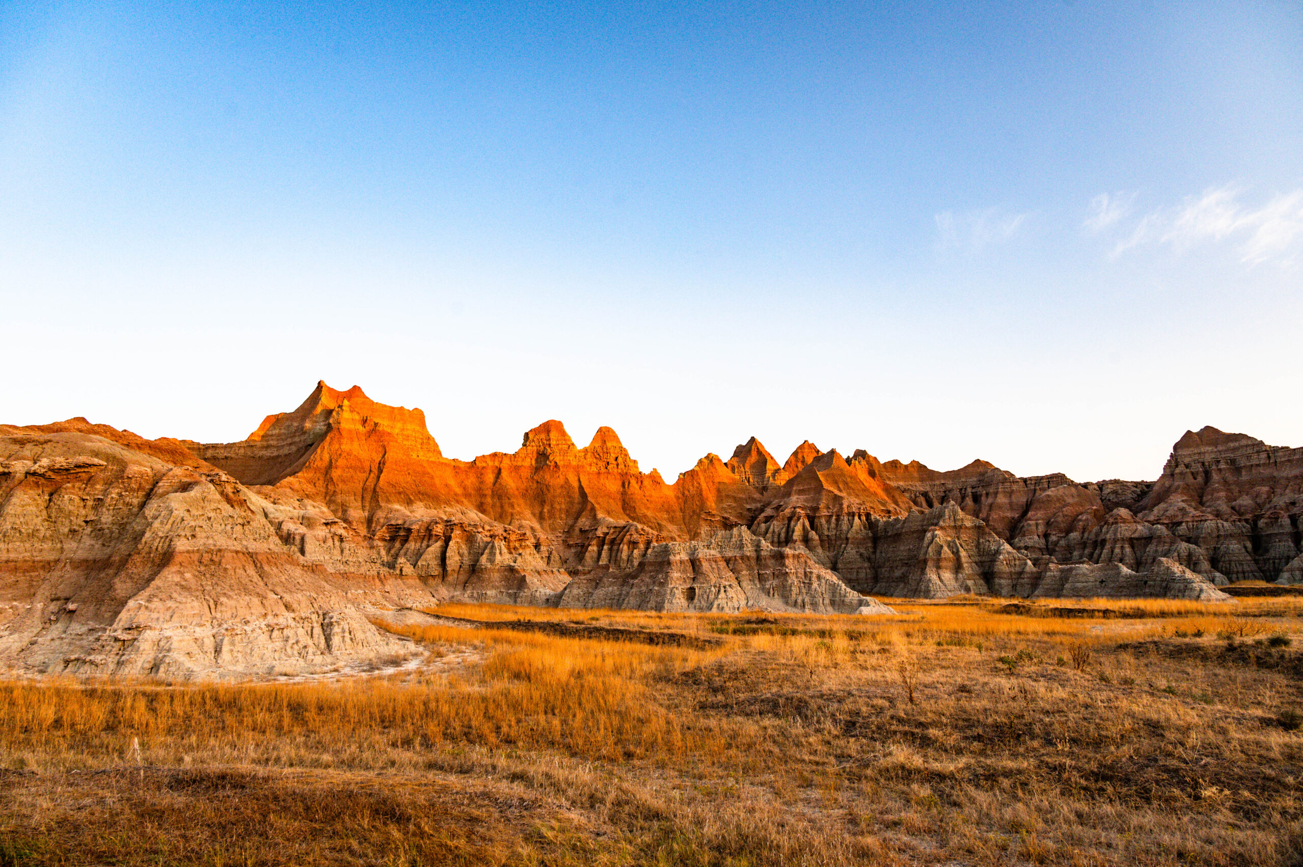
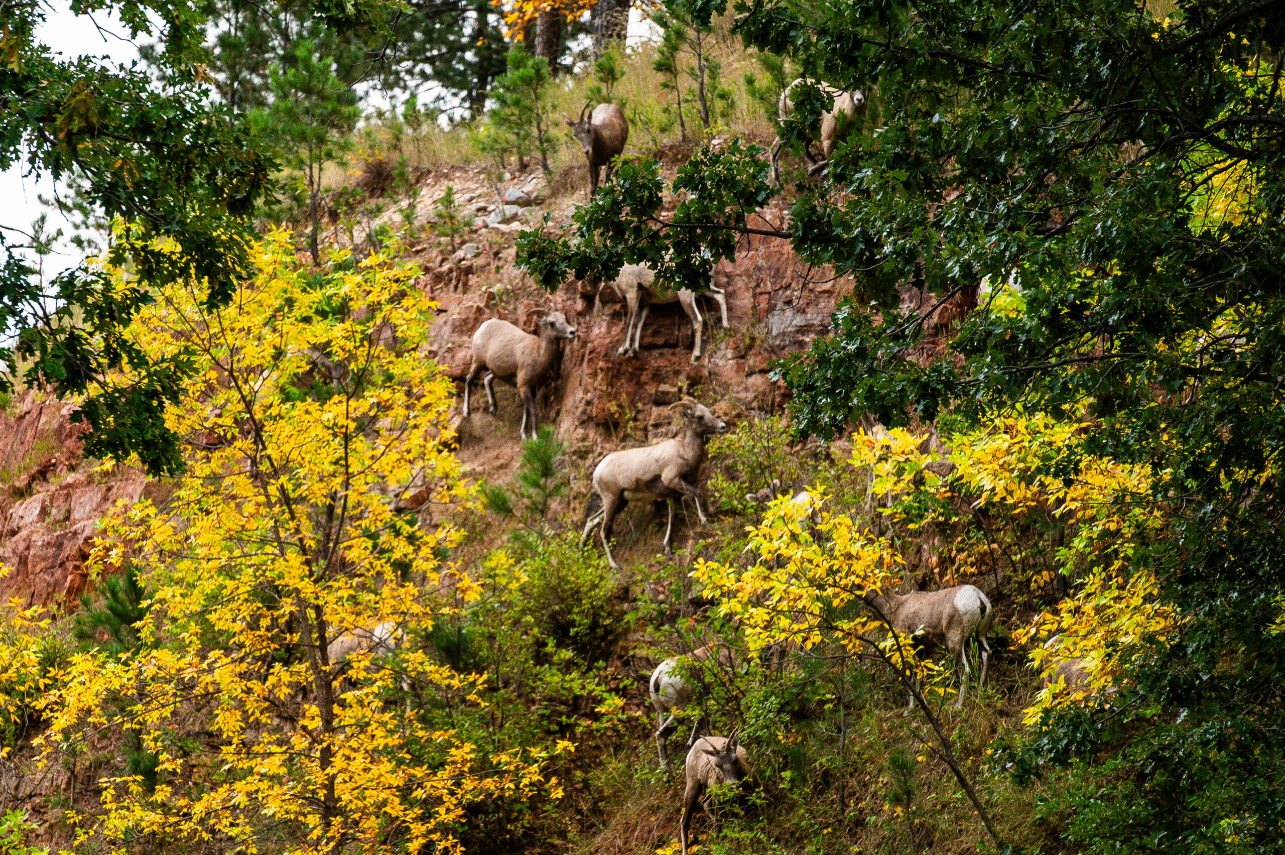
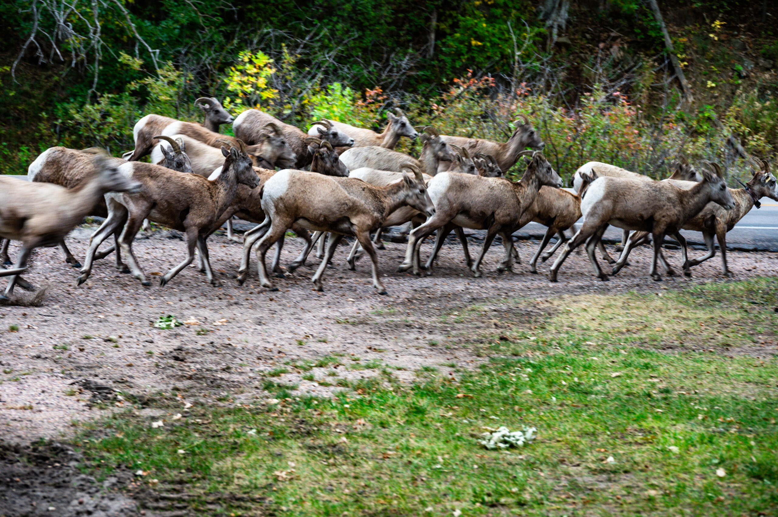
The next day really shows us the spectacular landscape, with great cloud formations and a short but violent thunderstorm. There are repeated warnings about rattlesnakes. We see Bighorn Sheep, scattered bison and finally leave the park via the rim route towards Rapid City and spend the night in Wind Cave NP (huge cave complex) after a wonderful drive with lots of deer. Unfortunately, the next morning we discover that the cave is closed for renovation. The movie of the cave tour shows what we are missing. The famous large „boxwork“ deposit is at least clearly displayed in the small museum. We drive deeper into the Black Hill Mountains, unfortunately also higher. The difficulties with cooling the engine increase, and more and more unplanned stops are necessary to cool down. The Crazy Horse Monument and especially the Mt. Rushmore memorial fascinate us. As senior citizens, we buy a parking ticket for $5 – it is valid for a whole year. In view of this potential saving, we treat ourselves to 2 bison burgers with a view of the presidential heads. In the evening, the light show and flag ceremony with thanks and tribute to the veterans are impressive, very moving, very American. The cultural and spiritual counterpoint is provided by the Lakota women’s dances the next morning.
The Black Hills (in Lakota Paha Sapa‘ Black Mountains or He Sapa) are a mountain range in the west of the US state of South Dakota, extending into north-eastern Wyoming. It is isolated in the eastern foothills of the Rocky Mountains on the western edge of the Great Plains and has a fauna and flora that differs from the surrounding area. A subspecies of junco, for example, only occurs here and the forests are home to coastal pines, white spruce and bent pines. Due to the dense coniferous forests, the area is home to bird species such as the pine jay, spruce crossbill and Indian goldcrest. The Black Hills are considered sacred mountains by the Lakota Sioux. They are also the subject of numerous Lakota myths. Even today, some members of the tribe visit the spiritual places in the mountains to practise their religion. In the Treaty of Fort Laramie of 1868, which the US government concluded with the Lakota, Cheyenne and Arapaho Indians, the Sioux reservation was granted to the three tribes and the Black Hills were promised to the Lakota as an exclusive hunting ground. An illegal expedition under George Armstrong Custer explored the Black Hills in 1874 and found gold in the mountains. After the gold discovery, the government tried to persuade the Lakota to cede the mountain range, but without success. Gold prospectors illegally invaded the area and a gold rush developed. Conflicts in the winter of 1875/76 led to the renewed deployment of Custer and the 7th Cavalry Regiment and the Battle of Little Bighorn in June 1876. After the final defeat of the Indians in the fall of the same year, the Great Sioux Reservation was broken up in 1877 and the Black Hills were taken from the Lakota. A 1921 lawsuit by the Lakota lasted until 1980, when the Supreme Court, in United States v. Sioux Nation of Indians, 448 U.S. 371 (1980), classified the action as eminent domain and awarded the Lakota $105 million in compensation. Although the Lakota reservation is one of the poorest regions in the United States, the people’s representatives did not accept the payment and are still demanding the return of the mountains. By 2007, the money had grown to over $750 million through interest. The Black Hills extend between 43°30′ and 45° north latitude and 103° and 105° west longitude. The mountain range, which is almost elliptical on the map, is around 160 km long and up to 96 km wide. Its longitudinal axis runs in a north-south direction. The base of the Black Hills lies between 760 and 900 m above sea level. The highest point is Black Elk Peak at 2,208 m in the south. [Wikipedia]
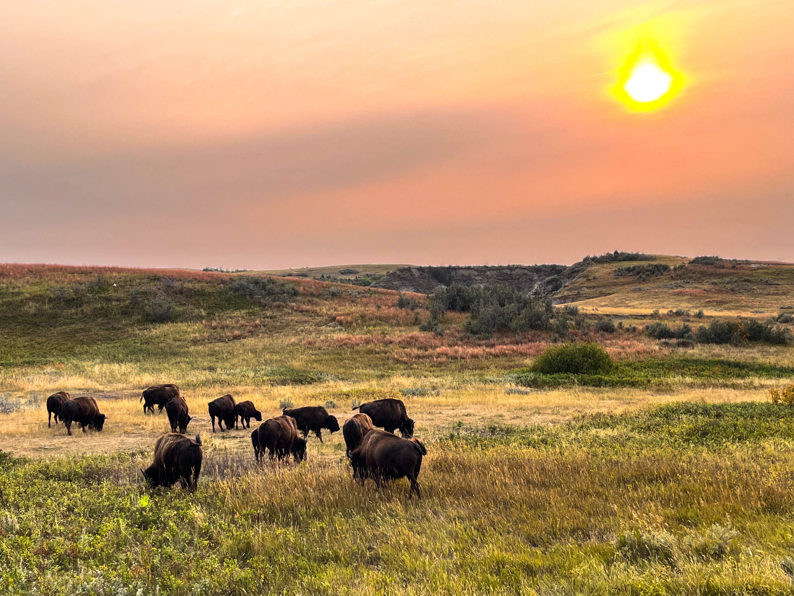
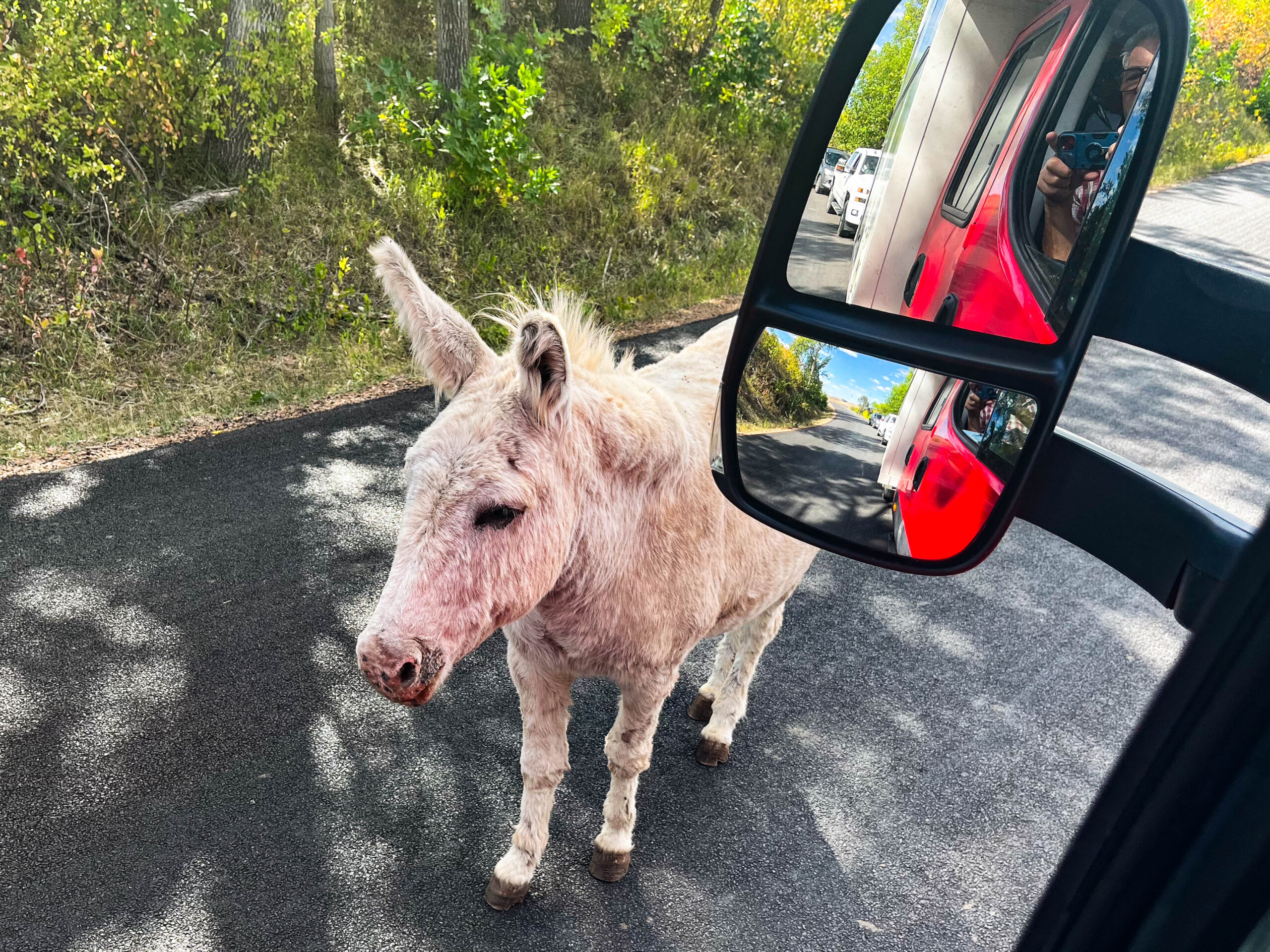
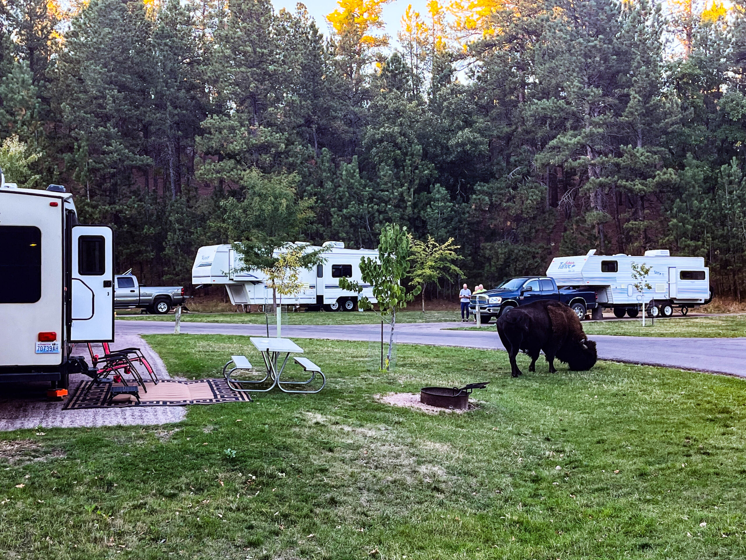
We urgently need to take care of our engine’s temperature problem and decide to seek help in Rapid City. After a number of refusals (fear of liability claims), we struggle to find someone at Floyd’s Truck Services who is willing to look after our engine. After a bit of waiting, it is clear that the clutch of the auxiliary fan is defective. A replacement part has to be flown in from Germany and should arrive within a week. A friend at home invests a lot of time and effort and organizes the shipment. We make an appointment to have it replaced at the workshop and decide to spend the waiting time at the nearby Custer State Park. According to the sign at the entrance, the annual Buffalo Roundup & Arts Festival takes place 10 days later. Too bad for us, we thought, we’ll be in Yellowstone NP with a repaired Homey. But firstly things turn out differently and secondly: after 2 days we have a tracking number and comprehensive picture documentation on how we can/must take our Iveco apart to replace the clutch. We enjoy the park in autumn colors at temperatures between 30/35 °, hike, swim and do extensive „game drives“. In fact, the bison top everything here, with large herds moving sometimes close to or on the road, sometimes far away over the hills, almost like the great migration in Africa. There are also bighorn sheep, springboks, prairie dogs, white-tailed deer, donkeys, coyotes and mountain goats along the route.
But why is our replacement hitch not moving from the UPS Center at Frankfurt Airport? Michael and we spent days trying to get information in the UPS service desert, a customs declaration was missing, although everything was discussed with a UPS employee and filled out with his help. One day after we finally knew why it was stalling, we sent the customs declaration to UPS via a customs agent. However, they were not able to assign the customs declaration to the parcel or the tracking number and finally sent the parcel back to the sender (where it is still waiting for us today).
Our mood is at rock bottom. We decide to drive back to Canada, skipping the mountains. We still take the Buffalo Roundup with us, but grudgingly postpone the Yellowstone NP.
Frustrated, we drive to Custer – a visit to the hairdresser always helps – and treat ourselves to a bison steak in the park in the evening at the Coolidge Game Lodge, the summer „White House“ of the 30th President of the USA.
We hire a car to drive the Needles Highway and Iron Mountain Road Scenic Drives. The „Slingshot“ that the majority of you had requested in the poll was no longer available – thank goodness, as the day progressed we were very glad to have working air conditioning and a roof over our heads (sun protection). The brand new Ford Bronco was almost as eye-catching as our Homey and drove brilliantly quietly and precisely. A spectacular day with beautiful views, narrow roads, narrow, low tunnels that barely allow a not-too-large car to pass and all without traffic lights. The Doane Robinson Tunnel offers a great view of the presidential heads of Mount Rushmore on the drive north. A special feature just behind it, a 360° road viaduct, is reminiscent of the famous Brusio circular railroad viaduct of the Rhaetian Railway in Poschiavo.
The day of the big event starts early and shortly after 5:00 am we join the queue (approx. 9 km) in front of the North Parking & Viewing of the Buffalo Roundup. Just in time for sunrise, we set off in a very disciplined manner. Once we arrive at the park, we follow the well-intentioned advice of a ranger and have breakfast in peace and quiet instead of rushing up the hill and exposing ourselves to the glaring sun. Just how right and good this decision was becomes clear when we find great spots with fantastic views of the expected spectacle and have to wait even longer for the bison. The singing of the national anthem makes all the waiting spectators stand up with their hands on their hearts. Due to the hot weather, the animals take their time, instead of 9:30 it is almost an hour later and it is more of a tired procession than a stampede of animals that makes the ground tremble. The whip cracking of the cowgirls and cowboys hardly moves the mighty animals today, even Governor Kristin Noem on her white horse with the big American flag in her hand seems annoyed by the wait. But seeing hundreds of bison is worth the effort! So we don’t shy away from the heat and walk to the corrals afterwards to watch the hustle and bustle: Stocktaking, sorting out the animals to be sold, branding yearlings (S for South Dakota and number for year of birth), vaccinating. Again and again, the metal cages shake under the animals‘ kicks before the hydraulic restraining cages no longer allow any movement. Incidentally, the males are already separated („they are making too much trouble“). Nevertheless, it is very dangerous, one employee was almost caught by a horn. The stress is palpable, and unfortunately stun guns have to be used repeatedly. The last shuttle bus takes us back to the park area.
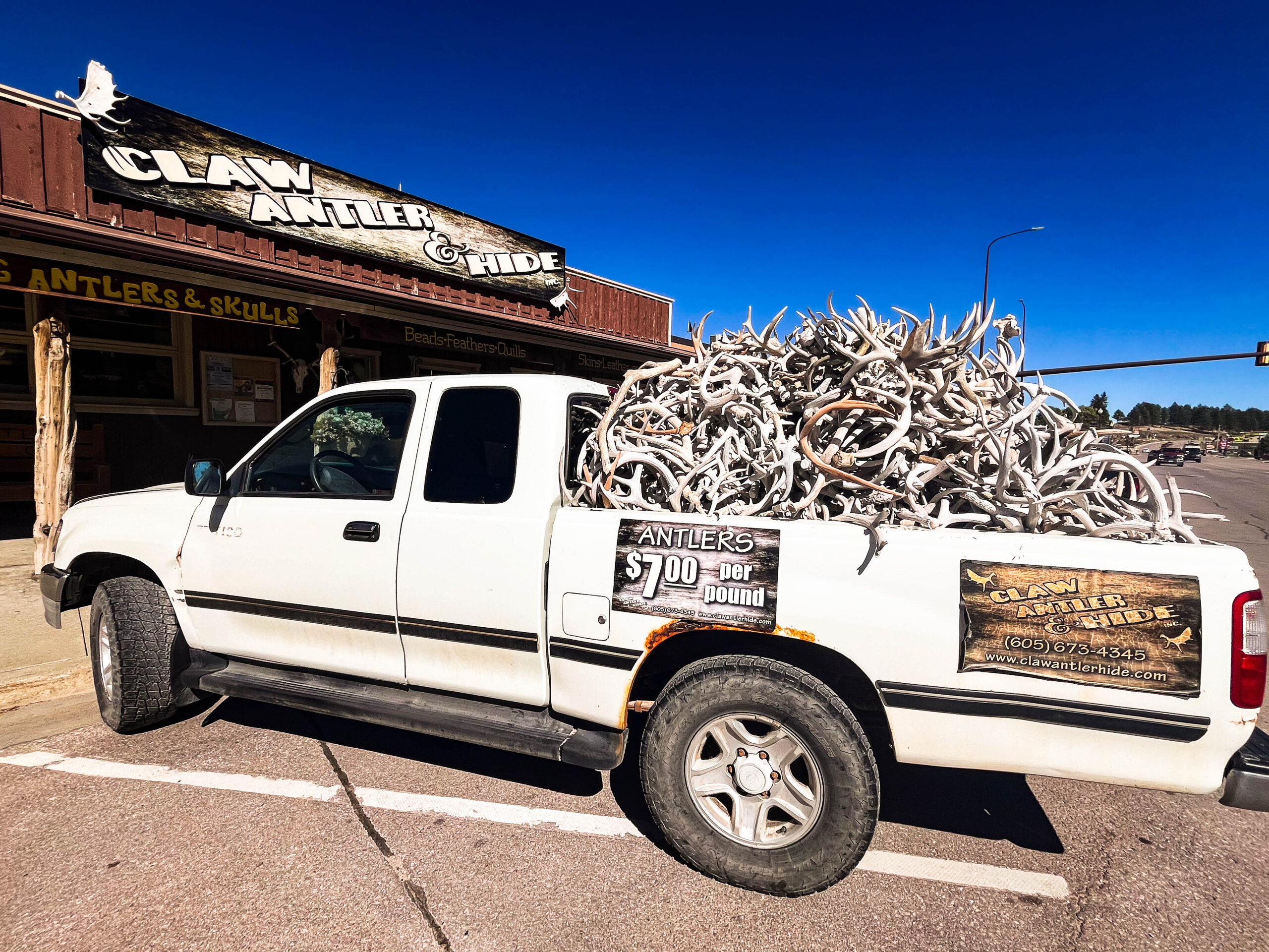
The pancake breakfast has us at the Buffalo Arts Festival at 8am the next morning. Country musicians perform every hour in the large marquee. The stalls show lots of beautiful and interesting things, a really completely different range to ours: antlers, hides, lots of bison leather items, knives (some decorative objects with stone blades and valuable handles), whips and wardrobe elements with gun holders (photography not allowed!), next to the Republican and Democrat stalls – which, however, had very few visitors in „Trump“ country. But there were also familiar items such as wooden boards, stones, T-shirts, felt goods and lots of jewelry. We get talking to almost all the traders, they show interest in where we come from, it’s a good time and the souvenir box fills up.
Our plan: heading back to Canada via Devil’s Tower and the prairie.
28.09.24 / Speedometer 39,464 km, of which 15,781 km in Canada and 1,889 km in the USA
