🇩🇪 ein bisschen Québec und ein winziges Stückchen Labrador
🇬🇧 a little bit of Québec and a tiny bit of Labrador-
🇩🇪 ein bisschen Québec und ein winziges Stückchen Labrador
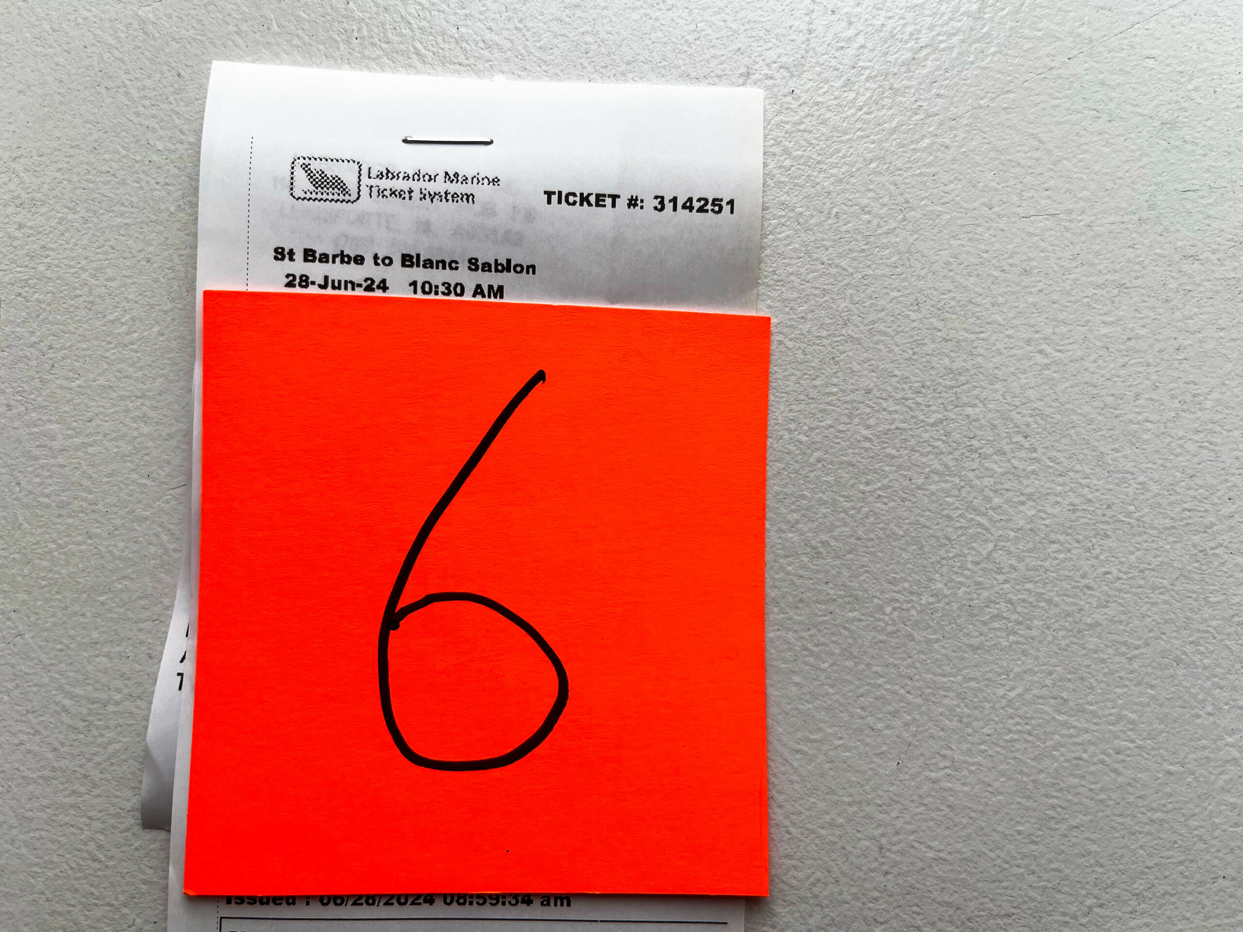
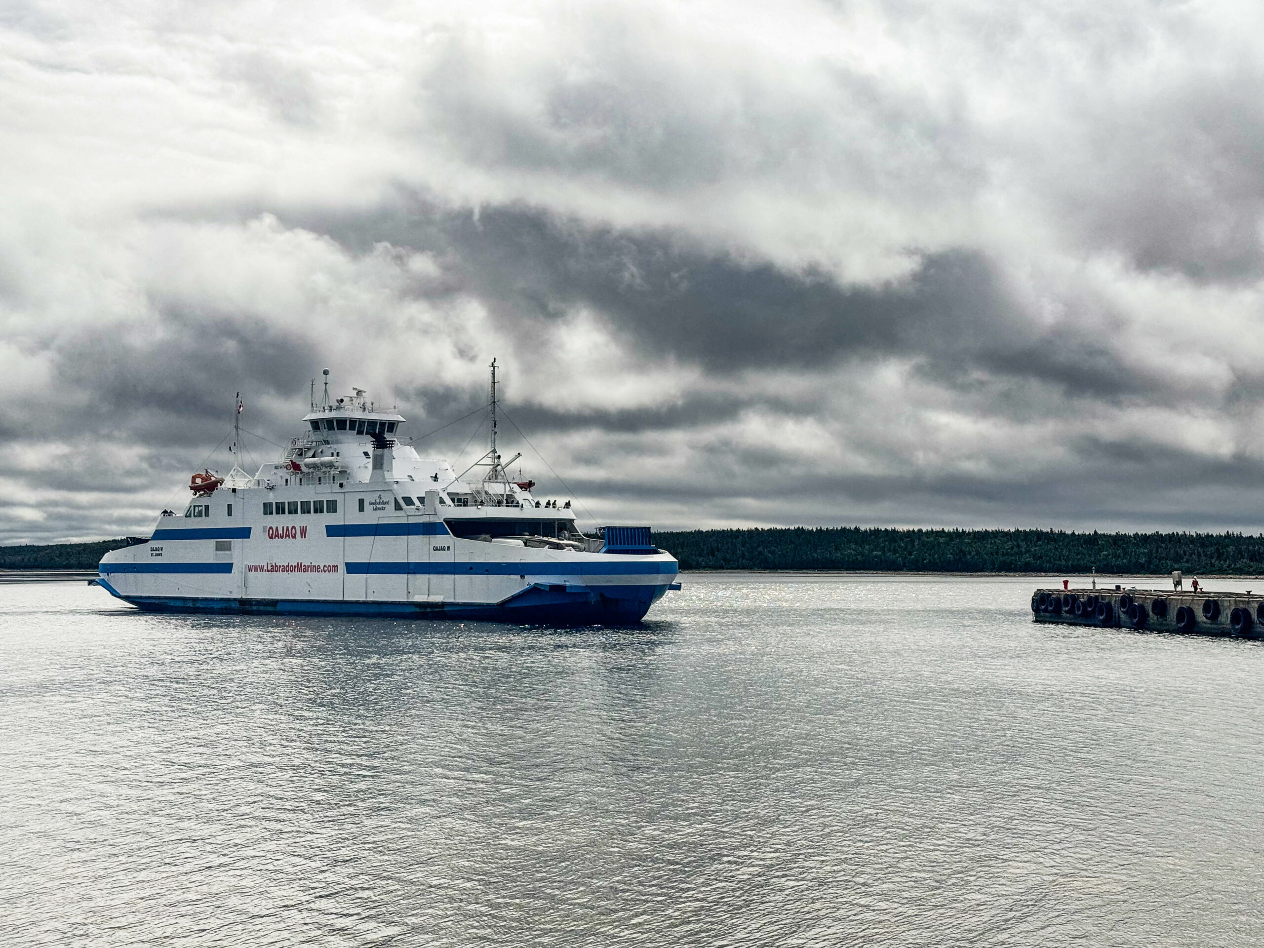
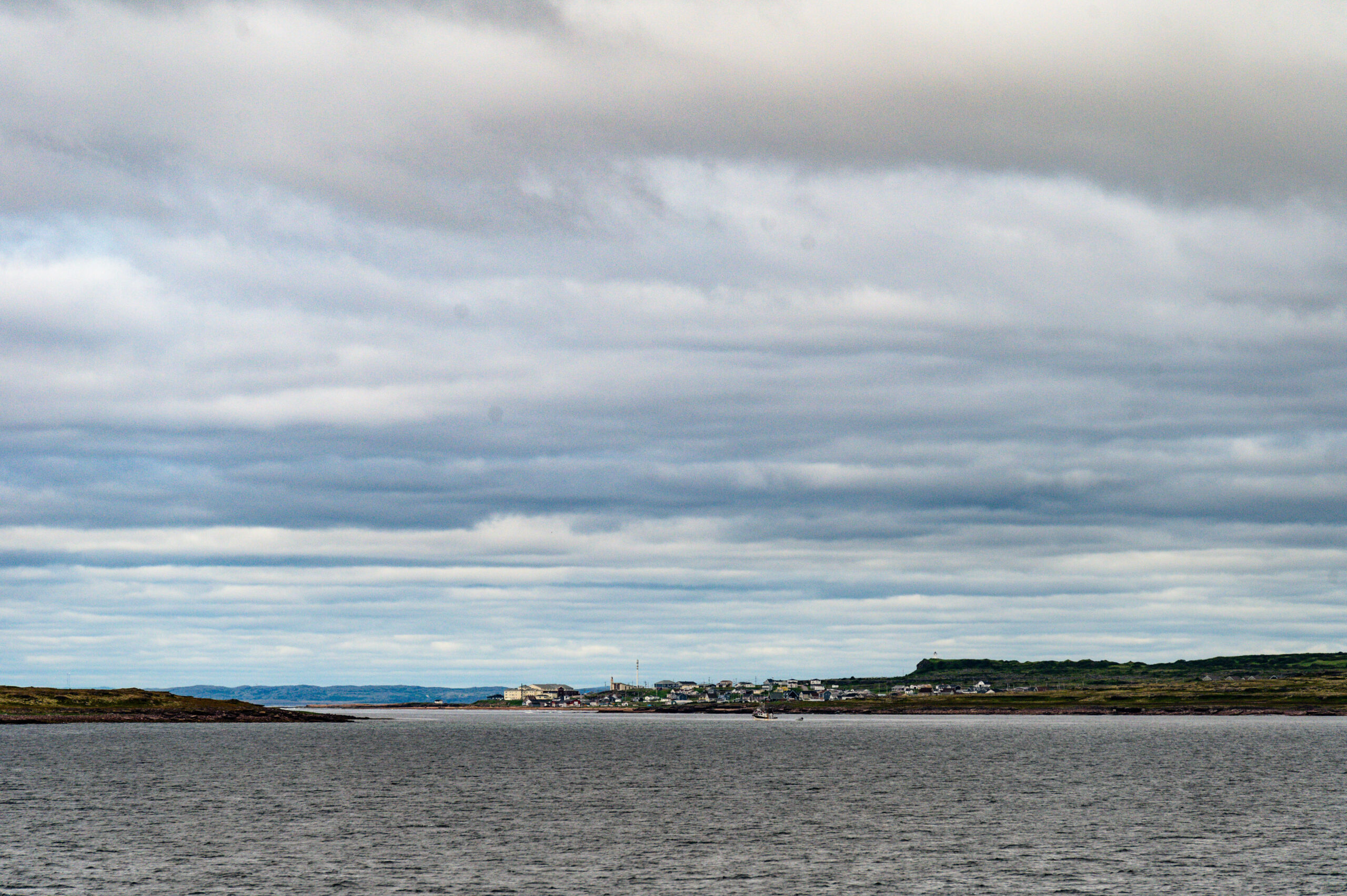
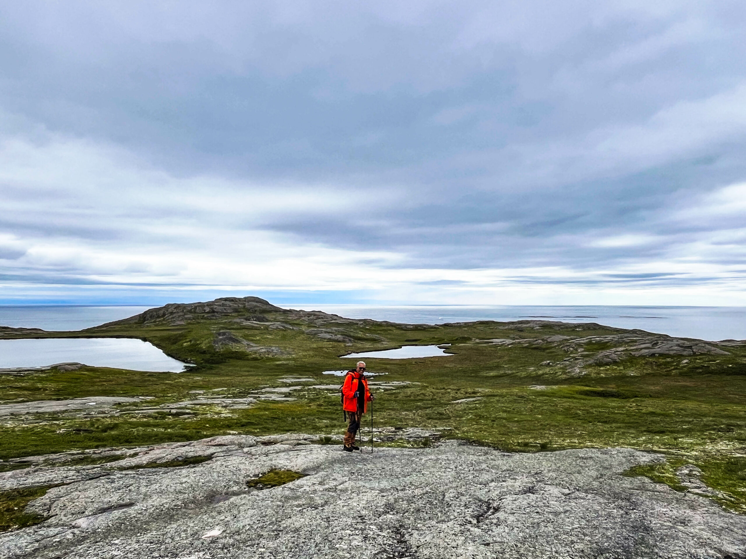
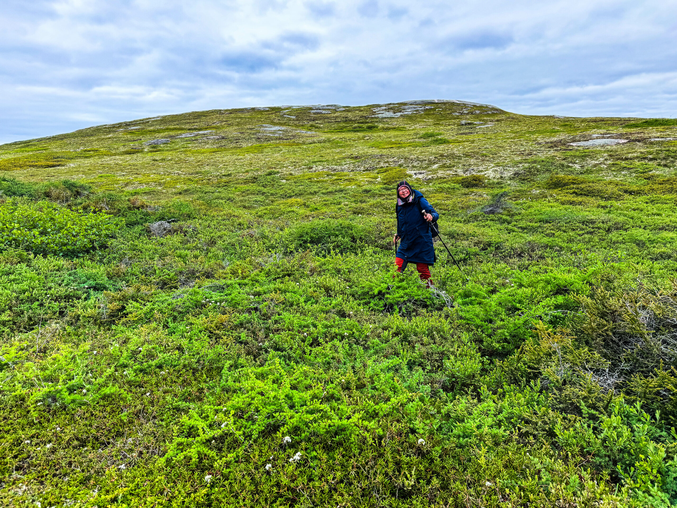
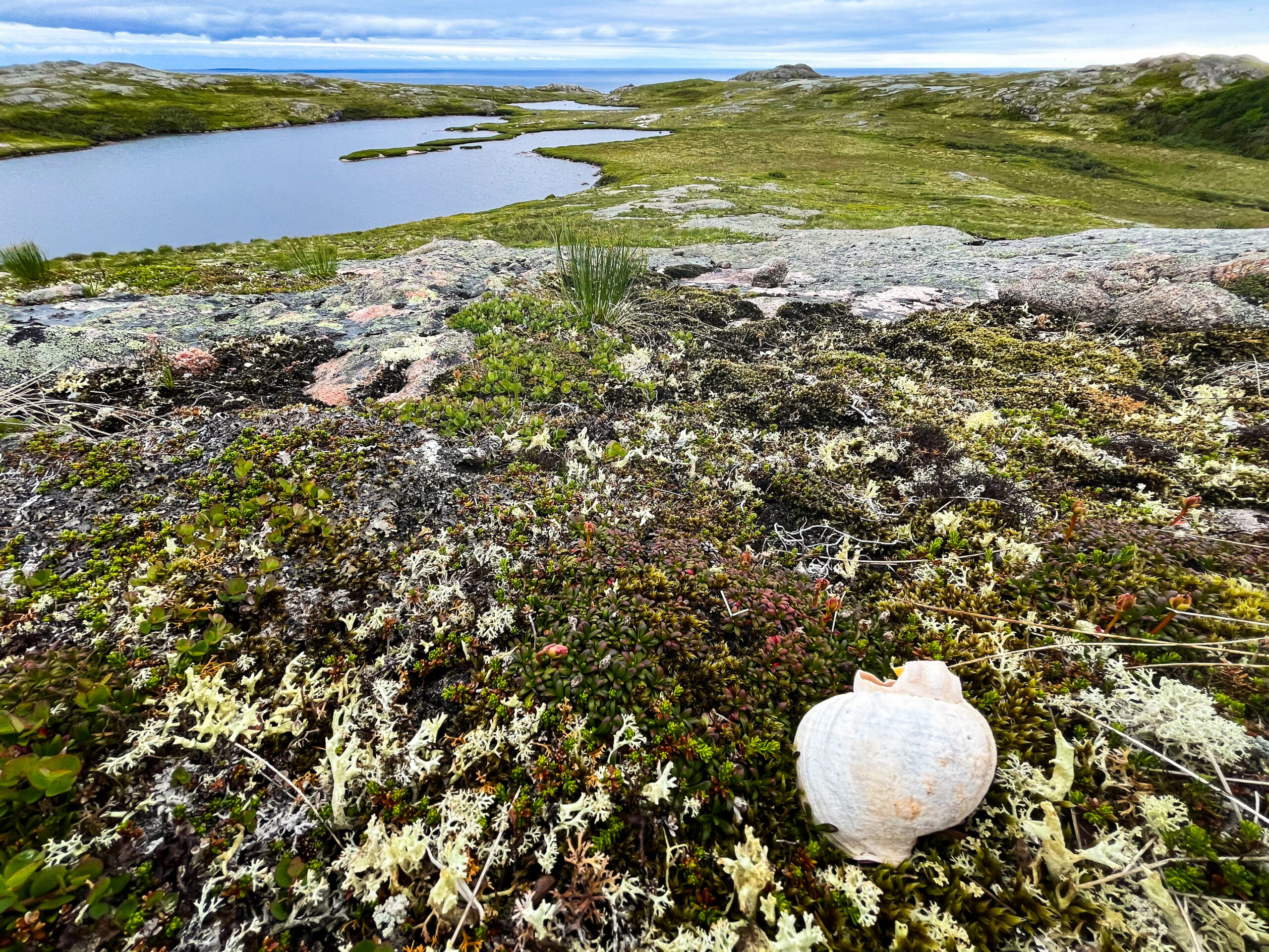
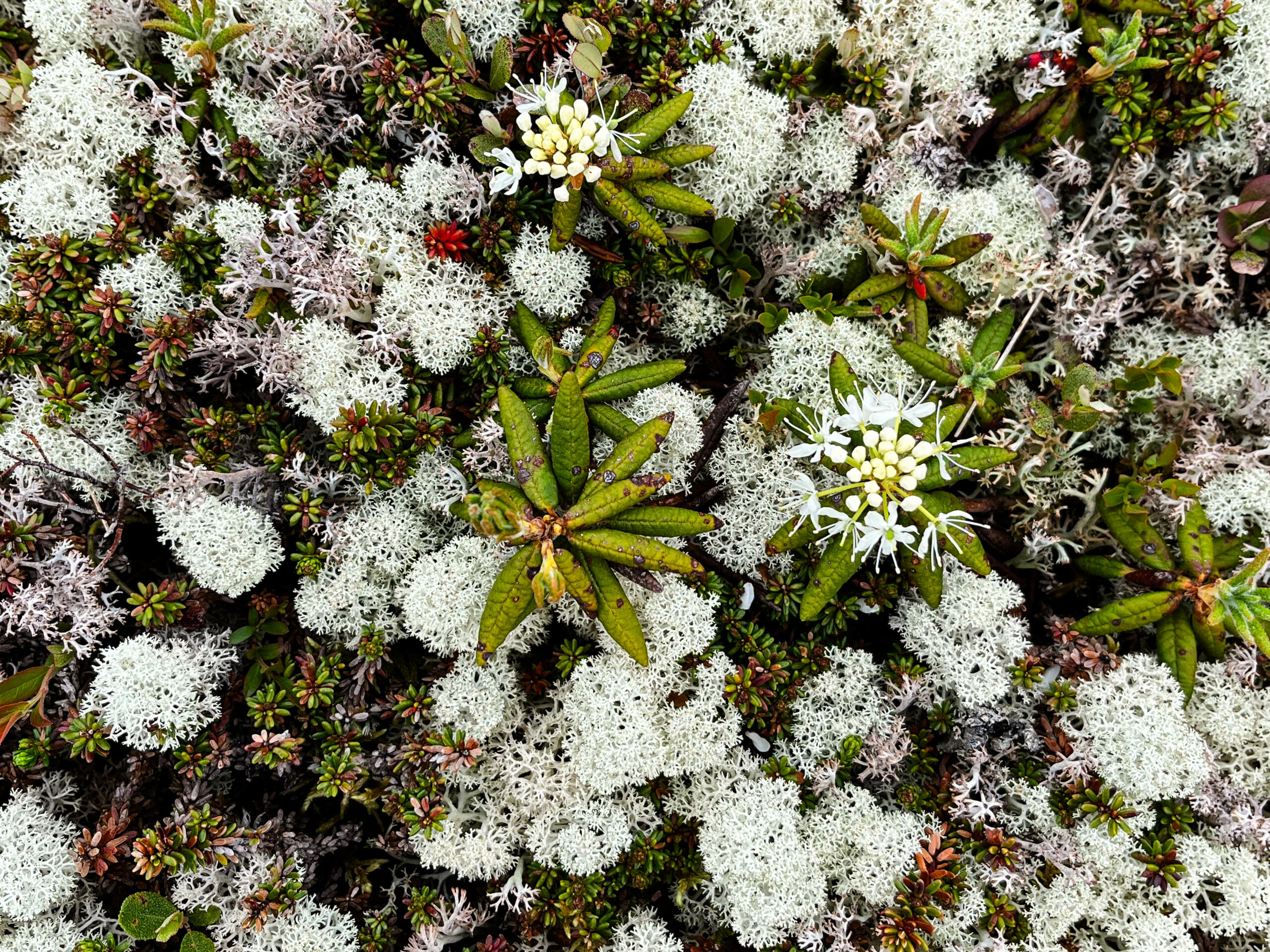
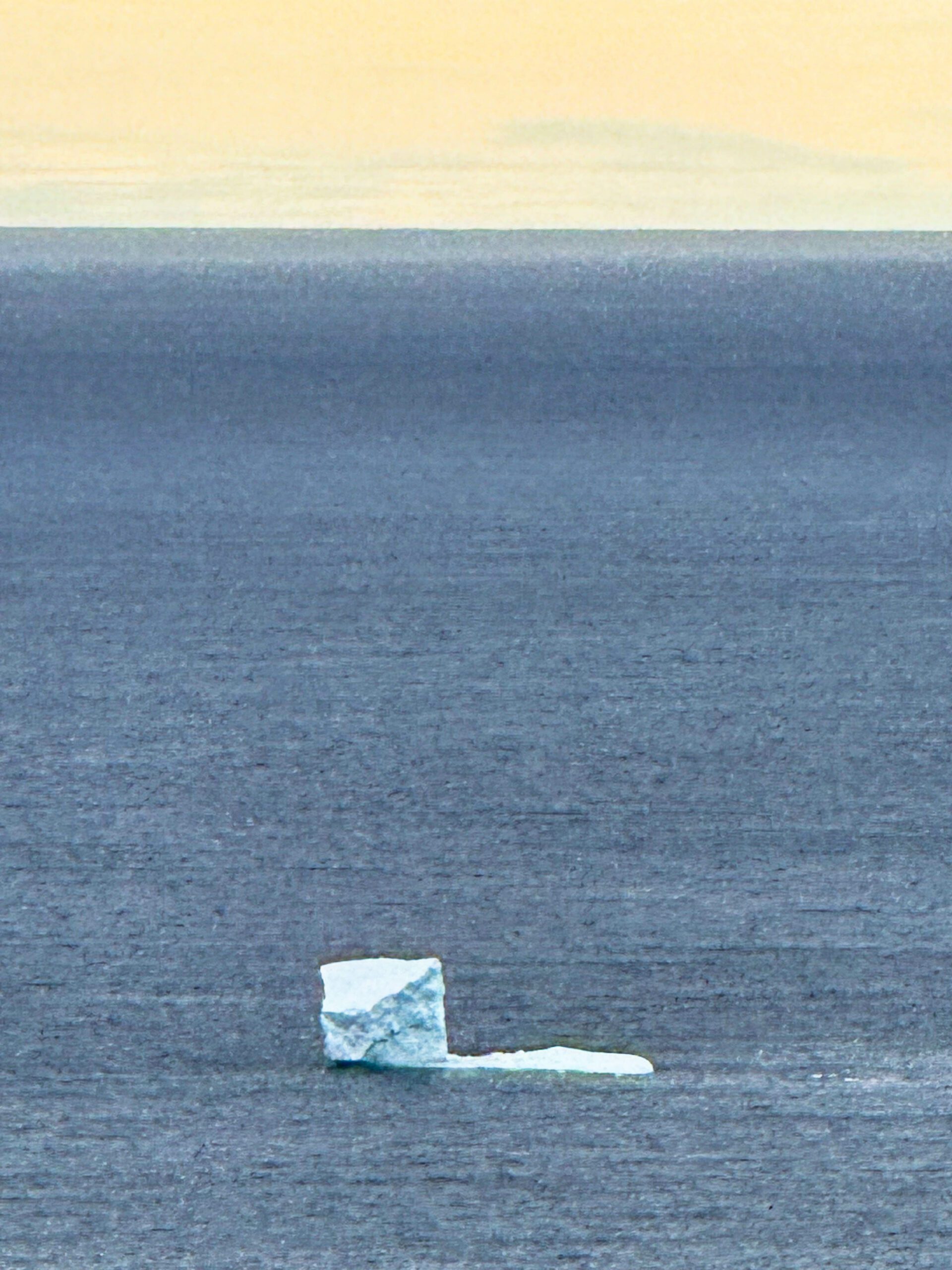
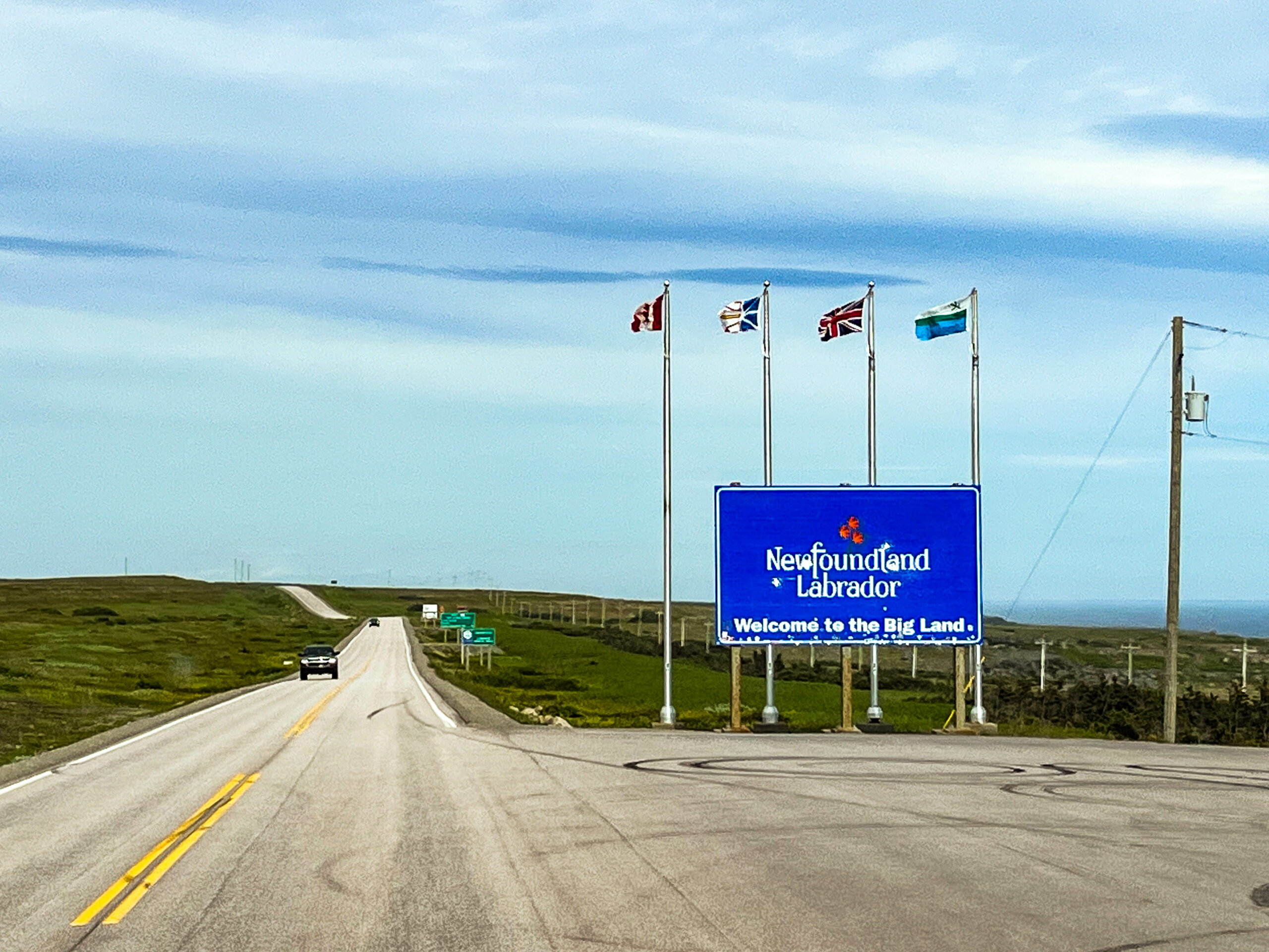
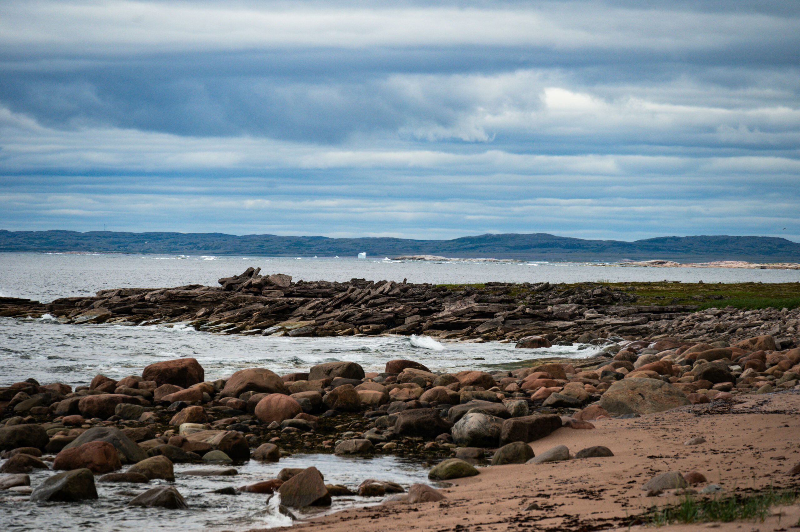
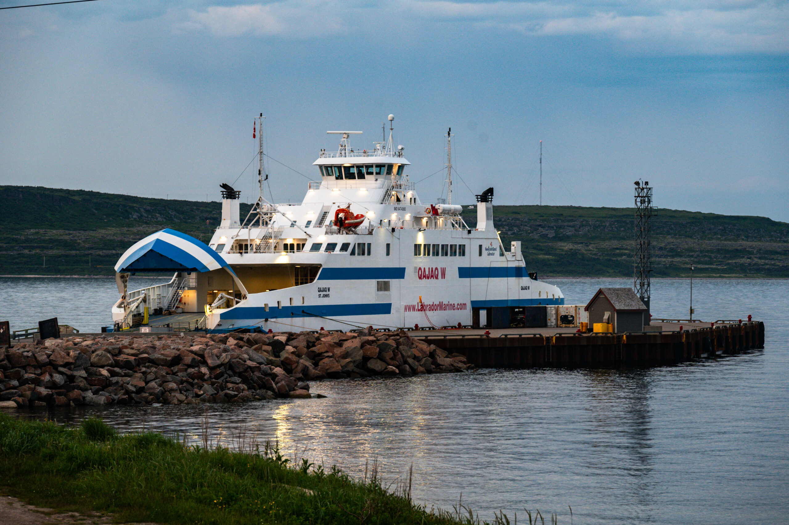
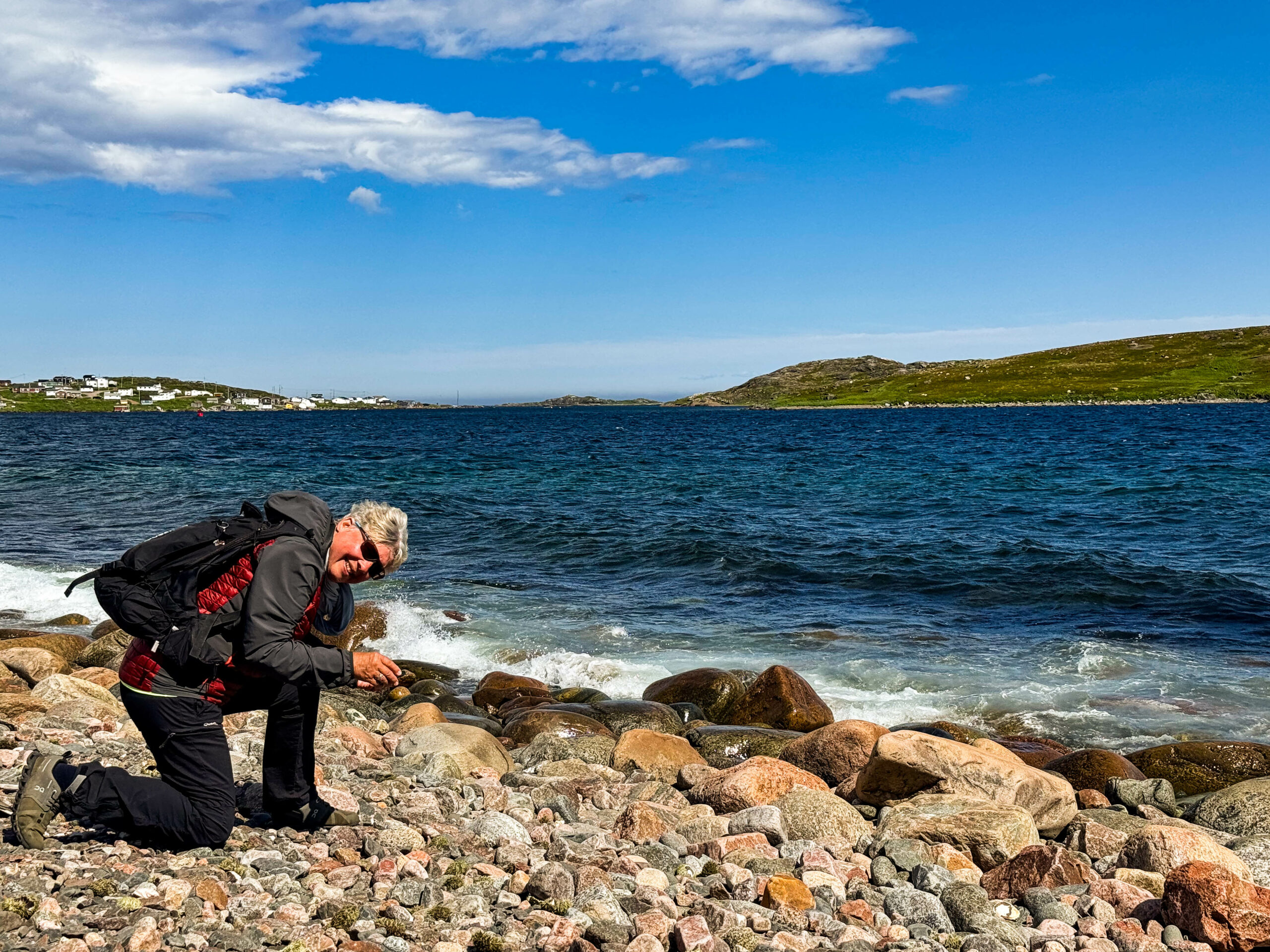
Morgens früh am Ticketoffice in St. Barbe die Nummer 6 zugeteilt bekommen, wir sind also ohne Reservation das 6. Auto für die freien Plätze auf der Fähre nach Blanc-Sablon (Qc). Der Aufreger des Morgens war aber Gabis Ruf, Eisberg voraus – tatsächlich war es unser Schiff am Horizont und kein auf uns zutreibender Eisberg. Jedenfalls waren wir wach und voller Vorfreude auf Labrador. Der Fährplatz war letztendlich easy, wenngleich die Fähre am Ende quasi voll war (3 PKW‘s hätten noch Platz gehabt). Die Überfahrt ruhig, leider ohne Walsichtung. Vor Blanc Sablon mussten wir warten, bis der Container-/ Passagierfrachter, der die Häfen rechtsseitig des St. Lorenz-Strom anläuft, abgelegt hatte. Bei dieser Gelegenheit haben wir dann doch einen größeren Eisberg in Richtung Lourdes-de-Blanc-Sablon gespottet. Endlich am Land haben wir voller Überraschung festgestellt in Québec zu sein. Folglich andere Zeitzone (-90‘), die Fährzeiten sind aber in der NFL-Zeit angegeben (!), das Chaos also vorprogrammiert und tatsächlich haben wir auch gleich die ersten Personen getroffen, die dem Zeitchaos und den „falschen“ Abfahrtszeiten zum Opfer fielen. Für uns positiv, sind wir quasi zur Abfahrtszeit schon wieder angekommen. Nach Wasserfassen am Visitorcenter/Touristinfo und der Bestätigung, Eisberge sind an der Küste, ging es westlich auf die Jagd. Eine erste Eisscholle machte Appetit auf mehr, durch das Fernglas sah man auch deutlich Eisberge an der Küste. Dumm nur, dass die Straße nicht an der Küste entlang führte. Letztlich halten wir neben der Straße und laufen querfeldein durch die Taiga zur Küste durch Sumpf und Gestrüpp – über Berg und Tal bis wir einen kleinen Eisbergfriedhof entdeckt haben. Glaubt es mir, viel anstrengender als ursprünglich gedacht und natürlich auch viel weiter als es aussah. Ohne die Wanderstöcke und vor allem den hohen Wanderschuhen wären wir vermutlich nicht bis auf die Klippen gekommen. Das Laufen durch die Taiga ist faszinierend, ständig die Suche nach soviel festem Grund unter der Sohle, dass man keinen „Schlappen“ bekam oder der Schuh vom Fuß gezogen wurde. Das federnde Nachgeben führte schnell dazu, sich an den Felsen zu orientieren und lieber einen Umweg in Kauf zu nehmen denn nasser Füße. Aber die Mühe hat sich gelohnt. Zurück laufen wir einen besser ans Gelände angepassten Bogen (meinten wir), aber der Homey scheint immer näher, um dann doch wieder ein weiteres Tal queren zu müssen, kurzentschlossen bleiben wir gleich an Ort und Stelle über Nacht, als wir es wirklich geschafft haben.
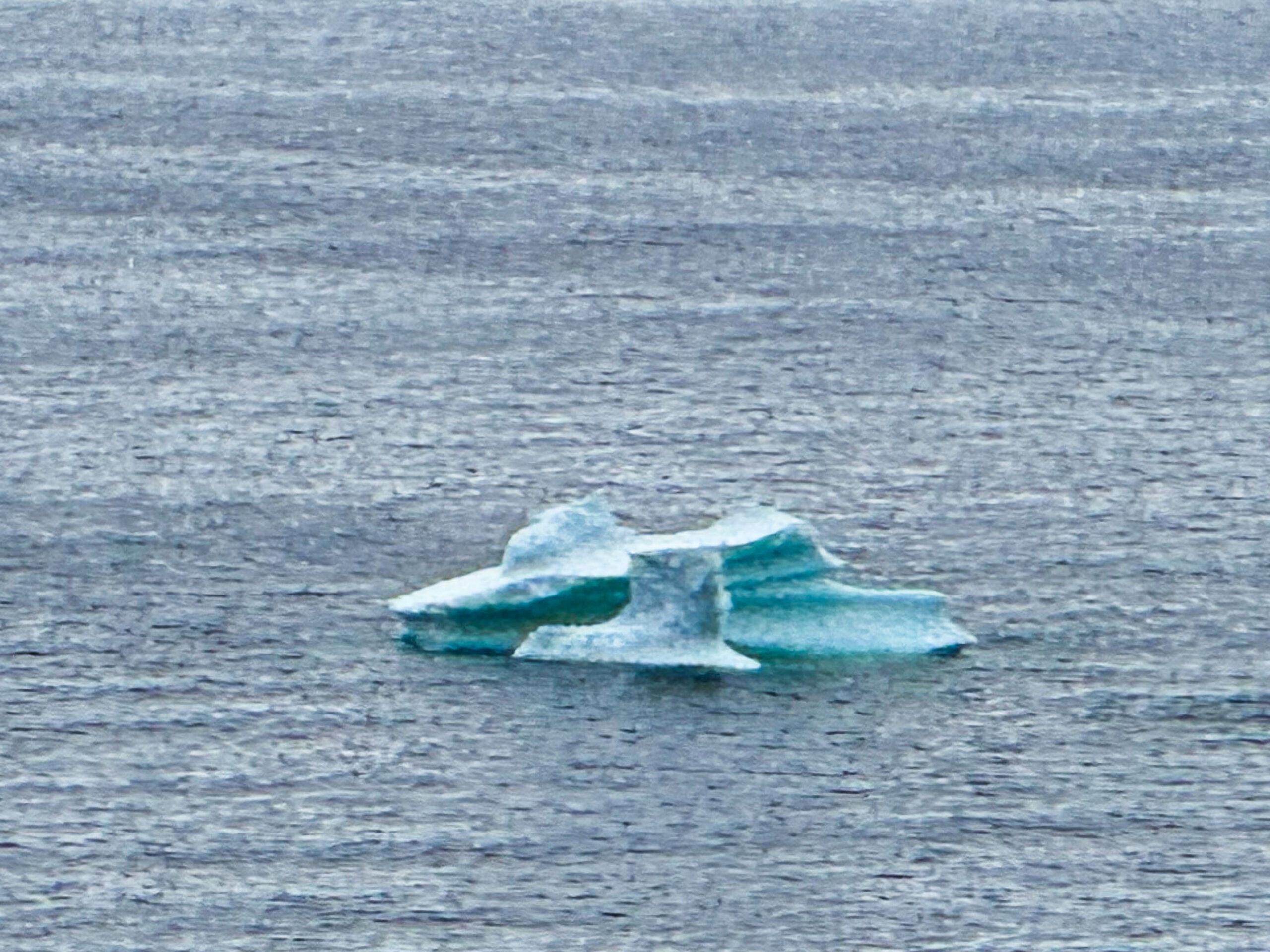
Morgens dann strahlend blauer Himmel, wir fahren weiter und besuchen bei Pointe-Rocheuse erneut die Eisberg-Reste in einer kleinen Bucht bei schönem Licht. Diesmal laufen wir einer Zufahrt zum Strand folgend. Der kleinere dreht sich ansatzlos ohne Vorzeichen direkt vor unseren Augen.
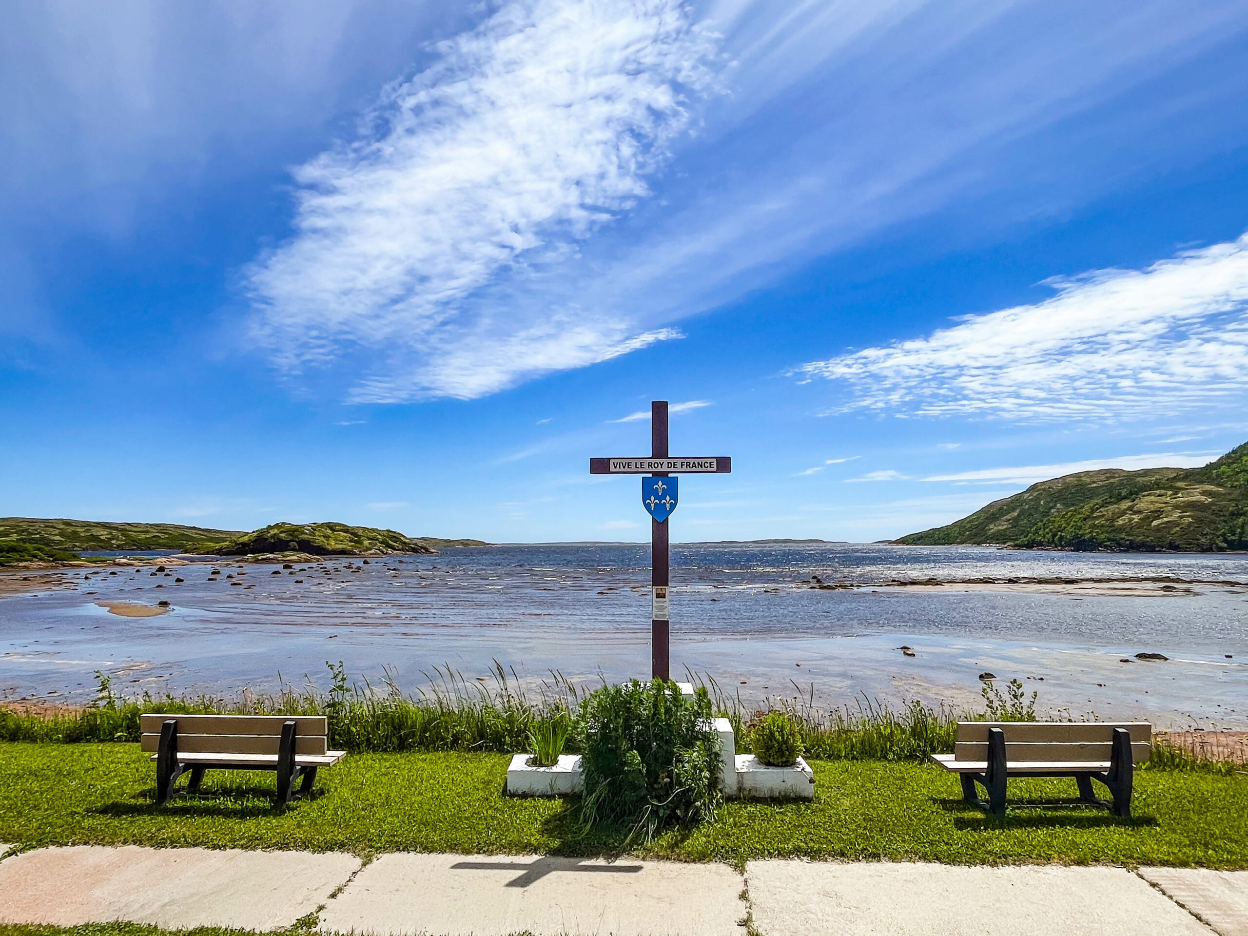
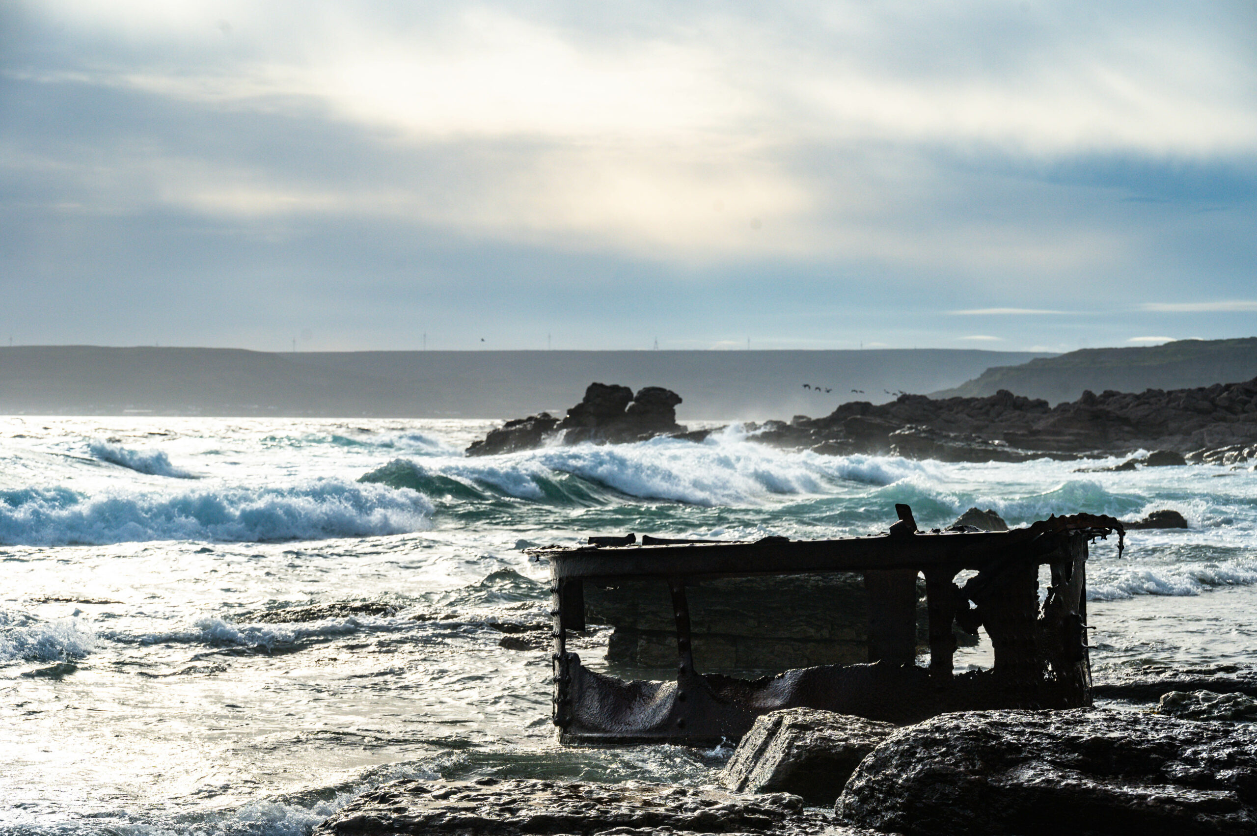
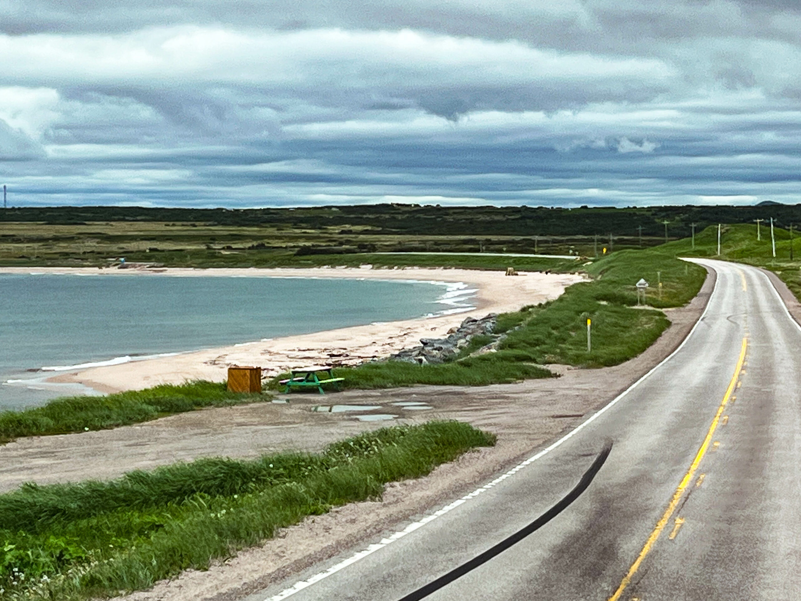
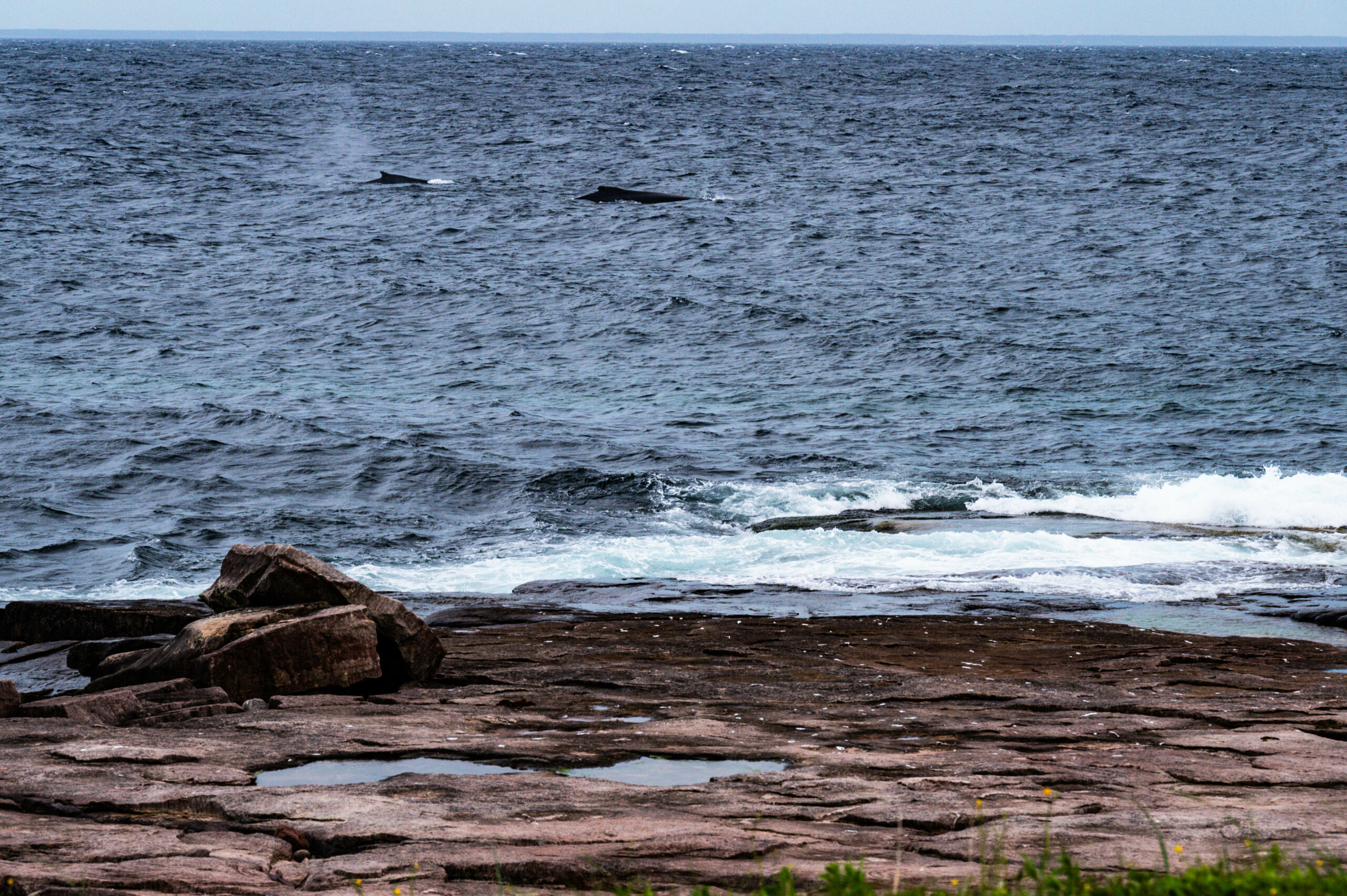
Wir fahren und folgen der Straße bis zum Ende in Old Fort, drehen dann um und nun geht es wie geplant nach Norden, nach Labrador. Auf der Suche nach einem gesichteten Eisberg folgen wir einer Piste zum Strand und laufen dann noch ein gutes Stück des Küstenwanderweges, leider zeigt sich der Eisberg nicht. Enttäuscht drehen wir um und sehen bald darauf 3 Wale die Küste entlang ziehen, direkt auf uns zu. Wieder hört man den Blas bevor man ihn sieht. Beeindruckend schön, langsam, fast majestätisch gleiten sie durch die aufgewühlte See. Ursprünglich wollten wir am Pointe Amour Lighthouse stehen bleiben, fahren dann doch ein bisschen zurück und stehen direkt am Meer vor den Resten eines gesunkenen Kriegsschiffes. Havariert beim Ausweichen vor einem Eisberg, dummerweise war dann das Land zu nah für die Geschwindigkeit. Kaum sind wir von der Besichtigung der spärlichen Reste zurück, beginnt der angesagte Regen, der uns auch den nächsten Tag begleitet.
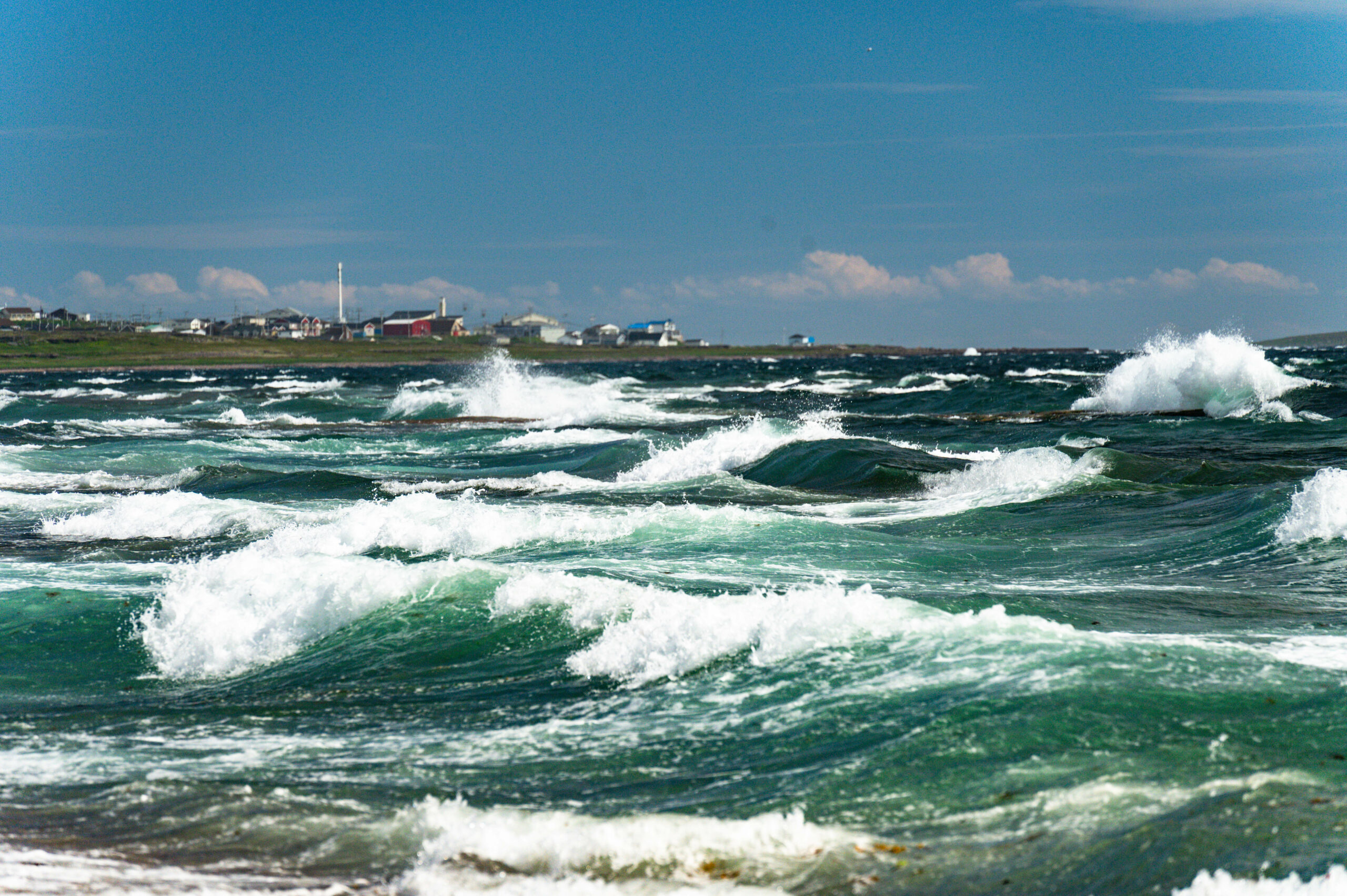
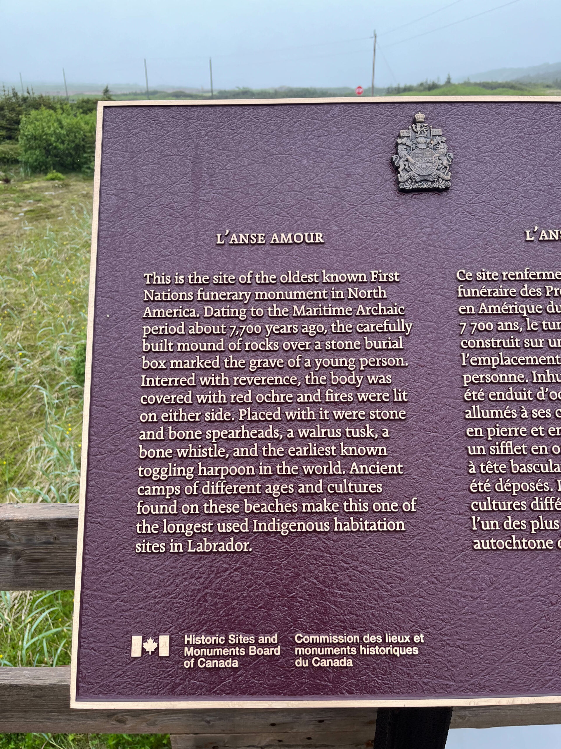
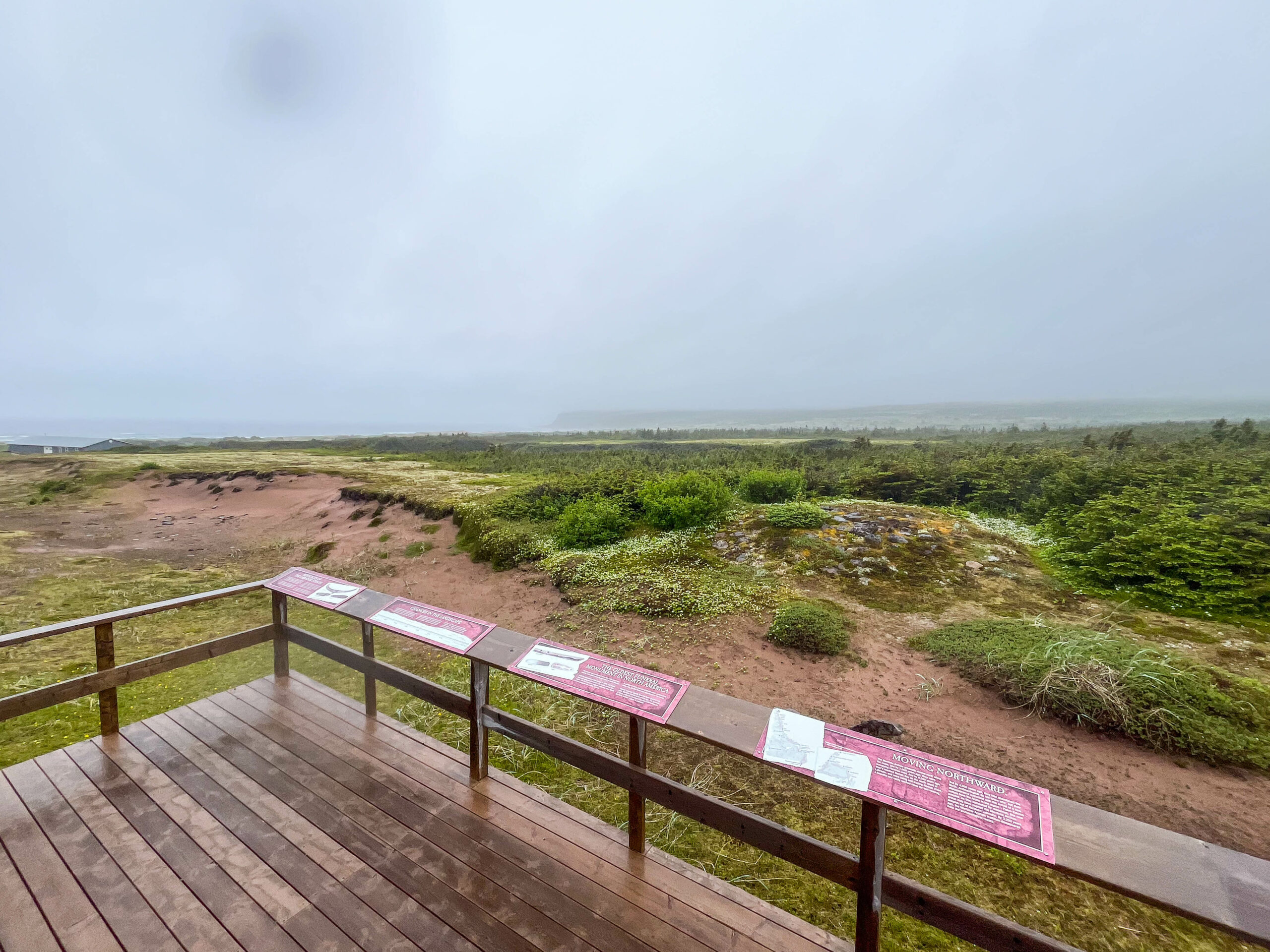
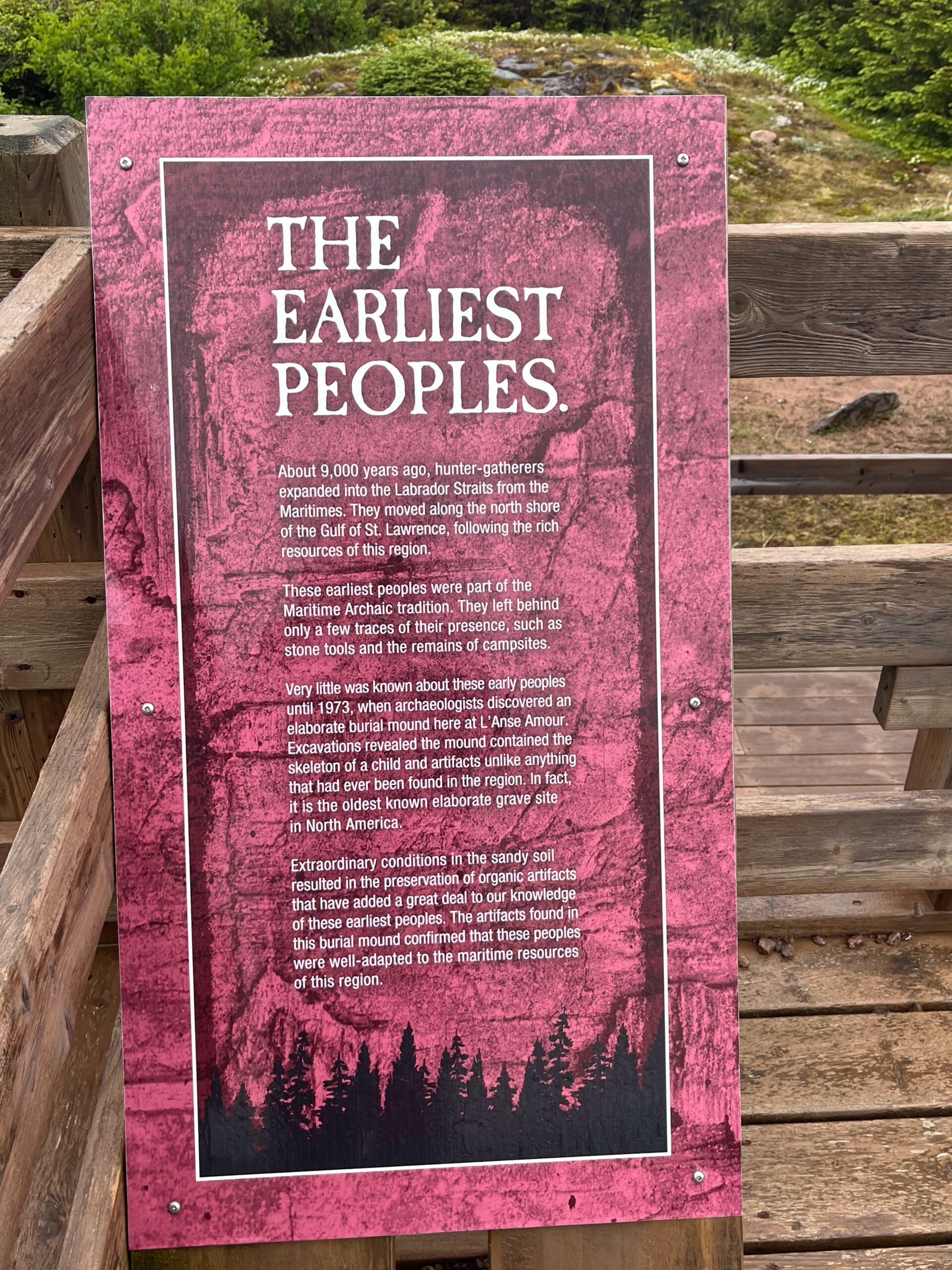
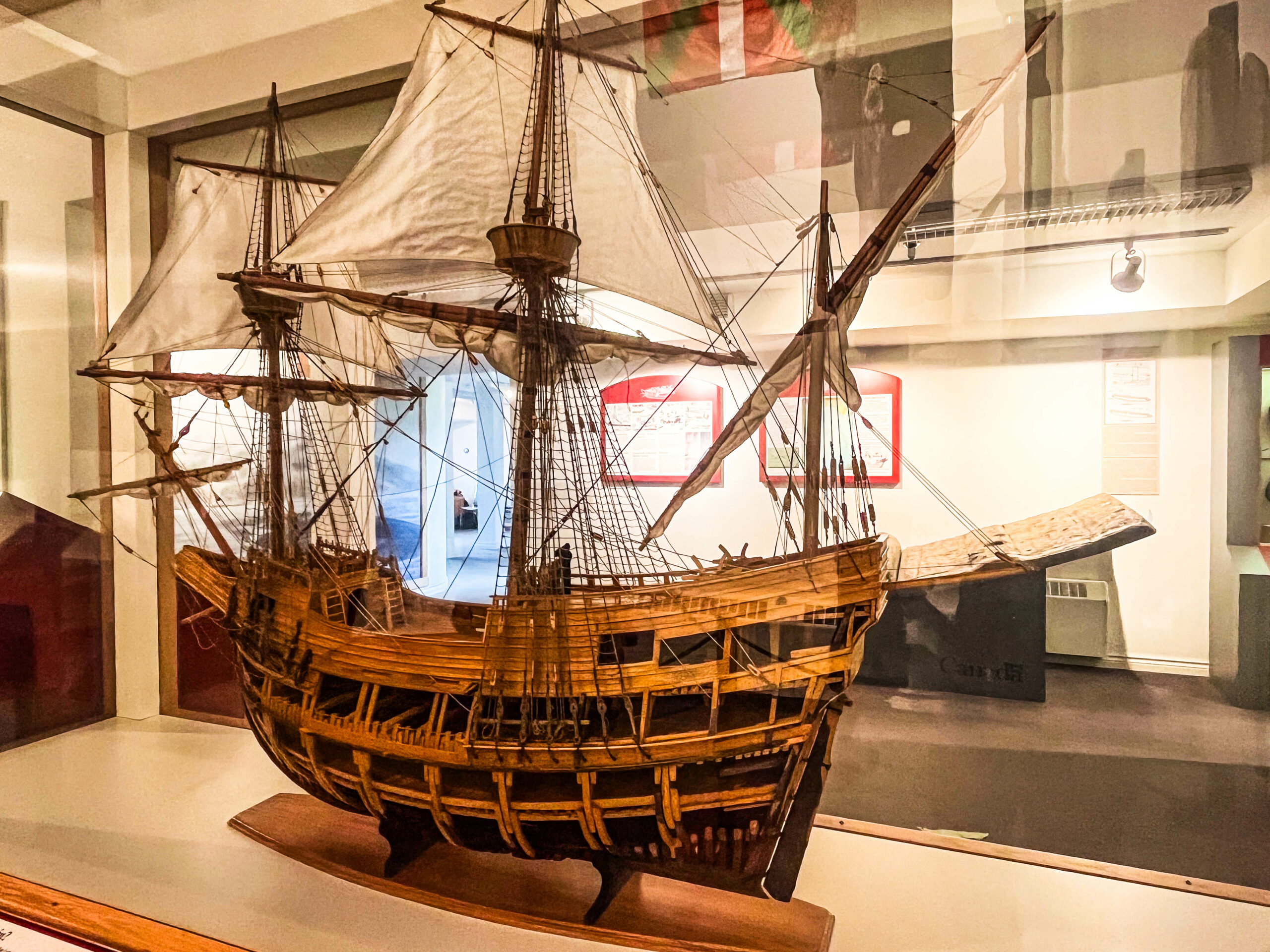
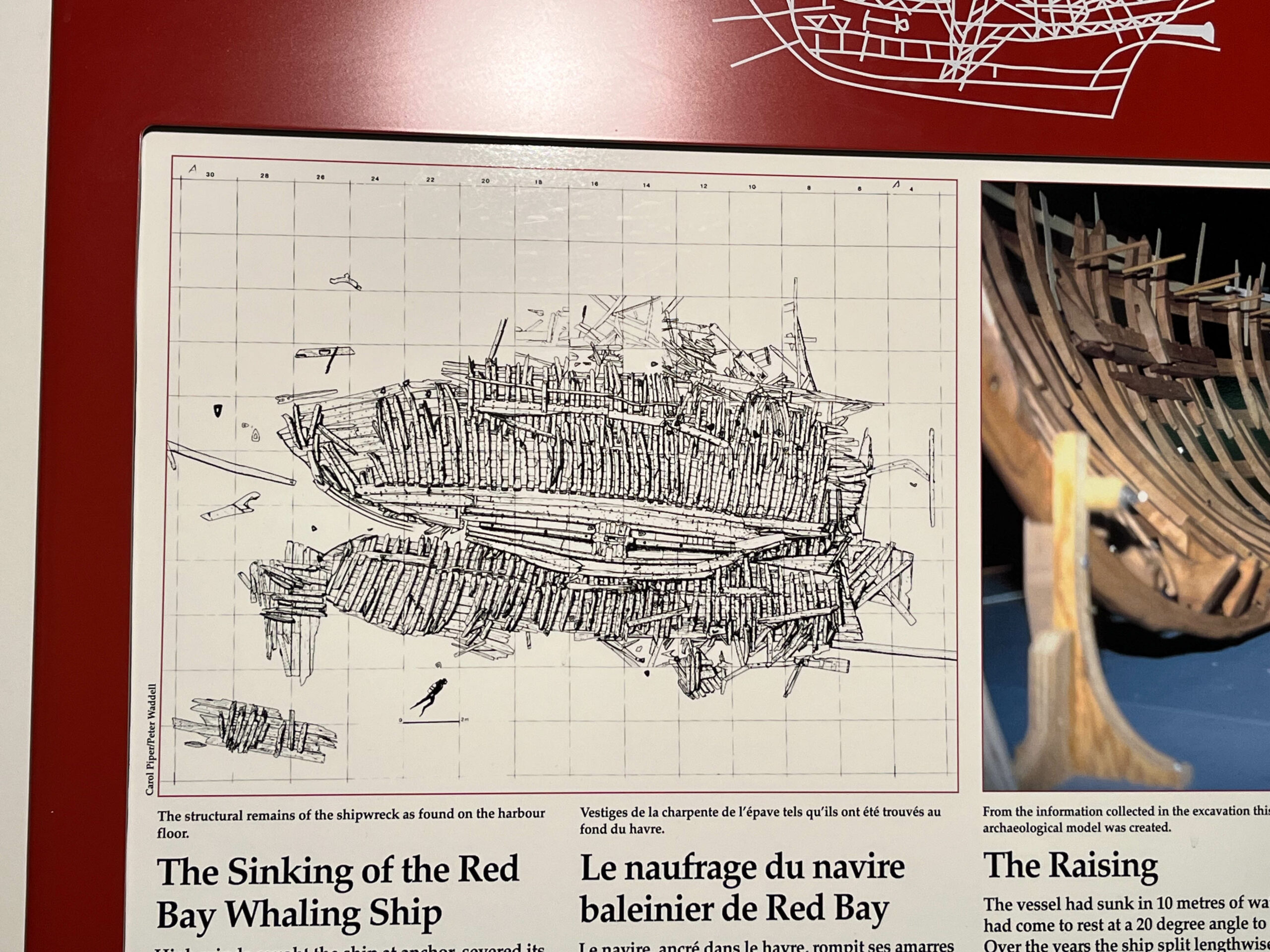
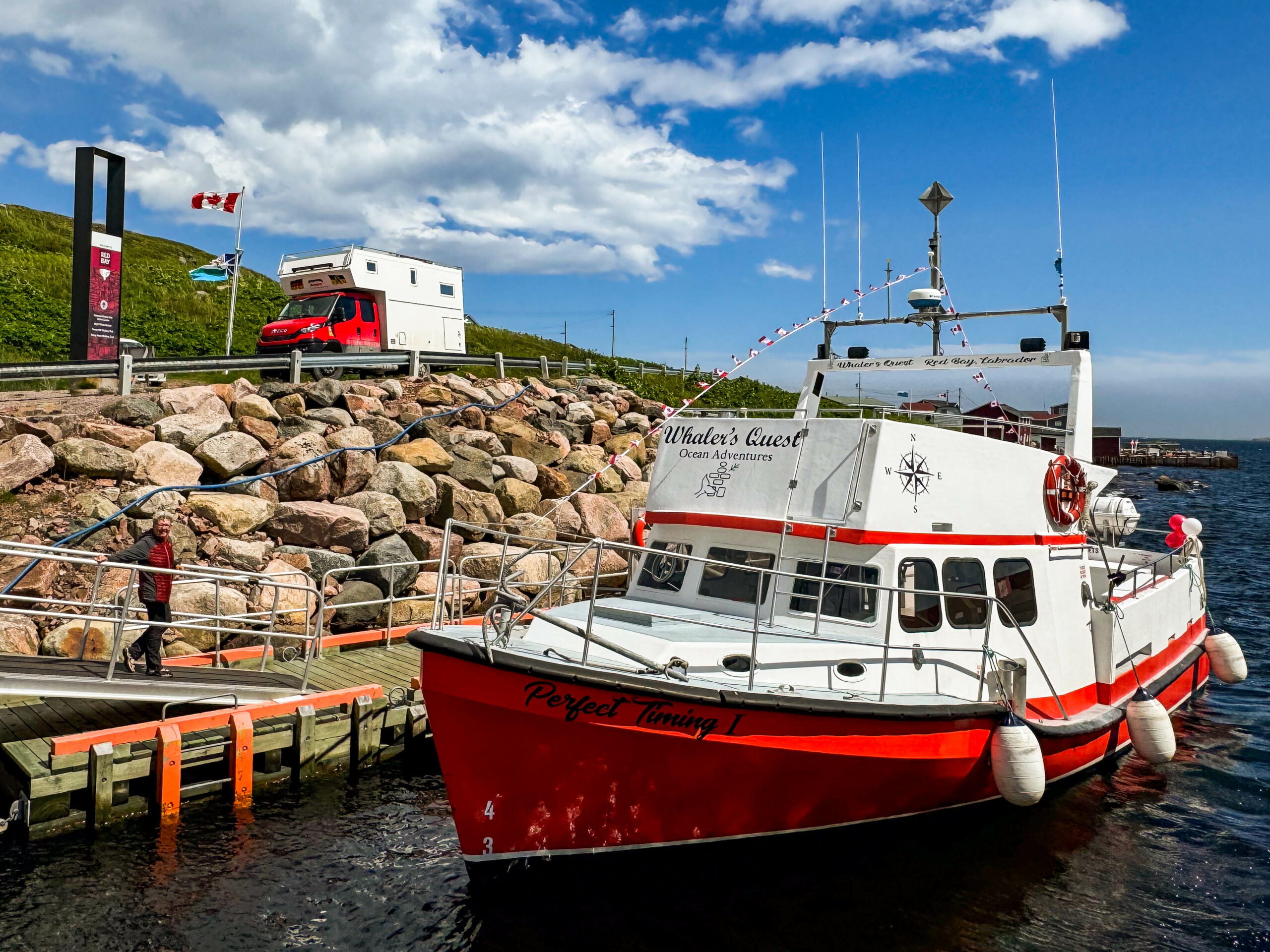
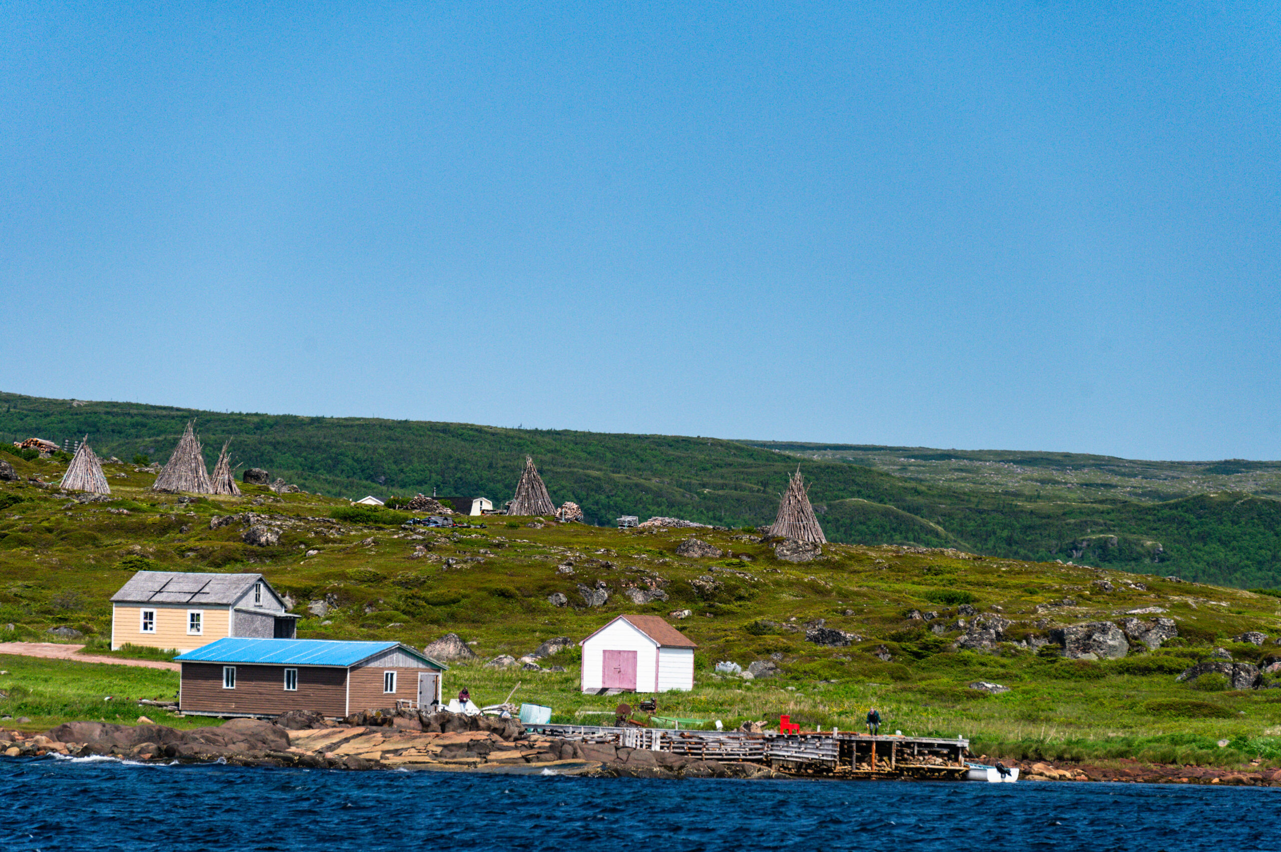
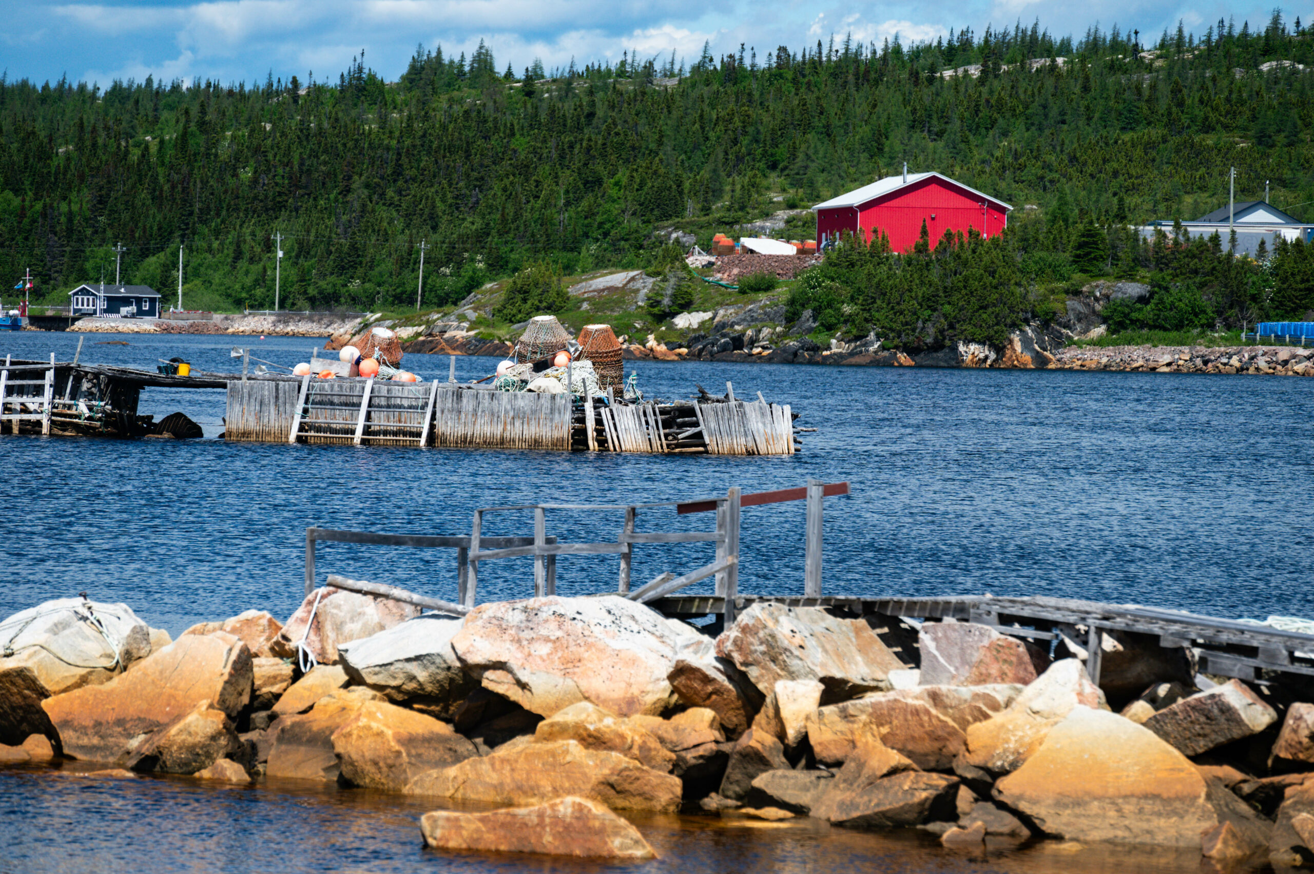
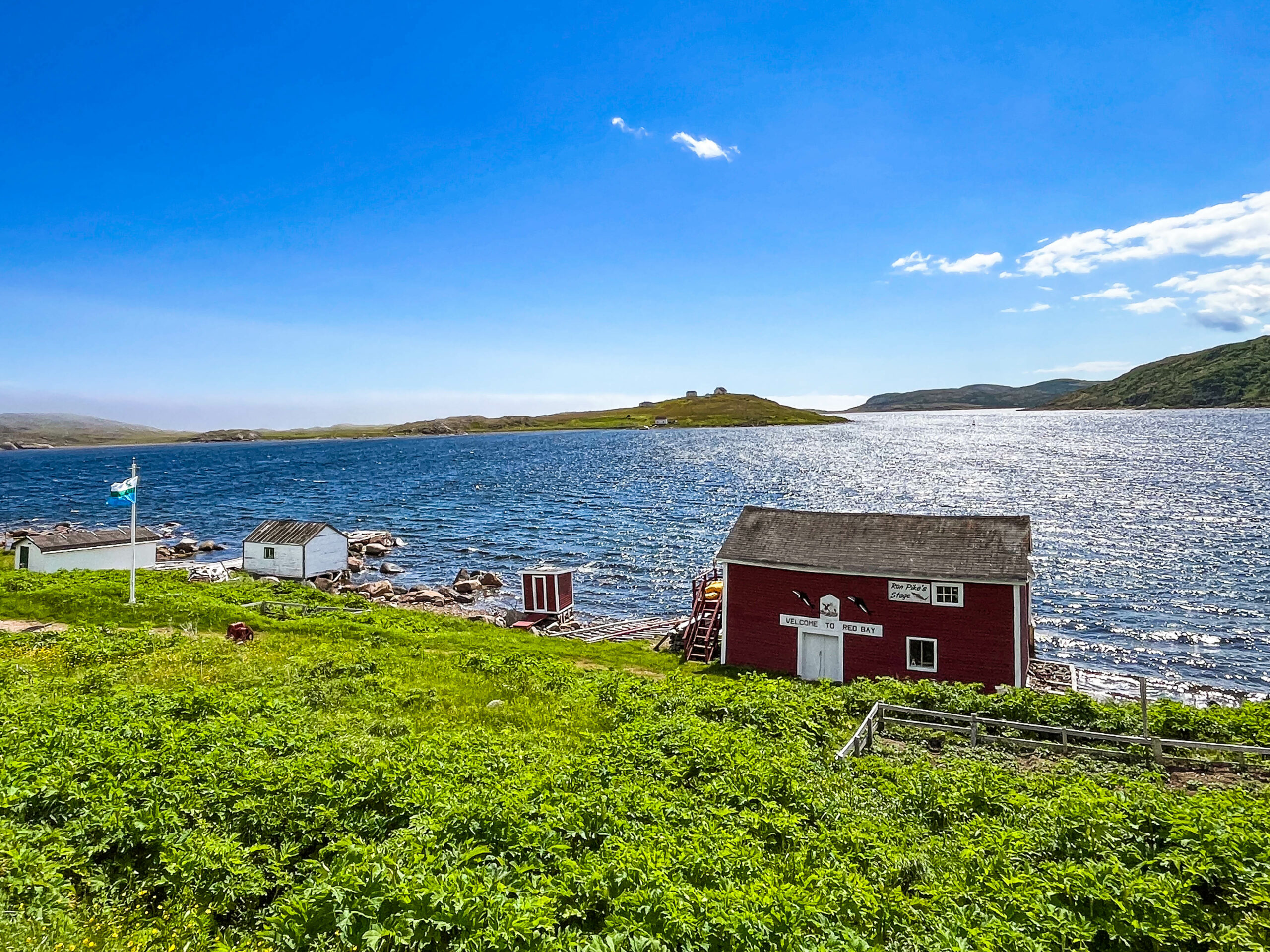
Dem Wetter entsprechend spätes Frühstücken, es wird nicht besser den ganzen Tag. Beim Aufbruch eine „fast Sitzbesichtigung“ (frei nach Hape Kerkeling) der ältesten Grabstätte des Nordamerikanischen Kontinents (ca. 7700 v. Ch.), um die die Straße einen extra Bogen schlägt. In Red Bay besuchen wir wieder eine „UNESCO World Heritage Site / National Historic Site of Canada“. Auch wenn es heute ein kleines Dorf mit <200 Einwohnern ist, war Red Bay zwischen 1543 und dem frühen 17. Jahrhundert ein wichtiges Zentrum baskischer Walfang-Aktivitäten. Aus den Gebieten Südfrankreichs und Nordspaniens wurden je Saison 15 Walfangschiffe mit etwa 600 Mann Besatzung nach Red Bay ausgesandt, die in der gefährlichen, weil nur zeitweise eisfreien Belle-Isle-Straße Grönland- und Glattwale jagten, die zu jener Zeit in diesen Gewässern häufig waren. Damals galt Red Bay als „Welthauptstadt des Walfangs“. Im Dezember 1565 sank ein Schiff, dessen Wrack in der Nähe von Sattle Island aufgefunden wurde. Von diesem wird angenommen, dass es sich um die San Juan handelt. Darüber hinaus wurden weitere Wracks von Walfängern und kleinere Schiffe gefunden, vermutlich die Schaluppen der San Juan. Weitere moderne Wracks liegen in der Nähe von Red Bay, so das des kanadischen Trawlers Bernier (1919), der 1966 auf Sattle Island strandete.
Ein historischer Friedhof bewahrt die Gebeine von 140 Walfängern. Unklar ist, warum der Walfang in Red Bay zum Erliegen kam. Überwiegend wird angenommen, dass infolge übermäßiger Ausbeutung die Walbestände zusammenbrachen und der Ort dann aufgegeben wurde. Auch sperrte England 1579 seinen Markt für die Einfuhr spanischen Waltrans, so dass der baskische Walfang stark schrumpfte.
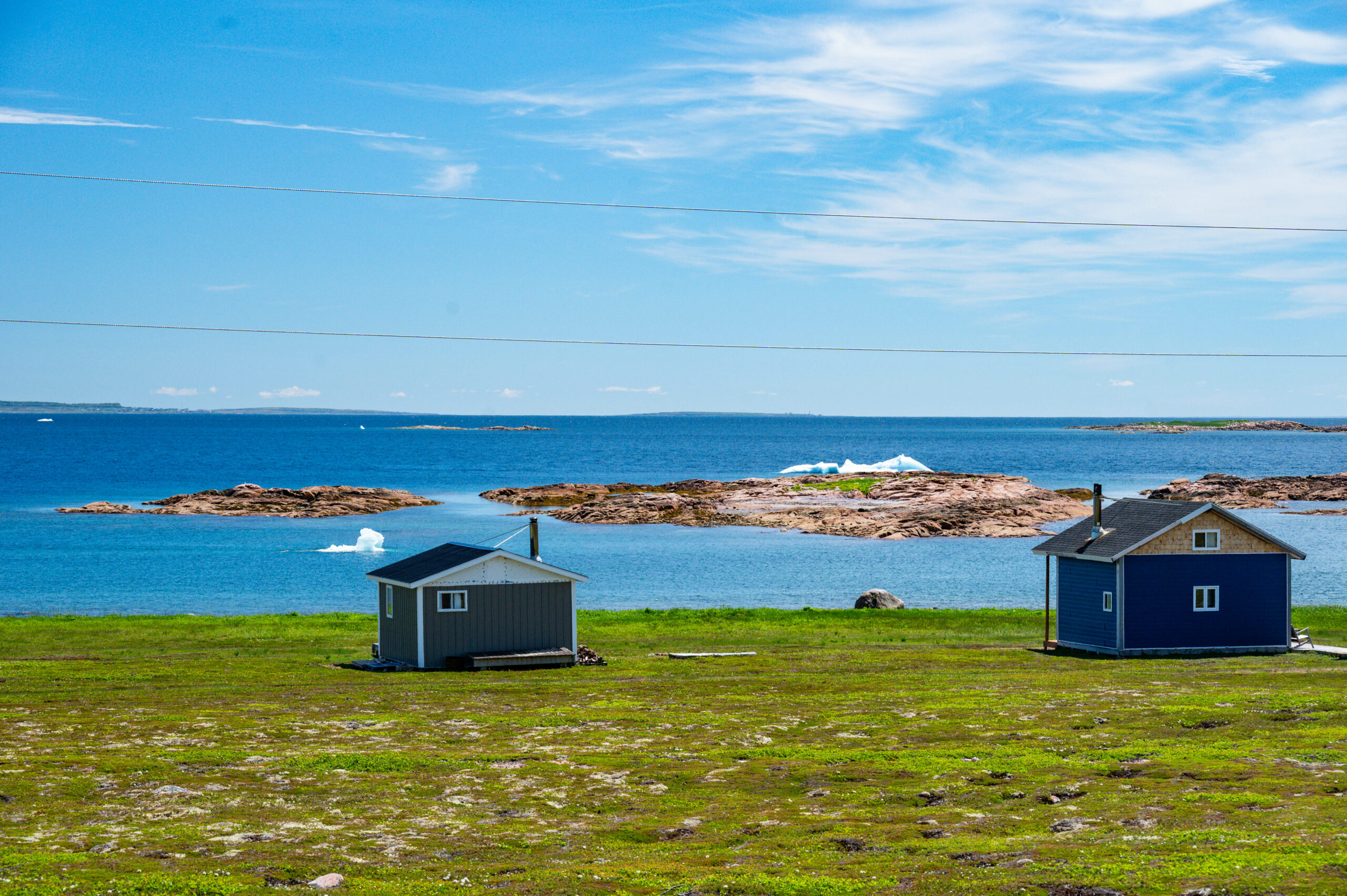
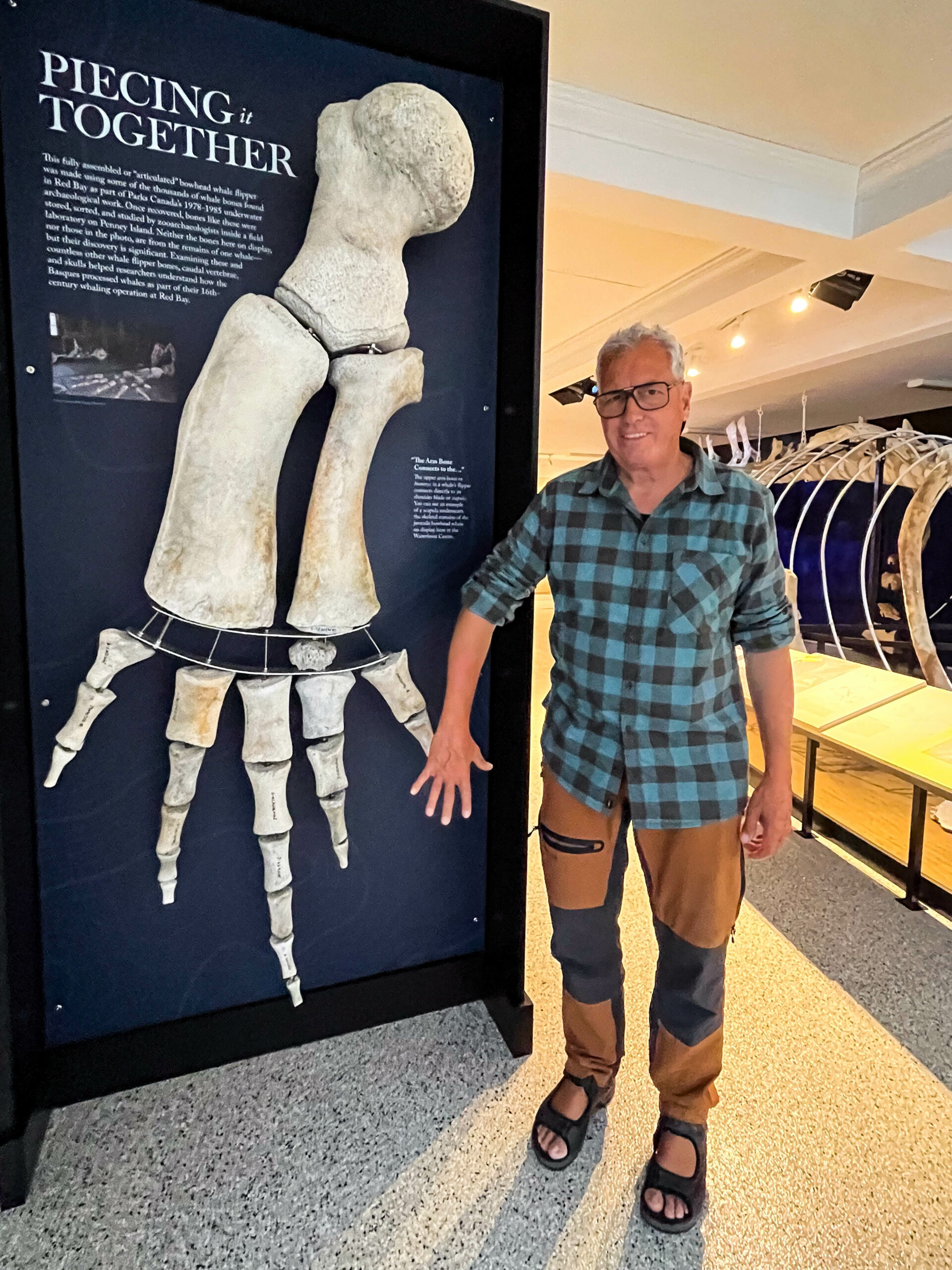
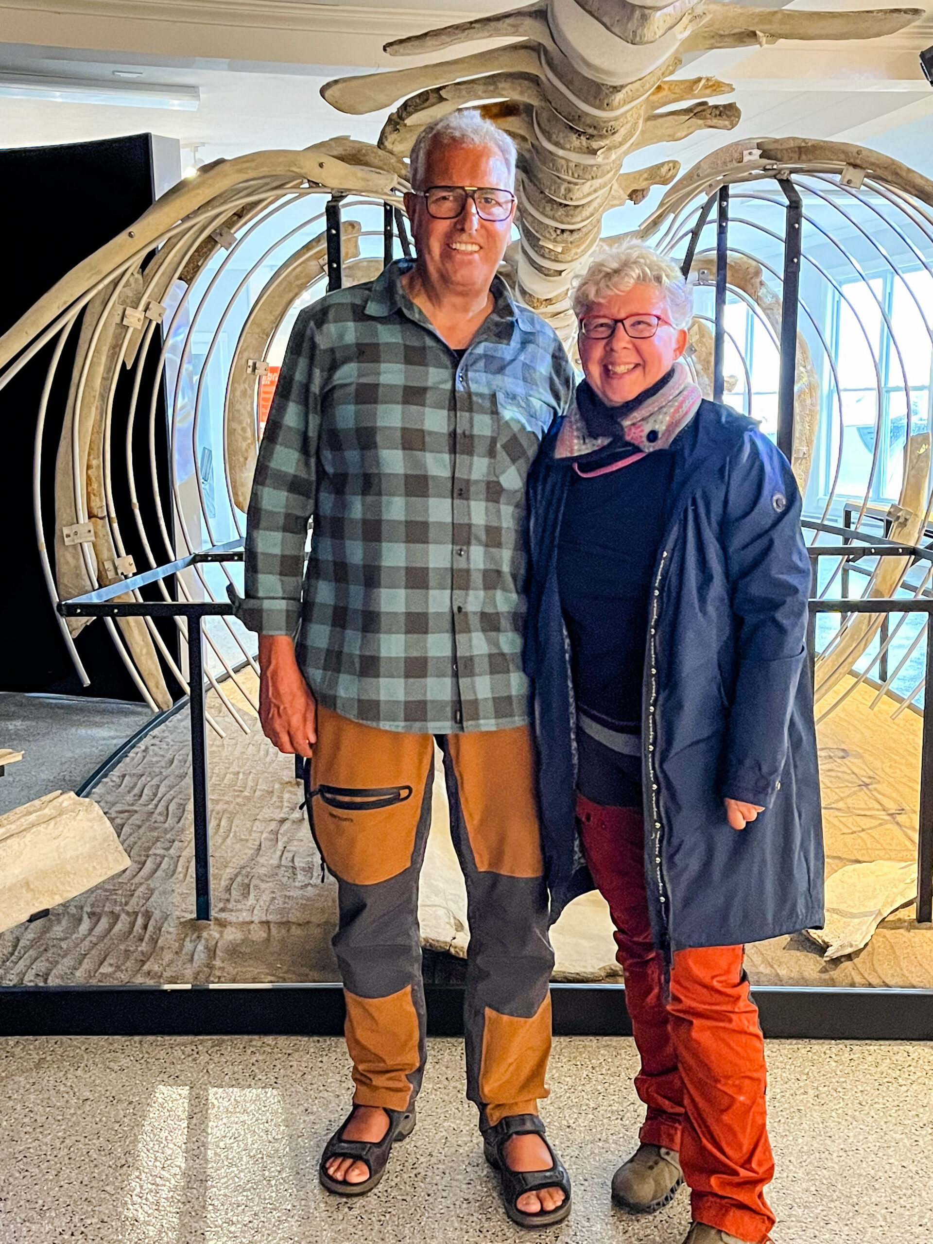
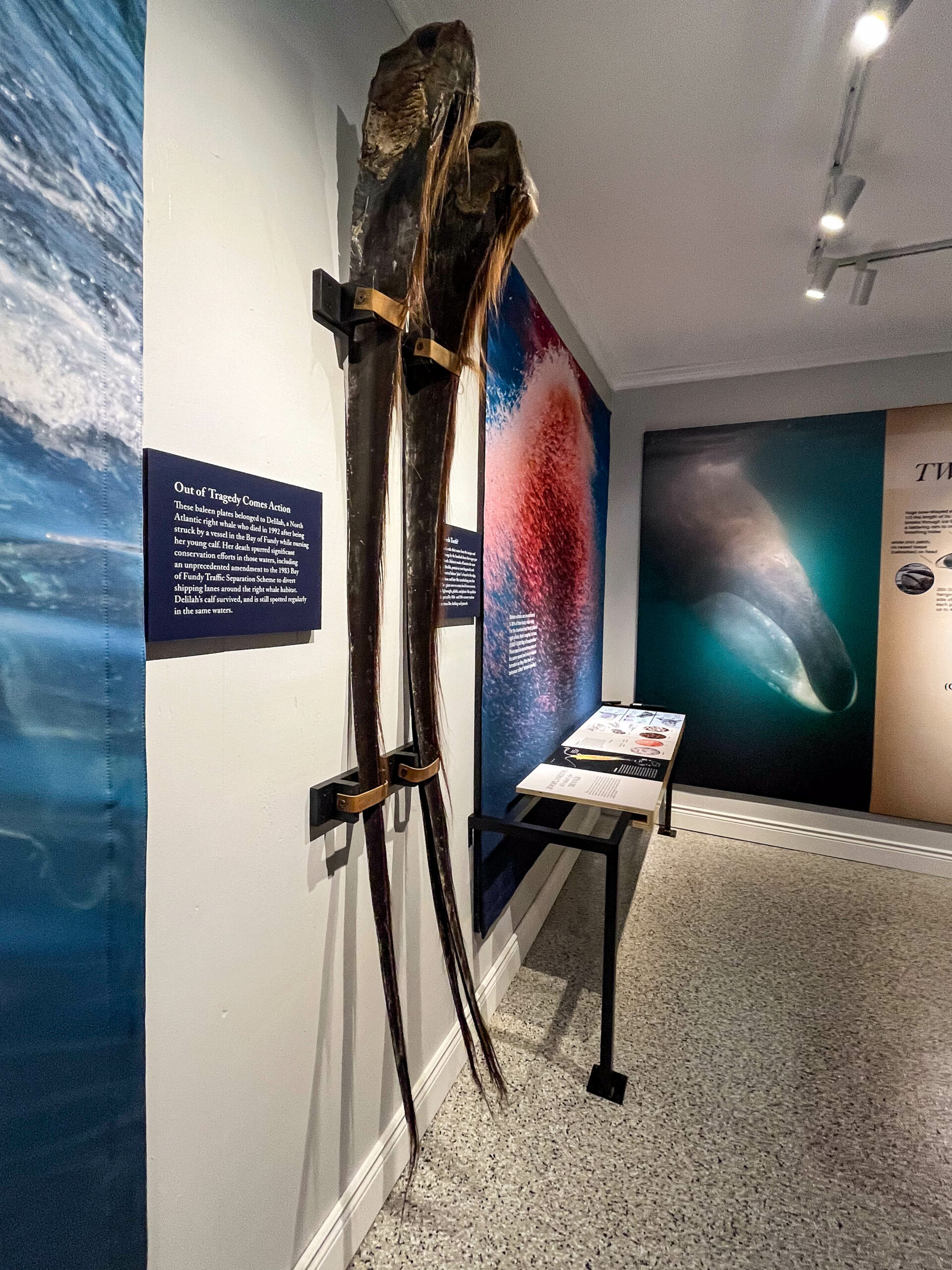
Zu Beginn des 19. Jahrhunderts ließen sich erneut kanadische Fischer in dem Ort nieder, zunächst saisonal, dann ständig. Die Bucht, die dem Ort seinen Namen gibt, bildet einen Naturhafen. Dieser gilt aufgrund seiner geschützten Lage als einer der besten der gesamten Küste Labradors. Er wurde auch während des Zweiten Weltkrieges für Schiffe der Kriegsmarine benutzt. In der Bucht befinden sich die Inseln Penney Island und Sattle Island. Das Museum stellt Dokumente und Überreste aus der Zeit des Walfangs aus, darunter ein Beiboot der San Juan. Des Weiteren gibt es ein privates Museum, wo das Skelett eines Buckelwals ausgestellt ist, besonders beeindruckend die schiere Größe der Barten. Auch ein netter Film über die Forschungen bzgl. des baskischen Einflusses in dieser Gegend und der Bergung des Walfängers. Kurz ein dem Wetter angepasstes Tagwerk. Wir fahren dann noch bis Mary‘s Harbour, weil das Wetter am nächsten Tag besser sein sollte und wir die Chance auf eine Tages-Bootstour (Eisberg und Wale, rund um Battle-Harbour) sahen. Wir finden auch das Schiff und versuchen gerade telefonisch eine Buchung, als uns eine Frau aus dem geschlossenen Büro Maske tragend entgegen kommt, sie habe sich auf Geschäftsreise in Girona / Spanien (!) mit COVID infiziert und Ihren Mann den Skipper angesteckt. Die ganze Woche werde es leider noch keine Bootstouren geben. Unsere Stimmung ist entsprechend nicht so gut, den morgigen „Canada Day“ hatten wir uns anders vorgestellt.
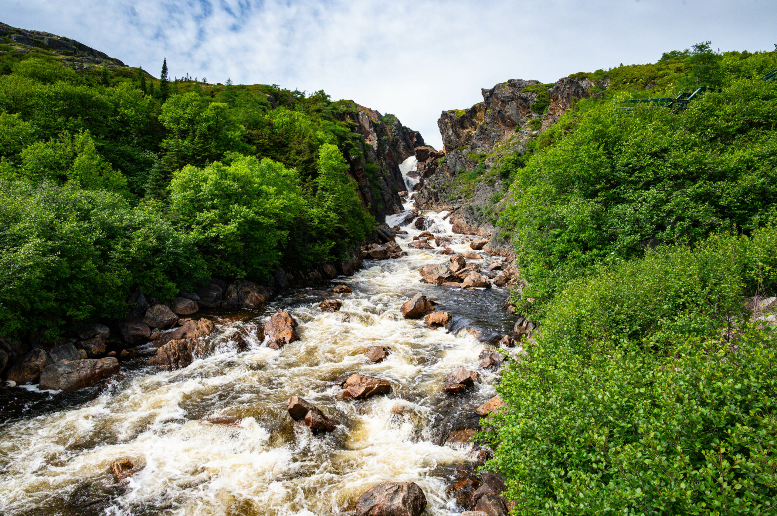
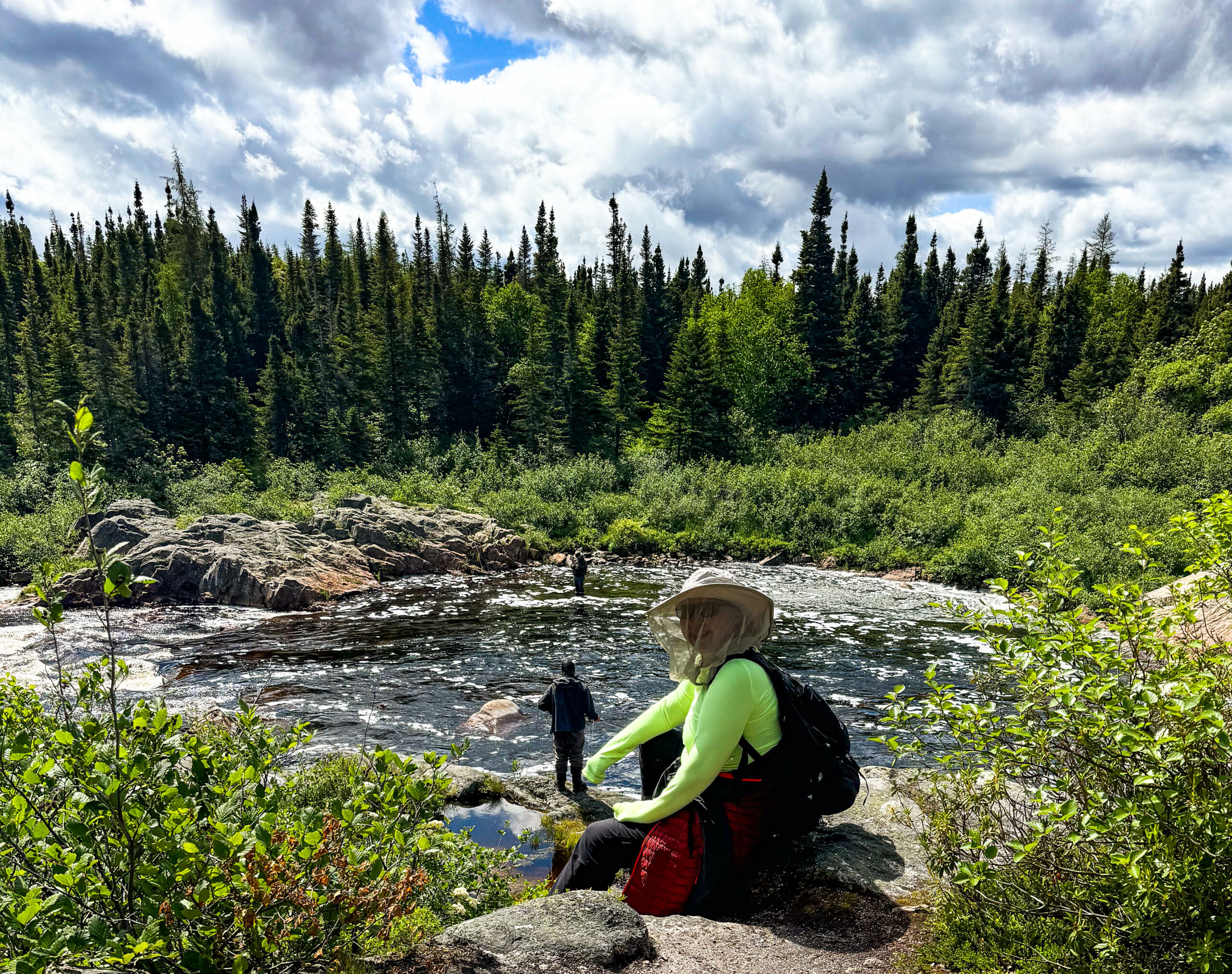
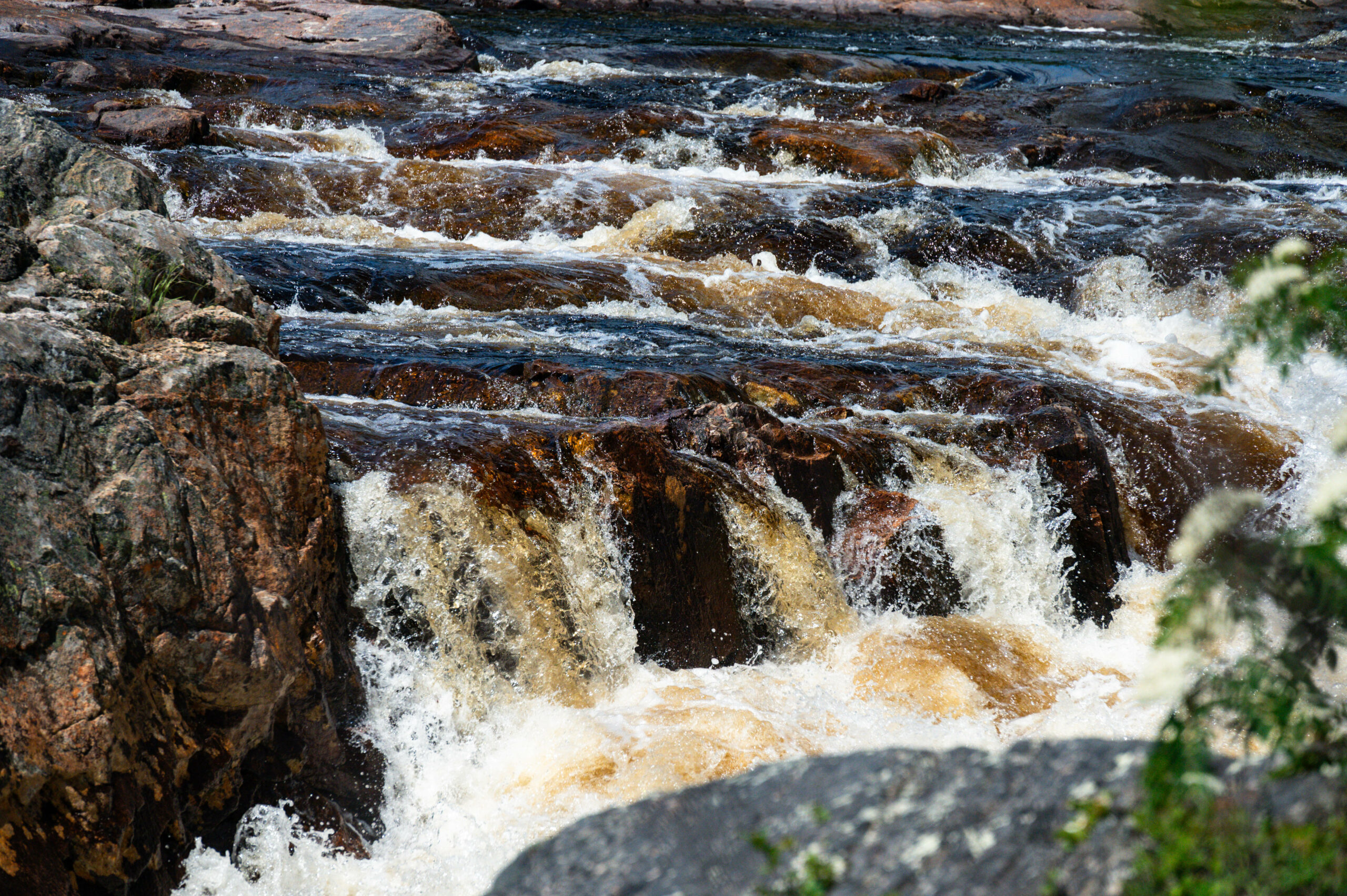
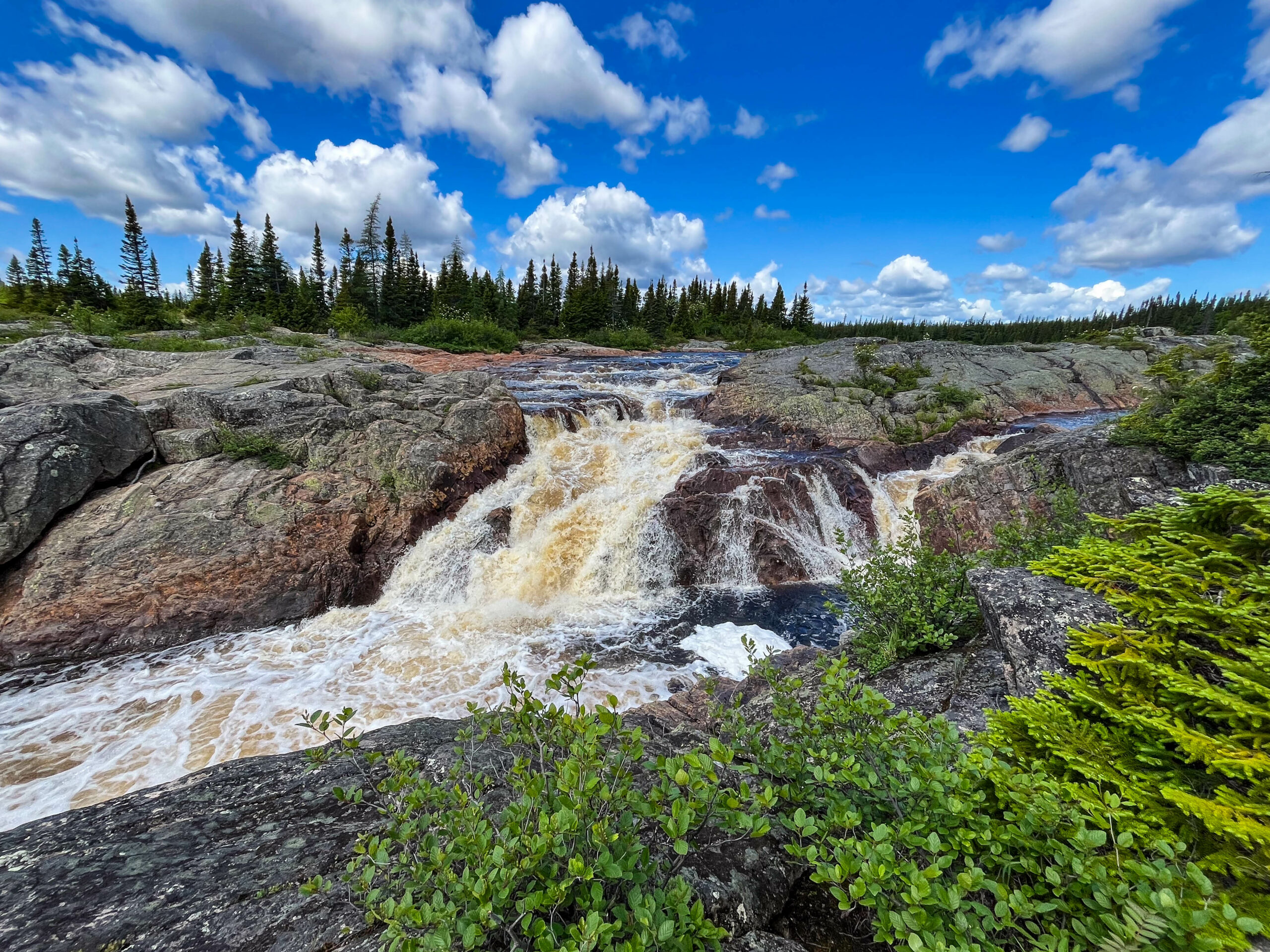
Am Feiertag das angekündigte klasse Wetter, unser alternativer Plan mit der Personenfähre nach Battle Harbour kommt nicht zustande, die Fähre bleibt auf der Insel und fährt heute nicht zurück. Wir laufen zu einem Wasserfall und schauen den Fliegenfischern zu, die versuchen Lachse zu angeln. Ein paar beißen auch an, schaffen es jedoch immer vor dem Käscher vom Haken. Sind aber auch riesige Brocken, die vor Kraft nur so strotzen. Fast scheint es, dass das meditative Auswerfen und Einholen der Fliegenfischschnur wichtigster Bestandteil der Übung ist, ob der Fisch gefangen wird scheint sekundär.
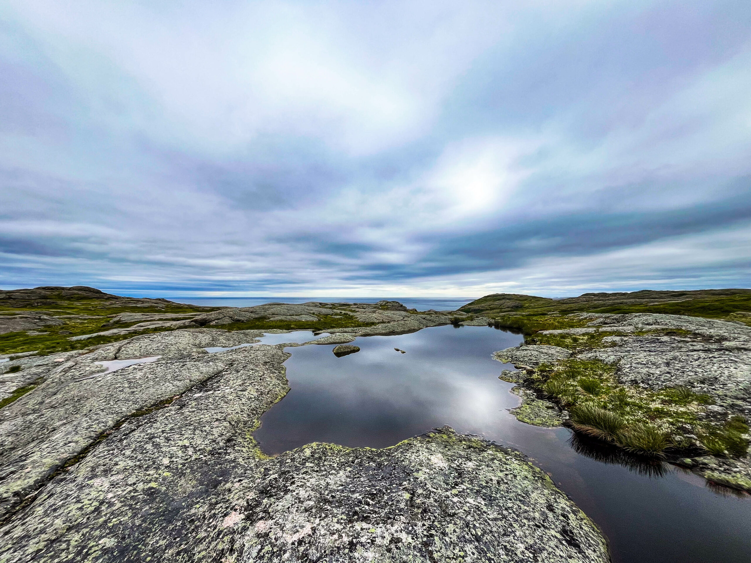
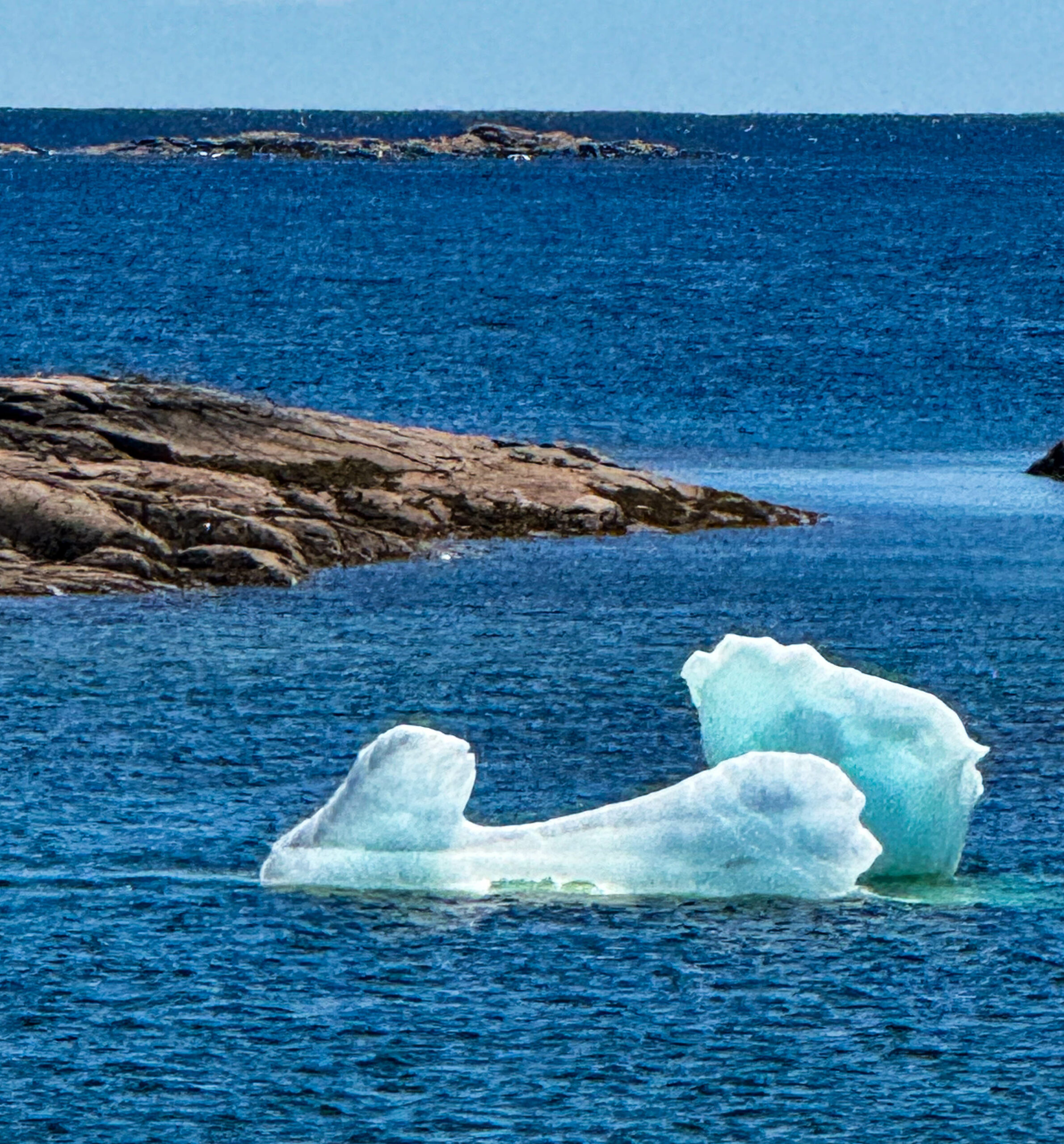
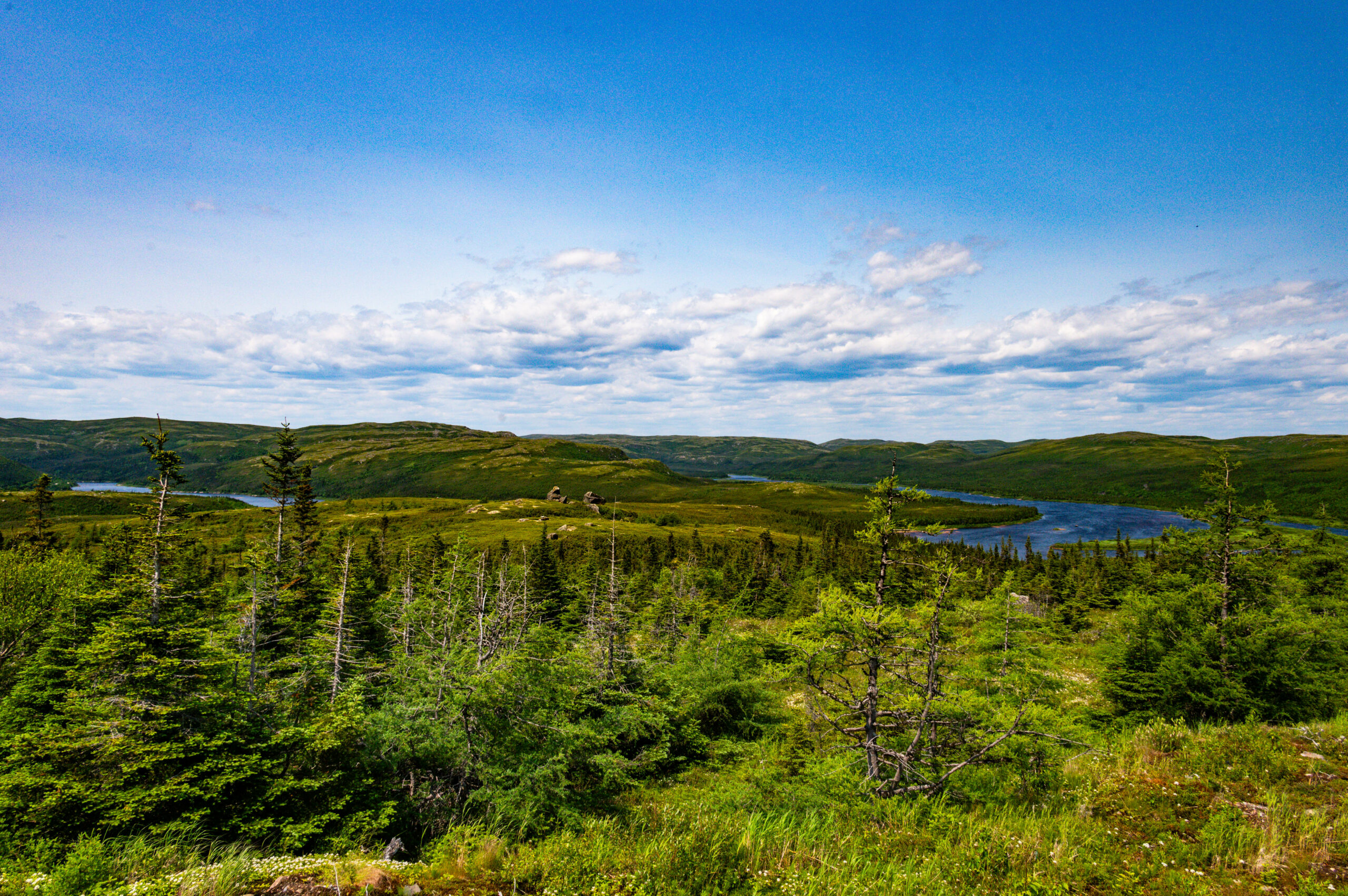
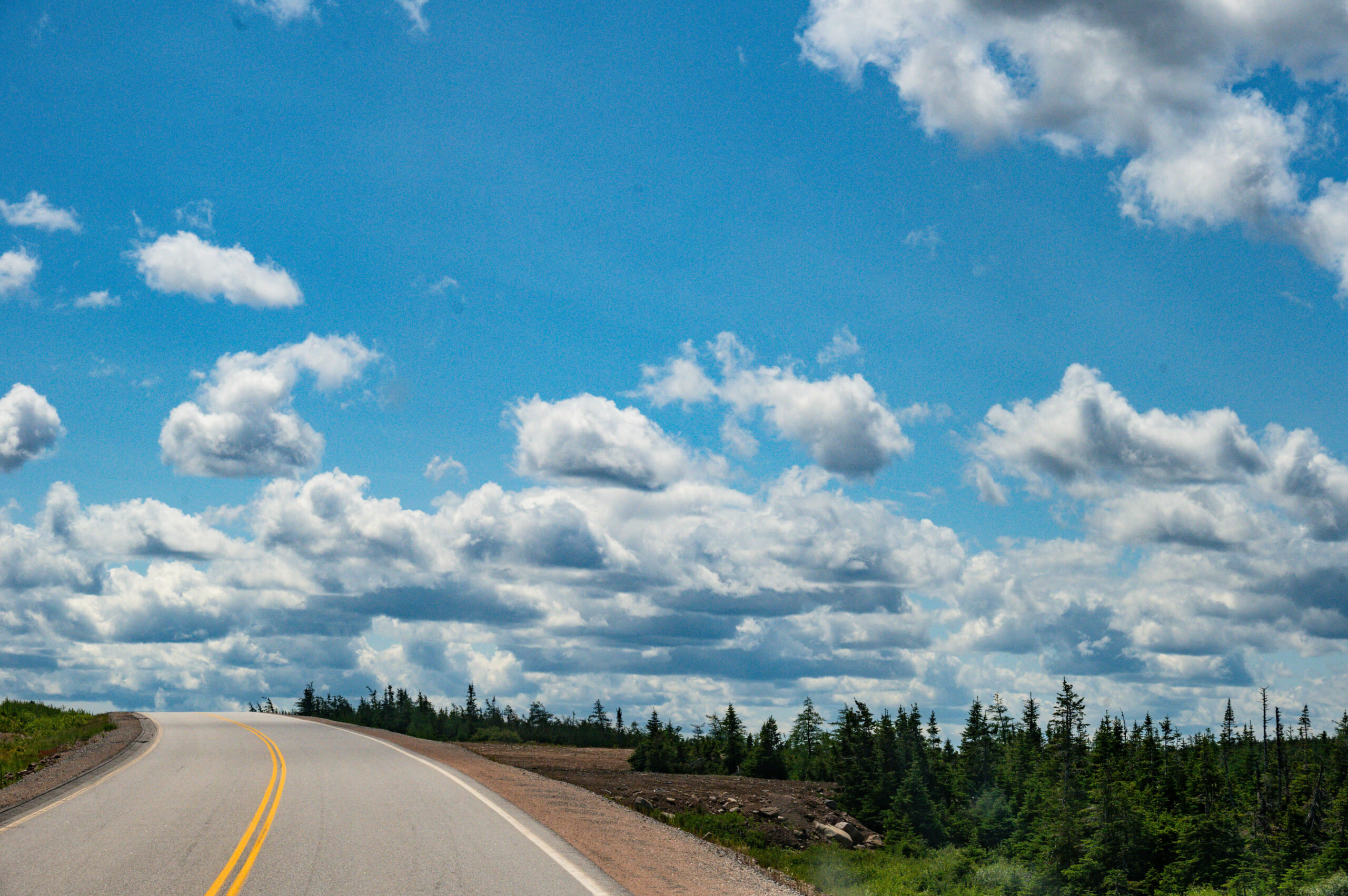
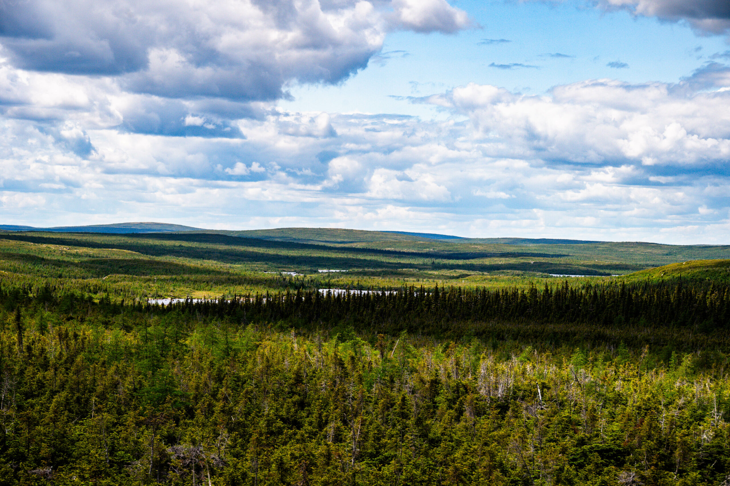
Der Tag ist noch früh, wir verlassen unseren für lange Zeit nördlichsten Punkt Kanadas (52.18°) und fahren nunmehr bei Sonnenschein südwärts zurück nach Red Bay, dort kann man auch eine Bootsfahrt buchen. Labrador zeigt seine ganze Schönheit, es erinnert uns stark an Nordschweden oder Finnland, aber viel gewaltigere Flüsse.
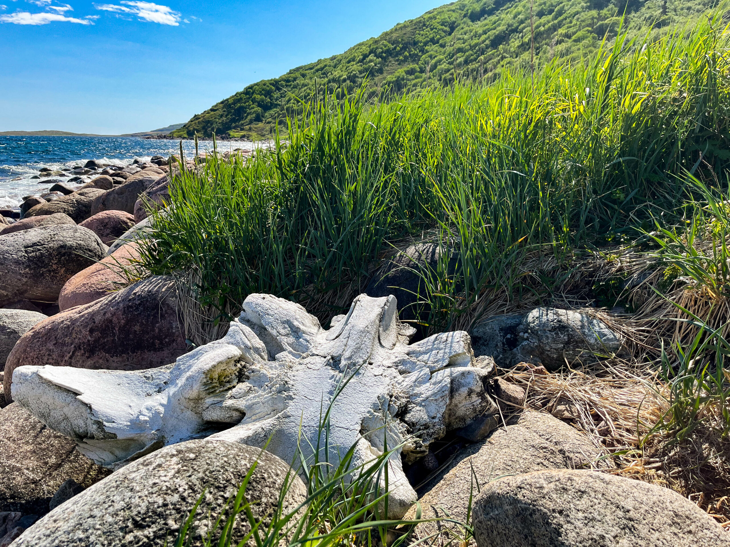
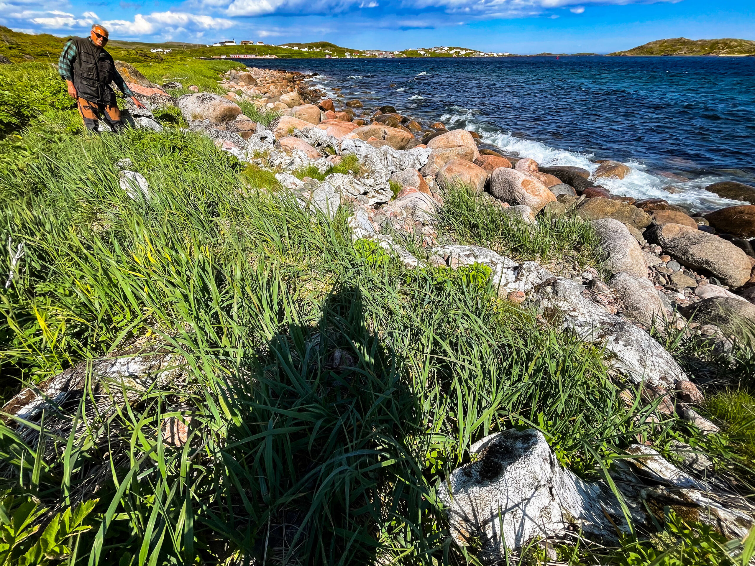
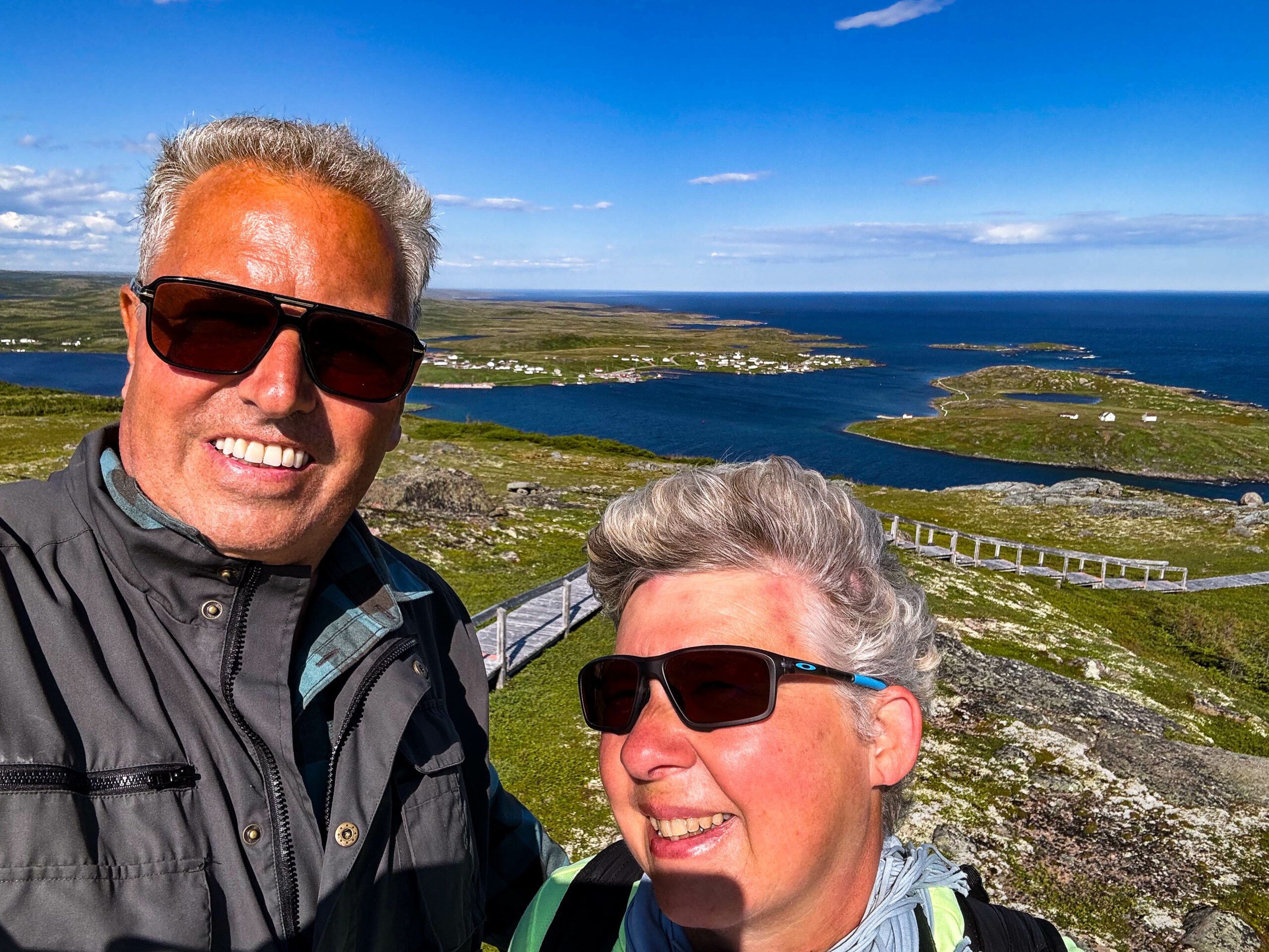
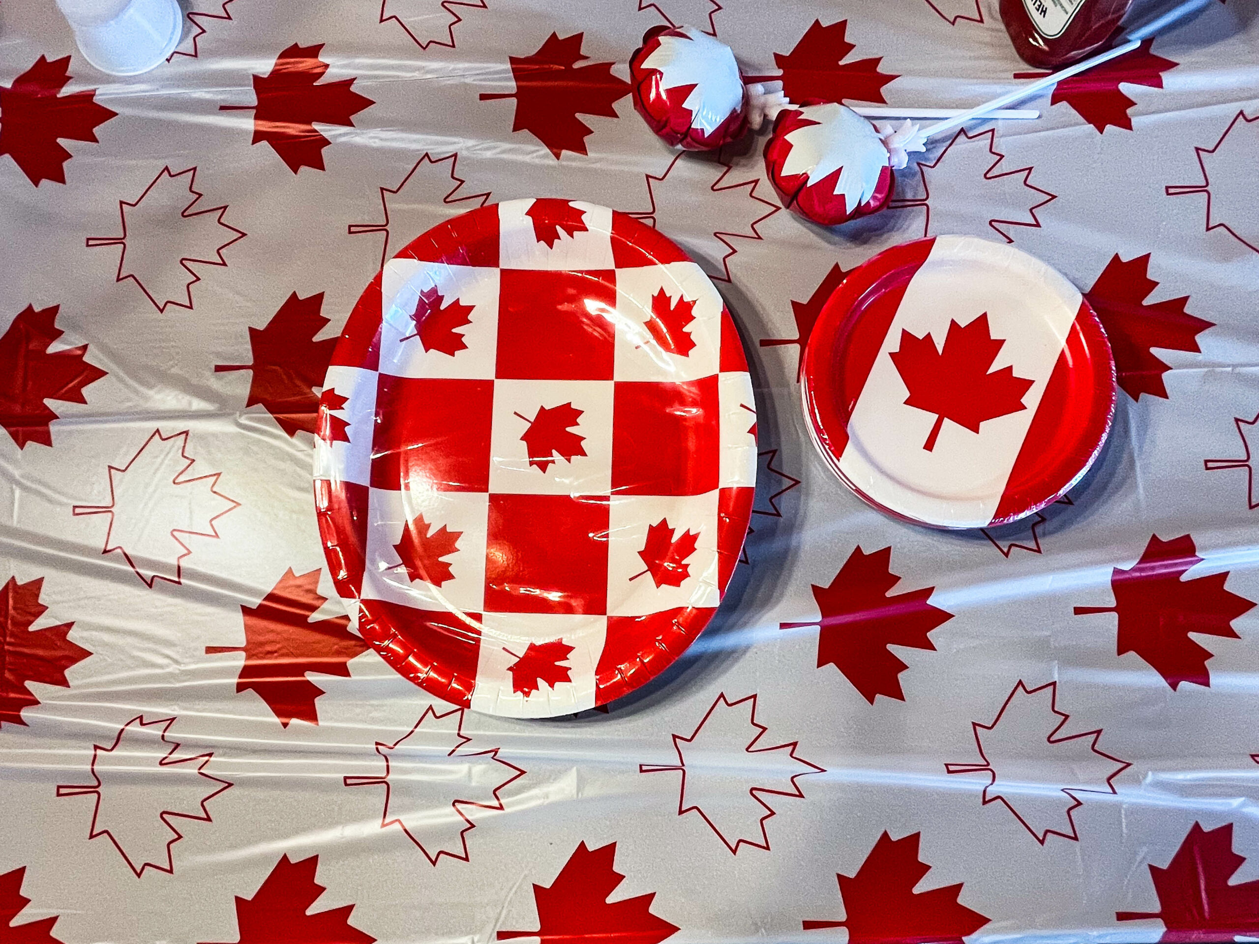
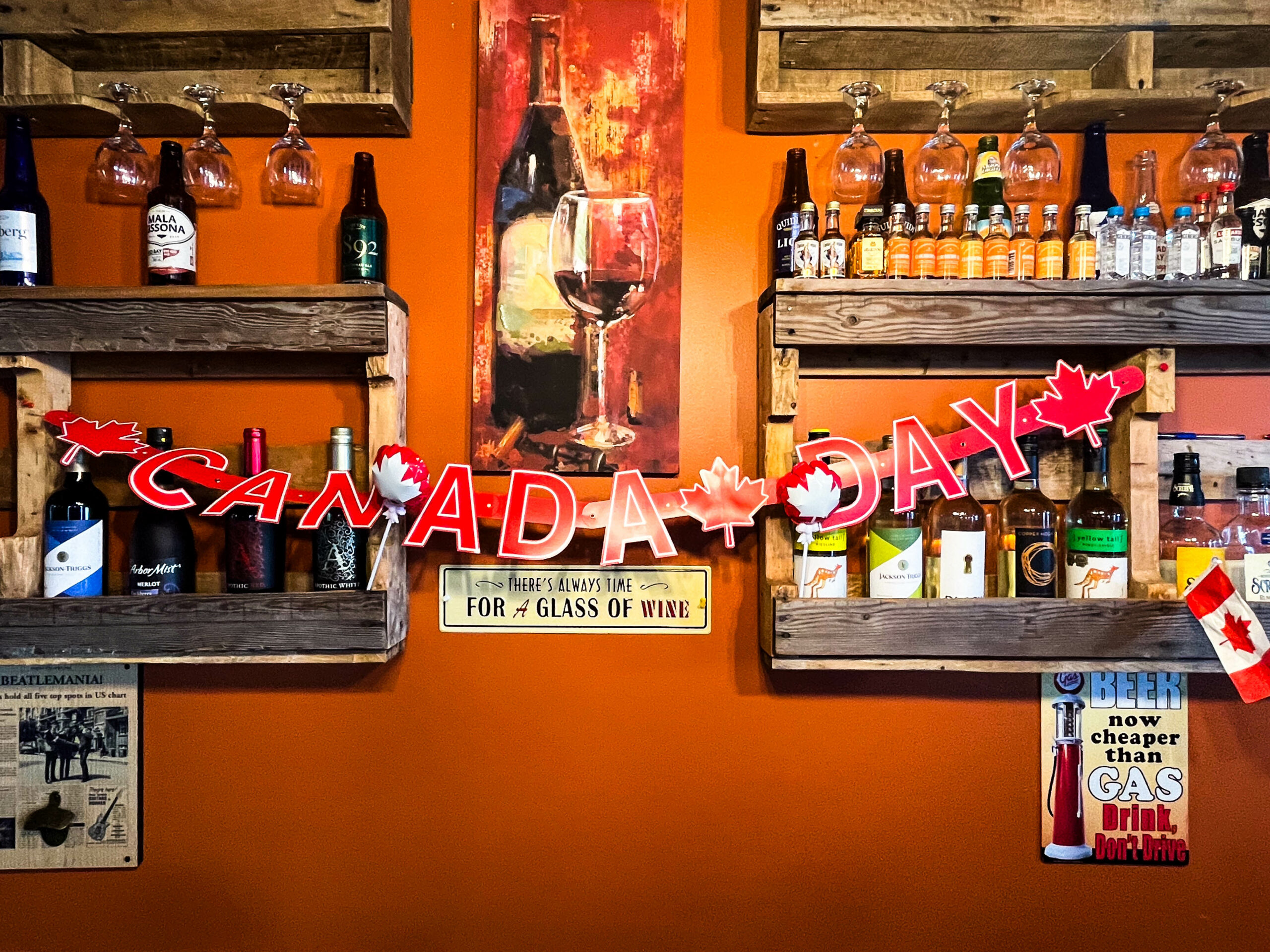
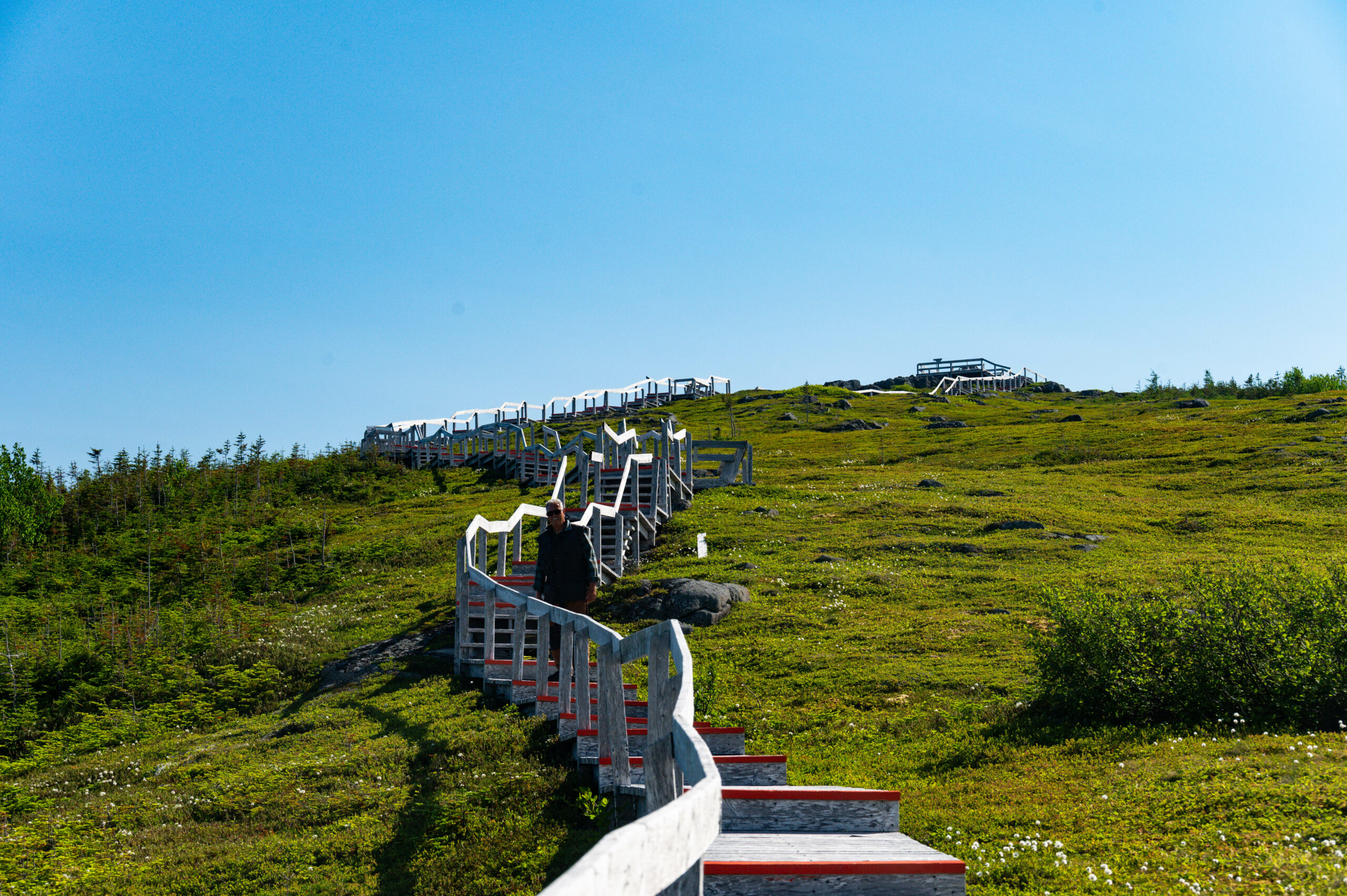
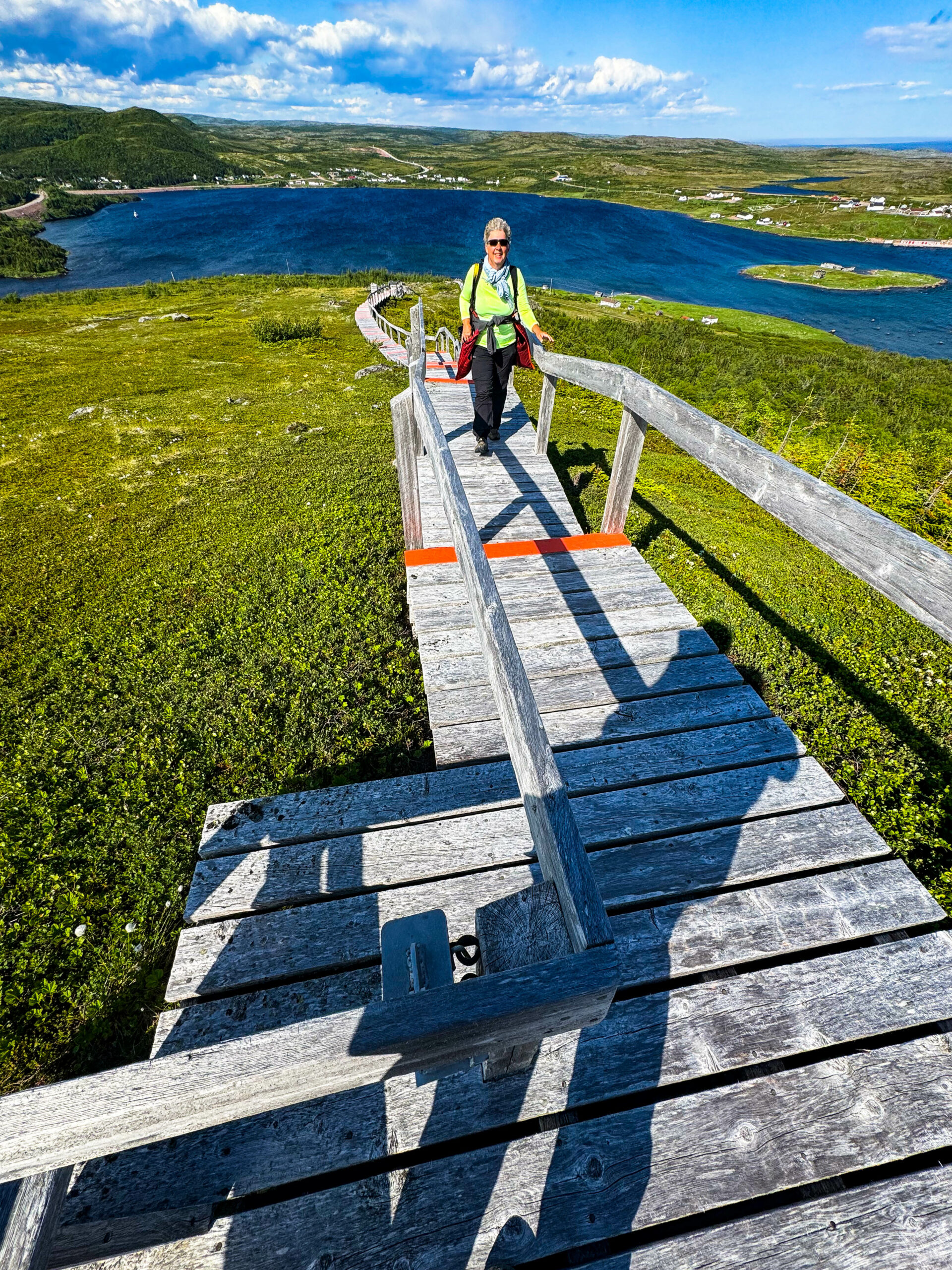
Red Bay nun in vollem Sonnenlicht schmeichelt unseren Augen. Wir reservieren eine Bootstour für morgen und einen Platz zum Abendessen im örtlichen Restaurant, wo heute Abend Musik gespielt wird. Wegen dem Canadaday sind alle weißrot angezogen, tragen rote Hüte mit der Kanadischen Fahne und das Lokal ist mit Flaggen und Girlanden geschmückt. Wir nutzen das schöne Licht, fahren zur gegenüberliegenden Seite der Bay und machen 2 Trails. Der Boney Shore Walking Trail führt am Strand entlang zu etlichen alten Walknochen, der Tracey Hill Trail zeigt uns die ganze Gegend, der Anstieg auf den Küstenberg wird durch knapp 700 Stufen und reichlich Plankenweg deutlich erleichtert, das schmälert jedoch nicht die tolle Aussicht von oben. Fantastisch. Das Abendessen beschert uns eine kan. Flagge für Gabis Pinwand.
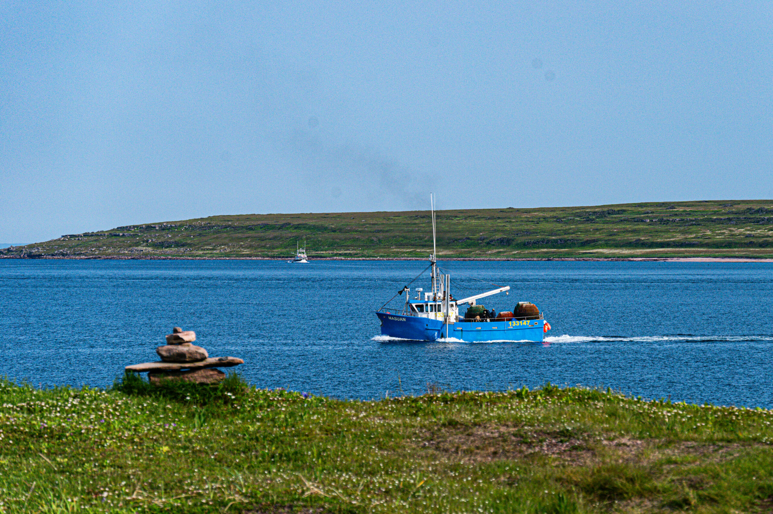
Am nächsten Morgen eine nette Bootsfahrt um die Inseln, eine kurze Walsichtung, ein paar Robben und vielChillen. Bleibt noch Sattle Island und die archäologischen Grabungsstätten. Netter Spaziergang, die vorgefundenen Objekte wurden katalogisiert und in situ konserviert, d.h. zu sehen gab‘s nichts außer Dokumentationstafeln und was die eigene Fantasie mit der vorgefundenen Landschaft daraus zauberte. Evozierte Geschichte eben.
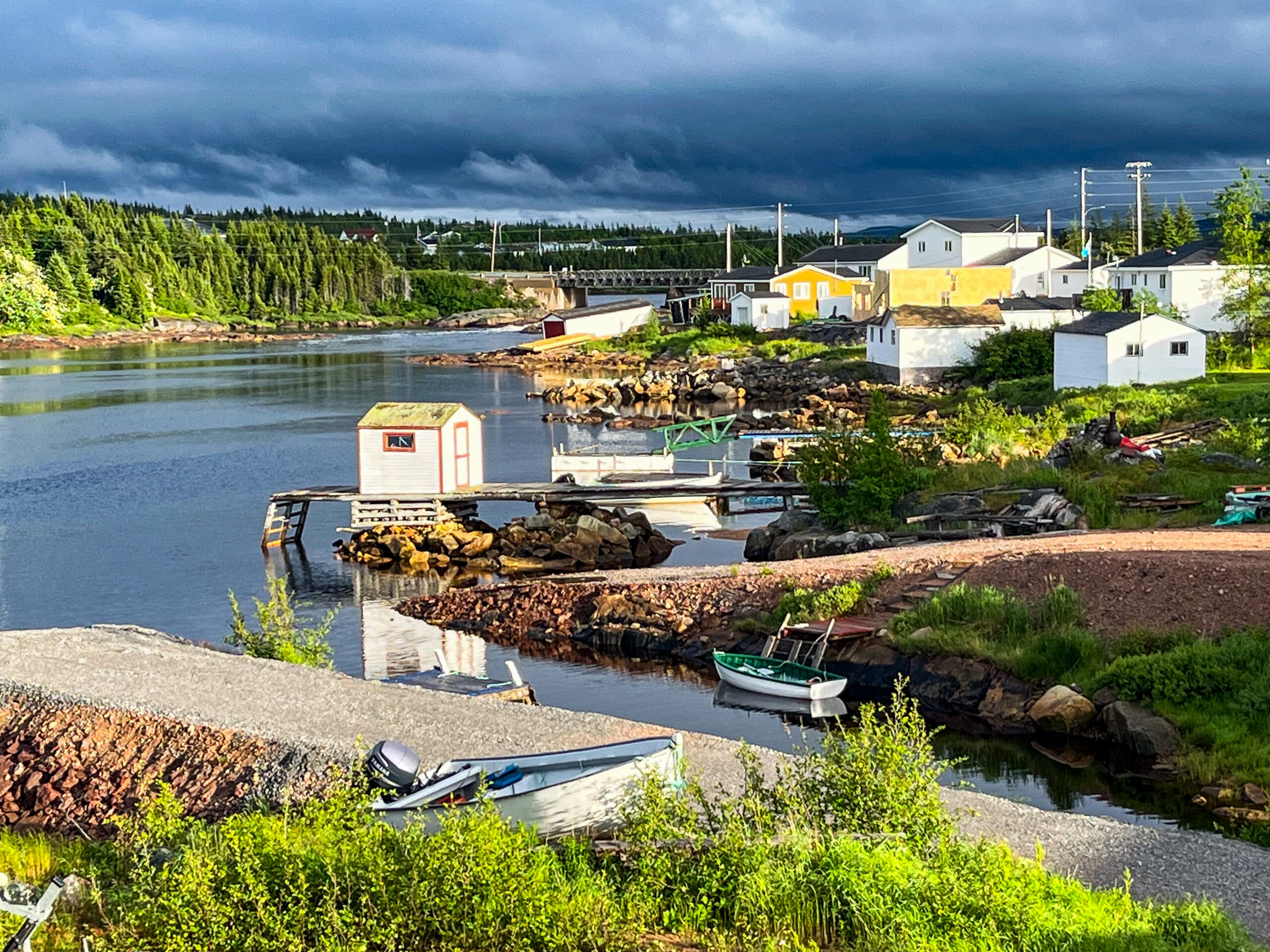
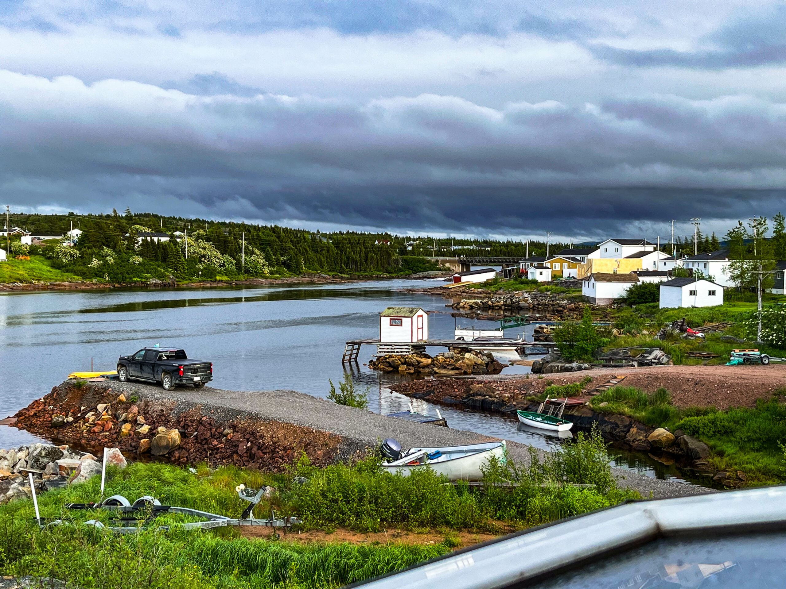
Wir fahren am späten Abend noch bis zur Fähre zurück. Unterwegs erstehen wir in einer Fischgenossenschaft reichlich Fisch (Seeteufel, Heilbuttfilets und Jakobsmuscheln). Wir sind erstaunt, wie günstig und im totalen Gegensatz zum sonst gewohnten Preisniveau wir eingekauft haben. Leider hat das Ticketoffice der Fährgesellschaft schon geschlossen, also müssen wir uns halt doch schon um kurz vor sechs morgens anstellen und den Platz zurück nach Neufundland buchen. Hatten wir befürchtet und den Stellplatz entsprechend neben dem Fähr-Terminal gewählt.
Gesamte Reise: 6.486 km
– davon NFL: 1.968 km (Qc/Labrador 537 km)
🇬🇧 a little bit of Québec and a tiny bit of Labrador
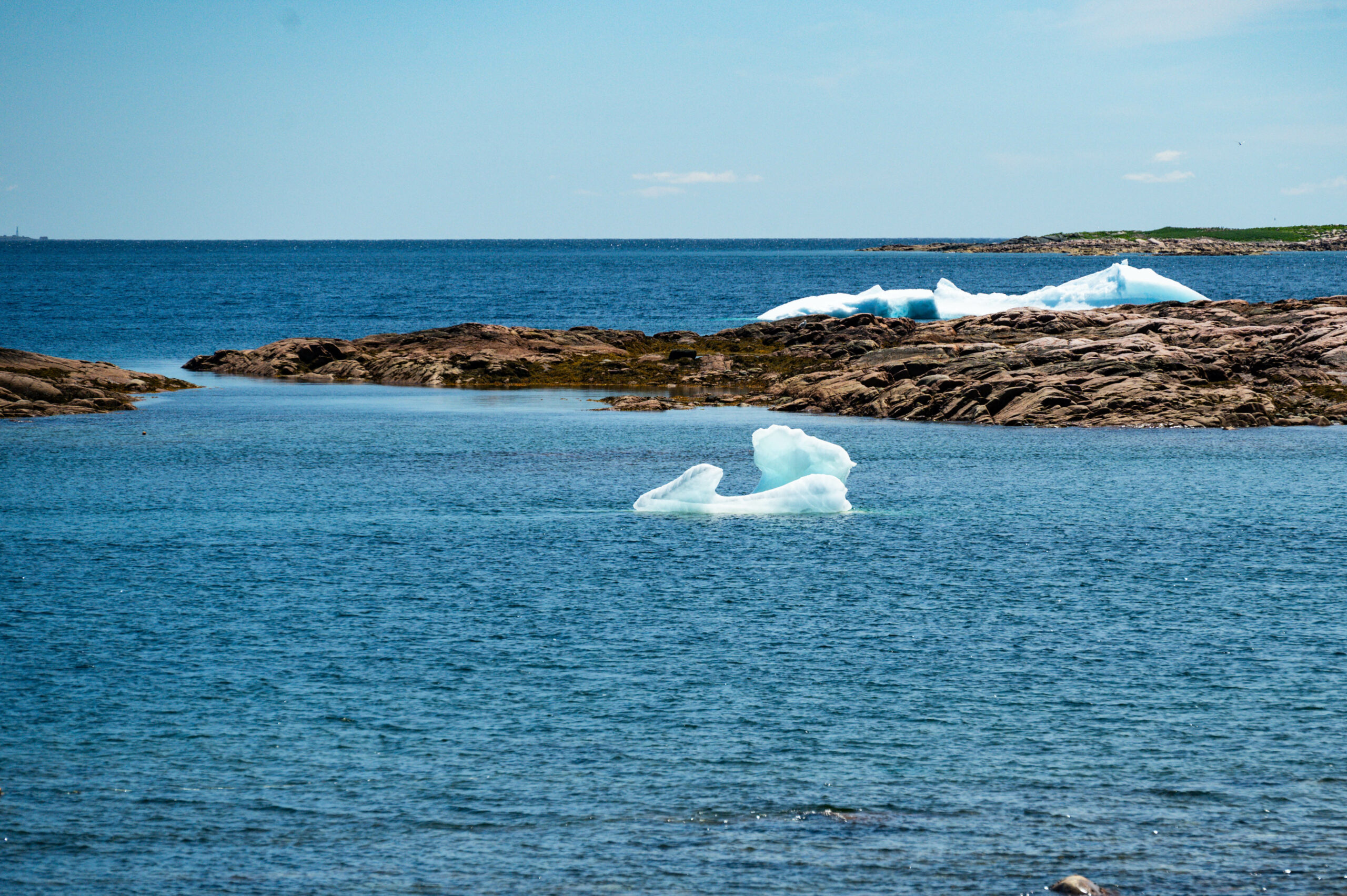
Early in the morning we were allocated number 6 at the ticket office in St. Barbe, so without a reservation we were the 6th car for the free seats on the ferry to Blanc-Sablon (Qc). But the excitement of the morning was Gabi’s call, iceberg ahead – in fact it was our ship on the horizon and not an iceberg drifting towards us. In any case, we were awake and full of anticipation for Labrador. The ferry terminal was easy in the end, even though the ferry was almost full at the end (there would have been room for 3 cars). The crossing was calm, unfortunately without any whale sightings. Off Blanc Sablon we had to wait until the container/passenger freighter, which calls at the ports on the right side of the St. Lawrence River, had cast off. On this occasion, we spotted a large iceberg in the direction of Lourdes-de-Blanc-Sablon. When we finally reached land, we were surprised to realize that we were in Québec. Consequently, a different time zone (-90′), but the ferry times are given in NFL time (!), so chaos was inevitable and we actually met the first people who fell victim to the time chaos and the „wrong“ departure times. On the plus side for us, we arrived virtually at departure time. After taking on water at the visitor center/tourist info and confirmation that there were icebergs on the coast, we headed west on the hunt. A first ice floe whetted our appetite for more, and through the binoculars we could clearly see icebergs on the coast. Unfortunately, the road did not run along the coast. In the end, we stopped next to the road and walked cross-country through the taiga to the coast through swamps and undergrowth – over hill and dale until we discovered a small iceberg cemetery. Believe me, it’s much more strenuous than we originally thought and of course much further than it looked. Without the hiking poles and, above all, the high hiking boots, we probably wouldn’t have made it as far as the cliffs. Walking through the taiga is fascinating, constantly searching for as much solid ground under your soles so that you don’t get a „slipper“ or have your shoe pulled off your foot. The springy yielding quickly led us to orient ourselves to the rocks and to take a detour rather than getting our feet wet. But the effort was worth it. We walk back along an arc that is better suited to the terrain (we thought), but the Homey seems to be getting closer and closer, only to have to cross another valley again.
In the morning, the sky is bright blue, we drive on and visit the remains of an iceberg in a small bay near Pointe-Rocheuse again in beautiful light. This time we follow an access road to the beach. The smaller one turns without a trace right before our eyes.
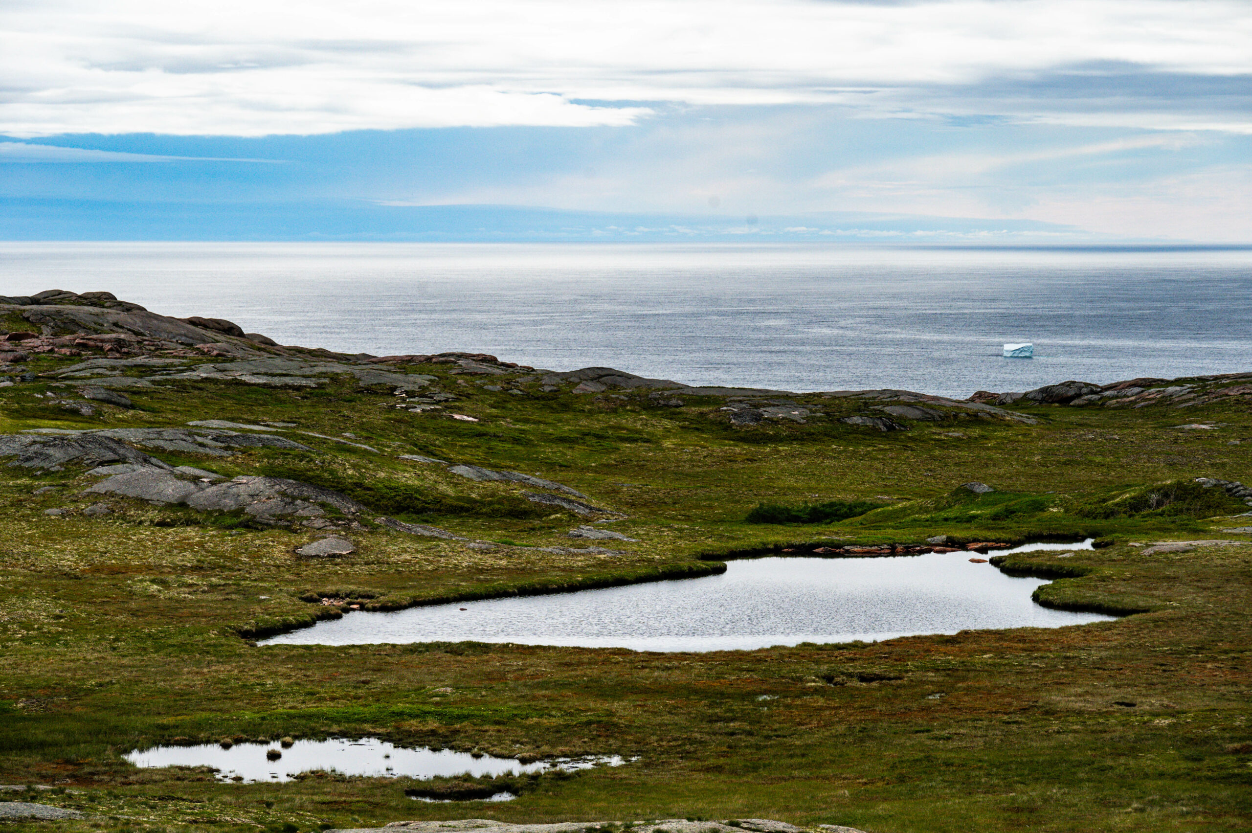
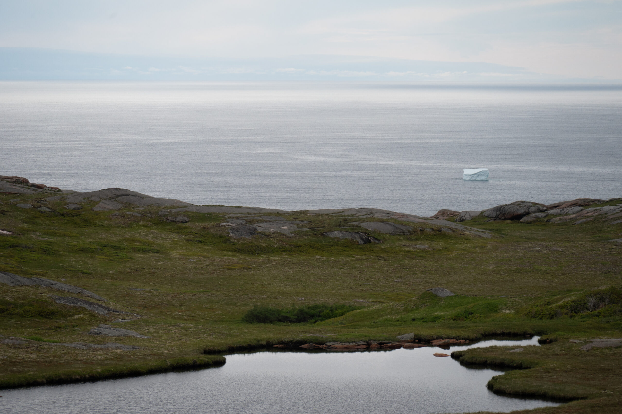
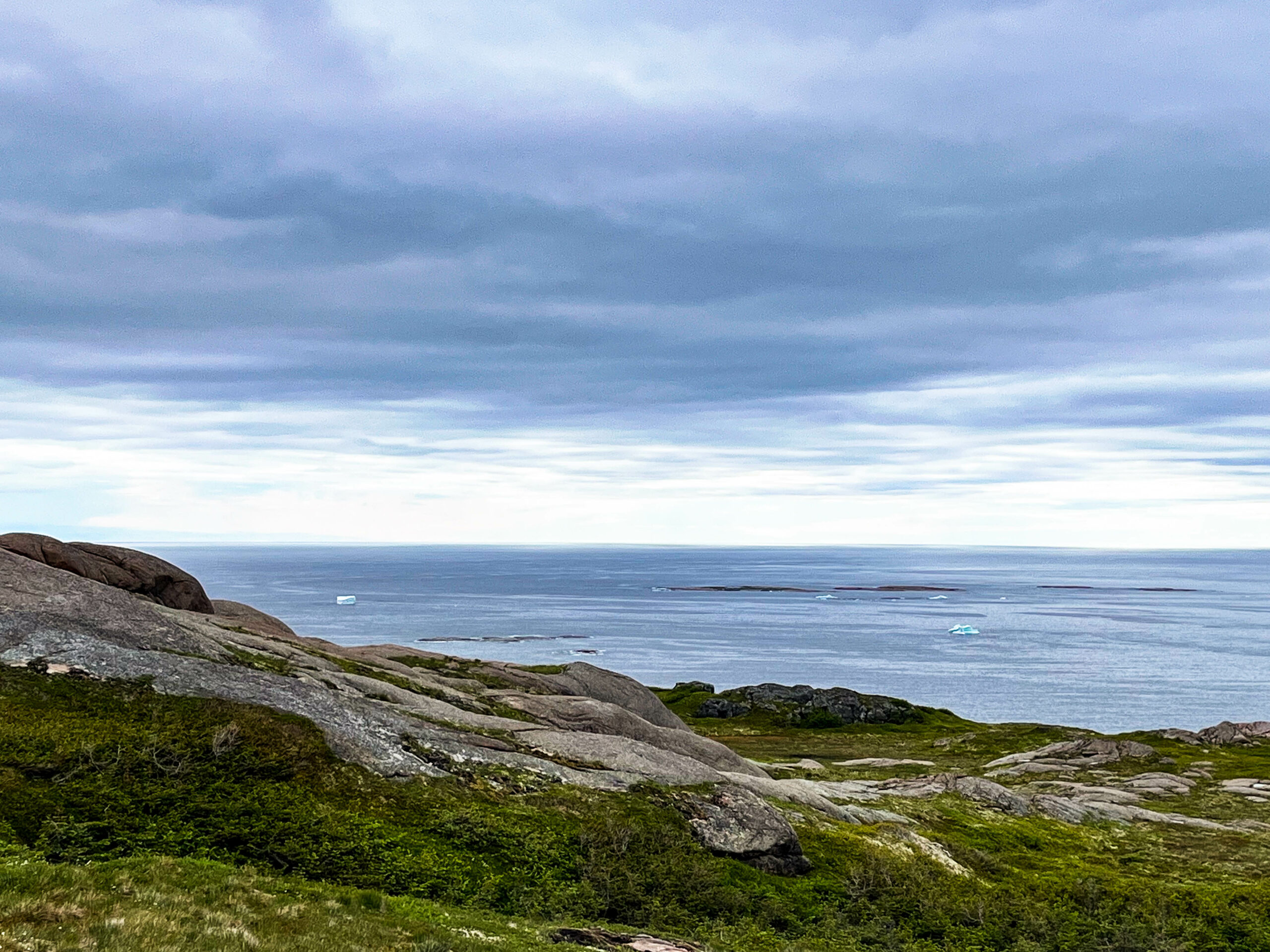
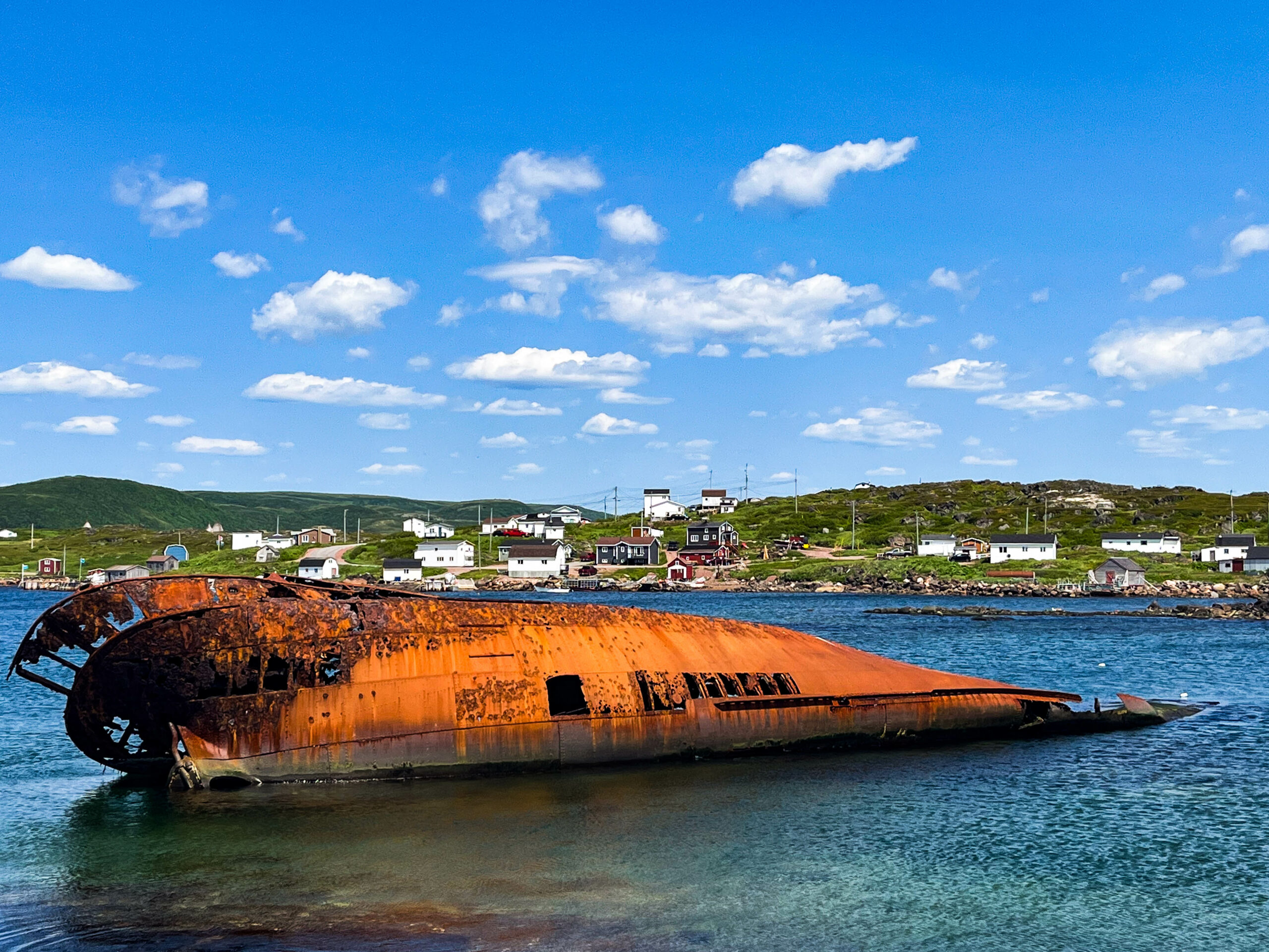
We drive and follow the road to the end in Old Fort, then turn around and head north to Labrador as planned. In search of a sighted iceberg, we follow a track to the beach and then walk a good distance along the coastal footpath, but unfortunately the iceberg doesn’t show itself. Disappointed, we turn around and soon see 3 whales moving along the coast, heading straight for us. Again, you hear the blow before you see it. Impressively beautiful, slowly, almost majestically, they glide through the choppy sea. We originally wanted to stop at the Pointe Amour Lighthouse, but then we drive back a little and find ourselves standing right by the sea in front of the remains of a sunken warship. Wrecked while avoiding an iceberg, unfortunately the land was too close for the speed. As soon as we get back from inspecting the scant remains, the forecast rain starts and stays with us for the next day.
A late breakfast in keeping with the weather, it doesn’t get any better all day. On the way out, an „almost sit-down visit“ (loosely based on Hape Kerkeling) to the oldest burial site on the North American continent (approx. 7700 BC), around which the road makes an extra loop. In Red Bay we visit another „UNESCO World Heritage Site / National Historic Site of Canada“. Although today it is a small village with <200 inhabitants, Red Bay was an important center of Basque whaling activities between 1543 and the early 17th century. Each season, 15 whaling ships with a crew of around 600 were sent to Red Bay from the south of France and the north of Spain to hunt bowhead and right whales, which were common in these waters at the time, in the dangerous Belle Isle Strait, which was only occasionally free of ice. At the time, Red Bay was considered the „whaling capital of the world“. In December 1565, a ship sank, the wreck of which was found near Sattle Island. This is believed to be the San Juan. Other wrecks of whalers and smaller ships were also found, presumably the sloops of the San Juan. Other modern wrecks are located near Red Bay, such as that of the Canadian trawler Bernier (1919), which ran aground on Sattle Island in 1966.
A historic cemetery preserves the remains of 140 whalers. It is unclear why whaling in Red Bay came to a standstill. It is generally assumed that the whale stocks collapsed as a result of over-exploitation and the site was then abandoned. England also closed its market to the import of Spanish whale trans in 1579, causing the Basque whaling industry to shrink considerably.
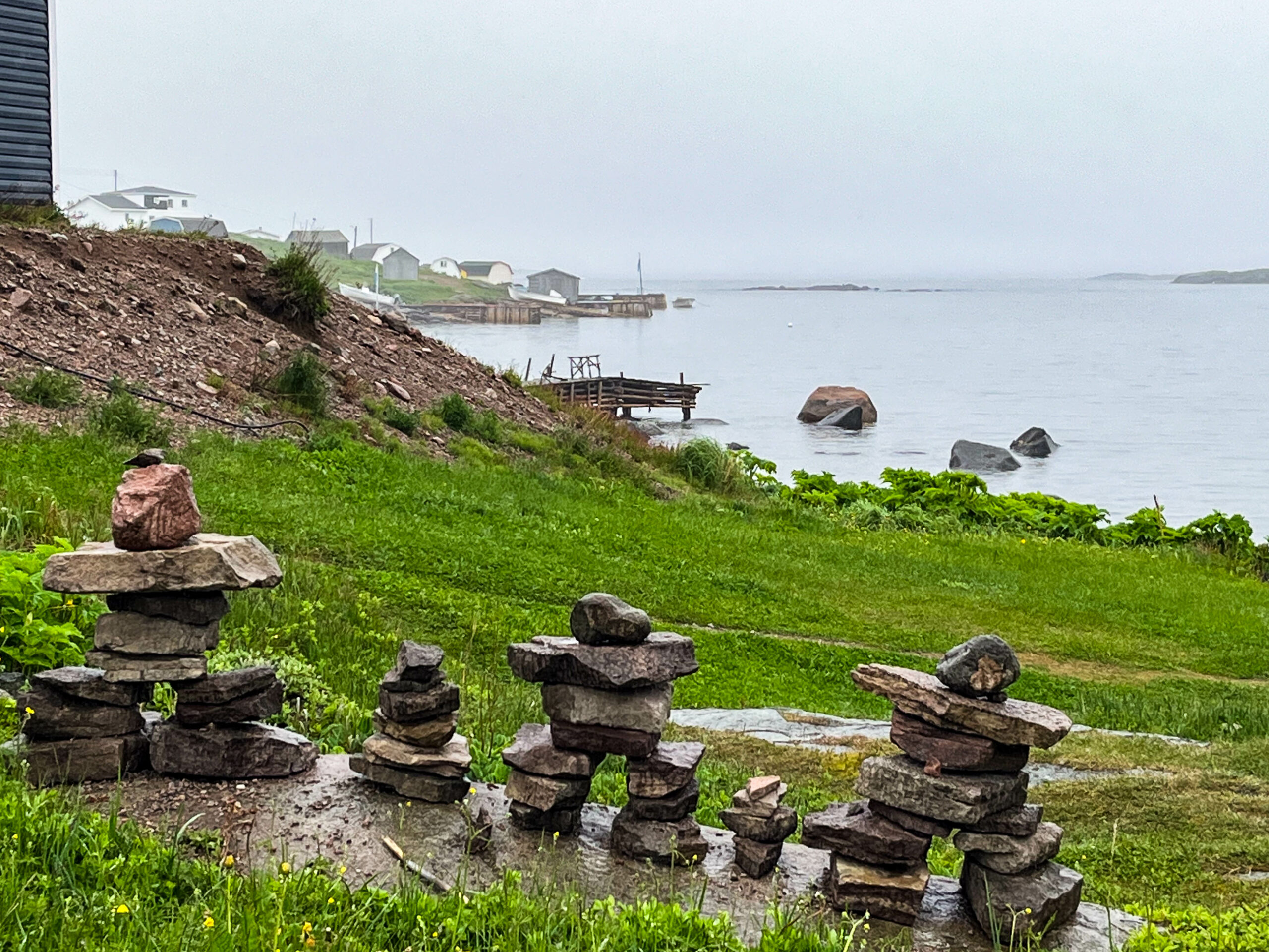
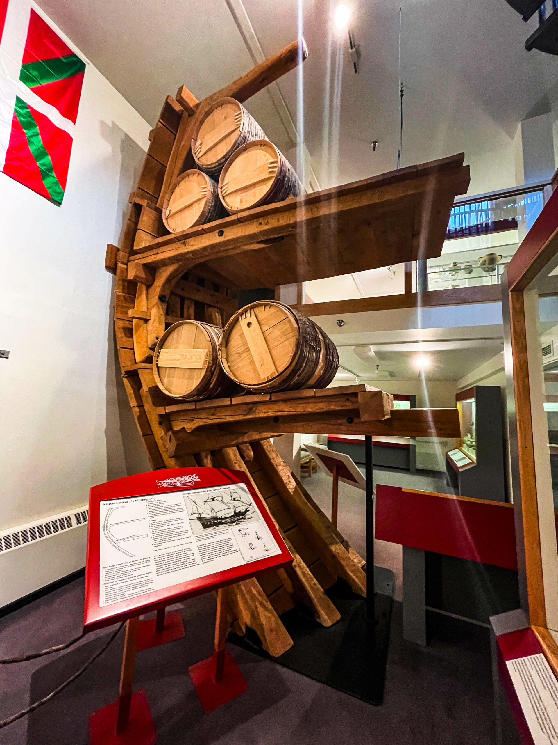
At the beginning of the 19th century, Canadian fishermen once again settled in the village, initially seasonally and then permanently. The bay that gives the town its name forms a natural harbor. Due to its sheltered location, it is considered one of the best on the entire Labrador coast. It was also used for naval vessels during the Second World War. Penney Island and Sattle Island are located in the bay. The museum exhibits documents and relics from the whaling era, including a dinghy from the San Juan. There is also a private museum where the skeleton of a humpback whale is on display, the sheer size of the baleen is particularly impressive. There is also a nice film about the research into the Basque influence in this area and the recovery of the whaler. In short, a day’s work adapted to the weather. We then drive to Mary’s Harbour because the weather was supposed to be better the next day and we saw the chance of a day boat trip (iceberg and whales, around Battle Harbour). We also find the ship and are just trying to make a booking by phone when a woman wearing a mask comes out of the closed office to tell us that she had contracted COVID on a business trip in Girona / Spain (!) and infected her husband, the skipper. Unfortunately, there will be no boat trips all week. Our mood is accordingly not so good, we had imagined tomorrow’s „Canada Day“ to be different.
On the public holiday, the great weather that was forecast, our alternative plan with the passenger ferry to Battle Harbour does not materialize, the ferry stays on the island and does not return today. We walk to a waterfall and watch the fly fishermen trying to catch salmon. A few of them bite, but they always manage to get off the hook before the cutter. But they are also huge chunks, bursting with power. It almost seems that the meditative casting and reeling in of the fly fishing line is the most important part of the exercise, whether the fish are caught seems secondary.
The day is still early, we leave what is for a long time the northernmost point in Canada (52.18°) and drive southwards in the sunshine back to Red Bay, where you can also book a boat trip. Labrador shows all its beauty, it reminds us strongly of northern Sweden or Finland, but with much more powerful rivers.
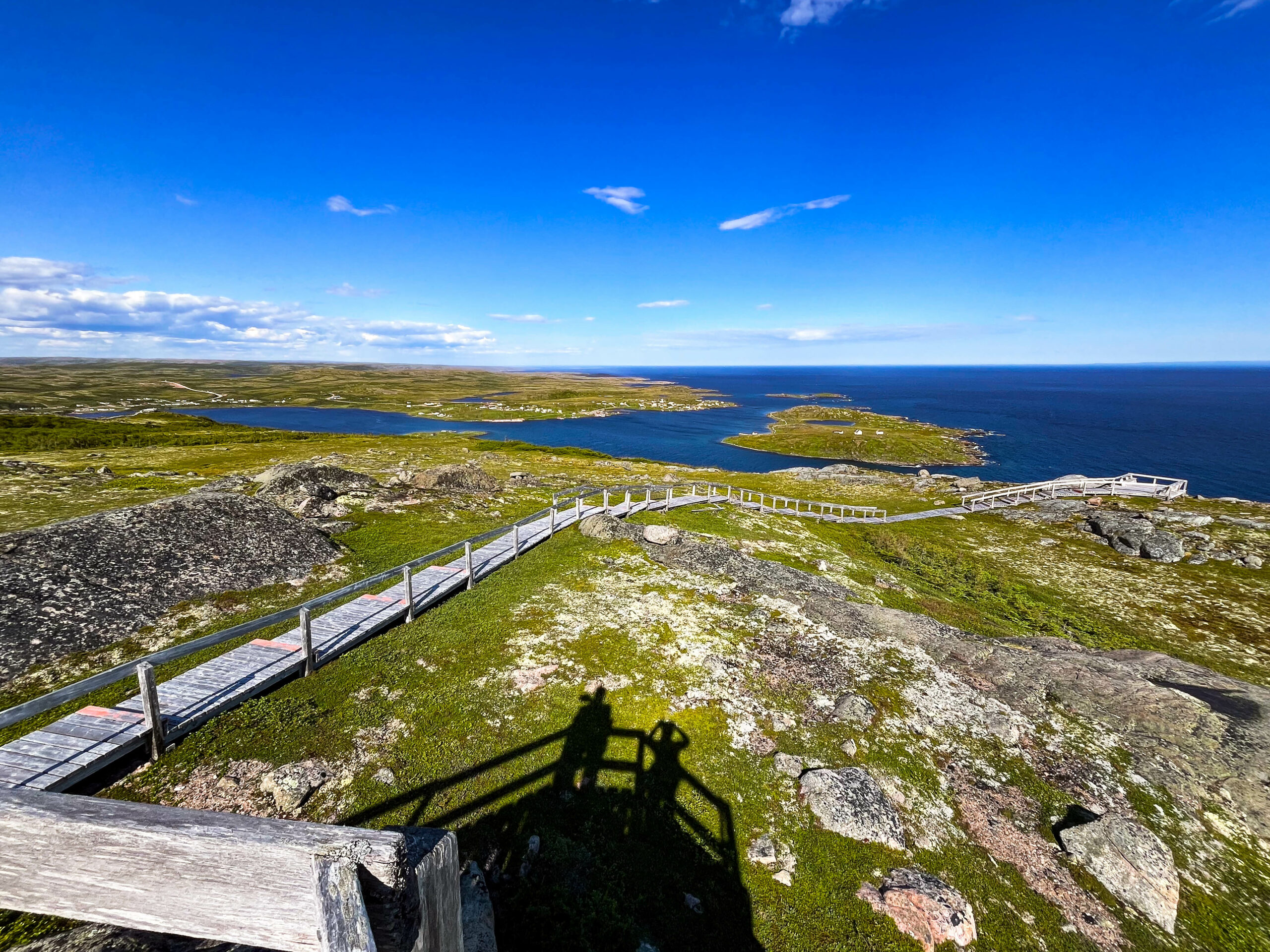
Red Bay now in full sunlight is pleasing to the eye. We book a boat tour for tomorrow and a place for dinner in the local restaurant, where there will be music tonight. Because of Canadaday, everyone is dressed in white and red, wearing red hats with the Canadian flag and the restaurant is decorated with flags and garlands. We take advantage of the beautiful light, drive to the opposite side of the bay and do two trails. The Boney Shore Walking Trail leads along the beach to several old whale bones, the Tracey Hill Trail shows us the whole area, the climb up the coastal hill is made much easier by almost 700 steps and plenty of plank paths, but that doesn’t detract from the great view from the top. Fantastic. Dinner brings us a can. Flag for Gabi’s pinboard.
The next morning, a nice boat trip around the islands, a brief whale sighting, a few seals and lots of chilling. That leaves Sattle Island and the archaeological excavation sites. Nice walk, the objects found were cataloged and preserved in situ, i.e. there was nothing to see except documentation boards and what your own imagination conjured up with the landscape you found. Evoked history, in other words.
We drive back to the ferry late in the evening. On the way, we buy plenty of fish (monkfish, halibut fillets and scallops) at a fish cooperative. We are amazed at how cheaply we have bought the fish, in total contrast to the usual price level. Unfortunately, the ferry company’s ticket office is already closed, so we have to queue up shortly before six in the morning to book our place back to Newfoundland. We had feared this and chose the pitch next to the ferry terminal accordingly.
Total journey: 6,486 km
– of which NFL: 1,968 km (Qc/Labrador 537 km)
